State Route 22 is an east–west state highway in the U.S. state of California that connects Long Beach with northern Orange County. It runs between Pacific Coast Highway in Long Beach and the Costa Mesa Freeway in Orange by way of Garden Grove. The westernmost part of SR 22 runs along Long Beach's 7th Street. From West Garden Grove to its eastern terminus in Orange, it is known as the Garden Grove Freeway. It is one of the two principal east–west routes in Orange County.
State Route 58 is a major east-west state highway in the U.S. state of California that runs across the Coast Ranges, the southern San Joaquin Valley, the Tehachapi Mountains, which border the southern Sierra Nevada, and the Mojave Desert. It runs between U.S. Route 101 near Santa Margarita and Interstate 15 in Barstow. It has junctions with Interstate 5 near Buttonwillow, State Route 99 in Bakersfield, State Route 202 in Tehachapi, State Route 14 near Mojave, and U.S. Route 395 at Kramer Junction. SR 58 also provides access to Edwards Air Force Base. At various points it is known as the Calf Canyon Highway, Carrisa Highway, Bakersfield-McKittrick Highway, Rosa Parks Highway, Westside Parkway, Barstow-Bakersfield Highway, Bakersfield Tehachapi Highway, Kern County Korean War Veterans Memorial Highway, and Mojave-Barstow Highway.

State Route 86 is a north–south state highway in the U.S. State of California that connects the Imperial and Coachella valleys in the southeastern desert region of the state. It runs from State Route 111 near the Mexican border crossing at Calexico north through the Imperial Valley via El Centro and Brawley, and around the west side of the Salton Sea into the Coachella Valley. It then goes through Coachella before terminating at Interstate 10 in Indio.
State Route 111 is a state highway in the southeastern part of U.S. state of California. It is a north-south route serving the Imperial Valley, the eastern shore of the Salton Sea, and the Coachella Valley. Its southern terminus is at Imperial Avenue and 1st Street in Calexico, at the former entrance to the Calexico West Port of Entry. SR 111's northern terminus is at Interstate 10 at the northwestern corner of the Palm Springs city limits, near the unincorporated community of Whitewater.

State Route 99 (SR 99) is a major north–south state highway in the U.S. state of California, stretching almost the entire length of the Central Valley. From its southern end at Interstate 5 (I-5) near Wheeler Ridge to its northern end at SR 36 near Red Bluff, SR 99 goes through the densely populated eastern parts of the valley. Cities served include Bakersfield, Delano, Tulare, Visalia, Fresno, Madera, Merced, Turlock, Modesto, Manteca, Stockton, Sacramento, Yuba City, and Chico.
State Route 160 is a state highway in the U.S. state of California consisting of two sections. The longer, southern, section is a scenic highway through the alluvial plain of the Sacramento River, linking SR 4 in Antioch with Sacramento via the Antioch Bridge. The northern section, separated from the southern by Sacramento city streets, is the North Sacramento Freeway, running from the 16th Street Bridge over the American River to Interstate 80 Business towards Roseville.

State Route 3 is a state highway in the U.S. state of California that serves Trinity and Siskiyou counties. It runs from SR 36 north along the shore of Trinity Lake, Fort Jones and Etna. The route then approaches Yreka, intersecting with Interstate 5 (I-5), and turns east to Montague. The road was numbered SR 3 in 1964, and most of it has been part of the state highway system since 1933.
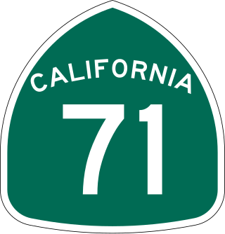
State Route 71 (SR 71) is a 15-mile (24 km) state highway in the U.S. state of California. Serving Riverside, San Bernardino, and Los Angeles counties, it runs from SR 91 in Corona to the Kellogg Interchange with I-10 and SR 57 on the border of Pomona and San Dimas. The segment from SR 91 to SR 83 in Chino Hills is called the Corona Freeway, formerly the Corona Expressway and before then the Temescal Freeway. SR 71 is designated as the Chino Valley Freeway between SR 83 and the Kellogg Interchange.

State Route 142, also known as Carbon Canyon Road for most of its length, is a state highway in the U.S. state of California that connects Brea in Orange County with Chino Hills in San Bernardino County. The eastern portion of the route is known as Chino Hills Parkway.

State Route 20 is a state highway in the northern-central region of the U.S. state of California, running east–west north of Sacramento from the North Coast to the Sierra Nevada. Its west end is at SR 1 in Fort Bragg, from where it heads east past Clear Lake, Colusa, Yuba City, Marysville and Nevada City to I-80 near Emigrant Gap, where eastbound traffic can continue on other routes to Lake Tahoe or Nevada.

State Route 34 is a state highway in the U.S. state of California. It runs through Ventura County from Rice Avenue in Oxnard to State Route 118 in Somis.
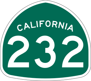
State Route 232 is a state highway in the U.S. state of California that runs along Vineyard Avenue in Ventura County, serving as a connector between US 101 in Oxnard and SR 118 near Saticoy.

State Route 26 is a state highway in the U.S. state of California, running from State Route 99 in Stockton in San Joaquin County to State Route 88 near Pioneer in Amador County. The highway is routed to serve Mokelumne Hill and West Point in Calaveras County.

State Route 198 is an east–west state highway in the U.S. state of California that runs from U.S. Route 101 south of King City to Sequoia National Park. It connects the California Central Coast to the mid–Central Valley through Hanford and Visalia, although the most developed portion is in the Central Valley itself. SR 198 intersects the major north–south routes in the Central Valley, including Interstate 5 (I-5), SR 33, and SR 99.

State Route 62 is a state highway in the U.S. state of California that cuts across the Little San Bernardino Mountains in Riverside and San Bernardino counties. Its western terminus is at Interstate 10 in unincorporated Riverside County outside the borders of Whitewater and Palm Springs. Its eastern terminus is at the Arizona state line just east of Parker, Arizona. The highway passes through the city of Twentynine Palms and along the northern boundary of the Joshua Tree National Park.
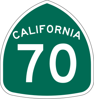
State Route 70 is a state highway in the U.S. state of California, connecting SR 99 north of Sacramento with U.S. Route 395 near Beckwourth Pass via the Feather River Canyon. Through the Feather River Canyon, from SR 149 to US 395, SR 70 is the Feather River Scenic Byway, a Forest Service Byway that parallels the ex-Western Pacific Railroad's Feather River Route.

State Route 98 is a state highway in the U.S. state of California. It is a loop of Interstate 8 (I-8) running west to east south of the Interstate through the border city of Calexico. It passes through the city of Calexico and ends east of Holtville. The highway was added to the state highway system in 1933, and signed as Route 98 by 1938. The highway was paved and rerouted to its current path during the 1950s.

State Route 115 is a state highway in the U.S. state of California. It runs in Imperial County from Interstate 8 (I-8) southeast of Holtville to SR 111 in Calipatria. The routing was added to the state highway system in 1933, and was constructed by 1934; SR 115 was officially designated in the 1964 state highway renumbering.

State Route 127 is a state highway in the U.S. state of California that connects Interstate 15 in Baker to Nevada State Route 373 at the Nevada state line, passing near the eastern boundary of Death Valley National Park. The entire length of the highway closely follows the central portion of the former Tonopah and Tidewater Railroad and loosely follows the Amargosa River.

U.S. Route 95 (US 95) is a United States Numbered Highway, stretching from the Mexican border in San Luis, Arizona to the Canadian border near Eastport, Idaho. The California portion of US 95 traverses through the far eastern edges of both Riverside and San Bernardino counties. US 95 serves Blythe and Needles and junctions with SR 62 at Vidal Junction.


