| Yuraqmayu | |
| Río Blanco | |
| River | |
| Name origin: Quechua | |
| Country | Peru |
|---|---|
| Region | Lima Region |
| Source | |
| - location | San Mateo District |
| - coordinates | 11°52′25″S76°04′26″W / 11.87361°S 76.07389°W |
| Mouth | |
| - location | Chicla-San Mateo |
| - coordinates | 11°43′59″S76°16′9″W / 11.73306°S 76.26917°W Coordinates: 11°43′59″S76°16′9″W / 11.73306°S 76.26917°W |
| Length | 36.2 km (22 mi) |
| Yuraqmayu Dam | |
|---|---|
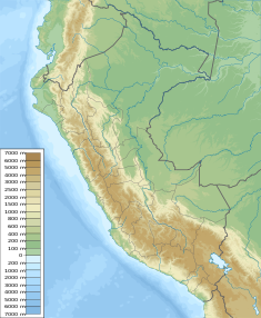 Location of Yuraqmayu Dam in Peru | |
| Dam and spillways | |
| Height | 56 m (184 ft) |
| Length | 590 m (1,940 ft) |
| Reservoir | |
| Total capacity | 46,500,000 m3 (37,700 acre⋅ft) |
| Power Station | |
| Operator(s) | Edegel |
The Yuraqmayu (Quechua yuraq white, mayu river, [1] "white river", hispaniciced spelling Yuracmayo) or Río Blanco (Spanish for "white river") is a 36.2 km long river in Peru located in the Lima Region, Huarochirí Province, in the districts of Chicla and San Mateo. It is a left tributary of the Rimac River which empties into the Pacific Ocean. [2] [3]

Spanish or Castilian, is a Western Romance language that originated in the Castile region of Spain and today has hundreds of millions of native speakers in the Americas and Spain. It is a global language and the world's second-most spoken native language, after Mandarin Chinese.

Peru, officially the Republic of Peru, is a country in western South America. It is bordered in the north by Ecuador and Colombia, in the east by Brazil, in the southeast by Bolivia, in the south by Chile, and in the west by the Pacific Ocean. Peru is a megadiverse country with habitats ranging from the arid plains of the Pacific coastal region in the west to the peaks of the Andes mountains vertically extending from the north to the southeast of the country to the tropical Amazon Basin rainforest in the east with the Amazon river.
The river originates in the San Mateo District, southeast of Kunkus Yantaq. Its direction is mainly to the northwest. Upstream it is the natural border between the districts of Chicla and San Mateo. The confluence with the Rimac River is south of Chicla. [3]

Kunkus Yantaq is a 5,354-metre-high (17,566 ft) mountain in the Paryaqaqa mountain range in the Andes of Peru. It is located in the Lima Region, Huarochirí Province, San Mateo District. Kunkus Yantaq lies southeast of Qullqayuq.
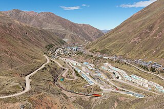
The Yuraqmayu dam which was erected near the village of Yuraqmayu at 11°50′15″S76°09′33″W / 11.83750°S 76.15917°W was erected in 1995. It is 56 m (184 ft) high and 590 m (650 yd) long. It is operated by Edegel. The reservoir has a volume of 1,667,000 m3 (1,351 acre⋅ft) and a capacity of 46,500,000 m3 (37,700 acre⋅ft). [4]

A reservoir is, most commonly, an enlarged natural or artificial lake, pond or impoundment created using a dam or lock to store water.