Gmina Kańczuga is an urban-rural gmina in Przeworsk County, Subcarpathian Voivodeship, in south-eastern Poland. Its seat is the town of Kańczuga, which lies approximately 11 kilometres (7 mi) south-west of Przeworsk and 29 km (18 mi) east of the regional capital Rzeszów.

Strzelce is a village in the administrative district of Gmina Mniszków, within Opoczno County, Łódź Voivodeship, in central Poland. It lies approximately 6 kilometres (4 mi) west of Mniszków, 24 km (15 mi) west of Opoczno, and 58 km (36 mi) south-east of the regional capital Łódź.
Longinówka is a village in the administrative district of Gmina Rozprza, within Piotrków County, Łódź Voivodeship, in central Poland. It lies approximately 9 kilometres (6 mi) north-east of Rozprza, 4 km (2 mi) south of Piotrków Trybunalski, and 49 km (30 mi) south of the regional capital Łódź.
Hadle Kańczuckie is a village in the administrative district of Gmina Jawornik Polski, within Przeworsk County, Subcarpathian Voivodeship, in south-eastern Poland.
Hadle Szklarskie is a village in the administrative district of Gmina Jawornik Polski, within Przeworsk County, Subcarpathian Voivodeship, in south-eastern Poland. It lies approximately 22 kilometres (14 mi) south-west of Przeworsk and 25 km (16 mi) south-east of the regional capital Rzeszów.
Hucisko Jawornickie is a village in the administrative district of Gmina Jawornik Polski, within Przeworsk County, Subcarpathian Voivodeship, in south-eastern Poland. It lies approximately 22 kilometres (14 mi) south-west of Przeworsk and 29 km (18 mi) south-east of the regional capital Rzeszów.
Jawornik Polski is a village in Przeworsk County, Subcarpathian Voivodeship, in south-eastern Poland. It is the seat of the gmina called Gmina Jawornik Polski. It lies approximately 26 kilometres (16 mi) south-west of Przeworsk and 36 km (22 mi) south-east of the regional capital Rzeszów.
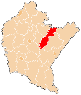
Jawornik-Przedmieście is a village in the administrative district of Gmina Jawornik Polski, within Przeworsk County, Podkarpackie Voivodeship, in south-eastern Poland.
Manasterz is a village in the administrative district of Gmina Jawornik Polski, within Przeworsk County, Subcarpathian Voivodeship, in south-eastern Poland. It lies approximately 10 kilometres (6 mi) north-east of Jawornik Polski, 17 km (11 mi) south-west of Przeworsk, and 28 km (17 mi) east of the regional capital Rzeszów.
Widaczów is a village in the administrative district of Gmina Jawornik Polski, within Przeworsk County, Subcarpathian Voivodeship, in south-eastern Poland. It lies approximately 22 kilometres (14 mi) south-west of Przeworsk and 26 km (16 mi) south-east of the regional capital Rzeszów.
Rożniatów is a village in the administrative district of Gmina Zarzecze, within Przeworsk County, Subcarpathian Voivodeship, in south-eastern Poland. It lies approximately 10 km (6 mi) south of Przeworsk and 39 km (24 mi) east of the regional capital Rzeszów.
Rupin is a village in the administrative district of Gmina Młynarze, within Maków County, Masovian Voivodeship, in east-central Poland. It lies approximately 5 kilometres (3 mi) south-west of Młynarze, 21 km (13 mi) north-east of Maków Mazowiecki, and 86 km (53 mi) north of Warsaw.
Nojszew is a village in the administrative district of Gmina Korytnica, within Węgrów County, Masovian Voivodeship, in east-central Poland. It lies approximately 6 kilometres (4 mi) south of Korytnica, 15 km (9 mi) west of Węgrów, and 59 km (37 mi) east of Warsaw.
Mrozy is a village in the administrative district of Gmina Puszcza Mariańska, within Żyrardów County, Masovian Voivodeship, in east-central Poland. It lies approximately 4 kilometres (2 mi) north of Puszcza Mariańska, 6 km (4 mi) south-west of Żyrardów, and 49 km (30 mi) south-west of Warsaw.
Dębsko is a village in the administrative district of Gmina Koźminek, within Kalisz County, Greater Poland Voivodeship, in west-central Poland. It lies approximately 6 kilometres (4 mi) north-east of Koźminek, 21 km (13 mi) east of Kalisz, and 119 km (74 mi) south-east of the regional capital Poznań.
Chrustowo is a village in the administrative district of Gmina Przedecz, within Koło County, Greater Poland Voivodeship, in west-central Poland. It lies approximately 10 kilometres (6 mi) north of Przedecz, 29 km (18 mi) north-east of Koło, and 139 km (86 mi) east of the regional capital Poznań.
Izdebno is a village in the administrative district of Gmina Ostrowite, within Słupca County, Greater Poland Voivodeship, in west-central Poland. It lies approximately 3 kilometres (2 mi) south-east of Ostrowite, 16 km (10 mi) north-east of Słupca, and 79 km (49 mi) east of the regional capital Poznań.
Feliksów is a village in the administrative district of Gmina Malanów, within Turek County, Greater Poland Voivodeship, in west-central Poland. It lies approximately 2 kilometres (1 mi) west of Malanów, 12 km (7 mi) south-west of Turek, and 111 km (69 mi) south-east of the regional capital Poznań.
Nowiec is a village in the administrative district of Gmina Dzierzgoń, within Sztum County, Pomeranian Voivodeship, in northern Poland. It lies approximately 4 kilometres (2 mi) north of Dzierzgoń, 23 km (14 mi) east of Sztum, and 67 km (42 mi) south-east of the regional capital Gdańsk.