
Zaburze is a village in the administrative district of Gmina Radecznica, within Zamość County, Lublin Voivodeship, in eastern Poland. It lies approximately 4 kilometres (2 mi) south of Radecznica, 29 km (18 mi) west of Zamość, and 63 km (39 mi) south of the regional capital Lublin.
Worsy is a village in the administrative district of Gmina Drelów, within Biała Podlaska County, Lublin Voivodeship, in eastern Poland. It lies approximately 11 kilometres (7 mi) south-west of Drelów, 32 km (20 mi) south-west of Biała Podlaska, and 69 km (43 mi) north of the regional capital Lublin.
Majdan Abramowski is a village in the administrative district of Gmina Goraj, within Biłgoraj County, Lublin Voivodeship, in eastern Poland. It lies approximately 9 kilometres (6 mi) east of Goraj, 19 km (12 mi) north of Biłgoraj, and 61 km (38 mi) south of the regional capital Lublin.
Czartoria is a village in the administrative district of Gmina Miączyn, within Zamość County, Lublin Voivodeship, in eastern Poland. It lies approximately 21 kilometres (13 mi) east of Zamość and 87 km (54 mi) south-east of the regional capital Lublin.

Złojec is a village in the administrative district of Gmina Nielisz, within Zamość County, Lublin Voivodeship, in eastern Poland. It lies approximately 12 kilometres (7 mi) north-west of Zamość and 66 km (41 mi) south-east of the regional capital Lublin.
Czarnystok is a village in the administrative district of Gmina Radecznica, within Zamość County, Lublin Voivodeship, in eastern Poland. It lies approximately 12 kilometres (7 mi) south of Radecznica, 31 km (19 mi) west of Zamość, and 69 km (43 mi) south of the regional capital Lublin.
Dzielce is a village in the administrative district of Gmina Radecznica, within Zamość County, Lublin Voivodeship, in eastern Poland. It lies approximately 7 kilometres (4 mi) south-east of Radecznica, 28 km (17 mi) west of Zamość, and 65 km (40 mi) south of the regional capital Lublin.
Gaj Gruszczański is a village in the administrative district of Gmina Radecznica, within Zamość County, Lublin Voivodeship, in eastern Poland. It lies approximately 3 kilometres (2 mi) north-east of Radecznica, 30 km (19 mi) west of Zamość, and 57 km (35 mi) south of the regional capital Lublin.
Gorajec-Zagroble is a village in the administrative district of Gmina Radecznica, within Zamość County, Lublin Voivodeship, in eastern Poland. It lies approximately 10 kilometres (6 mi) south of Radecznica, 30 km (19 mi) west of Zamość, and 68 km (42 mi) south of the regional capital Lublin.
Gruszka Zaporska is a village in the administrative district of Gmina Radecznica, within Zamość County, Lublin Voivodeship, in eastern Poland. It lies approximately 4 kilometres (2 mi) north of Radecznica, 31 km (19 mi) west of Zamość, and 55 km (34 mi) south of the regional capital Lublin.
Latyczyn is a village in the administrative district of Gmina Radecznica, within Zamość County, Lublin Voivodeship, in eastern Poland. It lies approximately 2 kilometres (1 mi) south of Radecznica, 31 km (19 mi) west of Zamość, and 61 km (38 mi) south of the regional capital Lublin.
Mokrelipie is a village in the administrative district of Gmina Radecznica, within Zamość County, Lublin Voivodeship, in eastern Poland. It lies approximately 3 kilometres (2 mi) east of Radecznica, 28 km (17 mi) west of Zamość, and 60 km (37 mi) south of the regional capital Lublin.
Podborcze is a village in the administrative district of Gmina Radecznica, within Zamość County, Lublin Voivodeship, in eastern Poland. It lies approximately 6 kilometres (4 mi) south of Radecznica, 29 km (18 mi) west of Zamość, and 64 km (40 mi) south of the regional capital Lublin.
Radecznica is a village in Zamość County, Lublin Voivodeship, in eastern Poland. It is the seat of the gmina called Gmina Radecznica. It lies approximately 31 kilometres (19 mi) west of Zamość and 59 km (37 mi) south of the regional capital Lublin.
Zaporze is a village in the administrative district of Gmina Radecznica, within Zamość County, Lublin Voivodeship, in eastern Poland. It lies approximately 3 kilometres (2 mi) north-west of Radecznica, 32 km (20 mi) west of Zamość, and 57 km (35 mi) south of the regional capital Lublin.
Czołki is a village in the administrative district of Gmina Sitno, within Zamość County, Lublin Voivodeship, in eastern Poland. It lies approximately 4 kilometres (2 mi) west of Sitno, 7 km (4 mi) north-east of Zamość, and 75 km (47 mi) south-east of the regional capital Lublin.
Huszczka Duża is a village in the administrative district of Gmina Skierbieszów, within Zamość County, Lublin Voivodeship, in eastern Poland. It lies approximately 4 kilometres (2 mi) west of Skierbieszów, 15 km (9 mi) north of Zamość, and 69 km (43 mi) south-east of the regional capital Lublin.
Huszczka Mała is a village in the administrative district of Gmina Skierbieszów.

Bortatycze is a village in the administrative district of Gmina Zamość, within Zamość County, Lublin Voivodeship, in eastern Poland. It lies approximately 8 kilometres (5 mi) north-west of Zamość and 69 km (43 mi) south-east of the regional capital Lublin.
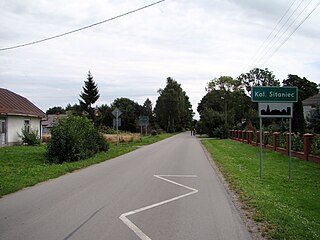
Sitaniec-Kolonia is a village in the administrative district of Gmina Zamość, within Zamość County, Lublin Voivodeship, in eastern Poland. It lies approximately 5 kilometres (3 mi) north of Zamość and 72 km (45 mi) south-east of the regional capital Lublin.


