Zakrzewek, Włocławek County

Last updated
Zakrzewek
Village
Country Flag of Poland.svg  Poland
Voivodeship Kuyavian-Pomeranian
County Włocławek County
Gmina Choceń

Zakrzewek [zaˈkʂɛvɛk] (German : Stauen) is a village in the administrative district of Gmina Choceń, within Włocławek County, Kuyavian-Pomeranian Voivodeship, in north-central Poland. [1]

German language West Germanic language

German is a West Germanic language that is mainly spoken in Central Europe. It is the most widely spoken and official or co-official language in Germany, Austria, Switzerland, South Tyrol (Italy), the German-speaking Community of Belgium, and Liechtenstein. It is also one of the three official languages of Luxembourg and a co-official language in the Opole Voivodeship in Poland. The languages which are most similar to German are the other members of the West Germanic language branch: Afrikaans, Dutch, English, the Frisian languages, Low German/Low Saxon, Luxembourgish, and Yiddish. There are also strong similarities in vocabulary with Danish, Norwegian and Swedish, although those belong to the North Germanic group. German is the second most widely spoken Germanic language, after English.

Gmina Choceń is a rural gmina in Włocławek County, Kuyavian-Pomeranian Voivodeship, in north-central Poland. Its seat is the village of Choceń, which lies approximately 19 kilometres (12 mi) south of Włocławek and 67 km (42 mi) south-east of Toruń.

Włocławek County County in Kuyavian-Pomeranian, Poland

Włocławek County is a unit of territorial administration and local government (powiat) in Kuyavian-Pomeranian Voivodeship, north-central Poland. It came into being on January 1, 1999, as a result of the Polish local government reforms passed in 1998. Its administrative seat is the city of Włocławek, although the city is not part of the county. The county contains six towns: Brześć Kujawski, which lies 12 km (7 mi) south-west of Włocławek, Kowal, which lies 15 km (9 mi) south-east of Włocławek, Lubraniec, which lies 19 km (12 mi) south-west of Włocławek, Izbica Kujawska, which lies 33 km (21 mi) south-west of Włocławek, Chodecz, which lies 28 km (17 mi) south of Włocławek, and Lubień Kujawski, 29 km (18 mi) south of Włocławek.

Related Research Articles

Traby is a village in the administrative district of Gmina Bielawy, within Łowicz County, Łódź Voivodeship, in central Poland.

SIM2 protein-coding gene in the species Homo sapiens

Single-minded homolog 2 is a protein that in humans is encoded by the SIM2 gene. It plays a major role in the development of the central nervous system midline as well as the construction of the face and head.

Puszcza Rządowa Village in Kuyavian-Pomeranian, Poland

Puszcza Rządowa is a village in the administrative district of Gmina Rypin, within Rypin County, Kuyavian-Pomeranian Voivodeship, in north-central Poland.

Pustki Śmiłowskie is a village in the administrative district of Gmina Choceń, within Włocławek County, Kuyavian-Pomeranian Voivodeship, in north-central Poland.

Stefanowo is a village in the administrative district of Gmina Choceń, within Włocławek County, Kuyavian-Pomeranian Voivodeship, in north-central Poland.

Niwki is a village in the administrative district of Gmina Chodecz, within Włocławek County, Kuyavian-Pomeranian Voivodeship, in north-central Poland.

Trzeszczon is a village in the administrative district of Gmina Chodecz, within Włocławek County, Kuyavian-Pomeranian Voivodeship, in north-central Poland.

Bileńska Kolonia is a village in the administrative district of Gmina Lubień Kujawski, within Włocławek County, Kuyavian-Pomeranian Voivodeship, in north-central Poland.

Krzewie Drugie is a village in the administrative district of Gmina Lubień Kujawski, within Włocławek County, Kuyavian-Pomeranian Voivodeship, in north-central Poland.

Bowętów is a village in the administrative district of Gmina Grabów, within Łęczyca County, Łódź Voivodeship, in central Poland.

Janków, Gmina Łęczyca Village in Łódź, Poland

Janków is a village in the administrative district of Gmina Łęczyca, within Łęczyca County, Łódź Voivodeship, in central Poland. It lies approximately 9 kilometres (6 mi) west of Łęczyca and 38 km (24 mi) north-west of the regional capital Łódź.

Łęka-Kolonia is a village in the administrative district of Gmina Łęczyca, within Łęczyca County, Łódź Voivodeship, in central Poland.

Rydzyna is a village in the administrative district of Gmina Świnice Warckie, within Łęczyca County, Łódź Voivodeship, in central Poland.

Chodów, Łódź Voivodeship Village in Łódź, Poland

Chodów is a village in the administrative district of Gmina Wartkowice, within Poddębice County, Łódź Voivodeship, in central Poland. It lies approximately 5 kilometres (3 mi) north-east of Wartkowice, 14 km (9 mi) north-east of Poddębice, and 37 km (23 mi) north-west of the regional capital Łódź.

Anielin is a village in the administrative district of Gmina Gostynin, within Gostynin County, Masovian Voivodeship, in east-central Poland.

Malewo is a village in the administrative district of Gmina Raciąż, within Płońsk County, Masovian Voivodeship, in east-central Poland.

Jaworowo-Lipa is a village in the administrative district of Gmina Zawidz, within Sierpc County, Masovian Voivodeship, in east-central Poland.

Różopole is a village in the administrative district of Gmina Ślesin, within Konin County, Greater Poland Voivodeship, in west-central Poland.

Shinshiro Station railway station in Shinshiro, Aichi Prefecture, Japan

Shinshiro Station is a railway station on the Iida Line in Shinshiro, Aichi Prefecture, Japan. It is located 21.6 rail kilometers from the southern terminus of the Iida Line at Toyohashi Station.

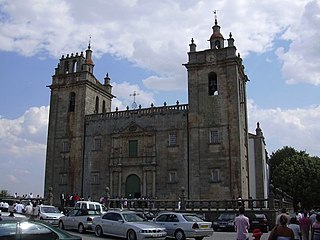
Cathedral of Miranda do Douro

The Cathedral of Miranda do Douro is a Roman Catholic cathedral in Miranda do Douro, Portugal. It is the co-cathedral of the Diocese of Bragança-Miranda, which has its see in the Cathedral of Braganza.

References


Coordinates: 52°29′36″N19°02′24″E / 52.4933°N 19.04°E / 52.4933; 19.04

Geographic coordinate system Coordinate system

A geographic coordinate system is a coordinate system that enables every location on Earth to be specified by a set of numbers, letters or symbols. The coordinates are often chosen such that one of the numbers represents a vertical position and two or three of the numbers represent a horizontal position; alternatively, a geographic position may be expressed in a combined three-dimensional Cartesian vector. A common choice of coordinates is latitude, longitude and elevation. To specify a location on a plane requires a map projection.