
Płońsk(listen) is a town in north-central Poland with 22,500 inhabitants (2010). It is situated in the Masovian Voivodeship at the river Płonka; previously, it was in Ciechanów Voivodeship (1975–98). The city is noted for being the birthplace of Israeli Prime Minister David Ben-Gurion, for whom a square is named.
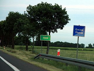
Ilino is a village in the administrative district of Gmina Płońsk, within Płońsk County, Masovian Voivodeship, in east-central Poland. It lies approximately 6 kilometres (4 mi) south-west of Płońsk and 63 km (39 mi) north-west of Warsaw.

Arcelin is a village in the administrative district of Gmina Płońsk, within Płońsk County, Masovian Voivodeship, in east-central Poland. It lies approximately 5 kilometres (3 mi) west of Płońsk and 67 km (42 mi) north-west of Warsaw.
Brody is a village in the administrative district of Gmina Płońsk, within Płońsk County, Masovian Voivodeship, in east-central Poland. It lies approximately 2 kilometres (1 mi) south of Płońsk and 62 km (39 mi) north-west of Warsaw.

Cempkowo is a village in the administrative district of Gmina Płońsk, within Płońsk County, Masovian Voivodeship, in east-central Poland. It lies approximately 6 kilometres (4 mi) south-east of Płońsk and 58 km (36 mi) north-west of Warsaw.
Cholewy is a village in the administrative district of Gmina Płońsk, within Płońsk County, Masovian Voivodeship, in east-central Poland. It lies approximately 8 kilometres (5 mi) south-west of Płońsk and 62 km (39 mi) north-west of Warsaw.
Ćwiklin is a village in the administrative district of Gmina Płońsk, within Płońsk County, Masovian Voivodeship, in east-central Poland. It lies approximately 5 kilometres (3 mi) north-west of Płońsk and 67 km (42 mi) north-west of Warsaw.
Ćwiklinek is a village in the administrative district of Gmina Płońsk, within Płońsk County, Masovian Voivodeship, in east-central Poland. It lies approximately 5 kilometres (3 mi) north of Płońsk and 67 km (42 mi) north-west of Warsaw.

Ilinko is a village in the administrative district of Gmina Płońsk, within Płońsk County, Masovian Voivodeship, in east-central Poland. It lies approximately 5 kilometres (3 mi) west of Płońsk and 65 km (40 mi) north-west of Warsaw.
Jeżewo is a village in the administrative district of Gmina Płońsk, within Płońsk County, Masovian Voivodeship, in east-central Poland. It lies approximately 6 kilometres (4 mi) south of Płońsk and 60 km (37 mi) north-west of Warsaw.
Koziminy-Stachowo is a village in the administrative district of Gmina Płońsk, within Płońsk County, Masovian Voivodeship, in east-central Poland. It lies approximately 4 kilometres (2 mi) north-east of Płońsk and 63 km (39 mi) north-west of Warsaw.
Krępica is a village in the administrative district of Gmina Płońsk, within Płońsk County, Masovian Voivodeship, in east-central Poland. It lies approximately 10 kilometres (6 mi) south-east of Płońsk and 54 km (34 mi) north-west of Warsaw.
Lisewo is a village in the administrative district of Gmina Płońsk, within Płońsk County, Masovian Voivodeship, in east-central Poland. It lies approximately 7 kilometres (4 mi) south-east of Płońsk and 56 km (35 mi) north-west of Warsaw.
Michowo is a village in the administrative district of Gmina Płońsk, within Płońsk County, Masovian Voivodeship, in east-central Poland. It lies approximately 2 kilometres (1 mi) east of Płońsk and 62 km (39 mi) north-west of Warsaw.
Poczernin is a village in the administrative district of Gmina Płońsk, within Płońsk County, Masovian Voivodeship, in east-central Poland. It lies approximately 9 kilometres (6 mi) south-east of Płońsk and 54 km (34 mi) north-west of Warsaw.

Siedlin is a village in the administrative district of Gmina Płońsk, within Płońsk County, Masovian Voivodeship, in east-central Poland. It lies approximately 5 kilometres (3 mi) south-east of Płońsk and 59 km (37 mi) north-west of Warsaw.
Skarzyn is a village in the administrative district of Gmina Płońsk, within Płońsk County, Masovian Voivodeship, in east-central Poland. It lies approximately 5 kilometres (3 mi) south-west of Płońsk and 62 km (39 mi) north-west of Warsaw.
Strubiny is a village in the administrative district of Gmina Płońsk, within Płońsk County, Masovian Voivodeship, in east-central Poland. It lies approximately 6 kilometres (4 mi) east of Płońsk and 58 km (36 mi) north-west of Warsaw.
Szymaki is a village in the administrative district of Gmina Płońsk, within Płońsk County, Masovian Voivodeship, in east-central Poland. It lies approximately 6 kilometres (4 mi) north of Płońsk and 69 km (43 mi) north-west of Warsaw.
Unieck is a village in the administrative district of Gmina Raciąż, within Płońsk County, Masovian Voivodeship, in east-central Poland. It lies approximately 12 kilometres (7 mi) north-east of Raciąż, 29 km (18 mi) north-west of Płońsk, and 91 km (57 mi) north-west of Warsaw.


