
Gromadzyn is a village in the administrative district of Gmina Sochocin, within Płońsk County, Masovian Voivodeship, in east-central Poland. It lies approximately 3 kilometres (2 mi) south-east of Sochocin, 8 km (5 mi) north-east of Płońsk, and 62 km (39 mi) north-west of Warsaw.
Belin is a village in the administrative district of Gmina Nowe Miasto, within Płońsk County, Masovian Voivodeship, in east-central Poland.
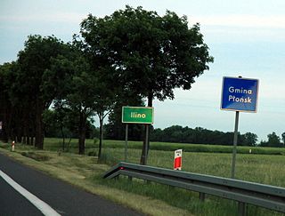
Ilino is a village in the administrative district of Gmina Płońsk, within Płońsk County, Masovian Voivodeship, in east-central Poland. It lies approximately 6 kilometres (4 mi) south-west of Płońsk and 63 km (39 mi) north-west of Warsaw.
Korzybie is a village in the administrative district of Gmina Baboszewo, within Płońsk County, Masovian Voivodeship, in east-central Poland. It lies approximately 4 kilometres (2 mi) south of Baboszewo, 9 km (6 mi) west of Płońsk, and 70 km (43 mi) north-west of Warsaw.
Janikowo is a village in the administrative district of Gmina Czerwińsk nad Wisłą, within Płońsk County, Masovian Voivodeship, in east-central Poland. It lies approximately 5 kilometres (3 mi) north of Czerwińsk nad Wisłą, 24 km (15 mi) south of Płońsk, and 54 km (34 mi) north-west of Warsaw.
Beszyno is a village in the administrative district of Gmina Naruszewo, within Płońsk County, Masovian Voivodeship, in east-central Poland. It lies approximately 6 kilometres (4 mi) north-west of Naruszewo, 10 km (6 mi) south-west of Płońsk, and 62 km (39 mi) north-west of Warsaw.
Sosenkowo is a village in the administrative district of Gmina Naruszewo, within Płońsk County, Masovian Voivodeship, in east-central Poland. It lies approximately 15 kilometres (9 mi) south-west of Płońsk and 62 km (39 mi) north-west of Warsaw.
Stachowo is a village in the administrative district of Gmina Naruszewo, within Płońsk County, Masovian Voivodeship, in east-central Poland. It lies approximately 8 kilometres (5 mi) north-west of Naruszewo, 9 km (6 mi) south-west of Płońsk, and 63 km (39 mi) north-west of Warsaw.
Arcelin is a village in the administrative district of Gmina Płońsk, within Płońsk County, Masovian Voivodeship, in east-central Poland. It lies approximately 5 kilometres (3 mi) west of Płońsk and 67 km (42 mi) north-west of Warsaw.
Brody is a village in the administrative district of Gmina Płońsk, within Płońsk County, Masovian Voivodeship, in east-central Poland. It lies approximately 2 kilometres (1 mi) south of Płońsk and 62 km (39 mi) north-west of Warsaw.
Cholewy is a village in the administrative district of Gmina Płońsk, within Płońsk County, Masovian Voivodeship, in east-central Poland. It lies approximately 8 kilometres (5 mi) south-west of Płońsk and 62 km (39 mi) north-west of Warsaw.
Michowo is a village in the administrative district of Gmina Płońsk, within Płońsk County, Masovian Voivodeship, in east-central Poland. It lies approximately 2 kilometres (1 mi) east of Płońsk and 62 km (39 mi) north-west of Warsaw.
Nowe Koziminy is a village in the administrative district of Gmina Płońsk, within Płońsk County, Masovian Voivodeship, in east-central Poland. It lies approximately 3 kilometres (2 mi) north-east of Płońsk and 63 km (39 mi) north-west of Warsaw.
Skarzyn is a village in the administrative district of Gmina Płońsk, within Płońsk County, Masovian Voivodeship, in east-central Poland. It lies approximately 5 kilometres (3 mi) south-west of Płońsk and 62 km (39 mi) north-west of Warsaw.
Biele is a village in the administrative district of Gmina Sochocin, within Płońsk County, Masovian Voivodeship, in east-central Poland. It lies approximately 3 kilometres (2 mi) south-west of Sochocin, 6 km (4 mi) north-east of Płońsk, and 63 km (39 mi) north-west of Warsaw.
Idzikowice is a village in the administrative district of Gmina Sochocin, within Płońsk County, Masovian Voivodeship, in east-central Poland. It lies approximately 6 kilometres (4 mi) south-east of Sochocin, 11 km (7 mi) east of Płońsk, and 58 km (36 mi) north-west of Warsaw.
Kołoząb is a village in the administrative district of Gmina Sochocin, within Płońsk County, Masovian Voivodeship, in east-central Poland. It lies approximately 4 kilometres (2 mi) south of Sochocin, 8 km (5 mi) east of Płońsk, and 60 km (37 mi) north-west of Warsaw.
Kondrajec is a village in the administrative district of Gmina Sochocin, within Płońsk County, Masovian Voivodeship, in east-central Poland. It lies approximately 4 kilometres (2 mi) north-east of Sochocin, 12 km (7 mi) north-east of Płońsk, and 63 km (39 mi) north-west of Warsaw.
Rzy is a village in the administrative district of Gmina Sochocin within Płońsk County, Masovian Voivodeship in east-central Poland. It lies approximately 7 kilometres (4 mi) east of Sochocin, 15 km (9 mi) north-east of Płońsk, and 62 km (39 mi) north-west of Warsaw.
Wycinki is a village in the administrative district of Gmina Sochocin, within Płońsk County, Masovian Voivodeship, in east-central Poland. It lies approximately 4 kilometres (2 mi) south-west of Sochocin, 5 km (3 mi) north-east of Płońsk, and 62 km (39 mi) north-west of Warsaw.


