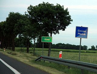
Ilino is a village in the administrative district of Gmina Płońsk, within Płońsk County, Masovian Voivodeship, in east-central Poland. It lies approximately 6 kilometres (4 mi) south-west of Płońsk and 63 km (39 mi) north-west of Warsaw.
Henrykowo is a village in the administrative district of Gmina Nowe Miasto, within Płońsk County, Masovian Voivodeship, in east-central Poland.

Arcelin is a village in the administrative district of Gmina Płońsk, within Płońsk County, Masovian Voivodeship, in east-central Poland. It lies approximately 5 kilometres (3 mi) west of Płońsk and 67 km (42 mi) north-west of Warsaw.
Jeżewo is a village in the administrative district of Gmina Płońsk, within Płońsk County, Masovian Voivodeship, in east-central Poland. It lies approximately 6 kilometres (4 mi) south of Płońsk and 60 km (37 mi) north-west of Warsaw.
Koziminy-Stachowo is a village in the administrative district of Gmina Płońsk, within Płońsk County, Masovian Voivodeship, in east-central Poland. It lies approximately 4 kilometres (2 mi) north-east of Płońsk and 63 km (39 mi) north-west of Warsaw.
Michowo is a village in the administrative district of Gmina Płońsk, within Płońsk County, Masovian Voivodeship, in east-central Poland. It lies approximately 2 kilometres (1 mi) east of Płońsk and 62 km (39 mi) north-west of Warsaw.

Siedlin is a village in the administrative district of Gmina Płońsk, within Płońsk County, Masovian Voivodeship, in east-central Poland. It lies approximately 5 kilometres (3 mi) south-east of Płońsk and 59 km (37 mi) north-west of Warsaw.
Szymaki is a village in the administrative district of Gmina Płońsk, within Płońsk County, Masovian Voivodeship, in east-central Poland. It lies approximately 6 kilometres (4 mi) north of Płońsk and 69 km (43 mi) north-west of Warsaw.
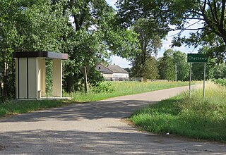
Chyczewo is a village in the administrative district of Gmina Raciąż, within Płońsk County, Masovian Voivodeship, in east-central Poland. It lies approximately 6 kilometres (4 mi) south-west of Raciąż, 24 km (15 mi) north-west of Płońsk, and 85 km (53 mi) north-west of Warsaw.
Ćwiersk is a village in the administrative district of Gmina Raciąż, within Płońsk County, Masovian Voivodeship, in east-central Poland. It lies approximately 6 kilometres (4 mi) south-east of Raciąż, 19 km (12 mi) north-west of Płońsk, and 82 km (51 mi) north-west of Warsaw.
Kiniki is a village in the administrative district of Gmina Raciąż, within Płońsk County, Masovian Voivodeship, in east-central Poland. It lies approximately 4 kilometres (2 mi) east of Raciąż, 21 km (13 mi) north-west of Płońsk, and 84 km (52 mi) north-west of Warsaw.
Kocięcin-Brodowy is a village in the administrative district of Gmina Raciąż, within Płońsk County, Masovian Voivodeship, in east-central Poland. It lies approximately 10 kilometres (6 mi) north-east of Raciąż, 28 km (17 mi) north-west of Płońsk, and 89 km (55 mi) north-west of Warsaw.
Kruszenica is a village in the administrative district of Gmina Raciąż, within Płońsk County, Masovian Voivodeship, in east-central Poland. It lies approximately 10 kilometres (6 mi) east of Raciąż, 19 km (12 mi) north-west of Płońsk, and 81 km (50 mi) north-west of Warsaw.
Stare Gralewo is a village in the administrative district of Gmina Raciąż, within Płońsk County, Masovian Voivodeship, in east-central Poland. It lies approximately 8 kilometres (5 mi) south of Raciąż, 21 km (13 mi) north-west of Płońsk, and 82 km (51 mi) north-west of Warsaw.
Stary Niedróż is a village in the administrative district of Gmina Raciąż, within Płońsk County, Masovian Voivodeship, in east-central Poland. It lies approximately 8 kilometres (5 mi) west of Raciąż, 31 km (19 mi) north-west of Płońsk, and 93 km (58 mi) north-west of Warsaw.

Szapsk is a village in the administrative district of Gmina Raciąż, within Płońsk County, Masovian Voivodeship, in east-central Poland. It lies approximately 8 kilometres (5 mi) south of Raciąż, 20 km (12 mi) north-west of Płońsk, and 81 km (50 mi) north-west of Warsaw.
Szczepkowo is a village in the administrative district of Gmina Raciąż, within Płońsk County, Masovian Voivodeship, in east-central Poland. It lies approximately 10 kilometres (6 mi) north-east of Raciąż, 28 km (17 mi) north-west of Płońsk, and 90 km (56 mi) north-west of Warsaw.
Unieck is a village in the administrative district of Gmina Raciąż, within Płońsk County, Masovian Voivodeship, in east-central Poland. It lies approximately 12 kilometres (7 mi) north-east of Raciąż, 29 km (18 mi) north-west of Płońsk, and 91 km (57 mi) north-west of Warsaw.
Żychowo is a village in the administrative district of Gmina Raciąż, within Płońsk County, Masovian Voivodeship, in east-central Poland. It lies approximately 6 kilometres (4 mi) north-east of Raciąż, 26 km (16 mi) north-west of Płońsk, and 88 km (55 mi) north-west of Warsaw.
Kaliszki is a village in the administrative district of Gmina Czosnów, within Nowy Dwór Mazowiecki County, Masovian Voivodeship, in east-central Poland. It lies approximately 2 kilometres (1 mi) south of Czosnów, 8 km (5 mi) south-east of Nowy Dwór Mazowiecki, and 25 km (16 mi) north-west of Warsaw.


