Zieleniewo, Kuyavian-Pomeranian Voivodeship

Last updated
Zieleniewo
Village
Country Flag of Poland.svg  Poland
Voivodeship Kuyavian-Pomeranian
County Włocławek County
Gmina Chodecz
The wayside shrine. Zieleniewo, Gmina Chodecz, Poland.jpg
The wayside shrine.

Zieleniewo [ʑɛlɛˈɲɛvɔ] (German : Zielau) is a village in the administrative district of Gmina Chodecz, within Włocławek County, Kuyavian-Pomeranian Voivodeship, in north-central Poland. [1]

German language West Germanic language

German is a West Germanic language that is mainly spoken in Central Europe. It is the most widely spoken and official or co-official language in Germany, Austria, Switzerland, South Tyrol (Italy), the German-speaking Community of Belgium, and Liechtenstein. It is also one of the three official languages of Luxembourg and a co-official language in the Opole Voivodeship in Poland. The languages which are most similar to German are the other members of the West Germanic language branch: Afrikaans, Dutch, English, the Frisian languages, Low German/Low Saxon, Luxembourgish, and Yiddish. There are also strong similarities in vocabulary with Danish, Norwegian and Swedish, although those belong to the North Germanic group. German is the second most widely spoken Germanic language, after English.

Gmina Chodecz is an urban-rural gmina in Włocławek County, Kuyavian-Pomeranian Voivodeship, in north-central Poland. Its seat is the town of Chodecz, which lies approximately 28 kilometres (17 mi) south of Włocławek and 76 km (47 mi) south of Toruń.

Włocławek County County in Kuyavian-Pomeranian, Poland

Włocławek County is a unit of territorial administration and local government (powiat) in Kuyavian-Pomeranian Voivodeship, north-central Poland. It came into being on January 1, 1999, as a result of the Polish local government reforms passed in 1998. Its administrative seat is the city of Włocławek, although the city is not part of the county. The county contains six towns: Brześć Kujawski, which lies 12 km (7 mi) south-west of Włocławek, Kowal, which lies 15 km (9 mi) south-east of Włocławek, Lubraniec, which lies 19 km (12 mi) south-west of Włocławek, Izbica Kujawska, which lies 33 km (21 mi) south-west of Włocławek, Chodecz, which lies 28 km (17 mi) south of Włocławek, and Lubień Kujawski, 29 km (18 mi) south of Włocławek.

Related Research Articles

Alviksbron bridge between Alvik and Stora Essingen in Stockholm, Sweden

Alviksbron is a box girder bridge in central Stockholm, Sweden. Stretching over Oxhålssundet, it connects Stora Essingen island to the western suburb Bromma. Built 1996-1998 by the Nordic Construction Company at a cost of 180 million SEK, it has served the Tvärbanan light rail line and pedestrians and bicyclists since its inauguration in August 2000. The name is derived from Alvik, originally a local manor house built in 1819 and demolished in 1930.

Sarayburnu is a promontory quarter separating the Golden Horn and the Sea of Marmara in Istanbul, Turkey. The area is where the renowned Topkapı Palace and Gülhane Park stand. Sarayburnu is included in the historic areas of Istanbul, added to the UNESCO World Heritage List in 1985.

Wiązówka is a village in the administrative district of Gmina Wyszogród, within Płock County, Masovian Voivodeship, in east-central Poland.

Choiny, Wołomin County Village in Masovian, Poland

Choiny is a village in the administrative district of Gmina Poświętne, within Wołomin County, Masovian Voivodeship, in east-central Poland.

Galczyce is a village in the administrative district of Gmina Wierzbinek, within Konin County, Greater Poland Voivodeship, in west-central Poland.

Goczki Polskie is a village in the administrative district of Gmina Wierzbinek, within Konin County, Greater Poland Voivodeship, in west-central Poland.

Kazubek is a village in the administrative district of Gmina Wierzbinek, within Konin County, Greater Poland Voivodeship, in west-central Poland.

Majdany is a village in the administrative district of Gmina Wierzbinek, within Konin County, Greater Poland Voivodeship, in west-central Poland.

Suskowo is a village in the administrative district of Gmina Wierzbinek, within Konin County, Greater Poland Voivodeship, in west-central Poland.

Wojciechowo is a village in the administrative district of Gmina Wierzbinek, within Konin County, Greater Poland Voivodeship, in west-central Poland.

Strzyżewo is a village in the administrative district of Gmina Września, within Września County, Greater Poland Voivodeship, in west-central Poland.

Petworth Park at Petworth, Sussex was used as the venue for three first-class cricket matches between 1824 and 1826.

Eyumodjock is a town and commune in Cameroon, and the sub-divisional headquarters of the Eyumjock sub-division in the Manyu division. The small Lake Ejagham is near the town.

Cangnan railway station is a railway station located in Zhejiang Province, People's Republic of China, on the Wenfu Railway which operated by Shanghai Railway Bureau, China Railway Corporation.

Borin Do is a village in the municipality of Vlasotince, Serbia. According to the 2002 census, the village has a population of 148 people.

Windsor High School is a former whites only school situated in the suburb of Lansdowne in Cape Town, South Africa.

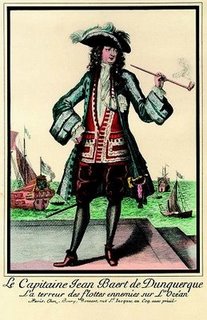
<i>Jean Bart</i> (2002)

Jean Bart is the name given to the replica of a 1670, 84-gun, ship-of-the-line, that is being constructed by the Association Tourville at Gravelines, Dunkirk, to the plans of the seventeenth century ship builder Colbert. It has European funding through the Heroes2c programme.

2nd Battle of Kidal

Since the foreign intervention in Mali, Kidal was retaken by French, Malian, and Chadian troops. On 17 May 2014, Moussa Mara, the Malian prime minister came to visit Kidal.

Layari railway station or Lyari railway station is located in Karachi, Pakistan.

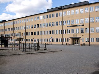
Lycée Français de Stockholm French international school in Stockholm

Lycée Français St Louis de Stockholm is a French international school in Stockholm, Sweden. It serves levels maternelle through lycée.

References


Coordinates: 52°24′26″N18°59′11″E / 52.4072°N 18.9864°E / 52.4072; 18.9864

Geographic coordinate system Coordinate system

A geographic coordinate system is a coordinate system that enables every location on Earth to be specified by a set of numbers, letters or symbols. The coordinates are often chosen such that one of the numbers represents a vertical position and two or three of the numbers represent a horizontal position; alternatively, a geographic position may be expressed in a combined three-dimensional Cartesian vector. A common choice of coordinates is latitude, longitude and elevation. To specify a location on a plane requires a map projection.