Gallery
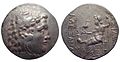 Alexander the Great Tetradrachm from the Messembria Mint, c. 175-125 BC
 Bathymetry map of the Aegean Sea
Zone (Ancient Greek : Ζώνη) was an ancient Greek polis on the Aegean coast of ancient Thrace on a promontory of the same name, a short distance to the west of the entrance of the Lacus Stentoris. [1] [2] [3]
According to Apollonius of Rhodes and Mela, it was to this place that the woods followed Orpheus, when set in motion by his wondrous music. [2] [4]
Herodotus says that it was – together with Sale - one of the cities near the promontory or Serreion, currently named Cape Makri, [5] on whose beaches the ships of the Persian army of Xerxes landed so that their crews could rest at Doriscus, and Xerxes proceeded to count his army at the beginning of the expedition of the year 480 BCE against Greece. [6] In the Periplus of Pseudo-Scylax , Zone and Drys are mentioned as neighboring cities of Maroneia, Diceaa, and Abdera but located in the interior, although Zone was close to the island of Samothrace. [7] The city must have belonged to the Delian League since it appears in an Athenian decree of the year 422/1 BCE. [5]
Although it was thought that its location was in the modern town of Makri, [8] [9] several recent archaeological finds support the identification of Zone with a site at the mouth of the river Shabla Dere, a place that was previously identified with the old Mesembria. These findings include, among others, a sanctuary of Apollo of the Archaic Period and numerous coins, in which the head of Apollo is represented and the allusion to the name of the city in the forms ΖΩΝΑΙΩΝ, ΖΩΝΑΙ , ΖΩΝ or ΖΩ. [10]


Agora, also called Cherronesos or Chersonesos, was an ancient Greek town in Thrace. It was situated about the middle of the narrow neck of the Thracian Chersonese, and not far from Cardia, in what is now European Turkey.
Pistyrus or Pistyros, or Pistirus or Pistiros (Πίστιρος), or Bistirus or Bistiros (Βίστιρος), also known as Pisteira (Πίστειρα), was an ancient Greek polis on the coast of Edonis, in ancient Thrace. It was founded as a colony of Thasos and itself may have founded Pistiros in inland Thrace. The army of Xerxes I passed by Pistyrus after crossing the Nestus River. The name Pistyrus was also applied to the adjoining lake, which was described by Herodotus as 30 stadia in circumference, full of fish, and exceedingly salty.

Phagres was a Greek city located in ancient Thrace and later in Macedon, in the region between the river Strymon and the river Nestos called Edonis or Pieris. It was founded by colonists from Thasos. It was perhaps together with Galepsus and Apollonia occupied and destroyed by Philip II of Macedon after the capture of Amphipolis. Despite this, archeological remains include Hellenistic finds and indications that Phagres survived into the Roman period.
Oesyme or Oisyme and Aisyme or Aesyme was an ancient Greek polis (city-state) located in ancient Thrace and later in Macedonia. It was within the region of Pieras or Edonis between the river Strymon and the river Nestos.
Sale was a Greek city located on the south coast of ancient Thrace, near the west mouth of the Hebrus, and nearly equidistant from Zone and Doriscus, thus between the river Nestos and the Hebrus.
Stryme was an ancient Greek city on the south coast of ancient Thrace, a little to the west of Mesembria, between which and Stryme flowed the small river Lissus, which the army of Xerxes I is said to have drunk dry. It was founded by colonists from Thasos; but disputes seem to have arisen respecting it between the Thasii and the people of the neighbouring city of Maroneia. In some sources, Stryme is called a Thasian polis bordering on Mesambria, but the account Herodotos provides is contradictory. Stryme was located in the Briantike, a region belonging to the Thracian Kikones.
Drys was an ancient Greek town of ancient Thrace.
Deris was an ancient Greek city located in ancient Thrace, located in the region of the Thracian Chersonesus. It is cited in the Periplus of Pseudo-Scylax, which mentions that it was an Emporium and was located between the river Melas, which flows into the Gulf of Melas, and Cardia. It has been suggested that it would be the same as a city called Deiraeus or Deiraios (Δειραῖος), cited by Stephanus of Byzantium and appearing in an inscription according to which it belonged to the Delian League.
Pactya or Paktye was an ancient Greek city located in ancient Thrace, on the Thracian Chersonesus. It is cited in the Periplus of Pseudo-Scylax, in its recitation of the towns of the Thracian Chersonesus, along with Aegospotami, Cressa, Crithote and then Pactya, situated 36 stadia from Cardia. It is said that Miltiades founded it. Strabo places it on the Propontis between Crithote and Macron Teichos. According to Herodotus, Miltiades the Elder ordered a wall built between Cardia, which was on the coast of Gulf of Melas and Pactya, which was on the Propontis side, to prevent invasion of the Chersonesus by the Apsinthii. Alcibiades retired here the Athenians had for the second time deprived him of the command. It was a member of the Delian League. Pliny the Elder points out that both Cardia and Pactya later joined to form Lysimachia.
Ide was an ancient Greek city located in ancient Thrace, located in the region of the Thracian Chersonesus. It is cited in the Periplus of Pseudo-Scylax, in the second position of its recitation of the towns of the Thracian Chersonesus, along with Cardia, Ide, Paeon, Alopeconnesus, Araplus, Elaeus and Sestos.
Crithote or Krithote was an ancient Greek city located in Thrace, located in the region of the Thracian Chersonesos. It was on the Hellespont north of Gallipolis, and was an Athenian colony founded by Miltiades. It is cited in the Periplus of Pseudo-Scylax among the cities of the Thracian Chersonesos: Aegospotami, Cressa, Crithote, and Pactya.
Paeon or Paion was an ancient Greek city located in ancient Thrace, on the west coast of the Thracian Chersonesus. It is cited in the Periplus of Pseudo-Scylax, in the third position of its recitation of the towns of the Thracian Chersonesus, along with Cardia, Ide, Paeon, Alopeconnesus, Araplus, Elaeus and Sestos.
Daminon Teichos, also Daunium or Daunion (Δαύνιον), was a Greek city in ancient Thrace, located in the region of the Propontis.
Tyrodiza was a Greek city in ancient Thrace, located in the region of the Propontis. It appears to have flourished between 550 BCE and 330 BCE, and is identified with the place called Tiristasis in the Periplus of Pseudo-Scylax and Pliny the Elder. It was a member of the Delian League and appears in the tribute lists of ancient Athens between 452/1 and 445/4 BCE. In 340 BCE, Tiristasis was taken by the Athenian general Diopeithes, who enslaved its inhabitants along with those of Crobyle.
Meliboea or Meliboia was a town and polis (city-state) of Magnesia in ancient Thessaly, mentioned by Homer, in the Catalogue of Ships in the Iliad, as one of the places subject to Philoctetes. It was situated upon the sea coast, and is described by Livy as situated at the roots of Mount Ossa, and by Strabo as lying in the gulf between Mount Ossa and Mount Pelion.
Acrothoum or Akrothoon or Acrothoi or Akrothooi (Ἀκρόθωοι) or Acroathon or Acrothon was a town of Chalcidice in ancient Macedon, situated near the extremity of the Acte or Akte (Ακτή) peninsula, the easternmost of the three peninsulas forming the ancient Chalcidice. Thucydides says that among the cities of the aforementioned peninsula, Sane was colony of Andros, while Thyssus, Cleonae, Acrothoum, Olophyxus and Dium had a heterogeneous population of bilingual barbarians formed by a few Chalcidians and, the rest, Pelasgians, Bisaltians, Crestonians and Edoni. Strabo points out that its primitive populated was composed of Pelasgians from Lemnos. It was stated by Pomponius Mela and other ancient writers that the inhabitants of the town lived longer than ordinary men.
Dium or Dion was a city on the Acte or Akte (Ακτή) peninsula, the easternmost of the three peninsulas forming the ancient Chalcidice, on its northeastern coast, north of Olophyxus. Thucydides says that among the cities of the peninsula, Sane was colony of Andros, while Thyssus, Cleonae, Acrothoum, Olophyxus and Dium had a heterogeneous population of bilingual barbarians formed by a few Chalcidians and, the rest, Pelasgians, Bisaltians, Crestonians and Edoni. Strabo says that its primitive population was composed of Pelasgians from Lemnos. Pseudo Scylax writes that it was a Greek city. It was the closest city to the isthmus of the peninsula.
Cnemides or Knemides, also Cnemis or Knemis (Κνῆμις), is the name of a fortress, and probably of a town, in ancient Phocis. Strabo places Cnemides on Cape Cnemides opposite the islands called Lichades and the Euboean promontory Cenaeum, distant 20 stadia from Thronium and from Daphnus. The Periplus of Pseudo-Scylax, successively describing towns along the Phocian coast, places Cnemides after Thronium and before Elateia and Panopeus.
Mesambria, or Mesembria (Μεσημβρία), was an ancient Greek city located in ancient Thrace, on the coast of the Black Sea.
Serrheum or Serreion, or Serrhium or Serrion (Σέρριον), was a town on the southern coast of ancient Thrace, on a promontory of the same name. It lay to the west of Maroneia, and opposite to the island of Samothrace. It is repeatedly mentioned by Demosthenes, as having been taken by Philip II of Macedon (346 BCE), contrary to his engagements with the Athenians; and Livy states that it was one of the Thracian towns captured by Philip V of Macedon in the year 200 BCE.
![]() This article incorporates text from a publication now in the public domain : Smith, William, ed. (1854–1857). "Zone". Dictionary of Greek and Roman Geography . London: John Murray.
This article incorporates text from a publication now in the public domain : Smith, William, ed. (1854–1857). "Zone". Dictionary of Greek and Roman Geography . London: John Murray.
40°51′20″N25°44′45″E / 40.8555°N 25.745773°E
| | This article about a location in ancient Thrace is a stub. You can help Wikipedia by expanding it. |