The North Bačka District is one of seven administrative districts of the autonomous province of Vojvodina, Serbia. It lies in the Bačka geographical region. According to the 2011 census results, it has a population of 186,906 inhabitants. The administrative center of the district is the city of Subotica.

The North Banat District is one of seven administrative districts of the autonomous province of Vojvodina, Serbia. It lies in the geographical regions of Banat and Bačka. According to the 2011 census, the district has a population of 146,690 inhabitants. The administrative center of the district is the city of Kikinda.

The South Banat District is one of seven administrative districts of the autonomous province of Vojvodina, Serbia. The administrative center of the district is the city of Pančevo. The district lies in the region of Banat. According to the 2011 census results, it has a population of 291,327 inhabitants.

The West Bačka District is one of seven administrative districts of the autonomous province of Vojvodina, Serbia. It lies in the geographical region of Bačka. It has a population of 188,087 inhabitants. The administrative seat of the district is the city of Sombor.

The International Dark-Sky Association (IDA) is a United States-based non-profit organization incorporated in 1988 by founders David Crawford, a professional astronomer, and Tim Hunter, a physician/amateur astronomer. The mission of the IDA is "to preserve and protect the night time environment and our heritage of dark skies through quality outdoor lighting." Light pollution is the result of outdoor lighting that is not properly shielded, allowing light to be directed into the eyes and the night sky. Light that shines into the eyes is called glare and light shining into the night sky above the horizon causes skyglow. Lighting can also cause light trespass when it is directed into areas that it is not wanted, e.g., a neighbor's yard and windows. IDA was the first organization in the dark-sky movement, and is currently the largest.

Ibafa is a small village with a population of 250 in Baranya county, Hungary. The village is in the valleys of Zselic. The mayor is László Benes.
Nagykovácsi is a small town in the Pilisvörösvári kistérség district of Hungary situated some 15 km (9 mi) north-west of the centre of Budapest, in a valley, at an altitude of 340 metres. It is located next to the second district of Budapest. According to the 2011 census, its population was given as 7095, though this figure does not include the many people who own a property there as a second residence. The town is known for its scenic setting in surrounding hills and forests, and much of the nearby forest have been designated conservation areas—Budai Tájvédelmi Körzet —in order to protect several rare species of flora growing there. Its location has contributed to the town's development in recent years. The American International School of Budapest chose Nagykovácsi as the site for its new campus in 2000.

Austria has seven protected areas known as national parks, six of them internationally accepted according to the IUCN standard. The first national park, Hohe Tauern, was established in 1981. Today the national parks of Austria have a combined area of 2,376 km², which is 2.8% of the country's total area. They include each of Austria's most important natural landscape types — alluvial forest, Alpine massif, Pannonian steppe and rocky valleys.

There are at least six types of protected areas of the Czech Republic.

Szenna is a village in Somogy county, Hungary. It is famous for the Szenna Open Air Museum, which won the Europa Nostra award in 1982.

Bárdudvarnok is a village in Somogy county, Hungary. It is located in the Zselic. The village of Szenna is very close to Bárdudvarnok. From the city of Kaposvár there are two ways to go to Bárdudvarnok.

Kiskorpád is a village in Somogy county, Hungary.
A landscape park is a type of protected area in Czech Republic, Poland, Slovakia, Ukraine, Hungary and Slovenia. It is of lower status than a National Park and with less stringent restrictions on development and economic use.

Protected areas of Estonia are regulated by the Nature Conservation Act, which was passed by the Estonian parliament on April 21, 2004 and entered into force May 10, 2004.

Somogyapáti is a village in the subregion of Szigetvár, Baranya county, Hungary.

In 1997 a protected ecological system embracing the adjoining area of the Balaton Uplands was established with the connection of the already protected areas which had been separate for a long time. The area of 56 997 hectares of the Balaton-felvidéki National Park mainly consists of these six landscape protection areas. The national park headquartered in Veszprém, in the largest city of the Balaton area.

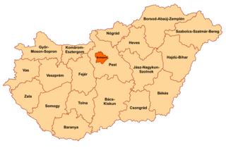
Gerecse is a mountain range in north-western Hungary, in the Central Transdanubian region, between the ranges Vértes and Pilis and part of the Komárom-Esztergom County. A low limestone mountain situated between the town of Tatabánya and the Danube River. The Gerecse Mountains are part of the Transdanubian Mountains. Gerecse occupies an area of 850 km2. The highest point is Nagy-Gerecse at 634 m. The main rock is chalk and limestone.
Szentlászló is a village in Baranya county, Hungary.
Szulimán is a village in Baranya county, Hungary.
Protected areas of Hungary includes 10 national parks, 35 landscape protection areas and 145 minor nature reserves. The national policy for governing and management of the protected areas is implemented by the Minister of Agriculture. The first national park in Hungary at the Great Hungarian Plain is Hortobágy National Park, established in 1973.