Toponymy
At the start of the French colony in America, Île aux Grues and Île aux Oies were designated as a single island on maps of the time. On October 20, 1633, during his expedition to explore the territory of the Côte-du-Sud, the Jesuit Paul Le Jeune wrote in his letters (referred to as “Relations des Jésuites”): “we left this island [presumably the island aux Cranes] to enter another called Cachibasiouachgate. We could name it Isle aux Oies blancs, because I saw more than a thousand in a band”.
In 1646 by Charles Huault de Montmagny (1601-1657) acquired these two islands as well as the seigneury of Rivière-du-Sud. Renowned as a great hunting enthusiast, he served as the first governor in title (1636-1648) of New France. In 1654, the territory of these islands was acquired by Jean-Jacques Moyen, Sieur des Granges, who settled there. Reluctantly, he was assassinated the following year during an Iroquois passage. The island was subsequently acquired by Louis Couillard, Lord of Rivière-du-Sud. In 1668, Couillard ceded part of the island to Paul Dupuy, his son-in-law.
In 1671, the island was subdivided. Pierre Bécart de Granville, Lord of Île-aux-Grues, became the owner of the western part, known at the time as Petite île aux Oies. While Paul Dupuy remains the owner of the eastern part, which was designated "Grande Île aux Oies". In 1713, the latter ceded his property to the Augustinian nuns of the Hôtel-Dieu de Québec. Subsequently, the nuns designated it their island lordship "Île Marie", as did the small boat transporting the foodstuffs they produced to Quebec. In 1875, the Augustines acquired Petite Île aux Oies (i.e. Île aux Grues today).
In 1964, Club Saint-Laurent acquired Île aux Oies, and around 1975, that of Domaine de l'Île aux Oies; these two territories were then exploited in private hunting clubs. [4]
Île aux Oies derives its toponymic designation from the presence of the Snow Goose during migratory periods. These birds attract many hunters during their stopover in autumn, that is, during their seasonal migration to the south. In history, several other toponymic variants (written and oral) have been listed, including Île Sainte-Marie, La Bécard, Île Hôpital, Île des Prairies, Île des Joncs and Île des Brousses. [1] The toponym "Île aux Oies" was made official on December 5, 1968, at the Commission de toponymie du Québec place name bank. [1]
Montmagny—L'Islet was a federal electoral district in Quebec, Canada, that was represented in the House of Commons of Canada from 1935 to 1968.

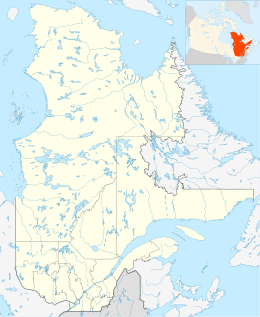
Isle-aux-Grues is an island situated on the Saint Lawrence River, in the municipality of Saint-Antoine-de-l'Isle-aux-Grues, in the Montmagny Regional County Municipality (MRC), in administrative region of Chaudière-Appalaches, in Quebec, in Canada.

Air Montmagny, trading as Montmagny Air Service is an on-demand aircraft charter company based in Montmagny, Quebec, Canada. It operates passenger and cargo services.

Saint-Antoine-de-l'Isle-aux-Grues is a parish municipality in Quebec, in the Montmagny Regional County Municipality in the administrative region of Chaudière-Appalaches. It is known for bird-watching, goose-hunting and cheeses.
The rivière des Petites Îles is a tributary of the south shore of the Saguenay River flowing successively in the municipalities of Petit-Saguenay and Baie-Sainte-Catherine, in Regional County Municipality (MRC) of Le Fjord-du-Saguenay, in Quebec, Canada.
The rivière aux Chiens flows south, on the north shore of the Saint Lawrence river, in the municipalities of Beaupré and Château-Richer, in the La Côte-de-Beaupré Regional County Municipality, in the administrative region of Capitale-Nationale, in the province from Quebec, to Canada. It empties into the St. Lawrence River at Beaupré.
L île aux Lièvres is a river island of the Richelieu River, in the territory of the municipality of Carignan, in the La Vallée-du-Richelieu Regional County Municipality, in the region administrative Montérégie, in the south of province of Quebec, in Canada.
L’Île aux Lièvres is an island of the St. Lawrence River, located between Saint-Siméon and Rivière-du-Loup, near the islands of the Pot à l'Eau-de-Vie. This island is part of the municipality of Saint-André-de-Kamouraska, in the Kamouraska Regional County Municipality, in the administrative region of Bas-Saint-Laurent, in the province of Quebec, in Canada.

L'Île Goyer is a river island of the Richelieu River. It belongs to the territory of the municipality of Carignan, in the La Vallée-du-Richelieu Regional County Municipality, in the administrative region of Montérégie, in the south of province of Quebec, in Canada.
The Rivière du Moulin flows in the municipality of Saint-Laurent-de-l'Île-d'Orléans, in the L'Île-d'Orléans Regional County Municipality, in the administrative region of Capitale-Nationale, in the province of Quebec, in Canada.

The Rivière Lafleur, sometimes called Rivière à la Fleur, is a watercourse of the Île d'Orléans located between the Maheu River and the village of Saint-Jean-de-l'Île-d'Orléans. Its course is exclusively in the municipality of Saint-Jean-de-l'Île-d'Orléans, in the L'Île-d'Orléans Regional County Municipality, in the administrative region of Capitale-Nationale, in the province of Quebec, in Canada.
The Dauphine River is a river in Quebec, Canada. It flows through the municipalities of Sainte-Famille-de-l'Île-d'Orléans and Saint-Jean-de-l'Île-d'Orléans, in the L'Île-d'Orléans Regional County Municipality, in the administrative region of Capitale-Nationale.
The rivière du Moulin is a tributary of chenal de l'Île d'Orléans, flowing in the municipality of Saint-Pierre-de-l'Île-d'Orléans, in the L'Île-d'Orléans Regional County Municipality, in the administrative region of Capitale-Nationale, in the province of Quebec, in Canada.
The Petite rivière de la Loutre is a watercourse flowing into Gulf of St. Lawrence, flowing in the eastern part of the municipality of L'Île-d'Anticosti, in the Minganie Regional County Municipality, in the administrative region of Côte-Nord, in the province of Quebec, in Canada. The course of this river delimits the eastern part of the territory of SÉPAQ Anticosti and the logging zone; the two sections of SÉPAQ Anticosti territory are separated by 82.9 km (51.5 mi).
The rivière des Orignaux crosses the municipality of Notre-Dame-Auxiliatrice-de-Buckland, in the Bellechasse Regional County Municipality, in the administrative region of Chaudière-Appalaches, in Quebec, in Canada.

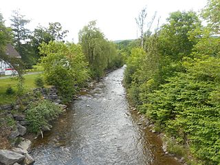
The Mongeau River is a tributary of the south-eastern bank of the rivière du Sud (Montmagny), which flows north-east to the south shore of the St. Lawrence River.
The rivière des Poitras is a tributary of the south bank of the Morigeau River which flows on the south-eastern bank of the rivière du Sud (Montmagny) ; the latter flows north-east to the south shore of the St. Lawrence River.

The Bras Saint-Nicolas is a tributary of the south-eastern bank of the rivière du Sud (Montmagny), which flows north-east to the south bank of the St. Lawrence River.
The rivière des Perdrix flows in the municipalities of Notre-Dame-du-Rosaire, Cap-Saint-Ignace and Montmagny, in the Montmagny Regional County Municipality, in the administrative region of Chaudière-Appalaches, in Quebec, in Canada.
The Petite rivière Sainte-Marguerite crosses the municipalities of Saint-François-de-la-Rivière-du-Sud and Saint-Raphaël, in the administrative region of Chaudière-Appalaches, in Quebec, in Canada.