| İsi | |
|---|---|
| Village and Municipality | |
| Country | Azerbaijan |
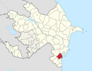
| Rayon | Masally |
| Population [ citation needed ] | |
| • Total | 186 |
| Time zone | AZT (UTC+4) |
| • Summer (DST) | AZT (UTC+5) |
İsi is a talysh village and municipality in the Masally Rayon of Azerbaijan. It has a population of 186.[ citation needed ]
Talysh are an Iranian ethnic group indigenous to a region shared between Azerbaijan and Iran which spans the South Caucasus and the southwestern shore of the Caspian Sea. They speak the Talysh language, one of the Northwestern Iranian languages. It is spoken in the northern regions of the Iranian provinces of Gilan and Ardabil and the southern parts of the Republic of Azerbaijan. Northern Talysh was historically known as Talish-i Gushtasbi. In Iran there is a Talesh County in Gilan Province.

Azerbaijan, officially the Republic of Azerbaijan, is a country in the South Caucasus region of Eurasia at the crossroads of Eastern Europe and Western Asia. It is bounded by the Caspian Sea to the east, Russia to the north, Georgia to the northwest, Armenia to the west and Iran to the south. The exclave of Nakhchivan is bounded by Armenia to the north and east, Iran to the south and west, and has an 11 km long border with Turkey in the northwest.