
Vas is an administrative county of Hungary. It was also one of the counties of the former Kingdom of Hungary. It is part of the Centrope Project.

Styria, also known as Slovenian Styria or Lower Styria to differentiate it from Austrian Styria, is a traditional region in northeastern Slovenia, comprising the southern third of the former Duchy of Styria. The population of Styria in its historical boundaries amounts to around 705,000 inhabitants, or 34.5% of the population of Slovenia. The largest city is Maribor.
The following is a list of Hungarian place names for towns and villages in the Prekmurje region of Slovenia. This region belonged to Kingdom of Hungary prior to the Treaty of Trianon.

Sveti Juraj na Bregu is a municipality in Međimurje County, Croatia.

The Ščavnica is a 56-kilometer (35 mi) river in Styria, Slovenia. It sources near Zgornja Velka and flows along the Slovene Hills towards the southeast. It passes Negova Castle and Sveti Jurij ob Ščavnici, traverses Lake Gajševci and the town of Ljutomer, and finally joins the Mur from the right in Razkrižje.
Čikečka Vas is a village in the Municipality of Moravske Toplice in the Prekmurje region of Slovenia. The village includes the hamlets of Felső-vég, Alsó-vég, and Cseke-hegy. It also has many Hungarian-language microtoponyms, including Alsó-mező, Felső-mező, and Külsö-hegy (fields), Vizköz and Alsó-rét (meadows), and Nagy-ritás and Ritka-tögyes (woods).
Motvarjevci is a village in the Municipality of Moravske Toplice in the Prekmurje region of Slovenia, right on the border with Hungary.
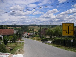
Pordašinci is a roadside village in the Municipality of Moravske Toplice in the Prekmurje region of Slovenia, close to the border with Hungary.
Prosenjakovci is a village in the Municipality of Moravske Toplice in the Prekmurje region of Slovenia, close to the border with Hungary.
Središče is a small village in the Municipality of Moravske Toplice in the Prekmurje region of Slovenia, by the border with Hungary. Središče has a population of 66 people; it has one church, a firehouse, and a cultural association.

The Mura Statistical Region is a statistical region in northeast Slovenia. It is predominantly agricultural with field crops representing over three-quarters of the total agricultural area. Climate and soil combined have made it the region with the highest crop production, but its geographical position and inferior infrastructure put it at a disadvantage and it is the region of Slovenia with the lowest GDP per capita and the highest rate of registered unemployment.
Radovci is a village in the Municipality of Grad in the Prekmurje region of northeastern Slovenia.
Gibina is a village on the right bank of the Mura River in the Municipality of Razkrižje in eastern Slovenia. The area traditionally belonged to Zala County in the Kingdom of Hungary and is now included in the Mura Statistical Region.
Kopriva is a small settlement in the Municipality of Razkrižje in eastern Slovenia, next to the border with Croatia. The area is part of the traditional region of Styria and is now included in the Mura Statistical Region.
Šprinc is a small settlement in the Municipality of Razkrižje in eastern Slovenia, next to the border with Croatia. The area traditionally belonged to Zala County in the Kingdom of Hungary and is now included in the Mura Statistical Region.

Veščica is a settlement on the banks of the Ščavnica River in the Municipality of Razkrižje in eastern Slovenia, next to the border with Croatia. The area traditionally belonged to Zala County in the Kingdom of Hungary and is now included in the Mura Statistical Region.

The Municipality of Razkrižje is a small municipality in Slovenia. The seat of the municipality is the town of Razkrižje. It was part of Zala County in the Kingdom of Hungary. It is now included in the Mura Statistical Region. It borders Croatia.

The Municipality of Hodoš is a municipality in Slovenia. The seat of the municipality is the village of Hodoš. It is part of the Prekmurje region. Both Slovene and Hungarian are official languages in the municipality. The municipality was established on 7 August 1998, when it was separated from the former Municipality of Hodoš–Šalovci.
Gibina is a Slovene place name that may refer to:

