Sutherland is a historic county, registration county and lieutenancy area in the Highlands of Scotland. Its county town is Dornoch. Sutherland borders Caithness and Moray Firth to the east, Ross-shire and Cromartyshire to the south and the Atlantic to the north and west. Like its southern neighbour Ross-shire, Sutherland has some of the most dramatic scenery in Europe, especially on its western fringe where the mountains meet the sea. These include high sea cliffs and very old mountains composed of Precambrian and Cambrian rocks.

Durness is a village and civil parish in the north-west Highlands of Scotland. It lies on the north coast of the country in the traditional county of Sutherland, around 120 miles north of Inverness. The area is remote, and the parish is huge and sparsely populated, covering an area from east of Loch Eriboll to Cape Wrath, the most north-westerly point of the Scottish mainland.

Lairg is a village and parish in Sutherland, Scotland. It has a population of 891 and is at the south-eastern end of Loch Shin.

The A836 is a major road entirely within the Highland area of Scotland. It is 122 miles (196 km) long and runs from Ross and Cromarty to Caithness, with the majority of its length in Sutherland. At 58.648°N where it passes through East Mey, it is the northernmost A-class road in mainland Great Britain.

Bonar Bridge is a village on the north bank of the Kyle of Sutherland to the west and the Dornoch Firth to the east in the Parish of Creich in the Highland council area of Scotland.

The A897 single track road is entirely within the Highland council area of Scotland. It runs generally north from the A9 at Helmsdale to the A836 near Halladale Bridge, east of Melvich. The road passes through or near Kildonan, Kinbrace and Forsinard, and has a junction with the B871 at Kinbrace. It also passes through Achiemore.

The A839 road is in Sutherland, in the Highland area of Scotland. It runs generally west from the A9 at The Mound near Golspie, via Rogart and Lairg, to the A837 at Rosehall. The Mound is a causeway or bridge carrying the A9 across the estuary of the River Fleet. Between The Mound and Lairg the A839 is in Strath Fleet. Rogart and Lairg have railway stations on the Far North Line.

The A949 is a major road in Sutherland, in the Highland area of Scotland. It has staggered junctions with the A9. From the A949 the A9 runs (1) generally north to Thurso and (2) generally south to Tain, Inverness, Perth, Stirling and Falkirk.

The River Shin is a river in the Scottish North West Highlands.
The Northwest Highlands are located in the northern third of Scotland that is separated from the Grampian Mountains by the Great Glen. The region comprises Wester Ross, Assynt, Sutherland and part of Caithness. The Caledonian Canal, which extends from Loch Linnhe in the south-west, via Loch Ness to the Moray Firth in the north-east splits this area from the rest of the country. The city of Inverness and the town of Fort William serve as gateways to the region from the south.

Eriboll is a village in Sutherland, Scotland. The village is situated on the south eastern shore of Loch Eriboll, in the northern part of the former county of Sutherland.
Rhiconich is a remote hamlet, located at the head of Loch Inchard, in Sutherland, Scottish Highlands in the Scottish council area of Highland. Rhiconich is situated 3 miles (4.8 km) north-east of Laxford Bridge and 11 miles (18 km) south-west of Durness on the A838 road. The B801 at Richonich links the village of Kinlochbervie and associated crofting townships such as Oldshoremore to the A838.
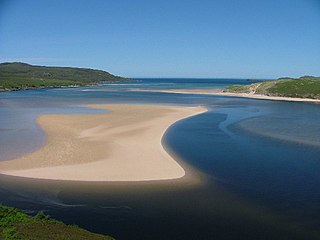
Kyle of Durness is a coastal inlet on the north coast of Scotland in the county of Sutherland. It extends 5+1⁄2 miles inland from Balnakeil and divides the Cape Wrath peninsula from the mainland. The nearest village is Durness.

The Kyle of Tongue Bridge is part of the Kyle of Tongue Causeway, which crosses Kyle of Tongue sea loch on the north coast of Scotland.
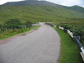
Laxford is a remote area in the far Northwest Highlands of Scotland around the River Laxford which runs northwest from Loch Stack to Laxford Bay. This bay is an inlet of Loch Laxford, a sea loch and Special Area of Conservation. The river is well known for its salmon fly fishing, indeed the name "Laxford" derives from the Norse for "salmon fjord". The area is important geologically, being a region of shear in the Moine Thrust. A road bridge, Laxford Bridge, crosses the river adjacent to the A838 and A894 roads, the road junction making the spot well known to tourists. Laxford is in Sutherland, in the Highland council area of Scotland; Scourie, 12 kilometres away, is the nearest village. The area forms part of the North West Sutherland National Scenic Area, one of 40 such areas in Scotland, which are defined so as to identify areas of exceptional scenery and to ensure its protection by restricting certain forms of development.

The Laxford Bridge is a stone arch bridge in Sutherland, Scotland which carries the A838 across the River Laxford north to Rhiconich and Durness.

Midfield is a remote hamlet on the north coast of Scotland in Sutherland in the Highland Council Area. It is a mile south of Tormade Point and just over a mile north of Talmine and the Achininver Beach and said location's Lodge are located within Midfield. Midfield is 4 miles from the A838 and 5 miles from the larger settlement of Tongue. Midfield is also labelled as a crofting settlement according to the Gazetteer for Scotland. Midfield is a part of the Melness area.
Loch Dionard is a medium-sized loch in the Durness Parish, in Sutherland, Highland Council Area, Northern Scotland. It is in the North-Western Highlands about four miles south of Polla.
Loch Merkland is a large long inland loch in Sutherland, Northern Scotland. It is located adjacent to the A838 main road which provides almost all access to the Loch and the Merkland Lodge to the south of it. There are many trails and hiking paths in the area, as per usual in the highlands of Scotland. On the Banks just above the Lodge there's also Merkland Cottage meaning there are residents around the Loch.

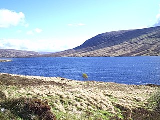
Loch Hope is a loch in the Durness parish in Sutherland in the Highland Council Area of northern Scotland. It is located on the A838 main road. The settlements of Hope, Lochside, and Muiseal directly on the loch in addition nearby there's Inverhope, Heilam, Moine House, Alltnacaillich, Strathmore, etc.. The Loch is a large tourist destination for the area around it.