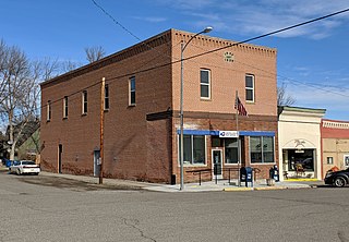
Yellowstone County is the most populous county in the U.S. state of Montana. As of the 2020 census, the population was 164,731. Its county seat is Billings, the state's most populous city. Like the nearby park, Yellowstone County is named after the Yellowstone River which roughly bisects the county, flowing southwest to northeast. The river, in turn, was named for the yellow sandstone cliffs in what is now Yellowstone County.

Big Horn County is a county located in the U.S. state of Montana. As of the 2020 census, the population was 13,124. The county seat is Hardin. The county, like the river and the mountain range, is named after the bighorn sheep in the Rocky Mountains. The county was founded in 1913. It is located on the south line of the state.

Crow Agency is a census-designated place (CDP) in Big Horn County, Montana, United States and is near the actual location for the Little Bighorn National Monument and re-enactment produced by the Real Bird family known as Battle of the Little Bighorn Reenactment. The population was 1,616 at the 2010 census. It is the governmental headquarters of the Crow Native Americans. It is also the location of the "agency offices" where the federal Superintendent of the Crow Indian Reservation and his staff interacts with the Crow Tribe, pursuant to federal treaties and statutes.

Fromberg is a town in Carbon County, Montana, United States. As of the 2020 census, the population of the town was 392.

Lolo is a census-designated place (CDP) in Missoula County, Montana, United States. It is part of the Missoula Metropolitan Statistical Area. The population was 4,399 at the 2020 census, an increase from its population of 3,892 in 2010. It is home to Travelers' Rest State Park, a site where Lewis and Clark camped in 1805 and again in 1806.

Gardiner is a census-designated place (CDP) in Park County, Montana, United States, along the 45th parallel. As of the 2020 census, the population of the community and nearby areas was 833.

Winnett is a town in and the county seat of Petroleum County, Montana, United States. The population was 188 at the 2020 census.

Ballantine is a census-designated place (CDP) in Yellowstone County, Montana, United States. It lies approximately nine miles (14 km) northeast of Billings on Interstate 94. The population was 346 at the 2000 census. Ballantine, along with the communities of Pompey's Pillar, Worden, and Huntley, is part of the Huntley Project, an irrigation district created by the United States Bureau of Reclamation. The majority of Ballantine's population lives on scattered farms and ranches surrounding the actual townsite.

Broadview is a town in Yellowstone County, Montana, United States. The population was 139 at the 2020 census.

Custer is a village in Yellowstone County, Montana, United States. The population was 145 at the 2000 census.

Huntley is a census-designated place (CDP) in Yellowstone County, Montana, United States. The population was 411 at the 2000 census. Huntley lent its name to the Huntley Project, a federal irrigation project that began delivering water to the arid district in 1907. Today, Huntley is an eastern suburb of Billings and is located east of Shepherd and west of Worden.
Pompeys Pillar is a Census Designated Place in Yellowstone County, Montana, United States and has a postal ZIP code (59064).
Wolf Creek is an unincorporated community in Lewis and Clark County, Montana, United States, along Interstate 15, 28 miles (45 km) north of Helena. Its ZIP code is 59648.
Comanche is an unincorporated community in Yellowstone County, Montana, United States. It lies on Montana Highway 3, 16 miles northwest of the city of Billings and shares a postal ZIP code with Acton (59002). Comanche is at an elevation of 3,747 ft. ; its coordinates are 45|59|51|N|108|46|24|W
Nibbe is a Census Designated Place located in Yellowstone County, Montana and shares a postal ZIP code with Pompey's Pillar (59064).
Zurich is an unincorporated community in Blaine County, Montana, United States, located at 48°35′4″N109°1′50″W. Located along the Hi-Line of Montana, between Harlem and Chinook, along U.S. Route 2. It has a post office with the ZIP code of 59547, and a public school serving grades PK through 8. There is also a bar; the store and bank are closed and abandoned, as are two grain elevators and other business buildings. Various online sources give the population as 22-23 residents.

Hinsdale is an unincorporated community and census-designated place in Valley County, Montana, United States. The town's population was 217 and the community's population as a whole was 583 as of the 2010 census. The community is located on the Milk River and U.S. Route 2, with Montana Highway 537 headed north out of town and South Bench Road crossing the railroad tracks and running south of town. Hinsdale has a post office with ZIP code 59241.
Piltzville is a census-designated place (CDP) in Missoula County, Montana, United States. The population was 395 at the 2010 census.
Bloomfield is a small unincorporated hamlet in Dawson County, Montana, United States. It is located 23 miles (37 km) northeast of the Yellowstone River and the city of Glendive, which is the county seat for Dawson County. Bloomfield is inside area code 406 and has a post office with ZIP code 59315. The population of the community was 150 at the 2010 census.
Mountain View Colony is a Hutterite community and census-designated place (CDP) in Yellowstone County, Montana, United States. It is in the western part of the county, 10 miles (16 km) to the southeast of Broadview and 26 miles (42 km) northwest of Billings.


