Lockwood, Montana

Last updated

Lockwood, Montana
CDP
Lockwood at night.JPG
Lockwood viewed from Billings at night
Back roas Lockwood.JPG
Lockwood's Emerald Hills
Lockwood montana.JPG
Lockwood, Montana
Emerald Hills sub.JPG
Emerald Hills Sub
Yellowstone County Montana Incorporated and Unincorporated areas Lockwood Highlighted.svg
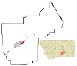
Location of Lockwood, Montana, just east of Billings
Coordinates: 45°49′12″N108°24′26″W / 45.82000°N 108.40722°W / 45.82000; -108.40722
CountryUnited States
State Montana
County Yellowstone
Area
[1]
  Total13.342 sq mi (34.556 km2)
  Land12.855 sq mi (33.294 km2)
  Water0.487 sq mi (1.262 km2)
Elevation
[2]
3,127 ft (953 m)
Population
 (2020) [3]
  Total7,195
  Estimate 
(2024) [4]
7,393
  Density559.70/sq mi (216.10/km2)
Time zone UTC–7 (Mountain (MST))
  Summer (DST) UTC–6 (MDT)
ZIP Code
59101
Area code 406
FIPS code 30-44200
GNIS feature ID2408626 [2]
Website lockwoodmontana.com

Lockwood is a census-designated place (CDP) in Yellowstone County, Montana, United States. It is not an organized city or town. The population was 7,195 at the 2020 census.The population was 7,222 at the 2020 census. [3] Lockwood is a suburb of Billings and is the second largest community in the Billings Metropolitan Statistical Area. Annexation of Lockwood to Billings has been studied; however, the June 2009 Billings City Council Annexation Plan states that the city has no plans to annex Lockwood in the foreseeable future. Lockwood is the site of a major Exxon refinery.

Contents

Geography

Lockwood is located at 45°48′27″N108°25′25″W / 45.80750°N 108.42361°W / 45.80750; -108.42361 (45.807504, -108.423600). [5]

According to the United States Census Bureau, the CDP has a total area of 12.855 square miles (33.29 km2), is land and 0.487 square miles (1.26 km2), is water. [1]

History

Lockwood bordered the Crow “Mitsiadazi” Reservation, in the 1800s. Cows replacing the buffalo brought an end to the plains Native Americans’ way of life. Lockwood was named after Captain Lockwood, reputed to have many victories fighting Native Americans and to have been a surveyor for the government who camped in the foothills in the late 1800s. In 1907, settlers opened a public road through Lockwood flats of heavy loam to the 2nd crossing of Dry Creek, to the Dry Creek Road traversing to the Reservation. The old Native American supply road is still etched into the side of the hill at the south end of Exxon Road which was later called Peter Hoe Road.

Lockwood Flats was home of the Johnson Ranch. Just to the southeast of the ranch, one can find reminisces of Cavalry camps as they stay in the area for a whole winter surveying the land for the federal government. The area known as Lockwood Flats was also originally the site of a stop called Hirsch, located just between Johnson Lane and old Coulson Road. A community began to develop around it, however, the topographical name Lockwood stuck, and the name Hirsch was eventually forgotten. On June 16, 1965, an F3 tornado touched down near Lockwood. It was the strongest tornado ever recorded in Yellowstone County. [6] [7]

Today, Lockwood has grown to become the largest unincorporated community in the state of Montana and the 16th largest population center in the state. Lockwood is also one of the fastest-growing communities in Montana, with an estimated 58% increase between the 2000 and 2010 censuses. In 2010, Lockwood gained status as a Census Designated Place. Residents and local businesses are working with Yellowstone County and the City of Billings to create a framework for proper infrastructure and zone planning, as well as an eventual incorporation as an official municipality.

On October 24, 2013, Lockwood residents gathered for a large community meeting with 250 attendees to discuss and organize community interest, goals, and direction. Pictures of the historic meeting were recorded of the event and posted on the new [www.lockwoodmontana.com community website]. Groups were organized and champions were chosen for many different issues whether it was for a high school, incorporation, better roads, Billings bypass, community garden, community festival, water & sewer, lighting, sidewalks, and businesses. A celebration was held one year from the historic gathering to celebrate the progress that had been made.

Demographics

Historical population
CensusPop.Note
1990 3,967
2000 4,3068.5%
2010 6,79757.8%
2020 7,1955.9%
2022 (est.)7,393 [4] 2.8%
U.S. Decennial Census [8]
2020 Census [3]

2020 census

As of the 2020 census, there were 7,195 people, 2,697 households, and 1,862 families residing in the CDP. [9] There were 2,811 housing units.

2010 census

As of the 2010 census, there were 6,797 people, 2,651 households, and 2,566 families residing in the CDP. The population density was 577.5 inhabitants per square mile (223.0/km2). There were 2,651 housing units at an average density of 224.8 per square mile (86.8/km2). The racial makeup of the CDP was 86.0% White, 0.4% African American, 4.5% Native American, 0.35% Asian, 0.12% Pacific Islander, 1.02% from other races, and 2.32% from two or more races. Hispanic or Latino of any race were 3.74% of the population.

There were 1,599 households, out of which 40.3% had children under the age of 18 living with them, 55.7% were married couples living together, 12.6% had a female householder with no husband present, and 26.3% were non-families. 20.8% of all households were made up of individuals, and 5.6% had someone living alone who was 65 years of age or older. The average household size was 2.69 and the average family size was 3.10.

In the CDP, the population was spread out, with 29.9% under the age of 18, 8.3% from 18 to 24, 31.7% from 25 to 44, 22.5% from 45 to 64, and 7.5% who were 65 years of age or older. The median age was 34 years. For every 100 females, there were 101.5 males. For every 100 females age 18 and over, there were 97.4 males.

Lockwood's census data shows that the Lockwood CDP has a population of 8,477 and a 2011 Median Household Income (MHI) of $47,059 compared to the State of Montana's MHI of $43,872. With this MHI it may make it more difficult to secure grants specific to low income residents.

Education

The school district for the vast majority of Lockwood is Lockwood K-12 Schools, a K-12 unified school district. A small portion of the territory is in Huntley Project K-12 Schools. [10]

Lockwood Schools provides education from kindergarten through high school. [11] Lockwood High School's team name is the Lions. [12]

Related Research Articles

<span class="mw-page-title-main">Yellowstone County, Montana</span> County in Montana, United States

Yellowstone County is the most populous county in the U.S. state of Montana. As of the 2020 census, the population was 164,731. Its county seat is Billings, the state's most populous city. Like the nearby park, Yellowstone County is named after the Yellowstone River which roughly bisects the county, flowing southwest to northeast. The river, in turn, was named for the yellow sandstone cliffs in what is now Yellowstone County.

<span class="mw-page-title-main">Crow Agency, Montana</span> Census designated place in Montana, United States

Crow Agency is a census-designated place (CDP) in Big Horn County, Montana, United States and is near the actual location for the Little Bighorn National Monument and re-enactment produced by the Real Bird family known as Battle of the Little Bighorn Reenactment. The population was 1,616 at the 2010 census. It is the governmental headquarters of the Crow Native Americans. It is also the location of the "agency offices" where the federal Superintendent of the Crow Indian Reservation and his staff interacts with the Crow Tribe, pursuant to federal treaties and statutes.

<span class="mw-page-title-main">Pryor, Montana</span> Census-designated place in Montana, United States

Pryor is a census-designated place (CDP) in Big Horn County, Montana, United States. The community is located on Crow Tribe's reservation. The population was 618 at the 2010 census. The area is named for Nathaniel Hale Pryor, a sergeant in the Lewis and Clark Expedition.

<span class="mw-page-title-main">Wyola, Montana</span> Census-designated place in Montana, United States

Wyola is a census-designated place (CDP) in Big Horn County, Montana, United States. The population was 215 at the 2010 census. 79% of the residents are Native American, and the majority are members of the Crow Tribe.

<span class="mw-page-title-main">Belfry, Montana</span> Census-designated place in Montana, United States

Belfry is a census-designated place (CDP) in Carbon County, Montana, United States. It is part of the Billings, Montana Metropolitan Statistical Area. The population was 218 at the 2010 census. It is located approximately 11 miles (18 km) from the Wyoming border, roughly halfway between Billings, Montana and Cody, Wyoming.

<span class="mw-page-title-main">Fromberg, Montana</span> Town in Carbon County, Montana, United States

Fromberg is a town in Carbon County, Montana, United States. As of the 2020 census, the population of the town was 392.

<span class="mw-page-title-main">Glendive, Montana</span> City in Montana, United States

Glendive is a city in and the county seat of Dawson County, Montana, United States, and home to Dawson Community College. Glendive was established by the Northern Pacific Railway when they built the transcontinental railroad across the northern tier of the western United States from Minnesota to the Pacific Coast. The town was the headquarters for the Yellowstone Division that encompassed 875 route miles (1,408 km); 546 (879) in main line and 328 (528) in branches with the main routes from Mandan, North Dakota, to Billings, Montana, and from Billings to Livingston. The town of Glendive is an agricultural and ranching hub of eastern Montana sited between the Yellowstone River and the Badlands. Makoshika State Park is located just east of Glendive.

<span class="mw-page-title-main">West Yellowstone, Montana</span> Town in Montana, United States

West Yellowstone is a town in Gallatin County, Montana, United States, adjacent to Yellowstone National Park. The population was 1,272 at the 2020 census. West Yellowstone is served by Yellowstone Airport. It is part of the Bozeman, MT Micropolitan Statistical Area.

<span class="mw-page-title-main">Gardiner, Montana</span> Unincorporated community in Park County, Montana, United States

Gardiner is a census-designated place (CDP) in Park County, Montana, United States, along the 45th parallel. As of the 2020 census, the population of the community and nearby areas was 833.

<span class="mw-page-title-main">Sidney, Montana</span> City in Montana, United States

Sidney is a city in and the county seat of Richland County, Montana, United States, less than 10 mi (16 km) west of the North Dakota border. The population was 6,346 at the 2020 census. The city lies along the Yellowstone River and is in proximity to the badlands of the Dakotas. Sidney is approximately midway between Glendive, Montana and Williston, North Dakota.

<span class="mw-page-title-main">Absarokee, Montana</span> CDP in Montana, United States

Absarokee is a census-designated place (CDP) in Stillwater County, Montana, United States, approximately 14 miles (23 km) south of Columbus on Highway 78. It is named after the Crow Indians who formerly inhabited the land. The population was 1,234 at the 2000 census. The Stillwater Mine, operated by the Stillwater Mining Company, is located near Absarokee.

<span class="mw-page-title-main">Park City, Montana</span> CDP in Montana, United States

Park City is a census-designated place (CDP) in Stillwater County, Montana, United States. The population was 870 at the 2000 census.

<span class="mw-page-title-main">Ballantine, Montana</span> CDP in Montana, United States

Ballantine is a census-designated place (CDP) in Yellowstone County, Montana, United States. It lies approximately nine miles (14 km) northeast of Billings on Interstate 94. The population was 346 at the 2000 census. Ballantine, along with the communities of Pompey's Pillar, Worden, and Huntley, is part of the Huntley Project, an irrigation district created by the United States Bureau of Reclamation. The majority of Ballantine's population lives on scattered farms and ranches surrounding the actual townsite.

<span class="mw-page-title-main">Billings, Montana</span> Largest city in Montana, U.S.

Billings is the most populous city in the U.S. state of Montana, with a population of 117,116 as of the 2020 census. Located in the south-central portion of the state, it is the seat of Yellowstone County and the principal city of the Billings Metropolitan Area, which had a population of 184,167 in the 2020 census. With one of the largest trade areas in the United States, Billings is the trade and distribution center for much of Montana east of the Continental Divide. Billings is also the largest retail destination for much of the same area. The Billings Chamber of Commerce claims the area of commerce covers more than 125,000 square miles (320,000 km2). In 2009, it was estimated to serve over 500,000 people.

<span class="mw-page-title-main">Custer, Montana</span> Village in Montana, United States

Custer is a village in Yellowstone County, Montana, United States. The population was 145 at the 2000 census.

<span class="mw-page-title-main">Huntley, Montana</span> CDP in Montana, United States

Huntley is a census-designated place (CDP) in Yellowstone County, Montana, United States. The population was 411 at the 2000 census. Huntley lent its name to the Huntley Project, a federal irrigation project that began delivering water to the arid district in 1907. Today, Huntley is an eastern suburb of Billings and is located east of Shepherd and west of Worden.

<span class="mw-page-title-main">Laurel, Montana</span> City in Montana, United States

Laurel is a city in Yellowstone County, Montana, United States. It is the third largest community in the Billings Metropolitan Statistical Area, and is located in the Yellowstone Valley, as an east–west terminal division point of the BNSF Railway. The population was 7,222 at the 2020 census.

<span class="mw-page-title-main">Shepherd, Montana</span> CDP in Montana, United States

Shepherd is a census-designated place (CDP) in Yellowstone County, Montana, United States. The population was 193 at the 2000 census. Shepherd is a Billings suburb located to the northeast. The unincorporated town was named after R.E. Shepherd, a prominent early settler and owner of the Billings Land and Irrigation Company and the Merchants National Bank. The post office opened in 1915.

<span class="mw-page-title-main">Worden, Montana</span> CDP in Montana, United States

Worden is a census-designated place (CDP) in Yellowstone County, Montana, United States. The population was 582 at the 506 at the 2020 census. Worden, along with Ballantine, Huntley, and Pompey's Pillar, is part of the Huntley Project, an irrigation district established by the United States Bureau of Reclamation in 1907.

<span class="mw-page-title-main">Billings Metropolitan Statistical Area</span>

The Billings Metropolitan Statistical Area is the largest metropolitan area in the U.S. state of Montana. Located in the south central portion of the state, its population is 184,167 as of 2020.

References

  1. 1 2 "2023 U.S. Gazetteer Files". United States Census Bureau. Retrieved February 29, 2024.
  2. 1 2 U.S. Geological Survey Geographic Names Information System: Lockwood, Montana
  3. 1 2 3 "Explore Census Data". United States Census Bureau . Retrieved March 1, 2024.
  4. 1 2 "Montana Cities by Population (2024)". World Population Review. March 1, 2024. Retrieved March 1, 2024.
  5. "US Gazetteer files: 2010, 2000, and 1990". United States Census Bureau. February 12, 2011. Retrieved April 23, 2011.
  6. "Tornado History Project: 19650616.30.2". www.tornadohistoryproject.com. Archived from the original on May 20, 2014.
  7. "Tornado History Project: Yellowstone County, Montana". www.tornadohistoryproject.com. Archived from the original on January 28, 2011.
  8. "Census of Population and Housing". United States Census Bureau. Retrieved June 4, 2015.
  9. "US Census Bureau, Table P16: Household Type". United States Census Bureau. Retrieved March 1, 2024.
  10. "2020 CENSUS - SCHOOL DISTRICT REFERENCE MAP: Yellowstone County, MT" (PDF). U.S. Census Bureau . Retrieved March 15, 2024. - Text list
  11. "Lockwood Schools". Lockwood Schools. Retrieved April 20, 2021.
  12. "Member Schools". Montana High School Association. Retrieved April 19, 2021.