Addington, New Zealand

Last updated

Addington
St Mary's Addington, NZ.jpg
St Mary's Anglican Church, a central landmark of Addington
Addington, New Zealand
Coordinates: 43°32′42″S172°36′32″E / 43.545°S 172.609°E / -43.545; 172.609
CountryNew Zealand
City Christchurch
Local authority Christchurch City Council
Electoral ward
  • Riccarton
  • Central
Community board
  • Waipuna Halswell-Hornby-Riccarton
  • Waihoro Spreydon-Cashmere-Heathcote
Established1860
Area
[1]
  Land263 ha (650 acres)
Population
 (June 2023) [2]
  Total6,080
Postcode(s)
8041
Upper Riccarton Riccarton Christchurch Central City
Middleton
Pfeil oben.svg
Pfeil links.svgAddingtonPfeil rechts.svg
Pfeil unten.svg
Sydenham
Hillmorton Spreydon

Addington is one of the older suburbs of Christchurch, New Zealand. It was originally open grassland with patches of shrubland which soon became a working-class suburb which was heavily industrialised with factories and large premises of railway workshops built along Main South Line. It is sited 2.5 kilometres (1.6 mi) south-west of the city centre. [3]

Contents

As an inner city suburb, Addington has a mix of residential, retail and light industrial properties, which grew significantly after professional and commercial companies were displaced from the central city after the 2011 Christchurch earthquake. [4]

Geography

Addington is sited between the suburbs of Spreydon and Riccarton, with Blenheim Road providing the boundary to Riccarton. The cluster of the shops in the suburb of Spreydon also provide a clear boundary between the suburbs. To the east of the suburb is Sydenham and to the west is Middleton. [5]

History

19th century

Addington Railway Workshops, 2 May 1898 Addington Railway Workshops, 2 May 1898.jpg
Addington Railway Workshops, 2 May 1898

For the first decade after the founding of Christchurch in 1850, Addington was farmland, consisting of large rural sections. In the early 1860s, the railway was surveyed through the area and subdivision of the larger sections began. Factories moved in; wool and grain sheds opened; and with the industry came working class residential settlement.

Development continued throughout the 19th century: the city's sale yards opened in 1874 and the railway workshops were moved to Addington in 1880. By the time the show grounds were opened in 1887, Addington had become an important suburb in the industrial and social life of Christchurch. [6] In 1874 the Addington Prison was built under the guidance of Benjamin Mountfort in Lincoln Road; it closed in 1999 and the Mountfort cell block and remaining perimeter walls are a Heritage New Zealand Historic Place Category 2 [7] and is now a hostel. [8] The suburb was named for the country residence of Archbishop John Sumner, one of the leading members of the Canterbury Association, and who was buried in St Mary's Church, Addington in England. [9]

20th century

The New Zealand Railways Department's Addington Workshops were situated in Addington until their closure in the 1990s; the historic concrete water-tower survives, [10] [11] next to the new Christchurch railway station. The tower has served as the centrepoint for the adjacent Tower Junction shopping complex. The previous railway station is located on Moorhouse Avenue in neighbouring Sydenham. The new station at Addington opened in 1994 and now serves the TranzAlpine, which takes tourists on the 223-kilometre (139 mi) coast-to-coast journey from Christchurch to Greymouth. [12] Addington was the home of the oldest blending plant in the Southern Hemisphere until it was demolished after sustaining some damage in the February 2011 Christchurch earthquake. The demolition of the plant sparked some controversy as the plant had been lined up to be carefully taken apart in an attempt to save Oregon timber valued at over $600,000. [13]

Demographics

Addington comprises four statistical areas. Addington North is primarily industrial, with the Main South Line running through it. Addington West and Addington East are residential. Tower Junction has a shopping centre, Addington Racecourse, and light industrial premises, and also includes two rest homes, which result in an unusually high median age for residents.

Individual statistical areas
NameArea
(km2)
PopulationDensity
(per km2)
HouseholdsMedian ageMedian
income
Addington North0.431228326.0 years$40,000 [14]
Addington West0.562,4094,30278635.8 years$30,200 [15]
Addington East0.572,9375,1531,20031.8 years$31,700 [16]
Tower Junction1.071201121280.6 years$22,500 [17]
New Zealand37.4 years$31,800

Residential areas

The residential areas of Addington, comprising the statistical areas of Addington West and Addington East cover 1.13 km2 (0.44 sq mi). [1] They had an estimated population of 5,860 as of June 2023, with a population density of 5,186 people per km2.

Historical population for residential areas
YearPop.±% p.a.
20064,287    
20135,031+2.31%
20185,346+1.22%
Source: [18]

The statistical areas of Addington West and Addington East had a population of 5,346 at the 2018 New Zealand census, an increase of 315 people (6.3%) since the 2013 census, and an increase of 1,059 people (24.7%) since the 2006 census. There were 1,986 households, comprising 2,817 males and 2,529 females, giving a sex ratio of 1.11 males per female, with 696 people (13.0%) aged under 15 years, 1,548 (29.0%) aged 15 to 29, 2,505 (46.9%) aged 30 to 64, and 597 (11.2%) aged 65 or older.

Ethnicities were 60.4% European/Pākehā, 10.7% Māori, 4.5% Pasifika, 29.8% Asian, and 4.0% other ethnicities. People may identify with more than one ethnicity.

The percentage of people born overseas was 41.0, compared with 27.1% nationally.

Although some people chose not to answer the census's question about religious affiliation, 40.1% had no religion, 41.7% were Christian, 0.5% had Māori religious beliefs, 4.3% were Hindu, 2.1% were Muslim, 1.1% were Buddhist and 4.2% had other religions.

Of those at least 15 years old, 1,212 (26.1%) people had a bachelor's or higher degree, and 780 (16.8%) people had no formal qualifications. 399 people (8.6%) earned over $70,000 compared to 17.2% nationally. The employment status of those at least 15 was that 2,544 (54.7%) people were employed full-time, 519 (11.2%) were part-time, and 183 (3.9%) were unemployed. [18]

Addington North

Addington North covers 0.43 km2 (0.17 sq mi). [1] It had an estimated population of 20 as of June 2023, [2] with a population density of 47 people per km2.

Statistics New Zealand do not publish detailed statistics for areas of very low population.

Tower Junction

Tower Junction covers 1.07 km2 (0.41 sq mi). [1] It had an estimated population of 200 as of June 2023, [2] with a population density of 187 people per km2.

Historical population for Tower Junction
YearPop.±% p.a.
200624    
201339+7.18%
2018120+25.21%
Source: [19]

Tower Junction had a population of 120 at the 2018 New Zealand census, an increase of 81 people (207.7%) since the 2013 census, and an increase of 96 people (400.0%) since the 2006 census. There were 12 households, comprising 42 males and 78 females, giving a sex ratio of 0.54 males per female. The median age was 80.6 years (compared with 37.4 years nationally), with 3 people (2.5%) aged under 15 years, 15 (12.5%) aged 15 to 29, 15 (12.5%) aged 30 to 64, and 84 (70.0%) aged 65 or older.

Ethnicities were 80.0% European/Pākehā, 2.5% Māori, 5.0% Pasifika, and 15.0% Asian. People may identify with more than one ethnicity.

The percentage of people born overseas was 30.0, compared with 27.1% nationally.

Although some people chose not to answer the census's question about religious affiliation, 22.5% had no religion, 70.0% were Christian and 2.5% had other religions.

Of those at least 15 years old, 12 (10.3%) people had a bachelor's or higher degree, and 45 (38.5%) people had no formal qualifications. The median income was $22,500, compared with $31,800 nationally. 3 people (2.6%) earned over $70,000 compared to 17.2% nationally. The employment status of those at least 15 was that 24 (20.5%) people were employed full-time, and 6 (5.1%) were part-time. [19]

Economy

Tower Junction shopping centre is located in Addington, owned by Ngāi Tahu. [20] It opened in 2002, [20] and was redeveloped in 2018. [21] It covers 37,000 m2 and has 40 tenants, including Bunnings Warehouse and Harvey Norman. [20]

Features

Addington Cemetery Addington Cemetery - No Visitors.jpg
Addington Cemetery

The suburb is home to multiple sporting and events complexes, including Horncastle Arena, Rugby League Park (currently branded as Orangetheory Stadium), and Addington Raceway. Along with Riccarton Racecourse, the Raceway is one of Christchurch's primary horse-racing venues, focusing predominantly on harness racing, and is the home to the annual New Zealand Trotting Cup. Addington is also close to many other event venues, notably Hagley Park to the north and the Canterbury Agricultural Park to the southwest.

Central to Addington's residential area is St Mary's Anglican Church, which is a historic building surrounded by the spacious grounds and trees of Church Square. The grounds are used by the community for galas, pancake races (on Shrove Tuesday) fairs and weddings. The buildings and surrounding area is registered by Heritage New Zealand as a historic area, with registration number 7516. [22]

Addington was also formerly home to an immigration barrack. [23]

The Court Theatre, whose buildings were damaged in the earthquake, relocated to "The Shed" and started operating in 2011. [24]

Manuka Cottage is a community house that serves the interests of a wide variety of people and local community groups. [25]

Education

Addington School is sited in the south–west corner of the suburb where the boundary with Spreydon is not clearly defined. [26] It is a contributing primary school for years 1 to 6. [27] It has a roll of 290 students. The school opened in 1881 as West Christchurch Side School, [28] the original building was built from timber but burnt down in 1909. [29]

Sacred Heart School is a Catholic state-integrated full primary school for years 1 to 8. [30] It has a roll of 170 students. Sacred Heart opened in 1877. [31]

Related Research Articles

<span class="mw-page-title-main">Ferrymead</span> Suburb of Christchurch, New Zealand

Ferrymead is a suburb south-east of Christchurch, New Zealand. It is the main thoroughfare for reaching the eastern sea suburbs such as Sumner, as well as home to a number of cliff-top residences and businesses along the estuary front. After the 2011 Canterbury earthquake, a number of prominent Christchurch businesses relocated to the Ferrymead area, making it into a secondary business hub.

<span class="mw-page-title-main">Christchurch</span> City in Canterbury, New Zealand

Christchurch is the largest city in the South Island and the second-largest city by urban area population in New Zealand, after Auckland. Christchurch lies in the Canterbury Region, near the centre of the east coast of the South Island, east of the Canterbury Plains. It is located near the southern end of Pegasus Bay, and is bounded to the east by the Pacific Ocean and to the south by Banks Peninsula. The Avon River / Ōtākaro flows through the centre of the city, with a large urban park along its banks. Christchurch has a reputation for being an 'English' city, with its architectural identity and common nickname the "Garden City" due to similarities with garden cities in England.

<span class="mw-page-title-main">Riccarton, New Zealand</span> Suburb of Christchurch, New Zealand

Riccarton is a suburb of Christchurch. It is due west of the city centre, separated from it by Hagley Park. Upper Riccarton is to the west of Riccarton.

<span class="mw-page-title-main">Ilam, New Zealand</span> Suburb of Christchurch, New Zealand

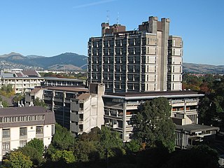
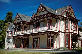
Ilam is a suburb of Christchurch, New Zealand about five kilometres west of the city centre. It is the location of the University of Canterbury.

<span class="mw-page-title-main">Heathcote Valley</span> Suburb of Christchurch, New Zealand

Heathcote Valley is a suburb of Christchurch, New Zealand. It is named after Sir William Heathcote, who was secretary of the Canterbury Association.

<span class="mw-page-title-main">Fendalton</span> Suburb of Christchurch, New Zealand

Fendalton is a suburb of Christchurch, in the South Island of New Zealand.

<span class="mw-page-title-main">Cashmere, New Zealand</span> Suburb of Christchurch, New Zealand

Cashmere is a suburb which rises above the southern end of the city of Christchurch in New Zealand's South Island.

<span class="mw-page-title-main">Halswell</span> Suburb of Christchurch, New Zealand

Originally a separate village, Halswell is now a residential suburb of Christchurch, New Zealand, located 9 kilometres (5.6 mi) southwest of Cathedral Square on State Highway 75.

<span class="mw-page-title-main">Hornby, New Zealand</span> Suburb of Christchurch, New Zealand

Hornby is a major residential and retail suburb at the western edge of Christchurch, New Zealand. The suburb is directly connected to other parts of Christchurch and the South Island by a number of main arterial routes, including State Highway 1 and the Christchurch Southern Motorway.

<span class="mw-page-title-main">Sydenham, New Zealand</span> Suburb of Christchurch, New Zealand

Sydenham is an inner suburb of Christchurch, New Zealand, two kilometres south of the city centre, on and around the city's main street, Colombo Street. It is a residential, retail and light industrial suburb.

<span class="mw-page-title-main">Rolleston, New Zealand</span> Town in the South Island of New Zealand

Rolleston is the seat and largest town in the Selwyn District, in the Canterbury region of New Zealand's South Island. It is located on the Canterbury Plains 22 kilometres (14 mi) south-west of Christchurch, and is part of the wider Christchurch metropolitan area. The town has a population of 29,600, making it New Zealand's 23rd-largest urban area and the second-largest in Canterbury.

<span class="mw-page-title-main">Spreydon</span> Suburb of Christchurch, New Zealand

Spreydon is a suburb of Christchurch, New Zealand, 4 kilometres (2.5 mi) south-south-west of Cathedral Square. The most central street through Spreydon is Barrington Street. Spreydon is flanked by the suburbs Hoon Hay, Sydenham, and Lower Cashmere. State Highway 76 marks the northern boundary of the suburb, including the eastern end of the Christchurch Southern Motorway.

Hoon Hay is an outer suburb of Christchurch, New Zealand, located at the base of the Port Hills and about 5 kilometres (3.1 mi) southwest of Cathedral Square. The area was named by Captain Wickham Talbot Harvey, a captain of the British Royal 10th Hussars, who moved to the area in 1852 and named it after the farm in Hoon, Derbyshire where he grew up. Harvey only stayed in the area for four years, before a fire destroyed his property and prompted him to return to the United Kingdom. Further fires in the following years destroyed the woodland which was on the property, including several large Tōtara, causing it to be converted into farmland. Remnants of this forest remain visible in the area, including with tree stumps being discovered during flood mitigation work on the Ōpāwaho / Heathcote River.

<span class="mw-page-title-main">Avonhead</span> Suburb of Christchurch, New Zealand

Avonhead is a suburb of the New Zealand city of Christchurch. It has two primary schools, a shopping centre and several parks.

<span class="mw-page-title-main">Riccarton Park Racecourse</span> Horse racecourse in Christchurch, New Zealand

Riccarton Park Racecourse is the main thoroughbred horse racecourse for the Christchurch city area in New Zealand.

<span class="mw-page-title-main">Upper Riccarton</span> Suburb of Christchurch, New Zealand

Upper Riccarton is a suburb of Christchurch. It is due west of Riccarton.

<span class="mw-page-title-main">Sockburn, New Zealand</span> Suburb in Christchurch, New Zealand

Sockburn is an industrial suburb of Christchurch, New Zealand, located between Hornby and Riccarton, some 7 kilometres (4.3 mi) west of the Christchurch city centre. The suburb is roughly bounded by the triangle formed by State Highway 1 in the west, Main South Road (SH73a) in the south and SH73 in the north. The suburb of Wigram, containing the city's former RNZAF base, is located nearby. One of the city's main horseracing circuits, Riccarton Racecourse, is located close to Sockburn's northern edge, and Racecourse was the initial name for the area. The name Sockburn is likely to have come from the village of Sockburn in County Durham, England.

<span class="mw-page-title-main">Bromley, New Zealand</span> Suburb of Christchurch, New Zealand

Bromley is a suburb of the city of Christchurch, New Zealand. It lies to the east of the city centre, mostly between Pages Road and the Avon river estuary.

<span class="mw-page-title-main">Middleton, New Zealand</span> Suburb of Christchurch, New Zealand

Middleton is a predominantly industrial and wholesale suburb of Christchurch, New Zealand. It is located in the west of the city, between Wigram and Addington, and immediately to the south of Upper Riccarton.

<span class="mw-page-title-main">Hillmorton, New Zealand</span> Suburb of Christchurch, New Zealand

Hillmorton is a suburb of south-western Christchurch, New Zealand. The suburb is centred around the intersection of Lincoln Road and Hoon hay Road, two arterial routes which form part of State Highway 75 and feed into the Christchurch Southern Motorway which runs to the north of the suburb.

References

  1. 1 2 3 4 "ArcGIS Web Application". statsnz.maps.arcgis.com. Retrieved 25 September 2021.
  2. 1 2 3 "Population estimate tables - NZ.Stat". Statistics New Zealand . Retrieved 25 October 2023.
  3. Wilson 2018, p. 13–15.
  4. Wilson 2018, p. 297.
  5. Wilson 2018, p. 21–22.
  6. Wilson 2018, p. 29.
  7. "Addington Prison". New Zealand Heritage List/Rārangi Kōrero. Heritage New Zealand . Retrieved 11 October 2022.
  8. "Get locked up in a historic prison hotel". The New Zealand Herald. 2 June 2017. Retrieved 17 May 2024.
  9. Reed, A. W. (2010). Peter Dowling (ed.). Place Names of New Zealand. Rosedale, North Shore: Raupo. p. 17. ISBN   978-0-14-320410-7.
  10. Wilson 2005, p. 140.
  11. Atkinson, Neill (2010). "Railways – Workshops". Te Ara – the Encyclopedia of New Zealand. Retrieved 17 May 2024.
  12. Gibbs, Tatiana (19 December 2023). "Carriage disconnects from TranzAlpine passenger train". The Press . Christchurch, New Zealand. Retrieved 17 May 2024.
  13. "Tensions rise as historic building demolished". Television New Zealand . 15 March 2011. Retrieved 15 September 2011.
  14. 2018 Census place summary: Addington North
  15. 2018 Census place summary: Addington West
  16. 2018 Census place summary: Addington East
  17. 2018 Census place summary: Tower Junction
  18. 1 2 "Statistical area 1 dataset for 2018 Census". Statistics New Zealand. March 2020. Addington West (326100) and Addington East (327400).
  19. 1 2 "Statistical area 1 dataset for 2018 Census". Statistics New Zealand. March 2020. Tower Junction (325500). 2018 Census place summary: Tower Junction
  20. 1 2 3 "About Tower Junction". shoptowerjunction.co.nz. Ngāi Tahu.
  21. McDonald, Liz (17 July 2017). "New shops and food outlets for expanding Tower Junction". stuff.co.nz. The Christchurch Press.
  22. "Church of St Mary the Virgin Historic Area". NZHPT. Retrieved 2 September 2011.
  23. "Immigration Barracks, Addington". The Star. Christchurch, New Zealand. 9 August 1872. p. 2. Retrieved 19 May 2024.
  24. Gates, Charlie (29 June 2022). "Court Theatre's building and land in Addington sold for development". Stuff. Archived from the original on 5 July 2022. Retrieved 3 May 2024.
  25. "Manuka Cottage – Addington Community House". Mental Health Education and Resource Centre. Archived from the original on 23 December 2018. Retrieved 19 May 2024.
  26. V.C Browne NZ Aerial Photograph Collection, 1320–1353
  27. Education Counts: Addington Te Kura Taumatua
  28. Clarke, Rae (2006). Addington Primary School – 125 Years 1881–2006. p. 13.
  29. Clarke, Rae (2006). Addington Primary School – 125 Years 1881–2006. p. 16.
  30. Education Counts: Sacred Heart School
  31. "History". Sacred Heart School. Retrieved 25 September 2021.

Works cited