Harewood, New Zealand

Last updated

Harewood
WP 20140908 025.jpg
Christchurch Airport, located within Harewood, with other parts of Harewood visible in the background
Harewood, New Zealand
Coordinates: 43°28′47″S172°33′45″E / 43.47979°S 172.56241°E / -43.47979; 172.56241
CountryNew Zealand
City Christchurch
Local authority Christchurch City Council
Electoral wardHarewood [1]
Area
[2]
  Land378 ha (934 acres)
Population
 (June 2022) [3]
  Total1,410
McLeans Island Northwood
Christchurch Airport
Pfeil oben.svg
Pfeil links.svgHarewoodPfeil rechts.svg
Pfeil unten.svg
Casebrook
Russley Burnside Bishopdale

Harewood is a northwestern suburb of Christchurch, New Zealand. The suburb is split by State Highway 1, with the bulk of Harewood's residential areas to the east of the highway and its industrial areas to the west.

Contents

Demographics

Harewood statistical area, which does not include Christchurch Airport or the industrial area north of SH1, covers 3.78 km2 (1.46 sq mi). [2] It had an estimated population of 1,410 as of June 2022, [3] with a population density of 373 people per km2.

Historical population
YearPop.±% p.a.
20061,428    
20131,401−0.27%
20181,386−0.22%
Source: [4]

Harewood had a population of 1,386 at the 2018 New Zealand census, a decrease of 15 people (-1.1%) since the 2013 census, and a decrease of 42 people (-2.9%) since the 2006 census. There were 495 households. There were 705 males and 681 females, giving a sex ratio of 1.04 males per female. The median age was 49.1 years (compared with 37.4 years nationally), with 195 people (14.1%) aged under 15 years, 240 (17.3%) aged 15 to 29, 657 (47.4%) aged 30 to 64, and 294 (21.2%) aged 65 or older.

Ethnicities were 83.3% European/Pākehā, 3.5% Māori, 1.5% Pacific peoples, 14.1% Asian, and 2.6% other ethnicities (totals add to more than 100% since people could identify with multiple ethnicities).

The proportion of people born overseas was 21.9%, compared with 27.1% nationally.

Although some people objected to giving their religion, 43.1% had no religion, 49.1% were Christian, 0.4% were Hindu, 1.5% were Buddhist and 0.9% had other religions.

Of those at least 15 years old, 321 (27.0%) people had a bachelor or higher degree, and 159 (13.4%) people had no formal qualifications. The median income was $37,800, compared with $31,800 nationally. The employment status of those at least 15 was that 561 (47.1%) people were employed full-time, 210 (17.6%) were part-time, and 30 (2.5%) were unemployed. [4]

Economy

Tiptree Cottage is a historic cob cottage built in the 1860s. Tiptree Cottage 19.JPG
Tiptree Cottage is a historic cob cottage built in the 1860s.

In addition to State Highway 1 passing through the suburb, Harewood is a major transport hub for Christchurch and the South Island owing to Christchurch International Airport sitting within the suburb. The airport is the second-busiest in New Zealand after only Auckland Airport, bringing approximately 6.9 million passengers through Harewood in 2019. [5] As a result of the airport, Harewood is also home to many freight and other industrial businesses which rely upon proximity to the airport, as well as rental car and campervan companies.

The suburb is also home to the International Antarctic Centre, a major Christchurch tourist attraction centred around the city's role as a departure point for many national Antarctic programmes. The centre was established in 1990, and is home to the administration offices of the New Zealand, United States, and Italian Antarctic programmes alongside multiple Antarctic-focused attractions. Hagglund armoured vehicles can occasionally be seen on roads around the Centre, offering rides to tourists.

The median income of Harewood residents aged 15 or more was $29,900 per annum, $100 more than the median income for the whole of Christchurch city. [6]

Education

Harewood School is a contributing primary school catering for years 1 to 6. [7] It had a roll of 176 as of April 2023. [8] The school opened in 1862. [9]

Related Research Articles

<span class="mw-page-title-main">Waltham, New Zealand</span> Suburb in Christchurch, New Zealand

Waltham is an inner suburb of Christchurch, New Zealand, located approximately two kilometres south-east of the city centre. State Highway 76, part of Christchurch's ring road system, and known there as Brougham Street, runs through the suburb, as does the Lyttelton Line rail corridor.

<span class="mw-page-title-main">Heathcote Valley</span> Suburb in Christchurch, New Zealand

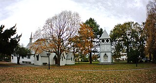
Heathcote Valley is a suburb of Christchurch, New Zealand. It is named after Sir William Heathcote, who was secretary of the Canterbury Association.

<span class="mw-page-title-main">Fendalton</span> Suburb in Christchurch, New Zealand

Fendalton is a suburb of Christchurch, in the South Island of New Zealand.

Abbotsford is a suburb of the New Zealand city of Dunedin. It is located to the west of the city centre.

<span class="mw-page-title-main">Addington, New Zealand</span> Suburb in Christchurch, New Zealand

Addington is a major suburb of Christchurch, New Zealand. It is sited 2.5 kilometres (1.6 mi) south-west of the city centre.

<span class="mw-page-title-main">Hornby, New Zealand</span> Suburb in Christchurch, New Zealand

Hornby is a major residential and retail suburb at the western edge of Christchurch, New Zealand. The suburb is directly connected to other parts of Christchurch and the South Island by a number of main arterial routes, including State Highway 1 and the Christchurch Southern Motorway.

<span class="mw-page-title-main">Sydenham, New Zealand</span> Suburb of Christchurch, New Zealand

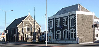
Sydenham is an inner suburb of Christchurch, New Zealand, two kilometres south of the city centre, on and around the city's main street, Colombo Street. It is a residential, retail and light industrial suburb.

<span class="mw-page-title-main">Bishopdale, Christchurch</span> Suburb in Christchurch, New Zealand

Bishopdale is a residential suburb located in the north of Christchurch, New Zealand.

Washdyke is an industrial suburb in the north of Timaru, in south Canterbury, New Zealand. State Highway 1 passes through Washdyke on the way north out of the city. The northern terminus of State Highway 8 is in Washdyke.

<span class="mw-page-title-main">Phillipstown, New Zealand</span> Suburb of Christchurch, New Zealand

Phillipstown is a small inner suburb of the city of Christchurch, New Zealand. It lies south-east of the city centre being bordered by Cashel Street to the north, Aldwins Road to the east, Ferry Road to the south, and Fitzgerald Avenue to the west.

<span class="mw-page-title-main">Grenada North</span> Suburb of Wellington City, New Zealand

Grenada North is a small suburb in northern Wellington, New Zealand. It is 5 km south of Porirua's city centre, and 13 km north of Wellington's city centre. Its western boundary is formed by State Highway 1 and Takapu Road. The suburb itself was named after Grenada in the Caribbean, and most streets are named after Caribbean islands.

<span class="mw-page-title-main">Hillsborough, Christchurch</span> Suburb in Christchurch, New Zealand

Hillsborough is a mixed industrial and residential suburb of Christchurch, New Zealand, located approximately 4 kilometres (2.5 mi) to the south-east of the city centre.

<span class="mw-page-title-main">Sockburn, New Zealand</span> Suburb in Christchurch, New Zealand

Sockburn is an industrial suburb of Christchurch, New Zealand, located between Hornby and Riccarton, some 7 kilometres (4.3 mi) west of the Christchurch city centre. The suburb is roughly bounded by the triangle formed by State Highway 1 in the west, Main South Road (SH73a) in the south and SH73 in the north. The suburb of Wigram, containing the city's former RNZAF base, is located nearby. One of the city's main horseracing circuits, Riccarton Racecourse, is located close to Sockburn's northern edge, and Racecourse was the initial name for the area. The name Sockburn is likely to have come from the village of Sockburn in County Durham, England.

Annesbrook is an industrial suburb of Nelson, New Zealand.

<span class="mw-page-title-main">Bromley, New Zealand</span> Suburb in Christchurch, New Zealand

Bromley is a suburb of the city of Christchurch, New Zealand. It lies to the east of the city centre, mostly between Pages Road and the Avon river estuary.

Izone is an industrial suburb of Rolleston in Selwyn District, Canterbury Region, New Zealand.

Middleton is a predominantly industrial and wholesale suburb of Christchurch, New Zealand. It is located in the west of the city, between Wigram and Addington, and immediately to the south of Upper Riccarton.

Russley is a suburb on the western side of Christchurch city.

<span class="mw-page-title-main">Marshland, New Zealand</span> Suburb in Christchurch, New Zealand

Marshland is a semi-rural suburb on the northern side of Christchurch city. The land is primarily used for horticulture and dairy farming.

Broomfield is a suburb on the western side of Christchurch city.

References

  1. "Wards, Councillors and Community Boards map". ccc.govt.nz. Christchurch City Council. Retrieved 14 August 2020.
  2. 1 2 "ArcGIS Web Application". statsnz.maps.arcgis.com. Retrieved 6 September 2021.
  3. 1 2 "Population estimate tables - NZ.Stat". Statistics New Zealand . Retrieved 25 October 2022.
  4. 1 2 "Statistical area 1 dataset for 2018 Census". Statistics New Zealand. March 2020. Harewood (317000). 2018 Census place summary: Harewood
  5. "2019 Annual Review" (PDF). 2019.
  6. 2013 Census QuickStats about a place (Income) : Harewood
  7. Education Counts: Harewood School
  8. "New Zealand Schools Directory". New Zealand Ministry of Education. Retrieved 12 December 2022.
  9. "Welcome". Harewood School. Retrieved 6 September 2021.