
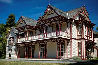
Timaru is a port city in the southern Canterbury Region of New Zealand, located 157 km (98 mi) southwest of Christchurch and about 196 km (122 mi) northeast of Dunedin on the eastern Pacific coast of the South Island. The Timaru urban area is home to 28,900 people, and is the largest urban area in South Canterbury, and the third-largest in the Canterbury Region overall, after Christchurch and Rolleston. The town is the seat of the Timaru District, which includes the surrounding rural area and the towns of Geraldine, Pleasant Point and Temuka, which combined have a total population of 48,900.

Christchurch is the largest city in the South Island of New Zealand and the seat of the Canterbury Region. Christchurch lies on the South Island's east coast, just north of Banks Peninsula on Pegasus Bay. The Avon River (Ōtākaro) flows through the centre of the city, with an urban park along its banks.
Waltham is an inner suburb of Christchurch, New Zealand, located approximately two kilometres south-east of the city centre. State Highway 76, part of Christchurch's ring road system, and known there as Brougham Street, runs through the suburb, as does the Lyttelton Line rail corridor.

Papanui is a major suburb of Christchurch, New Zealand. It is situated five kilometres to the northwest of the city centre. Papanui is a middle socio-economic area with a population of 3,645 consisting predominantly of Pākehā 86.9%, Asian 7.6%, Māori 5.3%, Pacific peoples 3.1%, Middle Eastern/Latin American/African 0.7%. The suburb is located at the junction of three busy thoroughfares; Papanui Road leading to the city, the Main North Road that leads to North Canterbury and Harewood Road that leads to Christchurch International Airport. However, as with most Christchurch suburbs, Papanui has no defined borders.

New Brighton is a coastal suburb of Christchurch, New Zealand, 8 kilometres (5.0 mi) east of the city centre. It is one of eastern Christchurch's main entertainment and tourist centres, with its architecturally unique pier and scenic coastline. The 2011 Christchurch earthquakes caused significant damage in the area.
Riccarton is a suburb of Christchurch. It is due west of the city centre, separated from it by Hagley Park. Upper Riccarton is to the west of Riccarton.

Hornby is a major residential and retail suburb at the western edge of Christchurch, New Zealand. The suburb is directly connected to other parts of Christchurch and the South Island by a number of main arterial routes, including State Highway 1 and the Christchurch Southern Motorway.

Wigram is a suburb in the southwest of Christchurch, New Zealand. The suburb lies close to the industrial estates of Sockburn and the satellite retail and residential zone of Hornby, and has undergone significant growth in recent years due to housing developments. It is seven kilometres to the west of the city centre.
Avonside is an eastern suburb in Christchurch, New Zealand. It is one of the oldest suburbs of the city, with only Heathcote being older.

Rolleston is the seat and largest town in the Selwyn District, in the Canterbury region of New Zealand's South Island. It is located on the Canterbury Plains 22 kilometres (14 mi) south-west of Christchurch, and is part of the wider Christchurch metropolitan area. The town has a population of 29,600, making it New Zealand's 23rd-largest urban area and the second-largest in Canterbury.

Bryndwr is a suburb in the north-west of Christchurch, New Zealand.
Redwood is a northern suburb of Christchurch, New Zealand which includes the sub-division of Redwood Springs. It is bordered by the Styx River to the north.

Bishopdale is a residential suburb located in the north of Christchurch, New Zealand.

St Albans is a large, inner-northern suburb of Christchurch, New Zealand, located directly north of the Christchurch Central Business District. It is the second largest suburb in the city by population, with a population of 13,137 at the 2018 Census. The suburb falls within the Christchurch Central electorate and is represented by Duncan Webb, who has been the member of parliament since the 2017 general election. St Albans is one of the most diverse residential neighbourhoods in Christchurch, with a wide range of densities, architectural styles and housing ages throughout the suburb. It has everything from run-down high-density council-owned flats, to modern luxurious high-density flats and apartments; old mid-density workers cottages through to large low-density estates of various ages.

Spreydon is a suburb of Christchurch, New Zealand, 4 kilometres (2.5 mi) south-south-west of Cathedral Square. The most central street through Spreydon is Barrington Street. Spreydon is flanked by the suburbs Hoon Hay, Sydenham, and Lower Cashmere. State Highway 76 marks the northern boundary of the suburb, including the eastern end of the Christchurch Southern Motorway.

Merivale is a suburb of Christchurch, New Zealand, north of the city centre. Like all suburbs in Christchurch, it has no defined boundaries and is a general area, but for the purposes of statistical analysis only, Statistics New Zealand defines it as being Heaton Street to the north, Papanui Road to the east, Harper and Bealey Avenues to the south and Rossall Street to the west, although Real Estate advertising often will claim residences outside this area, especially St Albans to the east of Papanui Road, as being Merivale due to the perceived desirability of the area. The area directly west of Rossall Street, which is called Holmwood by Statistics New Zealand, is sometimes considered part of Merivale.

Burnside is a suburb of Christchurch, New Zealand, located southeast of Christchurch International Airport. As with most suburbs in Christchurch, it has no defined boundaries and is a general area.

Beckenham is an inner suburb of Christchurch, New Zealand, located three kilometres south of the city centre. The Ōpāwaho / Heathcote River winds through this predominantly residential suburb, a section of which is often referred to locally as the "Beckenham Loop". Beckenham is bounded by Sydenham to the north, Somerfield to the west, Cashmere and Huntsbury to the south and St Martins to the east.

Avonhead is a suburb of the New Zealand city of Christchurch. It has two primary schools, a shopping centre and several parks.

Christchurch Central City or Christchurch City Centre is the geographical centre and the heart of Christchurch, New Zealand. It is defined as the area within the Four Avenues and thus includes the densely built up central city, some less dense surrounding areas of residential, educational and industrial usage, and green space including Hagley Park, the Christchurch Botanic Gardens and the Barbadoes Street Cemetery.


