Mairehau

Last updated

Mairehau
Mairehau High School, Christchurch, New Zealand 04.jpg
Mairehau High School
Mairehau
Coordinates: 43°29′56″S172°38′25″E / 43.498884°S 172.640324°E / -43.498884; 172.640324
CountryNew Zealand
City Christchurch
Local authority Christchurch City Council
Electoral wardInnes
Area
[1]
  Land361 ha (892 acres)
Population
 (June 2022) [2]
  Total6,860
Redwood Marshland Prestons
Northcote
Pfeil oben.svg
Pfeil links.svgMairehauPfeil rechts.svg
Pfeil unten.svg
Shirley
St Albans Edgeware Richmond

Mairehau is a suburb of Christchurch, New Zealand. It is located four kilometres north of the city centre, close to the edge of the urbanised central city area. Much new development is being carried out on the northern edge of Mairehau.

Contents

The suburb was named after Rose Mairehau (Maire) Hutton (née Rhodes), daughter of Arthur Rhodes, who in turn was Mayor of Christchurch in 1901–1902 and a major local property owner. [3] [4]

Demographics

Mairehau, comprising the statistical areas of Mairehau North and Mairehau South, covers 3.61 km2 (1.39 sq mi). [1] It had an estimated population of 6,860 as of June 2022, with a population density of 1,900 people per km2.

Historical population
YearPop.±% p.a.
20065,781    
20136,510+1.71%
20186,870+1.08%
Source: [5]

Mairehau had a population of 6,870 at the 2018 New Zealand census, an increase of 360 people (5.5%) since the 2013 census, and an increase of 1,089 people (18.8%) since the 2006 census. There were 2,547 households. There were 3,321 males and 3,549 females, giving a sex ratio of 0.94 males per female, with 1,335 people (19.4%) aged under 15 years, 1,350 (19.7%) aged 15 to 29, 2,976 (43.3%) aged 30 to 64, and 1,206 (17.6%) aged 65 or older.

Ethnicities were 84.7% European/Pākehā, 10.3% Māori, 4.0% Pacific peoples, 8.4% Asian, and 2.9% other ethnicities (totals add to more than 100% since people could identify with multiple ethnicities).

The proportion of people born overseas was 20.0%, compared with 27.1% nationally.

Although some people objected to giving their religion, 51.4% had no religion, 38.0% were Christian, 0.9% were Hindu, 1.0% were Muslim, 0.5% were Buddhist and 2.4% had other religions.

Of those at least 15 years old, 1,167 (21.1%) people had a bachelor or higher degree, and 966 (17.5%) people had no formal qualifications. The employment status of those at least 15 was that 2,781 (50.2%) people were employed full-time, 738 (13.3%) were part-time, and 186 (3.4%) were unemployed. [5]

Individual statistical areas
NamePopulationHouseholdsMedian ageMedian income
Mairehau North3,1231,15842.4 years$30,800 [6]
Mairehau South3,7471,38933.6 years$38,300 [7]
New Zealand37.4 years$31,800

Education

Mairehau High School is a secondary school for years 9 to 13. [8] It has a roll of 399. The school opened in 1961. [9]

Mairehau School is a full primary school catering for years 1 to 8. [10] It has a roll of 369. The school opened in 1953. [11] Birch Grove School closed and merged with Mairehau School in 2004. [12] Glenmoor School closed in 2014. [13]

St Francis of Assisi Catholic School is a state-integrated full primary school catering for years 1 to 8. [14] It has a roll of 389. The school opened in 2016 [15] as the result of a merger between Our Lady of Fatima School and St Paul's School. [12]

All these schools are coeducational. Rolls are as of April 2023. [16]

Related Research Articles

Opawa is an inner suburb of Christchurch, New Zealand, located 2.5 kilometres south-east of the city centre.
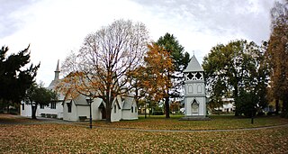
<span class="mw-page-title-main">Addington, New Zealand</span> Suburb in Christchurch, New Zealand

Addington is a major suburb of Christchurch, New Zealand. It is sited 2.5 kilometres (1.6 mi) south-west of the city centre.

<span class="mw-page-title-main">Shirley, New Zealand</span> Suburb in Christchurch, New Zealand

Shirley, sometimes referred to as Windsor, is a suburb of Christchurch, New Zealand, about 5 kilometres (3.1 mi) north-east of the city centre. The area was used for farming from the 1850s, and subdivision started in the early 20th century, with most of the houses being built between 1950 and 1980.
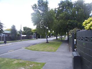
<span class="mw-page-title-main">Redwood, Christchurch</span> Suburb in Christchurch, New Zealand

Redwood is a suburb located in Christchurch, New Zealand which includes the sub-division of Redwood Springs. The suburb was first named Styx but renamed following a popular vote of local residents in the 1960s after a large Sequoia redwood tree still standing in Prestons Road. The original forest cover was Totara and Kahikatea. Redwood has its own community radio station called Good Music FM 107.5.

<span class="mw-page-title-main">Bishopdale, Christchurch</span> Suburb in Christchurch, New Zealand

Bishopdale is a residential suburb located in the north of Christchurch, New Zealand.

<span class="mw-page-title-main">St Albans, New Zealand</span> Suburb in Christchurch, New Zealand

St Albans is a large, inner-northern suburb of Christchurch, New Zealand, located directly north of the Christchurch Central Business District. It is the second largest suburb in the city by population, with a population of 13,137 at the 2018 Census. The suburb falls within the Christchurch Central electorate and is represented by Duncan Webb, who has been the member of parliament since the 2017 general election. St Albans is one of the most diverse residential neighbourhoods in Christchurch, with a wide range of densities, architectural styles and housing ages throughout the suburb. It has everything from run-down high-density council-owned flats, to modern luxurious high-density flats and apartments; old mid-density workers cottages through to large low-density estates of various ages.

<span class="mw-page-title-main">Burnside, Christchurch</span> Suburb in Christchurch, New Zealand

Burnside is a suburb of Christchurch, New Zealand, located southeast of Christchurch International Airport. As with most suburbs in Christchurch, it has no defined boundaries and is a general area.
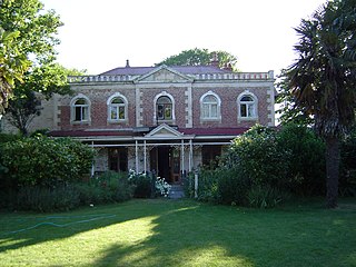
<span class="mw-page-title-main">Linwood, New Zealand</span> Suburb in Christchurch, New Zealand

Linwood is an inner suburb of the city of Christchurch, New Zealand. It lies to the east of the city centre, mostly between Ferry Road and Linwood Avenue, two of the major arterial roads to the eastern suburbs of Christchurch.

<span class="mw-page-title-main">Somerfield, New Zealand</span> Suburb in Christchurch, New Zealand

Somerfield is a suburb in the south of Christchurch, New Zealand. It is nominally bordered by the Ōpāwaho / Heathcote River to the south and west, Strickland and Colombo Streets to the east, and Milton Street to the north. The suburb includes Somerfield School, Somerfield Park and a small number of shops which service the local area, although it is predominantly residential. Somerfield is also known for its wide variety of trees, especially along the banks of the Ōpāwaho / Heathcote River.

<span class="mw-page-title-main">Richmond, Christchurch</span> Suburb in Christchurch, New Zealand

Richmond is a minor suburb of Christchurch, New Zealand.
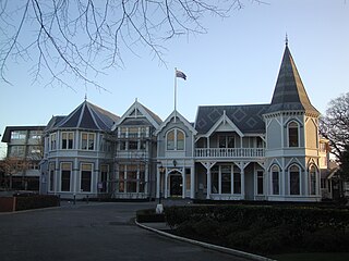
<span class="mw-page-title-main">Strowan</span> Suburb in Christchurch, New Zealand

Strowan is an affluent suburb of Christchurch, New Zealand, located approximately 5 km north-west of Christchurch's central business district. It had a population of 3,705 at the 2013 census. It is located between the suburbs of Merivale, Papanui, Bryndwr, Fendalton, and St Albans.

<span class="mw-page-title-main">Dallington, New Zealand</span> Suburb in Christchurch, New Zealand

Dallington is a suburb of Christchurch, New Zealand, on the north-east side of the city.

<span class="mw-page-title-main">Mount Pleasant, New Zealand</span> Suburb in Christchurch, New Zealand

Mount Pleasant (Tauhinukorokio) is a coastal suburb of Christchurch, New Zealand. The suburb is located on the northern flank of the mountain Tauhinukorokio/Mount Pleasant in the Port Hills. It takes its name from the English version of the mountain's name.

<span class="mw-page-title-main">Upper Riccarton</span> Suburb in Christchurch, New Zealand

Upper Riccarton is a suburb of Christchurch. It is due west of Riccarton.
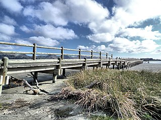
<span class="mw-page-title-main">South New Brighton</span> Suburb in Christchurch, New Zealand

South New Brighton is a coastal suburb on the eastern side of Christchurch city.

Hei Hei is a suburb of Christchurch, New Zealand. It is located in the west of Christchurch 11 kilometres (6.8 mi) from the central city, and is bisected by State Highway 1. The area was subdivided for poultry farming after World War I for returning serviceman, but the venture failed due to the poor soil conditions. The place name is related to the Māori word for chicken (heihei) due to the area's poultry farming history.

<span class="mw-page-title-main">Yaldhurst</span> Suburb in Christchurch, New Zealand

Yaldhurst is a semi-rural suburb on the western outskirts of Christchurch city. Frederick William Delamain (1835–1910), a settler and horse breeder, named a horse Yaldhurst after some stables in England. The area was named after the horse.

Casebrook is a suburb on the northern side of Christchurch city.
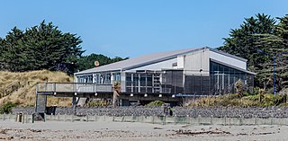
<span class="mw-page-title-main">North New Brighton</span> Suburb in Christchurch, New Zealand

North New Brighton is a suburb on the northern side of Christchurch city. It was originally known as North Beach and was readily accessible from Christchurch city by tram. It was renamed North New Brighton in 1953.

References

  1. 1 2 "ArcGIS Web Application". statsnz.maps.arcgis.com. Retrieved 19 September 2021.
  2. "Population estimate tables - NZ.Stat". Statistics New Zealand . Retrieved 25 October 2022.
  3. Harper, Margaret (April 2008). "Christchurch Place Names" (PDF). Christchurch: Christchurch City Libraries. p. 108. Archived from the original (PDF) on 22 February 2012. Retrieved 11 July 2012.
  4. Reed, A. W. (2010). Peter Dowling (ed.). Place Names of New Zealand. Rosedale, North Shore: Raupo. p. 229. ISBN   9780143204107.
  5. 1 2 "Statistical area 1 dataset for 2018 Census". Statistics New Zealand. March 2020. Mairehau North (321700) and Mairehau South (323100).
  6. 2018 Census place summary: Mairehau North
  7. 2018 Census place summary: Mairehau South
  8. Education Counts: Mairehau High School
  9. "Mairehau High School magazine (record)". National Library of New Zealand. Retrieved 19 September 2021.
  10. Education Counts: Mairehau School
  11. "History". Mairehau School. Retrieved 19 September 2021.
  12. 1 2 "School Mergers, Closures and New Schools – Education Counts". New Zealand Ministry of Education. Retrieved 19 September 2021.
  13. Parata, Hekia (20 June 2013). "Glenmoor School, Christchurch (3350) Closure Notice" (PDF). New Zealand Gazette . New Zealand Government. 2013 (78): 2138. Retrieved 19 September 2021.
  14. Education Counts: St Francis of Assisi Catholic School
  15. "St Francis of Assisi Catholic School". Education Review Office. 24 February 2020.
  16. "New Zealand Schools Directory". New Zealand Ministry of Education. Retrieved 12 December 2022.