Vadodara, also known as Baroda, is the second largest city in the Indian state of Gujarat. It serves as the administrative headquarters of the Vadodara district and is situated on the banks of the Vishwamitri River, 141 kilometres (88 mi) from the state capital of Gandhinagar. The railway line and National Highway 8, which connect Delhi with Mumbai, pass through Vadodara. The city is named for its abundance of the Banyan (Vad) tree. Vadodara is also locally referred to as the Sanskari Nagari and Kala Nagari of India.
The Narmada River, also called the Reva and previously also known as Narbada or anglicised as Nerbudda, is the 5th longest river and overall longest west-flowing river in India. It is also the largest flowing river in the state of Madhya Pradesh. This river flows through the states of Madhya Pradesh and Gujarat in India. It is also known as the "Life Line of Madhya Pradesh and Gujarat" due to its huge contribution to the two states in many ways. The Narmada River rises from the Amarkantak Plateau in Anuppur district Madhya Pradesh. It forms the traditional boundary between North India and South India and flows westwards over a length of 1,312 km (815.2 mi) before draining through the Gulf of Khambhat into the Arabian Sea, 30 km (18.6 mi) west of Bharuch city of Gujarat.

The Sardar Sarovar Dam is a concrete gravity dam built on the Narmada River in Navagam near the town of Kevadiya, Narmada District, in the state of Gujarat, India. The dam was constructed to provide water and electricity to four Indian states: Gujarat, Madhya Pradesh, Maharashtra, and Rajasthan.

Krishna Raja Sagara, also popularly known as KRS, is a lake and the dam that creates it. They are close to the settlement of Krishna Raja Sagara in the Indian State of Karnataka. The gravity dam made of surki mortar is below the confluence of river Kaveri with its tributaries Hemavati and Lakshmana Tirtha, in the district of Mandya.

Mettur is an industrial and tourist town located in the Salem district in the state of Tamil Nadu, India. It is best known for the Mettur Dam which is the largest dam in south India.

The Mangla Dam is a multipurpose dam situated on the Jhelum River in the Mirpur District of Azad Kashmir. It is the sixth-largest dam in the world. The village of Mangla, which sits at the mouth of the dam, serves as its namesake. In November 1961, the project's selected contractors were revealed; it was announced that Binnie & Partners, a British engineering firm, was going to serve as the lead designers, engineers, and inspectors for the construction of the dam. The project was undertaken by a consortium known as the Mangla Dam Contractors, which consisted of eight American construction firms sponsored by the Guy F. Atkinson Company based in South San Francisco, California.
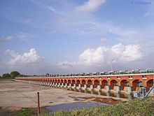
Originating from Pavagadh in the Panchmahal District of Gujarat, the Vishwamitri River flows mainly through the west of the city of Vadodara. The name of this river is said to have been derived from the name of the great saint Vishwamitra. Two other tributaries namely Dhadhar and Khanpur merge into it before it amalgamates with the Gulf of Khambhat. Human settlement dating back to 1000 B.C has been found on the bank of river Vishwamitri which ascertains the existence of Stone Age Era. Also in the beginning of the Christian era, a small township was developed on a mound on the banks of this river which later came to be known as Ankotakka while the mound is popular as Dhantekri. The Vishwamitri River was key to the settlement of Vadodara.

Nagarjuna Sagar Dam is a masonry dam across the Krishna River at Nagarjuna Sagar which straddles the border between Nalgonda district in Telangana and Palnadu district in Andhra Pradesh. The dam provides irrigation water to the Nalgonda, Suryapet, Krishna, NTR, Bapatla, Eluru, Palnadu, Khammam, West Godavari, Guntur, and Prakasam districts along with electricity generation.

Rabindra Sarobar is an artificial lake in South Kolkata in the Indian state of West Bengal. The name also refers to the area surrounding the lake. It is flanked by Southern Avenue to the North, Shyamaprasad Mukherjee Road to the West, Dhakuria to the East and the Kolkata Suburban Railway tracks to the south.

Jawai Bandh is a dam built across the Jawai river, a tributary of Luni river, in Rajasthan.

The Bear River is a tributary of the Feather River in the Sierra Nevada, winding through four California counties: Yuba, Sutter, Placer, and Nevada. About 73 miles (117 km) long, the river flows generally southwest through the Sierra then west through the Central Valley, draining a narrow, rugged watershed of 295 square miles (760 km2).

Dhosi Hill is an important Vedic period site, an extinct volcano, standing alone at the north-west end of the Aravalli mountain range. Its height varies from about 345 to 470 meters from the surrounding lands and 740 meters from the sea level. At present the hill has temples, a pakka pond, ruins of a fort, caves and forest around it. In the ancient times, as per various scriptures like Mahabharata - Vanparv, Puranas, Shathpath Brahmana etc. the hill had Ashrams of various Rishis who made contributions to Vedic scriptures.

Yātrā, in Indian-origin religions, Hinduism, Buddhism, Jainism and Sikhism, generally means a pilgrimage to holy places such as confluences of sacred rivers, sacred mountains, places associated with Hindu epics such as the Mahabharata and Ramayana, and other sacred pilgrimage sites. Visiting a sacred place is believed by the pilgrim to purify the self and bring one closer to the divine. The journey itself is as important as the destination, and the hardships of travel serve as an act of devotion in themselves.

Jayakwadi dam is an earthen dam located on Godavari river at the site of Jayakwadi village in Paithan taluka of Aurangabad district in Maharashtra, India. It is a multipurpose project. The water is mainly used to irrigate agricultural land in the drought-prone Marathwada region of the state. It also provides water for drinking and industrial usage to nearby towns and villages and to the municipalities and industrial areas of Aurangabad and Jalna districts. The surrounding area of the dam has a garden and a bird sanctuary.
Aliyar ( Reservoir is a 6.48 km2 reservoir located in Aliyar village near Pollachi town in Coimbatore District, Tamil Nadu, South India. The dam is located in the foothills of Valparai, in the Anaimalai Hills of the Western Ghats. It is about 65 kilometres from Coimbatore. The dam offers some ideal getaways including a park, garden, aquarium, play area and a mini Theme-Park maintained by Tamil Nadu Fisheries Corporation for visitors enjoyment. The scenery is beautiful, with mountains surrounding three quarters of the reservoir. Boating is also available.
The Ukai Dam, constructed across the Tapi River, is the second largest reservoir in Gujarat after the Sardar Sarovar. It is also known as Vallabh Sagar. Constructed in 1972, the dam is meant for irrigation, power generation and flood control. Having a catchment area of about 62,255 km2 and a water spread of about 52,000 hectares, its capacity is almost same as that of the Bhakra Nangal Dam. The site is located 94 km from Surat.

The Bhadra Dam or Lakkavalli Dam, which has created the Bhadra Reservoir, is located on the Bhadra River a tributary of Tungabhadra River. Bhadra Dam is located in the border of Bhadravathi and Tarikere, in the western part of Karnataka in India. The benefits derived from the reservoir storage are irrigation with gross irrigation potential of 162,818 hectares, hydro power generation of 39.2 MW, drinking water supply and industrial use. The dam commissioned in 1965 is a composite earth cum masonry structure of 59.13 metres (194.0 ft) height with length of 1,708 metres (5,604 ft) at the crest level, which submerges a land area of 11,250.88 hectares.

Kusum Sarovar is a sacred water reservoir with a historic sand monument in its backdrop. It is situated on the holy Govardhan Hill between Manasi Ganga and Radha Kund in Mathura district of Uttar Pradesh, India. Kusum Sarovar is considered one of the sacred spots that witnessed the pastimes of Hindu deities Radha and Krishna. It is also the place of Jat ruler Maharaja Suraj Mal's memorial chhatri. Kusum Sarovar has Narada Kund, where Bhakti Sutra verses were written by Narada and the Shri Radha Vana Bihari Temple in the vicinity.

Due to heavy rain in July–August 2019, the city of Vadodara and its administrative district in the Indian state of Gujarat were affected by severe flooding. On 31 July 2019, nearly 50 cm of rain fell on Vadodara within 12 hours, with 424mm recorded in one 6 hour period. As a result, the nearby Vishwamitri River rose to 1 metre below the danger line and the Ajwa dam overflowed, flooding the city.