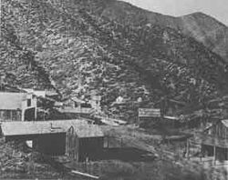
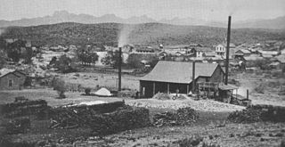
Gleeson is a ghost town situated in southeastern Cochise County, Arizona, United States. It has an estimated elevation of 4,924 feet (1,501 m) above sea level. The town was first settled as Turquoise in the 1870s in what was then the Arizona Territory, then later re-established as Gleeson in 1900.
Crown King is an unincorporated community in Yavapai County, Arizona, United States, located at an elevation of 5,771 feet (1,759 m). Crown King has a ZIP Code of 86343; in 2000, the population of the 86343 ZCTA was 133. The site of a former gold mining town, Crown King is 28 miles west of Interstate 17 on Senator Highway, high in the Bradshaw Mountains. The community is named after the Crowned King mine, but the name was shortened to Crown King in 1888. Horsethief Basin Lake resides 6.5 miles southeast of Crown King on Crown King Rd/Forest 259 Rd.

Contention City or Contention is a ghost mining town in Cochise County in the southeastern part of the U.S. state of Arizona. It was occupied from the early-1880s through the late-1880s in what was then known as the Arizona Territory. Only a few foundations now remain of this boomtown which was settled and abandoned with the rise and fall of silver mining in and around the area of Tombstone.

Tiger is a former populated place in Pinal County in the U.S. state of Arizona. The town was settled as Schultzcirca 1881 in what was then the Arizona Territory, then later reestablished as Tiger after World War I.
Tip Top is a ghost town in Yavapai County in the U.S. state of Arizona. The town was settled in 1876 in what was then the Arizona Territory.

Total Wreck is a ghost town in Pima County, Arizona. The town was built 7 miles (11 km) from Pantano, Arizona, whence "an excellent road" led from the Southern Pacific Railroad line and on to the Empire Ranch. It lay on the mail route to and from Harshaw.
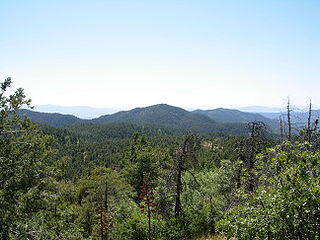
The Bradshaw Mountains are a mountain range in central Arizona, United States, named for brothers Isaac and William D. Bradshaw after their deaths, having been formerly known in English as the Silver Mountain Range.
Silver mining in Arizona was a powerful stimulus for exploration and prospecting in early Arizona. Cumulative silver production through 1981 totaled 490 million troy ounces. However, only about 10% of Arizona's silver production came from silver mining. More than 80% of the state's silver was a byproduct of copper mining; other silver came as a byproduct of lead, zinc, and gold mining.
Pinal or Pinal City is a ghost town in Pinal County in the U.S. state of Arizona. The town was populated from the 1870s into the 1890s, in what was then the Arizona Territory.

Castle Dome Landing, Arizona is a ghost town in the Castle Dome Mountains of Yuma County in the U.S. state of Arizona. It was first settled as a transport depot and mining camp around 1863 in what was then the Arizona Territory.

Harshaw is a ghost town in Santa Cruz County in the southeastern part of the U.S. state of Arizona. The town was settled in the 1870s, in what was then Arizona Territory. Founded as a mining community, Harshaw is named after the cattleman-turned-prospector David Tecumseh Harshaw, who first successfully located silver in the area. At the town's peak near the end of the 19th century, Harshaw's mines were among Arizona's highest producers of ore, with the largest mine, the Hermosa, yielding approximately $365,455 in bullion over a four-month period in 1880.
Allen, also known as Allen City is a ghost town in Pima County in southern Arizona. It was founded fifty miles southeast of Ajo, c. 1880. By 1886, the post office closed and the town has been abandoned since.

Big Bug is a ghost town in Yavapai County, Arizona, United States. The former settlement is located twelve miles southeast of Prescott and was established in 1862.
Cedar was a gold, silver and copper mining town in Mohave County, Arizona, United States. It was founded circa 1875 on the eastern slope of the Hualapai Mountains, sixty miles southeast of Kingman. A post office was established on September 24, 1895, and closed on July 31, 1911. In addition to the post office there were two saloons, and a general store with several homes. In 1907 the Cedar Valley Gold & Silver Company along with the Yucca Cyanide Mining & Milling Company reported that approximately 200 people lived in the town, within a decade later the site was abandoned. A half mile area inside Cedar Valley is littered with stone ruins and foundations of the mining buildings.
Cerbat is a ghost town just west of the Cerbat Mountains in Mohave County, Arizona, United States. Mining in the area began in the late 1860s and a camp was established soon after. Cerbat was built in a canyon 38 miles (61 km) from Hardyville. The town was prosperous and contained several mining and public buildings, along with cabins for over 100 settlers, as well as a school, a doctor's office and a lawyer's office. In the 1870s the town was connected by dirt road to Fort Rock, Camp Hualapai and Prescott. Cerbat was the third seat of Mohave County until 1877 when Mineral Park took the title.
McMillenville, also known as McMillianville or McMillanville, is a populated place in Gila County, Arizona. Silver ore was discovered by chance in 1876 by Theodore H. Harris and Charles McMillen, and the town formed around the ore deposits.

Salero is a ghost town in the Santa Rita Mountains of Santa Cruz County, Arizona. As one of the best preserved ghost towns remaining in Arizona, Salero is located on private property of the Salero Ranch and is not open to visitors.
Clip, or Clip Landing, was a steamboat landing and mill settlement in Yuma County, Arizona Territory. The site in the present day is owned and maintained by the Laccinole Family Living Trust, on the east bank of the Colorado River in La Paz County, Arizona. The settlement was located 70 miles up river from Yuma. It lies at an elevation of 223 feet, just south of Clip Wash, and the road to the Clip Mine at the top of the wash, 8 miles southeast of the mill.
Norton's Landing or Norton's, was a steamboat landing on the Colorado River, in what was then Yuma County, Arizona Territory. Today it is in La Paz County, Arizona. Nortons Landing is 52 miles upriver from Yuma, Arizona 4 miles above Picacho, California and 18 miles below the Clip, Arizona landing. It lies on a rocky point of land next to the river at 215 feet of elevation just east of Red Cloud Wash and Black Rock Wash, where roads to the district mines in the mountains met the Colorado River.
Manchester was a mining town in the Los Burros Mining District in the southern Big Sur region of Monterey County, California from about 1875 to 1895. The town was reached by a 20 miles (32 km) road from King City to Jolon. From Jolon travelers could ride or take a stage or wagon to the Wagon Caves, followed by a difficult 14 miles (23 km) trail over the steep Santa Lucia Mountains to the site, about 4 miles (6.4 km) inland of Cape San Martin. Prospecting began in the area in the 1850s.