Altamont, Kansas

Last updated

Altamont, Kansas
Labette County Kansas Incorporated and Unincorporated areas Altamont Highlighted.svg
Location within Labette County and Kansas
Map of Labette Co, Ks, USA.png
Coordinates: 37°11′23″N95°17′37″W / 37.18972°N 95.29361°W / 37.18972; -95.29361 [1]
Country United States
State Kansas
County Labette
Founded1879
Incorporated 1884
Named for Altamont, Illinois
Government
   Mayor Richard Hayward
Area
[2]
  Total1.93 sq mi (4.99 km2)
  Land1.90 sq mi (4.92 km2)
  Water0.02 sq mi (0.06 km2)
Elevation
[1]
912 ft (278 m)
Population
 (2020) [3]
  Total1,061
  Density550/sq mi (210/km2)
Time zone UTC-6 (CST)
  Summer (DST) UTC-5 (CDT)
ZIP code
67330
Area code 620
FIPS code 20-01550 [1]
GNIS ID 469438 [1]
Website altamontks.com

Altamont is a city in Labette County, Kansas, United States. [1] As of the 2020 census, the population of the city was 1,061. [3]

Contents

History

Altamont had its start in the year 1879 by the building of the railroad through that territory. The first settlers of Altamont was the Huston family. The present day street is named after them. When they went to the nearby town of Oswego, people would ask them where they lived. They would say about a mile east of the lone tree. Since there weren't many trees in Kansas at the time this would be served as a landmark. [4] It was named after Altamont, Illinois. [5] Altamont was incorporated in 1884. [6]

Geography

Altamont is located at 37°11′23″N95°17′37″W / 37.18972°N 95.29361°W / 37.18972; -95.29361 (37.189803, -95.293529). [7] According to the United States Census Bureau, the city has a total area of 1.66 square miles (4.30 km2), of which 1.64 square miles (4.25 km2) is land and 0.02 square miles (0.05 km2) is water. [8]

Climate

The climate in this area is characterized by hot, humid summers and generally mild to cool winters. According to the Köppen Climate Classification system, Altamont has a humid subtropical climate, abbreviated "Cfa" on climate maps. [9]

Demographics

Historical population
CensusPop.Note
1890 454
1900 54620.3%
1910 60611.0%
1920 603−0.5%
1930 598−0.8%
1940 6427.4%
1950 6521.6%
1960 6723.1%
1970 84525.7%
1980 1,05424.7%
1990 1,048−0.6%
2000 1,0924.2%
2010 1,080−1.1%
2020 1,061−1.8%
U.S. Decennial Census

2020 census

The 2020 United States census counted 1,061 people, 428 households, and 301 families in Altamont. [10] [11] The population density was 557.0 per square mile (215.0/km2). There were 448 housing units at an average density of 235.2 per square mile (90.8/km2). [11] [12] The racial makeup was 84.92% (901) white or European American (82.94% non-Hispanic white), 0.57% (6) black or African-American, 1.89% (20) Native American or Alaska Native, 0.38% (4) Asian, 0.0% (0) Pacific Islander or Native Hawaiian, 0.85% (9) from other races, and 11.4% (121) from two or more races. [13] Hispanic or Latino of any race was 3.3% (35) of the population. [14]

Of the 428 households, 36.9% had children under the age of 18; 54.9% were married couples living together; 24.3% had a female householder with no spouse or partner present. 25.0% of households consisted of individuals and 12.6% had someone living alone who was 65 years of age or older. [11] The average household size was 2.5 and the average family size was 3.0. [15] The percent of those with a bachelor’s degree or higher was estimated to be 15.4% of the population. [16]

26.2% of the population was under the age of 18, 7.5% from 18 to 24, 24.7% from 25 to 44, 23.7% from 45 to 64, and 17.9% who were 65 years of age or older. The median age was 38.2 years. For every 100 females, there were 110.5 males. [11] For every 100 females ages 18 and older, there were 111.6 males. [11]

The 2016-2020 5-year American Community Survey estimates show that the median household income was $48,971 (with a margin of error of +/- $10,120) and the median family income was $61,111 (+/- $2,603). [17] Males had a median income of $36,776 (+/- $5,126) versus $29,375 (+/- $9,949) for females. The median income for those above 16 years old was $34,412 (+/- $7,544). [18] Approximately, 6.3% of families and 10.4% of the population were below the poverty line, including 11.0% of those under the age of 18 and 7.1% of those ages 65 or over. [19] [20]

2010 census

As of the census [21] of 2010, there were 1,080 people, 419 households, and 291 families residing in the city. The population density was 658.5 inhabitants per square mile (254.2/km2). There were 447 housing units at an average density of 272.6 per square mile (105.3/km2). The racial makeup of the city was 92.7% White, 0.6% African American, 1.9% Native American, 0.5% from other races, and 4.3% from two or more races. Hispanic or Latino of any race were 2.5% of the population.

There were 419 households, of which 39.1% had children under the age of 18 living with them, 52.5% were married couples living together, 11.9% had a female householder with no husband present, 5.0% had a male householder with no wife present, and 30.5% were non-families. 27.4% of all households were made up of individuals, and 14.1% had someone living alone who was 65 years of age or older. The average household size was 2.58 and the average family size was 3.12.

The median age in the city was 36.1 years. 29.3% of residents were under the age of 18; 8.5% were between the ages of 18 and 24; 26.2% were from 25 to 44; 22% were from 45 to 64; and 14.1% were 65 years of age or older. The gender makeup of the city was 46.7% male and 53.3% female.

2000 census

As of the census [22] of 2000, there were 1,092 people, 427 households, and 303 families residing in the city. The population density was 677.1 inhabitants per square mile (261.4/km2). There were 458 housing units at an average density of 284.0 per square mile (109.7/km2). The racial makeup of the city was 96.43% White, 1.37% Native American, 0.18% Asian, 0.09% from other races, and 1.92% from two or more races. Hispanic or Latino of any race were 0.55% of the population.

There were 427 households, out of which 35.8% had children under the age of 18 living with them, 60.0% were married couples living together, 8.2% had a female householder with no husband present, and 29.0% were non-families. 26.5% of all households were made up of individuals, and 14.8% had someone living alone who was 65 years of age or older. The average household size was 2.51 and the average family size was 3.05.

In the city, the population was spread out, with 29.0% under the age of 18, 6.3% from 18 to 24, 25.5% from 25 to 44, 20.7% from 45 to 64, and 18.5% who were 65 years of age or older. The median age was 36 years. For every 100 females, there were 87.0 males. For every 100 females age 18 and over, there were 82.8 males.

The median income for a household in the city was $32,431, and the median income for a family was $40,987. Males had a median income of $30,694 versus $22,019 for females. The per capita income for the city was $14,895. About 5.2% of families and 9.5% of the population were below the poverty line, including 8.2% of those under age 18 and 21.2% of those age 65 or over.

Education

The community is served by Labette County USD 506 public school district. [23] The district school office, Labette County High School, and Altamont Grade School are located in the city of Altamont, and four grade schools are located in other cities in the school district.

The Labette County High School mascot is the Grizzlies, and their colors are red and gold. [24] Previously, Altamont High School was closed when school unification merged into USD 506.

Altamont Grade School, a Pre-K through 8th grade facility, acts as a feeder school to Labette County High School. Altamont Grade School's mascot is the Eagles, and their colors are Navy and Columbia Blue. [25]

Related Research Articles

<span class="mw-page-title-main">Neosho County, Kansas</span> County in Kansas, United States

Neosho County is a county located in Southeast Kansas. Its county seat is Erie. As of the 2020 census, the county population was 15,904. The county was named for the Neosho River, which passes through the county.

<span class="mw-page-title-main">Labette County, Kansas</span> County in Kansas, United States

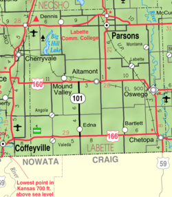
Labette County is a county located in Southeast Kansas. Its county seat is Oswego, and its most populous city is Parsons. As of the 2020 census, the county population was 20,184. The county was named after LaBette creek, the second-largest creek in the county, which runs roughly NNW-SSE from near Parsons to Chetopa. The creek in turn was named after French-Canadian fur trapper Pierre LaBette who had moved to the area, living along the Neosho River, and marrying into the Osage tribe in the 1830s and 1840s.

<span class="mw-page-title-main">Horton, Kansas</span> City in Brown County, Kansas

Horton is a city in Brown County, Kansas, United States. As of the 2020 census, the population of the city was 1,523.

<span class="mw-page-title-main">Gridley, Kansas</span> City in Coffey County, Kansas

Gridley is a city in Coffey County, Kansas, United States. As of the 2020 census, the population of the city was 313.

<span class="mw-page-title-main">Gove City, Kansas</span> City in Gove County, Kansas

Gove City, more commonly known as Gove, is a city in and the county seat of Gove County, Kansas, United States. As of the 2020 census, the population of the city was 80.

<span class="mw-page-title-main">Grinnell, Kansas</span> City in Gove County, Kansas

Grinnell is a city in Gove County, Kansas, United States. As of the 2020 census, the population of the city was 260.

<span class="mw-page-title-main">Copeland, Kansas</span> City in Gray County, Kansas

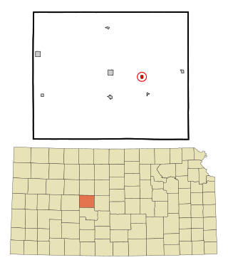
Copeland is a city in Gray County, Kansas, United States. As of the 2020 census, the population of the city was 251.

<span class="mw-page-title-main">Formoso, Kansas</span> City in Jewell County, Kansas

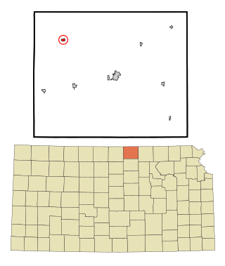
Formoso is a city in Jewell County, Kansas, United States. As of the 2020 census, the population of the city was 94.

<span class="mw-page-title-main">Bartlett, Kansas</span> City in Labette County, Kansas

Bartlett is a city in Labette County, Kansas, United States. As of the 2020 census, the population of the city was 69.

<span class="mw-page-title-main">Chetopa, Kansas</span> City in Labette County, Kansas

Chetopa is a city in Labette County, Kansas, United States. As of the 2020 census, the population of the city was 929. Chetopa was named for Chief Chetopah, an Osage Indian chief. Later, the community name was shortened.

<span class="mw-page-title-main">Edna, Kansas</span> City in Labette County, Kansas

Edna is a city in Labette County, Kansas, United States. As of the 2020 census, the population of the city was 388.

<span class="mw-page-title-main">Labette, Kansas</span> City in Labette County, Kansas

Labette is a city in Labette County, Kansas, United States. As of the 2020 census, the population of the city was 50.

<span class="mw-page-title-main">Mound Valley, Kansas</span> City in Labette County, Kansas

Mound Valley is a city in Labette County, Kansas, United States. As of the 2020 census, the population of the city was 348.

<span class="mw-page-title-main">Oswego, Kansas</span> City in Labette County, Kansas

Oswego is a city in and the county seat of Labette County, Kansas, United States, and situated along the Neosho River. As of the 2020 census, the population of the city was 1,668.

<span class="mw-page-title-main">Parsons, Kansas</span> City in Labette County, Kansas

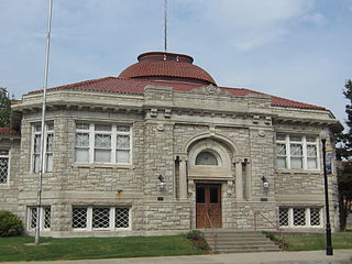
Parsons is a city in Labette County, Kansas, United States. As of the 2020 census, the population of the city was 9,600. It is the most populous city of Labette County, and the second-most populous city in the southeastern region of Kansas. It is home to Labette Community College and the Parsons State Hospital & Training Center.

<span class="mw-page-title-main">Dighton, Kansas</span> City in Lane County, Kansas

Dighton is a city in and the county seat of Lane County, Kansas, United States. As of the 2020 census, the population of the city was 960. Dighton is named for Dick Dighton, a surveyor.

<span class="mw-page-title-main">Munden, Kansas</span> City in Republic County, Kansas

Munden is a city in Republic County, Kansas, United States. As of the 2020 census, the population of the city was 96.

<span class="mw-page-title-main">Narka, Kansas</span> City in Republic County, Kansas

Narka is a city in Republic County, Kansas, United States. As of the 2020 census, the population of the city was 81.

<span class="mw-page-title-main">Alma, Kansas</span> City in Wabaunsee County, Kansas

Alma is a city in and the county seat of Wabaunsee County, Kansas, United States. As of the 2020 census, the population of the city was 802.

<span class="mw-page-title-main">Haddam, Kansas</span> City in Washington County, Kansas

Haddam is a city in Washington County, Kansas, United States. It is named after Haddam, Connecticut. As of the 2020 census, the population of the city was 110.

References

  1. 1 2 3 4 5 "Altamont, Kansas", Geographic Names Information System , United States Geological Survey, United States Department of the Interior
  2. "2019 U.S. Gazetteer Files". United States Census Bureau. Retrieved July 24, 2020.
  3. 1 2 "Profile of Altamont, Kansas in 2020". United States Census Bureau. Archived from the original on June 12, 2022. Retrieved June 12, 2022.
  4. Blackmar, Frank Wilson (1912). Kansas: A Cyclopedia of State History, Embracing Events, Institutions, Industries, Counties, Cities, Towns, Prominent Persons, Etc. Standard Publishing Company. pp.  66.
  5. "Profile for Altamont, Kansas". ePodunk. Archived from the original on July 14, 2014. Retrieved June 12, 2014.
  6. Case, Nelson (1893). History of Labette County, Kansas: From the First Settlement to the Close of 1892. Crane & Company. pp.  141.
  7. "US Gazetteer files: 2010, 2000, and 1990". United States Census Bureau. February 12, 2011. Retrieved April 23, 2011.
  8. "US Gazetteer files 2010". United States Census Bureau. Archived from the original on January 25, 2012. Retrieved July 6, 2012.
  9. Climate Summary for Altamont, Kansas
  10. "US Census Bureau, Table P16: HOUSEHOLD TYPE". data.census.gov. Retrieved December 31, 2023.
  11. 1 2 3 4 5 "US Census Bureau, Table DP1: PROFILE OF GENERAL POPULATION AND HOUSING CHARACTERISTICS". data.census.gov. Retrieved December 31, 2023.
  12. Bureau, US Census. "Gazetteer Files". Census.gov. Retrieved December 30, 2023.
  13. "US Census Bureau, Table P1: RACE". data.census.gov. Retrieved December 31, 2023.
  14. "US Census Bureau, Table P2: HISPANIC OR LATINO, AND NOT HISPANIC OR LATINO BY RACE". data.census.gov. Retrieved December 31, 2023.
  15. "US Census Bureau, Table S1101: HOUSEHOLDS AND FAMILIES". data.census.gov. Retrieved December 31, 2023.
  16. "US Census Bureau, Table S1501: EDUCATIONAL ATTAINMENT". data.census.gov. Retrieved December 31, 2023.
  17. "US Census Bureau, Table S1903: MEDIAN INCOME IN THE PAST 12 MONTHS (IN 2020 INFLATION-ADJUSTED DOLLARS)". data.census.gov. Retrieved December 31, 2023.
  18. "US Census Bureau, Table S2001: EARNINGS IN THE PAST 12 MONTHS (IN 2020 INFLATION-ADJUSTED DOLLARS)". data.census.gov. Retrieved December 31, 2023.
  19. "US Census Bureau, Table S1701: POVERTY STATUS IN THE PAST 12 MONTHS". data.census.gov. Retrieved December 31, 2023.
  20. "US Census Bureau, Table S1702: POVERTY STATUS IN THE PAST 12 MONTHS OF FAMILIES". data.census.gov. Retrieved December 31, 2023.
  21. "U.S. Census website". United States Census Bureau . Retrieved July 6, 2012.
  22. "U.S. Census website". United States Census Bureau . Retrieved January 31, 2008.
  23. USD 506 District Map; KSDOT.
  24. "USD 506 Labette County". USD 506. Retrieved January 7, 2017.
  25. "Labette County USD 506 - Altamont Grade School". www.usd506.org. Archived from the original on July 17, 2013.

Further reading