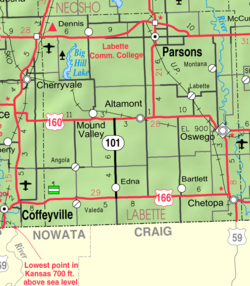
Chetopa, Kansas

Last updated

Chetopa, Kansas
Labette County Kansas Incorporated and Unincorporated areas Chetopa Highlighted.svg
Location within Labette County and Kansas
Map of Labette Co, Ks, USA.png
Coordinates: 37°2′15″N95°5′31″W / 37.03750°N 95.09194°W / 37.03750; -95.09194 [1]
Country United States
State Kansas
County Labette
Incorporated 1857
Named for Chief Chetopah
Area
[2]
  Total1.44 sq mi (3.74 km2)
  Land1.36 sq mi (3.53 km2)
  Water0.08 sq mi (0.20 km2)
Elevation
[1]
824 ft (251 m)
Population
 (2020) [3]
  Total929
  Density650/sq mi (250/km2)
Time zone UTC-6 (CST)
  Summer (DST) UTC-5 (CDT)
ZIP code
67336
Area code 620
FIPS code 20-12950 [1]
GNIS ID 469285 [1]
Website chetopa.org

Chetopa is a city in Labette County, Kansas, United States. [1] As of the 2020 census, the population of the city was 929. [3] Chetopa was named for Chief Chetopah, an Osage Indian chief. Later, the community name was shortened. [4]

Contents

History

The community began as an Osage village, named after its Chief Chetopah, whose name in the Osage language signifies "four lodges," was an advocate of peace, the leading chief of the Little Osage tribe, and one of the chief counselors of the Osage Nation. [5]

In 1847 a trading post to exchange goods with the Osage Nation was established here by Larkin McGhee. By the time of McGhee's arrival there were three other Euro-American families plus two families with a Euro-American husband and a Cherokee wife at Chetopa. There were also many Osage there. [6]

Chetopa was the site of a September 18, 1861 battle between the 6th Kansas Cavalry under the direction of James G. Blunt and pro-slavery raiders led by John Allen Mathews, whose wife was an Osage and was culturally identified with the Osages. [7]

The first post office in Chetopa was established in April 1867. [8] In 1880, Postmaster J.M. Cavaness petitioned the removal of the ending “h” in the original spelling to become Chetopa. [9]

Chetopa was the destination of the Nevada and Minden Railway, completed in 1886. [10] The town attracted that line, which ran southwest from Nevada, Missouri through Pittsburg, Kansas, when it donated land for right-of-way and year/depot purposes. [10] Much of the trackage has since been abandoned. [11]

Geography

Chetopa is located at 37°2′15″N95°5′31″W / 37.03750°N 95.09194°W / 37.03750; -95.09194 (37.037452, -95.091892). [12] According to the United States Census Bureau, the city has a total area of 1.42 square miles (3.68 km2), of which 1.34 square miles (3.47 km2) is land and 0.08 square miles (0.21 km2) is water. [13]

Climate

The climate in this area is characterized by hot, humid summers and generally mild to cool winters. According to the Köppen Climate Classification system, Chetopa has a humid subtropical climate, abbreviated "Cfa" on climate maps. [14]

Demographics

Historical population
CensusPop.Note
1870 960
1880 1,30535.9%
1890 2,26573.6%
1900 2,019−10.9%
1910 1,548−23.3%
1920 1,519−1.9%
1930 1,344−11.5%
1940 1,60619.5%
1950 1,6714.0%
1960 1,538−8.0%
1970 1,5963.8%
1980 1,7519.7%
1990 1,357−22.5%
2000 1,281−5.6%
2010 1,125−12.2%
2020 929−17.4%
U.S. Decennial Census

2020 census

The 2020 United States census counted 929 people, 430 households, and 233 families in Chetopa. [15] [16] The population density was 681.1 per square mile (263.0/km2). There were 530 housing units at an average density of 388.6 per square mile (150.0/km2). [16] [17] The racial makeup was 86.87% (807) white or European American (86.22% non-Hispanic white), 1.4% (13) black or African-American, 4.2% (39) Native American or Alaska Native, 1.08% (10) Asian, 0.11% (1) Pacific Islander or Native Hawaiian, 0.11% (1) from other races, and 6.24% (58) from two or more races. [18] Hispanic or Latino of any race was 0.75% (7) of the population. [19]

Of the 430 households, 24.4% had children under the age of 18; 38.1% were married couples living together; 30.7% had a female householder with no spouse or partner present. 41.2% of households consisted of individuals and 24.0% had someone living alone who was 65 years of age or older. [16] The average household size was 2.1 and the average family size was 2.8. [20] The percent of those with a bachelor’s degree or higher was estimated to be 11.5% of the population. [21]

19.9% of the population was under the age of 18, 6.2% from 18 to 24, 17.0% from 25 to 44, 31.5% from 45 to 64, and 25.3% who were 65 years of age or older. The median age was 49.9 years. For every 100 females, there were 101.5 males. [16] For every 100 females ages 18 and older, there were 106.1 males. [16]

The 2016-2020 5-year American Community Survey estimates show that the median household income was $21,953 (with a margin of error of +/- $13,624) and the median family income was $42,188 (+/- $10,817). [22] The median income for those above 16 years old was $20,375 (+/- $8,945). [23] Approximately, 29.2% of families and 34.0% of the population were below the poverty line, including 61.6% of those under the age of 18 and 17.4% of those ages 65 or over. [24] [25]

2010 census

As of the census [26] of 2010, there were 1,125 people, 493 households, and 292 families residing in the city. The population density was 839.6 inhabitants per square mile (324.2/km2). There were 647 housing units at an average density of 482.8 per square mile (186.4/km2). The racial makeup of the city was 85.4% White, 2.1% African American, 6.0% Native American, 0.3% Asian, 1.0% from other races, and 5.2% from two or more races. Hispanic or Latino of any race were 3.2% of the population.

There were 493 households, of which 25.2% had children under the age of 18 living with them, 42.8% were married couples living together, 11.2% had a female householder with no husband present, 5.3% had a male householder with no wife present, and 40.8% were non-families. 36.3% of all households were made up of individuals, and 18.5% had someone living alone who was 65 years of age or older. The average household size was 2.22 and the average family size was 2.87.

The median age in the city was 46.9 years. 20.3% of residents were under the age of 18; 8.4% were between the ages of 18 and 24; 19.1% were from 25 to 44; 29.3% were from 45 to 64; and 22.9% were 65 years of age or older. The gender makeup of the city was 49.3% male and 50.7% female.

2000 census

As of the census [27] of 2000, there were 1,281 people, 560 households, and 341 families residing in the city. The population density was 1,004.9 inhabitants per square mile (388.0/km2). There were 651 housing units at an average density of 510.7 per square mile (197.2/km2). The racial makeup of the city was 89.15% White, 2.26% African American, 6.32% Native American, 0.08% from other races, and 2.19% from two or more races. Hispanic or Latino of any race were 1.01% of the population.

There were 560 households, out of which 24.8% had children under the age of 18 living with them, 46.1% were married couples living together, 9.6% had a female householder with no husband present, and 39.1% were non-families. 35.7% of all households were made up of individuals, and 19.6% had someone living alone who was 65 years of age or older. The average household size was 2.22 and the average family size was 2.85.

In the city, the population was spread out, with 22.3% under the age of 18, 7.2% from 18 to 24, 22.6% from 25 to 44, 24.2% from 45 to 64, and 23.7% who were 65 years of age or older. The median age was 44 years. For every 100 females, there were 90.6 males. For every 100 females age 18 and over, there were 86.3 males.

As of 2000 the median income for a household in the city was $23,250, and the median income for a family was $29,338. Males had a median income of $24,479 versus $19,231 for females. The per capita income for the city was $11,705. About 13.1% of families and 18.8% of the population were below the poverty line, including 29.3% of those under age 18 and 15.7% of those age 65 or over.

Education

Chetopa is served by three Chetopa–St. Paul USD 505 public schools:

Chetopa is also served by a public library and a historic preservation society. The Chetopa Public Library is located at 312 Maple Street. The Historical Preservation Society of Labette County has a mission to preserve historical locales in Labette County for posterity.

See also

Related Research Articles

<span class="mw-page-title-main">Neosho County, Kansas</span> County in Kansas, United States

Neosho County is a county located in Southeast Kansas. Its county seat is Erie. As of the 2020 census, the county population was 15,904. The county was named for the Neosho River, which passes through the county.

<span class="mw-page-title-main">Labette County, Kansas</span> County in Kansas, United States

Labette County is a county located in Southeast Kansas. Its county seat is Oswego, and its most populous city is Parsons. As of the 2020 census, the county population was 20,184. The county was named after LaBette creek, the second-largest creek in the county, which runs roughly NNW-SSE from near Parsons to Chetopa. The creek in turn was named after French-Canadian fur trapper Pierre LaBette who had moved to the area, living along the Neosho River, and marrying into the Osage tribe in the 1830s and 1840s.

<span class="mw-page-title-main">Fulton, Kansas</span> City in Kansas, United States

Fulton is a city in Bourbon County, Kansas, United States. As of the 2020 census, the population of the city was 165.

<span class="mw-page-title-main">Baxter Springs, Kansas</span> City in Cherokee County, Kansas

Baxter Springs is a city in Cherokee County, Kansas, United States, and located along Spring River. As of the 2020 census, the population of the city was 3,888.

<span class="mw-page-title-main">Dexter, Kansas</span> City in Cowley County, Kansas

Dexter is a city in Cowley County, Kansas, United States. As of the 2020 census, the population of the city was 224.

<span class="mw-page-title-main">Gove City, Kansas</span> City in Gove County, Kansas

Gove City, more commonly known as Gove, is a city in and the county seat of Gove County, Kansas, United States. As of the 2020 census, the population of the city was 80.

<span class="mw-page-title-main">Attica, Kansas</span> City in Harper County, Kansas

Attica is a city in Harper County, Kansas, United States. As of the 2020 census, the population of the city was 516. The town was named after the historical region of Attica, in Greece.

<span class="mw-page-title-main">Edgerton, Kansas</span> City in Kansas, United States

Edgerton is a city in Johnson County, Kansas, United States, and part of the Kansas City metropolitan area. As of the 2020 census, the population of the city was 1,748. It is home to a large BNSF intermodal train facility named Logistics Park Kansas City.

<span class="mw-page-title-main">Altamont, Kansas</span> City in Labette County, Kansas

Altamont is a city in Labette County, Kansas, United States. As of the 2020 census, the population of the city was 1,061.

<span class="mw-page-title-main">Bartlett, Kansas</span> City in Labette County, Kansas

Bartlett is a city in Labette County, Kansas, United States. As of the 2020 census, the population of the city was 69.

<span class="mw-page-title-main">Edna, Kansas</span> City in Labette County, Kansas

Edna is a city in Labette County, Kansas, United States. As of the 2020 census, the population of the city was 388.

<span class="mw-page-title-main">Labette, Kansas</span> City in Labette County, Kansas

Labette is a city in Labette County, Kansas, United States. As of the 2020 census, the population of the city was 50.

<span class="mw-page-title-main">Mound Valley, Kansas</span> City in Labette County, Kansas

Mound Valley is a city in Labette County, Kansas, United States. As of the 2020 census, the population of the city was 348.

<span class="mw-page-title-main">Oswego, Kansas</span> City in Labette County, Kansas

Oswego is a city in and the county seat of Labette County, Kansas, United States, and situated along the Neosho River. As of the 2020 census, the population of the city was 1,668.

<span class="mw-page-title-main">Parsons, Kansas</span> City in Labette County, Kansas

Parsons is a city in Labette County, Kansas, United States. As of the 2020 census, the population of the city was 9,600. It is the most populous city of Labette County, and the second-most populous city in the southeastern region of Kansas. It is home to Labette Community College and the Parsons State Hospital & Training Center.

<span class="mw-page-title-main">Burlingame, Kansas</span> City in Osage County, Kansas

Burlingame is a city in Osage County, Kansas, United States. As of the 2020 census, the population of the city was 971.

<span class="mw-page-title-main">Lyndon, Kansas</span> City in Osage County, Kansas

Lyndon is a city in, and the county seat of Osage County, Kansas, United States. As of the 2020 census, the population of the city was 1,037.

<span class="mw-page-title-main">Osage City, Kansas</span> City in Osage County, Kansas

Osage City is a city in Osage County, Kansas, United States. As of the 2020 census, the population of the city was 2,861.

<span class="mw-page-title-main">Belleville, Kansas</span> City in Republic County, Kansas

Belleville is a city in and the county seat of Republic County, Kansas, United States. As of the 2020 census, the population of the city was 2,007.

<span class="mw-page-title-main">Neodesha, Kansas</span> City in Wilson County, Kansas

Neodesha is a city in Wilson County, Kansas, United States. As of the 2020 census, the population of the city was 2,275. The name is derived from the Osage Indian word, Ni-o-sho-de, and is translated as The-Water-Is-Smoky-With-Mud.

References

  1. 1 2 3 4 5 "Chetopa, Kansas", Geographic Names Information System , United States Geological Survey, United States Department of the Interior
  2. "2019 U.S. Gazetteer Files". United States Census Bureau. Retrieved July 24, 2020.
  3. 1 2 "Profile of Chetopa, Kansas in 2020". United States Census Bureau. Archived from the original on June 12, 2022. Retrieved June 12, 2022.
  4. Kansas Place-Names, John Rydjord, University of Oklahoma Press, 1972, p. 435 ISBN   0-8061-0994-7
  5. Reminiscences of a trader in the Osage Country, James Edwin Finney written down by Joseph B. Thoburn Archived May 23, 2011, at the Wayback Machine
  6. transcription from the History of Labette County by Nelson Case Archived 2009-07-07 at the Wayback Machine
  7. Kansas Memory entry on Mathews
  8. "Kansas Post Offices, 1828-1961". Kansas Historical Society. Retrieved June 12, 2014.
  9. "Archived copy" (PDF). Archived from the original (PDF) on March 4, 2016. Retrieved November 22, 2015.{{cite web}}: CS1 maint: archived copy as title (link)
  10. 1 2 "History of Labette County, Kansas, p.226" (PDF). Nelson Case, Crane & Company, 1893. Retrieved November 9, 2021.
  11. "Coffeyville Rail Bridge (East)". John Marvig Railroad Bridge Photography. Retrieved November 10, 2021.
  12. "US Gazetteer files: 2010, 2000, and 1990". United States Census Bureau. February 12, 2011. Retrieved April 23, 2011.
  13. "US Gazetteer files 2010". United States Census Bureau. Archived from the original on January 25, 2012. Retrieved July 6, 2012.
  14. Climate Summary for Chetopa, Kansas
  15. "US Census Bureau, Table P16: HOUSEHOLD TYPE". data.census.gov. Retrieved January 2, 2024.
  16. 1 2 3 4 5 "US Census Bureau, Table DP1: PROFILE OF GENERAL POPULATION AND HOUSING CHARACTERISTICS". data.census.gov. Retrieved January 2, 2024.
  17. Bureau, US Census. "Gazetteer Files". Census.gov. Retrieved December 30, 2023.
  18. "US Census Bureau, Table P1: RACE". data.census.gov. Retrieved January 2, 2024.
  19. "US Census Bureau, Table P2: HISPANIC OR LATINO, AND NOT HISPANIC OR LATINO BY RACE". data.census.gov. Retrieved January 2, 2024.
  20. "US Census Bureau, Table S1101: HOUSEHOLDS AND FAMILIES". data.census.gov. Retrieved January 2, 2024.
  21. "US Census Bureau, Table S1501: EDUCATIONAL ATTAINMENT". data.census.gov. Retrieved January 2, 2024.
  22. "US Census Bureau, Table S1903: MEDIAN INCOME IN THE PAST 12 MONTHS (IN 2020 INFLATION-ADJUSTED DOLLARS)". data.census.gov. Retrieved January 2, 2024.
  23. "US Census Bureau, Table S2001: EARNINGS IN THE PAST 12 MONTHS (IN 2020 INFLATION-ADJUSTED DOLLARS)". data.census.gov. Retrieved January 2, 2024.
  24. "US Census Bureau, Table S1701: POVERTY STATUS IN THE PAST 12 MONTHS". data.census.gov. Retrieved January 2, 2024.
  25. "US Census Bureau, Table S1702: POVERTY STATUS IN THE PAST 12 MONTHS OF FAMILIES". data.census.gov. Retrieved January 2, 2024.
  26. "U.S. Census website". United States Census Bureau . Retrieved July 6, 2012.
  27. "U.S. Census website". United States Census Bureau . Retrieved January 31, 2008.

Further reading