Alvar

Last updated
Alvar in Estonia near the town of Keila Loopealne Keilas 18-06-2012.jpg
Alvar in Estonia near the town of Keila
Alvar at Kinnekulle, Sweden. Most plants are confined to the numerous cracks in the limestone. Osterplana hed.jpg
Alvar at Kinnekulle, Sweden. Most plants are confined to the numerous cracks in the limestone.

An alvar is a biological environment based on a limestone plain with thin or no soil and, as a result, sparse grassland vegetation. Often flooded in the spring, and affected by drought in midsummer, alvars support a distinctive group of prairie-like plants. [1] Most alvars occur either in northern Europe [2] or around the Great Lakes in North America. [3] This stressed habitat supports a community of rare plants and animals, including species more commonly found on prairie grasslands. Lichen and mosses are common species. Trees and bushes are absent or severely stunted.

Contents

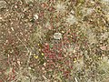
The primary cause of alvars is the shallow exposed bedrock. Flooding and drought, as noted, add to the stress of the site and prevent many species from growing. [1] Disturbance may also play a role. In Europe, grazing is frequent, while in North America, there is some evidence that fire may also prevent encroachment by forest. [4] The habitat also has strong competition gradients, with better competitors occupying the deeper soil and excluding other species to less productive locations. [5] Crevices in the limestone provide a distinctive habitat which is somewhat protected from grazing, and which may provide habitat for unusual ferns such as Pellaea atropurpurea . Bare rock flats provide areas with extremely low competition that serve as refugia for weak competitors such as the sandwort Minuartia michauxii and Micranthes virginiensis . In a representative set of four Ontario alvars, seven habitat types were described. From deep to shallow soil these were: tall grassy meadows, tall forb-rich meadows, low grassy meadows, low forb-rich meadows, dry grassland, rock margin grassland and bare rock flats. [6]

Alvars comprise a small percentage of the Earth's ecosystems by land extent. Although some 120 exist in the Great Lakes region, in total there are only about 43 sq mi (110 km2) left across the entire Great Lakes basin, and many of these have been degraded by agriculture and other human uses. More than half of all remaining alvars occur in Ontario. There are smaller areas in New York, Michigan, Ohio, Wisconsin and Quebec. [7]

In North America, alvars provide habitat for birds such as bobolinks, eastern meadowlarks, upland sandpipers, eastern towhees, brown thrashers and loggerhead shrikes whose habitat is declining elsewhere. Rare plants include Kalm's lobelia (Lobelia kalmii), Pringle's aster (Symphyotrichum pilosum var. pringlei), juniper sedge ( Carex juniperorum ), lakeside daisy ( Hymenoxys acaulis ), ram's-head lady's-slipper (Cypripedium arietinum), and dwarf lake iris (Iris lacustris). Also associated with alvars are rare butterflies and snails. [8] The use of the word "alvar" to refer to this type of environment originated in Sweden. [9] The largest alvar in Europe is located on the Swedish island of Öland. Here the thin soil mantle is only 0.5 to 2.0 centimeters thick in most places and in many extents consists of exposed limestone slabs. [10] [11] The landscape there has been designated a UNESCO World Heritage Site. There are other more local names for similar landforms, such as a pavement barren, although this term is also used for similar landforms based on sandstone. [12] In the United Kingdom the exposed landform is called a limestone pavement and thinly covered limestone is known as calcareous grassland.

European alvar locations

Some North American alvar locations

Alvar near the Singing Sands beach of Bruce Peninsula National Park, Canada Alvar near Singing Sands.JPG
Alvar near the Singing Sands beach of Bruce Peninsula National Park, Canada
Lichen, moss and grasses on limestone surface. Kelley's Island, Ohio in Lake Erie. Alvar2.JPG
Lichen, moss and grasses on limestone surface. Kelley's Island, Ohio in Lake Erie.

See also

Related Research Articles

<span class="mw-page-title-main">Thousand Islands – Frontenac Arch</span> Geologic region in North America

The Thousand Islands – Frontenac Arch region or the Frontenac Axis is an exposed strip of Precambrian rock in Canada and the United States that links the Canadian Shield from Algonquin Park with the Adirondack Mountain region in New York, an extension of the Laurentian mountains of Québec. The Algonquin to Adirondacks region, which includes the Frontenac Axis or Arch, is a critical linkage for biodiversity and resilience, and one with important conservation potential. The axis separates the St. Lawrence Lowlands and the Great Lakes Lowlands. It has many distinctive plant and animal species. It is one of four ecoregions of the Mixedwood Plains.

<span class="mw-page-title-main">Mississippi River (Ontario)</span> Tributary of the Ottawa River in Ontario, Canada

The Mississippi River is a tributary of the Ottawa River in Eastern Ontario, Canada which has no relation with the Mississippi River in the United States. It is 200 kilometres (120 mi) in length from its source at Mackavoy Lake, has a drainage area of 4,450 square kilometres (1,720 sq mi), and has a mean discharge of 40 cubic metres per second (1,400 cu ft/s). There are more than 250 lakes in the watershed.

<span class="mw-page-title-main">Lanark County</span> County in Ontario, Canada

Lanark County is a county located in the Canadian province of Ontario. Its county seat is Perth, which was first settled in 1816.

<span class="mw-page-title-main">Presqu'ile Provincial Park</span> Ontario park

Presqu'ile Provincial Park is a park in southeastern Northumberland County on the north shore of Lake Ontario near the town of Brighton in Ontario, Canada. The park occupies an area of 9.37 km2 (3.62 sq mi). The name of the park is the French word for peninsula, or literally "almost island", and was believed to be named by Samuel De Champlain on his second expedition. The peninsula was formed when a limestone island was connected to the mainland by a sand spit; this kind of formation is referred to as a tombolo.

<span class="mw-page-title-main">Flatwoods</span>

Flatwoods, pineywoods, pine savannas and longleaf pine-wiregrass ecosystem are terms that refer to an ecological community in the southeastern coastal plain of North America. Flatwoods are an ecosystem maintained by wildfire or prescribed fire and are dominated by longleaf pine, and slash pine in the tree canopy and saw palmetto, gallberry and other flammable evergreen shrubs in the understory, along with a high diversity of herb species. It was once one of the dominant ecosystem types of southeastern North America. Although grasses and pines are characteristic of this system, the precise composition changes from west to east, that is, from Texas to Florida. In Louisiana, savannas even differ between the east and west side of the Mississippi River. The key factor maintaining this habitat type is recurring fire. Without fire, the habitat is eventually invaded by other species of woody plants.

<span class="mw-page-title-main">Oak savanna</span> Lightly forested grassland where oak trees are dominant

An oak savanna is a type of savanna—or lightly forested grassland—where oaks are the dominant trees. The terms "oakery" or "woodlands" are also used commonly, though the former is more prevalent when referencing the Mediterranean area. These savannas were maintained historically through wildfires set by lightning, humans, grazing, low precipitation, and/or poor soil.

<span class="mw-page-title-main">Killbear Provincial Park</span> Provincial park in Ontario, Canada

Killbear Provincial Park is a provincial park located on Georgian Bay in the Parry Sound District of Ontario, near the town of Nobel. Killbear combines sandy beaches typical of the Great Lakes with the rock ridges and pines of the Canadian Shield. The park boundaries lie within the Georgian Bay Littoral UNESCO Biosphere Reserve.

<span class="mw-page-title-main">Serpentine soil</span> Soil type

Serpentine soil is an uncommon soil type produced by weathered ultramafic rock such as peridotite and its metamorphic derivatives such as serpentinite. More precisely, serpentine soil contains minerals of the serpentine subgroup, especially antigorite, lizardite, and chrysotile or white asbestos, all of which are commonly found in ultramafic rocks. The term "serpentine" is commonly used to refer to both the soil type and the mineral group which forms its parent materials.

<span class="mw-page-title-main">Bishop Middleham Quarry</span> Disused quarry in County Durham, England

Bishop Middleham Quarry is a disused quarry, about 4 kilometres (2.5 mi) north-west of Sedgefield, County Durham, England. Quarry-working here ceased in 1934, and the site has since been colonised by vegetation. The underlying rock is Magnesian Limestone and this has had a strong influence in determining the range of plant and animal communities now found there.

<span class="mw-page-title-main">Calcareous glade</span> Type of ecological community found where bedrock occurs near the surface.

A calcareous glade is a type of ecological community that is found in the central Eastern United States. Calcareous glades occur where bedrock such as limestone occurs near or at the surface, and have very shallow and little soil development. Due to the shallow soil and the extreme conditions created by it, trees are often unable to grow in the glades. This creates a habitat that is usually sunny, dry, and hot. Calcareous glade vegetation is more similar to that of a desert habitat than a grassland, being dominated by small spring annuals with occasional geophytic or succulent perennials.

<span class="mw-page-title-main">Stora Alvaret</span> UNESCO World Heritage Site

Stora Alvaret is an alvar, a barren limestone terrace, in the southern half of the island of Öland, Sweden. Stora Alvaret is a dagger shaped expanse almost 40 kilometres (25 mi) long and about 10 kilometres (6 mi) at the widest north end. The area of this formation exceeds 260 square kilometres (100 sq mi), making it the largest such expanse in Europe and comprising over one fourth of the land area of the island.

<span class="mw-page-title-main">Alby, Öland</span>

Alby is a village on the Baltic Sea in the Hulterstad district at the western fringe of the Stora Alvaret on the island of Öland, Sweden.

<span class="mw-page-title-main">Gettlinge</span>

Gettlinge is a village in the southwest portion of the island of Öland, Sweden. It is known for its impressive Viking stone ship burial ground. Gettlinge is situated on the western fringe of the Stora Alvaret, a World Heritage Site designated by UNESCO. The site is readily visible from the perimeter highway, Route 136. Gettlinge, as most prehistoric burial sites on Öland, is established on the low-lying ridge, described by Hogan as a geological formation of thickened soil in this alvar region of otherwise extremely thin soil mantle. This ridge was one of the few places on the southern part of the island that had sufficient soil depth for creation of burial mounds.

<span class="mw-page-title-main">Hulterstad</span>

Hulterstad is a small coastal town on the southeastern part of the island of Öland, Sweden. Hulterstad is situated at the eastern fringe of the Stora Alvaret, a limestone pavement habitat which hosts a diversity of rare plants and has been designated a World Heritage Site by UNESCO. Hulterstad is the municipal government center for this district and central records for centuries were kept at the Hulterstad Church. Significant gravefields and a Viking stone burial ship structure are located immediately south of Hulterstad. To the north is located the village of Alby, where a mesolithic village of early human settlement has been found, and to the south is the Ottenby Nature Reserve. Across the alvar to the west is the village of Gettlinge.

<span class="mw-page-title-main">Swedish county road 136</span>

Swedish county road 136 is a county road on the island of Öland, Sweden. This facility is a paved two lane structure that runs along the west coast of the island from Ottenby in the south to Nabbelund in the north. This highway constitutes the majority of named highway coverage on the island. Route 136 connects to Route 137 somewhat east of the Öland bridge, which crosses the Kalmar Strait. Much of the island of Öland has been designated a world heritage site by UNESCO in the form of the Stora Alvaret nature reserve. This reserve is home to a vast number of rare and endangered species due to the presence of an enormous limestone barren, which is the largest such formation in Europe. Route 136 is virtually the only spinal link allowing vehicle access to all parts of the Stora Alvaret.

<i>Cypripedium arietinum</i> Species of flowering plant in the orchid family Orchidaceae

Cypripedium arietinum, the ram's head lady's slipper, is a rare orchid that grows in lightly shaded areas with calcareous soils. It is characteristic of the alvars around the Great Lakes in North America, as well as in New England. In Canada, it is found from Quebec to Saskatchewan, plus an isolated population in Nova Scotia, where it grows on gypsum based soils, 330 km away from the nearest population in Maine.

<i>Tetraneuris herbacea</i> Species of flowering plant

Tetraneuris herbacea is a rare species of flowering plant in the aster family known by the common names eastern fournerved daisy, lakeside daisy, fournerved starflower, and Manitoulin gold. It is native to and endemic to the Great Lakes region in North America, where it is present in Ontario, Ohio, Michigan, and Illinois. It is threatened by habitat destruction and degradation by several forces, including limestone quarrying, recreational activity, fire suppression, and construction. It is a federally listed threatened species of the United States and of Canada.

<span class="mw-page-title-main">Burnt Lands alvar</span>

The Burnt Lands is an alvar between Almonte and Ottawa near Upper Huntley, Ontario, Canada. It probably obtained its name from one of the forest fires that swept the area during early European settlement.

The West Estonian Archipelago Biosphere Reserve is a UNESCO Biosphere Reserve in Estonia, located in the West Estonian archipelago in the eastern Baltic Sea. The 15,600 square kilometres (6,000 sq mi) reserve comprises the islands of Saaremaa, Hiiumaa, Vormsi and Muhu, as well as numerous islets and marine parts. The islands are in the transition zone between temperate needle-leaf and broadleaf forest.

<span class="mw-page-title-main">Wildlife of Sweden</span> Overview of the wildlife of Sweden

The wildlife of Sweden includes the diverse flora and fauna of Sweden. Habitats include mountain heath, montane forests, tundra, taiga, beech forests, rivers, lakes, bogs, brackish and marine coasts and cultivated land. The climate is in general very mild for a country at this latitude, because of the significant maritime influence.

References

  1. 1 2 Keddy, Paul A. (2007). Plants and Vegetation. Cambridge: Cambridge University Press. p. 666. ISBN   978-0-521-86480-0.
  2. Petterson, B. (1965). "Gotland and Öland: two limestone islands compared". Acta Phytogeographic Suecica. 50: 131–140.
  3. Catling, P. M.; Brownell, V. R. (1995). "A review of the alvars of the Great Lakes region: distribution, floristic composition, biogeography and protection". The Canadian Field-Naturalist. 109: 143–171.
  4. Catling, P. M.; Brownell, V.R. (1998). "Importance of fire in alvar ecosystems – evidence from the Burnt Lands, Eastern Ontario". The Canadian Field-Naturalist. 112: 661–667.
  5. Belcher, J. W.; Keddy, P. A.; Twolan-Strutt, L. (1995). "Root and shoot competition intensity along a soil depth gradient". Journal of Ecology. 83 (4): 673–682. doi:10.2307/2261635. JSTOR   2261635.
  6. Belcher, J.; Keddy, P.A.; Catling, P.F.C. (1992). "Alvar vegetation in Canada: a multivariate description at two scales". Canadian Journal of Botany. 70 (6): 1279–1291. doi:10.1139/b92-161.
  7. Reschke, Carol; Reid, Ron; Jones, Judith; Feeney, Tom; Potter, Heather (1999). "Conserving Great Lakes Alvars" (PDF). Final Technical Report of the International Alvar Conservation Initiative. Archived from the original (PDF) on 13 October 2008.
  8. Catling, P.M.; Brownell, V.R. (1999). "Alvars of the Great Lakes Region". In Anderson, Roger C.; Fralish, James S.; Baskin, Jerry M. (eds.). Savannas, Barrens and Rock Outcrop Communities of North America. Cambridge: Cambridge University Press. pp. 375–391. ISBN   978-0521573221.
  9. "Alvar". Svenska Akademiens ordbok (Dictionary of the Swedish Academy). 1898. Retrieved 11 March 2019.
  10. Hogan, C.M. (21 July 2006). The Stora Alvaret on Öland. Santa Rosa, Ca.: Lumina Technologies.
  11. Forslund, Markus, ed. (1999). The Countryside in Eastern Smaland. KalmarSund Tryck. ISBN   978-91-630-7610-7.
  12. "New York: Adirondacks: Gadway Sandstone Pavement Barrens". USA: The Nature Conservancy. Archived from the original on 2011-02-14. Retrieved 24 April 2010.
  13. 1 2 Käärt, Ulvar (1 November 2010). "Meie sümbolmaastik loopealsed on hävimas". Eesti Päevaleht (in Estonian). Archived from the original on 22 November 2010. Retrieved 13 December 2016.
  14. Ratt, Kadri (14 November 2010). "Haruldased loopealsed on hävinemas". Postimees (in Estonian). Retrieved 13 December 2016.
  15. "Trails". rare Charitable Research Reserve. 2011-12-02. Retrieved 13 December 2016.
  16. "North Shore Alvar State Nature Preserve". Ohio Department of Natural Resources. Retrieved 13 December 2016.
  17. "Stone Road Alvar Nature Reserve". Ontario Nature. Archived from the original on 20 December 2016. Retrieved 13 December 2016.
  18. "Maxton Plains". Michigan Department of Natural Resources. Retrieved 13 December 2016.
  19. "$5.2-million Globally Rare Habitat in Ontario to be Protected". Ontario Ministry of Natural Resources. Archived from the original on 16 August 2007. Retrieved 13 December 2016.
  20. "Quarry Bay Nature Reserve". Ontario Nature. Archived from the original on 20 December 2016. Retrieved 13 December 2016.
  21. "Bruce Alvar Nature Reserve". Ontario Nature. Archived from the original on 20 December 2016. Retrieved 13 December 2016.
  22. "Baptist Harbour Nature Reserve". Ontario Nature. Archived from the original on 20 December 2016. Retrieved 13 December 2016.
  23. "Come and visit the park!". Friends of Misery Bay. Retrieved 13 December 2016. Friends of Misery Bay is a registered non-profit charity devoted to supporting the Misery Bay Provincial Park in its mandates of protection (especially of its rare alvar habitats)...
  24. "Red Banks Alvar (No. 332)". Wisconsin Department of Natural Resources. 28 November 2016. Retrieved 13 December 2016.
  25. "The Carden Plain". The Couchiching Conservancy. Archived from the original on 20 December 2016. Retrieved 13 December 2016.
  26. "New York: Chaumont Barrens Preserve". Arlington, VA: The Nature Conservancy. Retrieved 13 December 2016.
  27. "Indian Point". Ontario Parks. Retrieved 13 December 2016.
  28. "Aylmer fears for its forest". Ottawa Citizen. 9 May 2008. Archived from the original on 4 November 2012. Retrieved 13 December 2016.
  29. Hamel, C.; Foster, C. (2004). Surveys of a Rare Alvar-like Plant Community in Eastern Clematis WMA and Comments on Regional Significance. Manitoba Conservation Data Centre.
  30. Hamel, C.; Foster, C. (2005). Rare Species Surveys and Stewardship Activities of the Manitoba Conservation Data Centre (PDF) (MS Report 05-01). Winnipeg, Manitoba: Manitoba Conservation Data Centre. Retrieved 13 December 2016.
  31. Manitoba Alvar Initiative (2012). Alvars in Manitoba: A Description of Their Extent, Characteristics & Land Use (PDF). Winnipeg, Manitoba: Nature Conservancy of Canada. Retrieved 13 December 2016.

Commons-logo.svg Media related to Alvar at Wikimedia Commons