Plain

Last updated
The Kakanui Range dominates the eastern horizon of the Maniototo Plain of New Zealand Maniototoevening.jpg
The Kakanui Range dominates the eastern horizon of the Maniototo Plain of New Zealand

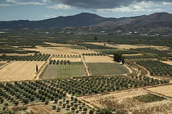
In geography, a plain, commonly known as flatland, is a flat expanse of land that generally does not change much in elevation, and is primarily treeless. Plains occur as lowlands along valleys or at the base of mountains, as coastal plains, and as plateaus or uplands. Plains are one of the major landforms on earth, being present on all continents and covering more than one-third of the world's land area. Plains in many areas are important for agriculture. There are various types of plains and biomes on them.

Contents

Montane plains as seen in Horton Plains in Sri Lanka. Horton Plains 2021.jpg
Montane plains as seen in Horton Plains in Sri Lanka.

Description

A plain or flatland is a flat expanse of land with a layer of grass that generally does not change much in elevation, and is primarily treeless. Plains occur as lowlands along valleys or at the base of mountains, as coastal plains, and as plateaus or uplands. [1] Plains are one of the major landforms on earth, where they are present on all continents, and cover more than one-third of the world's land area. [2]

In a valley, a plain is enclosed on two sides, but in other cases a plain may be delineated by a complete or partial ring of hills, by mountains, or by cliffs. Where a geological region contains more than one plain, they may be connected by a pass (sometimes termed a gap). Coastal plains mostly rise from sea level until they run into elevated features such as mountains or plateaus. [3] Plains can be formed from flowing lava; from deposition of sediment by water, ice, or wind; or formed by erosion by the agents from hills or mountains.

Biomes on plains include grassland (temperate or subtropical), steppe (semi-arid), savannah (tropical) or tundra (polar). In a few instances, deserts and rainforests may also be considered plains. [4]

Plains in many areas are important for agriculture because where the soils were deposited as sediments they may be deep and fertile, and the flatness facilitates mechanization of crop production; or because they support grasslands which provide good grazing for livestock. [5]

Types of plain

A small, incised alluvial plain from Red Rock Canyon State Park (California). AlluvialPlain.JPG
A small, incised alluvial plain from Red Rock Canyon State Park (California).
A flood plain in the Isle of Wight. Floodislewight.jpg
A flood plain in the Isle of Wight.

Depositional plains

The types of depositional plains include:

Erosional plains

Erosional plains have been leveled by various agents of denudation such as running water, rivers, wind and glacier which wear out the rugged surface and smoothens them. Plain resulting from the action of these agents of denudation are called peneplains (almost plain) while plains formed from wind action are called pediplains . [13]

Structural plains

Structural plains are relatively undisturbed horizontal surfaces of the Earth. They are structurally depressed areas of the world that make up some of the most extensive natural lowlands on the Earth's surface. [14]

Curry County, eastern New Mexico, on the North American Great Plains Curry County Eastern New Mexico 2010.jpg
Curry County, eastern New Mexico, on the North American Great Plains

Notable examples

The Pampas are a huge area of fertile grasslands in the southeastern area of South America, bordering the Atlantic Ocean Estacao Ecologica do Taim.jpg
The Pampas are a huge area of fertile grasslands in the southeastern area of South America, bordering the Atlantic Ocean
Nineveh Plains (Bozan, Iraq) Bozan village.jpg
Nineveh Plains (Bozan, Iraq)
A field plain in Liminka, Finland Liminka field 20080726 01.jpg
A field plain in Liminka, Finland
View of Fields at Biccavolu, Eastern coastal plains, Andhra Pradesh, India View of Fields at Biccavolu.jpg
View of Fields at Biccavolu, Eastern coastal plains, Andhra Pradesh, India
Yilan Plain, Taiwan Yilan Plain 2011-05-11.jpg
Yilan Plain, Taiwan
View of the South Smaland peneplain at Store Mosse National Park in Sweden. Store Mosse Stora Gungflyet.jpg
View of the South Småland peneplain at Store Mosse National Park in Sweden.
North Somerset Levels taken from Dolebury Warren, England, UK Nsomersetlevels.JPG
North Somerset Levels taken from Dolebury Warren, England, UK
Terrain near the central German town of Fulda. Fulda countryside.jpg
Terrain near the central German town of Fulda.
The Wallachian Plain, in the southern part of Arges County. Arges County Romania bgiu.jpg
The Wallachian Plain, in the southern part of Argeș County.
View of Messara from the hill of Phaestus, Greece. Festos - Valley of Messara 2.jpg
View of Messara from the hill of Phaestus, Greece.
Cumberland Plain bushland in Western Sydney, Australia. Western Sydney (Badgerys Creek) Airport site - Anton Rd.JPG
Cumberland Plain bushland in Western Sydney, Australia.
Looking southeast across the Taieri Plain, Otago, New Zealand. TaieriPlain.jpg
Looking southeast across the Taieri Plain, Otago, New Zealand.

America

Caribbean and South America

North America

Asia

Eastern Asia

North Asia

South Asia

Western Asia

Europe

Central Europe

Eastern Europe

Northern Europe

Southern Europe

Oceania

Australia

New Zealand

See also

Related Research Articles

<span class="mw-page-title-main">Valley</span> Low area between hills, often with a river running through it

A valley is an elongated low area often running between hills or mountains, which will typically contain a river or stream running from one end to the other. Most valleys are formed by erosion of the land surface by rivers or streams over a very long period. Some valleys are formed through erosion by glacial ice. These glaciers may remain present in valleys in high mountains or polar areas.

<span class="mw-page-title-main">Steppe</span> Ecoregion of plain grasslands without trees

In physical geography, a steppe is an ecoregion characterized by grassland plains without closed forests except near rivers and lakes. Steppe biomes may include:

<span class="mw-page-title-main">Prairie</span> Ecosystems considered part of the temperate grasslands, savannas, and shrublands biome

Prairies are ecosystems considered part of the temperate grasslands, savannas, and shrublands biome by ecologists, based on similar temperate climates, moderate rainfall, and a composition of grasses, herbs, and shrubs, rather than trees, as the dominant vegetation type. Temperate grassland regions include the Pampas of Argentina, Brazil and Uruguay, and the steppe of Ukraine, Russia and Kazakhstan. Lands typically referred to as "prairie" tend to be in North America. The term encompasses the area referred to as the Interior Lowlands of Canada, the United States, and Mexico, which includes all of the Great Plains as well as the wetter, hillier land to the east.

<span class="mw-page-title-main">Geomorphology</span> Scientific study of landforms

Geomorphology is the scientific study of the origin and evolution of topographic and bathymetric features generated by physical, chemical or biological processes operating at or near Earth's surface. Geomorphologists seek to understand why landscapes look the way they do, to understand landform and terrain history and dynamics and to predict changes through a combination of field observations, physical experiments and numerical modeling. Geomorphologists work within disciplines such as physical geography, geology, geodesy, engineering geology, archaeology, climatology, and geotechnical engineering. This broad base of interests contributes to many research styles and interests within the field.

<span class="mw-page-title-main">Intermontane Plateaus</span> Physiographic region of the contiguous United States

In the context of physical geography, the Intermontane Plateaus is one of eight physiographic regions of the contiguous United States. The region consists mostly of plateaus and mountain ranges lying between the Rocky Mountains on the east and the Cascade and Sierra Nevada Mountains on the west. It is subdivided into three physiographic provinces: the Columbia Plateau in the north, the Basin and Range Province in the central and southwestern portions, and the Colorado Plateau in the southeast. In turn, each of these provinces are each subdivided into a number of physiographic sections.

<span class="mw-page-title-main">Peneplain</span> Low-relief plain formed by protracted erosion

In geomorphology and geology, a peneplain is a low-relief plain formed by protracted erosion. This is the definition in the broadest of terms, albeit with frequency the usage of peneplain is meant to imply the representation of a near-final stage of fluvial erosion during times of extended tectonic stability. Peneplains are sometimes associated with the cycle of erosion theory of William Morris Davis, but Davis and other workers have also used the term in a purely descriptive manner without any theory or particular genesis attached.

The Global 200 is the list of ecoregions identified by the World Wide Fund for Nature (WWF), the global conservation organization, as priorities for conservation. According to WWF, an ecoregion is defined as a "relatively large unit of land or water containing a characteristic set of natural communities that share a large majority of their species dynamics, and environmental conditions". For example, based on their levels of endemism, Madagascar gets multiple listings, ancient Lake Baikal gets one, and the North American Great Lakes get none.

Landforms are categorized by characteristic physical attributes such as their creating process, shape, elevation, slope, orientation, rock exposure, and soil type.

<span class="mw-page-title-main">Tibetan Plateau</span> Plateau in Central, South and East Asia

The Tibetan Plateau, also known as Qinghai–Tibet Plateau and Qing–Zang Plateau, is a vast elevated plateau located at the intersection of Central, South, and East Asia covering most of the Tibet Autonomous Region, most of Qinghai, western half of Sichuan, Southern Gansu provinces in Western China, southern Xinjiang, Bhutan, the Indian regions of Ladakh and Lahaul and Spiti as well as Gilgit-Baltistan in Pakistan, northwestern Nepal, eastern Tajikistan and southern Kyrgyzstan. It stretches approximately 1,000 kilometres (620 mi) north to south and 2,500 kilometres (1,600 mi) east to west. It is the world's highest and largest plateau above sea level, with an area of 2,500,000 square kilometres (970,000 sq mi). With an average elevation exceeding 4,500 metres (14,800 ft) and being surrounded by imposing mountain ranges that harbor the world's two highest summits, Mount Everest and K2, the Tibetan Plateau is often referred to as "the Roof of the World".

<span class="mw-page-title-main">Outwash plain</span> Plain formed from glacier sediment transported by meltwater

An outwash plain, also called a sandur, sandr or sandar, is a plain formed of glaciofluvial deposits due to meltwater outwash at the terminus of a glacier. As it flows, the glacier grinds the underlying rock surface and carries the debris along. The meltwater at the snout of the glacier deposits its load of sediment over the outwash plain, with larger boulders being deposited near the terminal moraine, and smaller particles travelling further before being deposited. Sandurs are common in Iceland where geothermal activity accelerates the melting of ice flows and the deposition of sediment by meltwater.

Parent material is the underlying geological material in which soil horizons form. Soils typically inherit a great deal of structure and minerals from their parent material, and, as such, are often classified based upon their contents of consolidated or unconsolidated mineral material that has undergone some degree of physical or chemical weathering and the mode by which the materials were most recently transported.

<span class="mw-page-title-main">Lacustrine plain</span> Lakes filled by sediment

A lacustrine plain or lake plain is a plain formed due to the past existence of a lake and its accompanying sediment accumulation. Lacustrine plains can be formed through one of three major mechanisms: glacial drainage, differential uplift, and inland lake creation and drainage. Lake plains can have various uses depending on where and how they form.

<span class="mw-page-title-main">Geology of England</span> Overview of the geology of England

The geology of England is mainly sedimentary. The youngest rocks are in the south east around London, progressing in age in a north westerly direction. The Tees–Exe line marks the division between younger, softer and low-lying rocks in the south east and the generally older and harder rocks of the north and west which give rise to higher relief in those regions. The geology of England is recognisable in the landscape of its counties, the building materials of its towns and its regional extractive industries.

Fluvioglacial landforms or glaciofluvial landforms are those that result from the associated erosion and deposition of sediments caused by glacial meltwater. Glaciers contain suspended sediment loads, much of which is initially picked up from the underlying landmass. Landforms are shaped by glacial erosion through processes such as glacial quarrying, abrasion, and meltwater. Glacial meltwater contributes to the erosion of bedrock through both mechanical and chemical processes. Fluvio-glacial processes can occur on the surface and within the glacier. The deposits that happen within the glacier are revealed after the entire glacier melts or partially retreats. Fluvio-glacial landforms and erosional surfaces include: outwash plains, kames, kame terraces, kettle holes, eskers, varves, and proglacial lakes.

<span class="mw-page-title-main">Geography of Uttarakhand</span>

Uttarakhand has a total geographic area of 53,483 km2, of which 86% is mountainous and 65% is covered by forest. Most of the northern parts of the state are part of Greater Himalaya ranges, covered by the high Himalayan peaks and glaciers, while the lower foothills were densely forested till denuded by the British log merchants and later, after independence, by forest contractors. Recent efforts in reforestation, however, have been successful in restoring the situation to some extent. The unique Himalayan ecosystem plays host to many animals, plants and rare herbs. Two of India's great rivers, the Ganges and the Yamuna take birth in the glaciers of Uttarakhand, and are fed by myriad lakes, glacial melts and streams.

<span class="mw-page-title-main">Fluvisol</span>

A fluvisol in the World Reference Base for Soil Resources (WRB) is a genetically young soil in alluvial deposits. Apart from river sediments, they also occur in lacustrine and marine deposits. Fluvisols correlate with fluvents and fluvaquents of the USDA soil taxonomy. The good natural fertility of most fluvisols and their attractive dwelling sites on river levees and higher parts in marine landscapes were recognized in prehistoric times.

<span class="mw-page-title-main">Sub-Cambrian peneplain</span> Ancient, extremely flat, erosion surface

The sub-Cambrian peneplain is an ancient, extremely flat, erosion surface (peneplain) that has been exhumed and exposed by erosion from under Cambrian strata over large swathes of Fennoscandia. Eastward, where this peneplain dips below Cambrian and other Lower Paleozoic cover rocks. The exposed parts of this peneplain are extraordinarily flat with relief of less than 20 m. The overlying cover rocks demonstrate that the peneplain was flooded by shallow seas during the Early Paleozoic. Being the oldest identifiable peneplain in its area the Sub-Cambrian peneplain qualifies as a primary peneplain.

<span class="mw-page-title-main">Paleic surface</span> Erosion surface in Southern Norway

The paleic surface or palaeic surface is an erosion surface of gentle slopes that exist in South Norway. Parts of it are a continuation of the Sub-Cambrian peneplain and Muddus Plains found further east or equivalent to the strandflat coastal plains of Norway. Hardangervidda, a particularly flat and elevated part of the Paleic surface formed in the Miocene at sea level.

<span class="mw-page-title-main">Negro–Branco moist forests</span> Tropical broadleaf forest covering portions of Venezuela, Colombia, and Brazil

The Negro–Branco moist forests (NT0143) is an ecoregion of tropical moist broadleaf forest to the east of the Andes in southern Venezuela, eastern Colombia and northern Brazil, in the Amazon biome. It lies on the watershed between the Orinoco and Rio Negro basins. It includes both blackwater and whitewater rivers, creating different types of seasonally flooded forest. The vegetation is more typical of the Guiana region than the Amazon.

<span class="mw-page-title-main">Loess Plateau</span> Plateau in north/northwest China

The Chinese Loess Plateau, or simply the Loess Plateau, is a plateau in north-central China formed of loess, a clastic silt-like sediment formed by the accumulation of wind-blown dust. It is located southeast of the Gobi Desert and is surrounded by the Yellow River. It includes parts of the Chinese provinces of Gansu, Shaanxi and Shanxi. The depositional setting of the Chinese Loess Plateau was shaped by the tectonic movement in the Neogene period, after which strong southeast winds caused by the East Asian Monsoon transported sediment to the plateau during the Quaternary period. The three main morphological types in the Loess Plateau are loess platforms, ridges and hills, formed by the deposition and erosion of loess. Most of the loess comes from the Gobi Desert and other nearby deserts. The sediments were transported to the Loess Plateau during interglacial periods by southeasterly prevailing winds and winter monsoon winds. After the deposition of sediments on the plateau, they were gradually compacted to form loess under the arid climate.

References

  1. Rood, Stewart B.; Pan, Jason; Gill, Karen M.; Franks, Carmen G.; Samuelson, Glenda M.; Shepherd, Anita (2008-02-01). "Declining summer flows of Rocky Mountain rivers: Changing seasonal hydrology and probable impacts on floodplain forests". Journal of Hydrology. 349 (3–4): 397–410. Bibcode:2008JHyd..349..397R. doi:10.1016/j.jhydrol.2007.11.012.
  2. Geoff C. Brown; C. J. Hawkesworth; R. C. L. Wilson (1992). Understanding the Earth (2nd ed.). Cambridge University Press. p. 93. ISBN   978-0-521-42740-1. Archived from the original on 2016-06-03.
  3. Whittow, John (1984). Dictionary of Physical Geography. London: Penguin. p. 467. ISBN   978-0-14-051094-2.
  4. Gornitz, Vivien, ed. (2009). Encyclopedia of Paleoclimatology And Ancient Environments. Dordrecht: Springer. p. 665. ISBN   9781402045516.
  5. Powell, W. Gabe. 2009. Identifying Land Use/Land Cover (LULC) Using National Agriculture Imagery Program (NAIP) Data as a Hydrologic Model Input for Local Flood Plain Management. Applied Research Project, Texas State University.
  6. Goudie, A. S., ed. (2004). "Denudation chronology". Encyclopedia of Geomorphology. pp. 244–248.
  7. Vinogradova, N.G. (1997). "Zoogeography of the Abyssal and Hadal Zones". The Biogeography of the Oceans. Advances in Marine Biology. Vol. 32. pp. 325–387. doi:10.1016/S0065-2881(08)60019-X. ISBN   9780120261321.
  8. "Glossary of Landform and Geologic Terms" (PDF). National Soil Survey Handbook—Part 629. National Cooperative Soil Survey. April 2013. Archived from the original on 22 October 2016. Retrieved 17 August 2016.
  9. Magilligan F.J., Gomez B., Mertes L.A.K., Smith, L.C. Smith N.D., Finnegan D., Garvin J.B., Geomorphic effectiveness, sandur development, and the pattern of landscape response during jökulhlaups: Skeiðarársandur, southeastern Iceland, Geomorphology 44 (2002) 95–113
  10. Smith L.C., Sheng Y., Magilligan F.J., Smith N.D., Gomez B., Mertes L., Krabill W.B., Garven J.B., Geomorphic impact and rapid subsequent recovery from the 1996 Skeiðarársandur jökulhlaup, Iceland, measured with multi-year airborne lidar. Geomorphology vol. 75 Is. 1–2 (2006) 65–75
  11. United States. Department of Conservation. Division of Geology. Glacial Sluceways and Lacustrine Plains of Southern Indiana. By William D. Thornburry. Bloomington: n.p., 1950. Web. < "Archived copy" (PDF). Archived (PDF) from the original on 2016-03-03. Retrieved 2015-12-16.{{cite web}}: CS1 maint: archived copy as title (link)>.
  12. "Lava Plateaus". Archived from the original on 2013-11-14. Retrieved 2014-01-26.
  13. Migoń, Piotr (2004). "Planation surface". In Goudie, A.S. (ed.). Encyclopedia of Geomorphology. pp. 788–792.
  14. "Pediplain". Encyclopedia Britannica.