Amtala, Murshidabad

Last updated

Amtala
Town
West Bengal location map.svg
Red pog.svg
Amtala
Location in West Bengal, India
India location map 3.png
Red pog.svg
Amtala
Amtala (India)
Coordinates: 23°55′56″N88°26′51″E / 23.9322°N 88.4476°E / 23.9322; 88.4476
CountryFlag of India.svg  India
State West Bengal
District Murshidabad
Languages
  Official Bengali, English
Time zone UTC+5:30 (IST)
PIN
742121 (Amtala)
Lok Sabha constituency Baharampur
Vidhan Sabha constituency Naoda
Website murshidabad.gov.in

Amtala is a town, with a college, not identified in 2011 census, in the Naoda CD block in the Berhampore subdivision of Murshidabad district in the state of West Bengal, India.

Contents

Geography

Amtala, Murshidabad
Invisible Square.svg
Mapscaleline.svg
8km
5miles
Red pog.svg
Tomb of Mir Madan
H
Invisible Square.svg
Jalangi
River
Dwaraka
River
Mayurakshi
River
Bhagirathi
River
Panchthupi
R
Invisible Square.svg
Nagar
R
Invisible Square.svg
Khargram
R
Invisible Square.svg
Gram Salkia
R
Invisible Square.svg
Gokarna
R
Invisible Square.svg
Burwan
R
Invisible Square.svg
Bharatpur
R
Invisible Square.svg
Surangapur
R
Invisible Square.svg
Shaktipur
RV
Invisible Square.svg
Sarulia
R
Invisible Square.svg
Rejinagar
R
Invisible Square.svg
Naoda
R
Invisible Square.svg
Hariharpara
R
Invisible Square.svg
Daulatabad
R
Invisible Square.svg
Amtala
R
Karnasuvarna
H
Invisible Square.svg
Kandi
M
Invisible Square.svg
Beldanga
M
Invisible Square.svg
Berhampore
M
Invisible Square.svg
Salar
CT
Invisible Square.svg
Sibdanga Badarpur
CT
Invisible Square.svg
Haridasmati
CT
Invisible Square.svg
Gora Bazar
CT
Invisible Square.svg
Gopjan
CT
Invisible Square.svg
Goaljan
CT
Invisible Square.svg
Cossimbazar
CT
Invisible Square.svg
Chaltia
CT
Invisible Square.svg
Barua
CT
Invisible Square.svg
Banjetia
CT
Invisible Square.svg
Cities, towns and locations in the Berhampore and Kandi subdivisions, Murshidabad district
M: municipal town, CT: census town, R: rural/ urban centre, H: historical centres
Owing to space constraints in the small map, the actual locations in a larger map may vary slightly

Location

Amtala is located at 23°55′56″N88°26′51″E / 23.9322°N 88.4476°E / 23.9322; 88.4476 .

Area overview

The area shown in the map alongside, covering Berhampore and Kandi subdivisions, is spread across both the natural physiographic regions of the district, Rarh and Bagri. [1] [2] The headquarters of Murshidabad district, Berhampore, is in this area. [3] The ruins of Karnasubarna, the capital of Shashanka, the first important king of ancient Bengal who ruled in the 7th century, is located 9.6 kilometres (6.0 mi) south-west of Berhampore. [4] [5] [6] The entire area is overwhelmingly rural with over 80% of the population living in the rural areas. [7]

Note: The map alongside presents some of the notable locations in the subdivisions. All places marked in the map are linked in the larger full screen map.

Social background

[ better source needed ]

The area around Amtala is an agricultural area, which is somewhat cut off from the outside world.[ citation needed ] The nearest railway station, Beldanga is around 23 km away and buses for Baharampur few and far between. The population is largely Muslim and education particularly amongst the girls was not encouraged. The social reformation started with the setting up of Amtala High School, a co-educational institution. However, the conservative community was not eager to send the girls to school, post class VIII. The young girls continued to be married off early. With the help of a few liberal intellectuals, the forward-looking section of the population established a girls’ school, Anandaoni Balika Vidyalaya. Jatindra Rajendra Mahavidyalaya was started in 1986 with only 36 students, one third of them being girls. [8]

Education

Jatindra Rajendra Mahavidyalaya was established in 1986 at Amtala. Guru Prasad Biswas and Birendranath Biswas made a contribution, and the college was named after the fathers of them. Affiliated with the University of Kalyani, it offers honours courses in Bengali, English, Arabic, history, philosophy, political science and education. [8] [9] Amtala High School was established in 1919. It is a coeducational institution up to 12th class. Amtala Anadamani Balika Vidyalaya was established in 1972. It is a girls’ school up to 12th class.

Healthcare

Amtala Rural Hospital, with 50 beds, is the major government medical facility in Naoda CD block. [10]

Related Research Articles

<span class="mw-page-title-main">Beldanga</span> Town in West Bengal, India

Beldanga is a municipality town under the Berhampore subdivision of Murshidabad district in the state of West Bengal, India. Beldanga is an important trade centre of this district.

<span class="mw-page-title-main">Berhampore subdivision</span> Subdivision in West Bengal, India

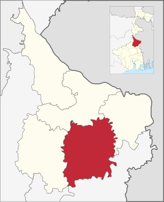
Berhampore subdivision is an administrative subdivision of Murshidabad district in the state of West Bengal, India.

Burwan is a village, with a police station, in the Burwan CD block in the Kandi subdivision of Murshidabad district in the state of West Bengal, India.

Khargram is a village, with a police station, in the Khargram CD block in the Kandi subdivision of Murshidabad district in the state of West Bengal, India.

Nagar is a village in the Khargram CD block in the Kandi subdivision of Murshidabad district in the state of West Bengal, India. It is located about 190 km from Kolkata, the state capital.

Gram Salkia is a village in the Burwan CD block in the Kandi subdivision of Murshidabad district in the state of West Bengal, India.

Bharatpur is a village in the Bharatpur I CD block in the Kandi subdivision of Murshidabad district in the state of West Bengal, India.

Salar is a census town in the Bharatpur II CD block in the Kandi subdivision of Murshidabad district in the state of West Bengal, India.

Daulatabad is a village and gram panchayat, with a police station, in the Berhampore CD block in the Berhampore subdivision of Murshidabad district in the state of West Bengal, India.

Sarulia is a village in the Beldanga I CD block in the Berhampore subdivision of Murshidabad district in the state of West Bengal, India.

Rejinagar is a village in the Beldanga II CD block in the Berhampore subdivision of Murshidabad district in the state of West Bengal, India.

Saktipur is a village in the Beldanga II CD block in the Berhampore subdivision of Murshidabad district in the state of West Bengal, India. It is situated 35km away from district headquarter Baharampur.

Naoda is a town, not identified in 2011 census, in the Naoda CD block in the Berhampore subdivision of Murshidabad district in the state of West Bengal, India.

Surangapur is a village in the Naoda CD block in the Berhampore subdivision of Murshidabad district in the state of West Bengal, India.

Hariharpara is a village, with a police station, in the Hariharpara CD block in the Berhampore subdivision of Murshidabad district in the state of West Bengal, India.

Panchthupi is a village in the Burwan CD block in the Kandi subdivision of Murshidabad district in the state of West Bengal, India.

Gokarna is a village in the Kandi CD block in the Kandi subdivision of Murshidabad district in the state of West Bengal, India.

Ajodhya Nagar is a census town in the Berhampore CD block in the Berhampore subdivision of the Murshidabad district in the state of West Bengal, India.

Haridasmati is a census town in the Berhampore CD block in the Berhampore subdivision of the Murshidabad district in the state of West Bengal, India.

Barua is a census town in the Beldanga I CD block in the Berhampore subdivision of the Murshidabad district in the state of West Bengal, India.

References

  1. "District Census Handbook: Murshidabad, Series 20 Part XII A" (PDF). Physiography, Page 13. Directorate of Census Operations, West Bengal, 2011. Retrieved 24 July 2017.
  2. "Murshidabad". Geography. Murshidabad district authorities. Retrieved 24 July 2017.
  3. "Murshidabad". Murshidabad district authorities. Retrieved 12 September 2017.
  4. Ray, Nihar Ranjan, Bangalir Itihas Adi Parba, (in Bengali), 1980 edition, pp. 160-161, Paschim Banga Niraksharata Durikaran Samiti
  5. Sengupta, Nitish, History of the Bengali-speaking People, p.25, UBS Publishers’ Distributors Pvt. Ltd.
  6. Majumdar, Dr. R.C., History of Ancient Bengal, first published 1971, reprint 2005, pp. 5-6, Tulshi Prakashani, Kolkata, ISBN   81-89118-01-3.
  7. "District Census Handbook, Murshidabad, Series 20, Part XII B" (PDF). District Primary Census Abstract page 26. Directorate of Census Operations West Bengal. Retrieved 2 July 2021.
  8. 1 2 "Jatindra Rajendra Mahavidyalaya". JRM. Retrieved 12 September 2017.
  9. "Jatindra Rajendra Mahavidyalaya". College Admission. Retrieved 12 September 2017.
  10. "Health & Family Welfare Department". Health Statistics. Government of West Bengal. Retrieved 19 September 2017.