Andrew Snable House

Last updated
Andrew Snable House
Andrew Snable House 3.jpg
The Andrew Snable House in 2011
Location map of Sussex County, New Jersey.svg
Red pog.svg
USA New Jersey location map.svg
Red pog.svg
Usa edcp location map.svg
Red pog.svg
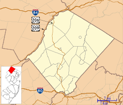
LocationSandyston-Haney's Mill Road
Walpack Township, New Jersey
Nearest city Wallpack Center, New Jersey
Coordinates 41°10′11″N74°52′15″W / 41.16972°N 74.87083°W / 41.16972; -74.87083 Coordinates: 41°10′11″N74°52′15″W / 41.16972°N 74.87083°W / 41.16972; -74.87083
Area1.3 acres (0.53 ha)
Built1801 (1801)
NRHP reference No. 79000236 [1]
NJRHP No.2643 [2]
Significant dates
Added to NRHPJuly 23, 1979
Designated NJRHPMarch 26, 1978

The Andrew Snable House is a historic house located on Sandyston-Haney's Mill Road near Wallpack Center in Walpack Township of Sussex County, New Jersey. It was added to the National Register of Historic Places on July 23, 1979, for its significance in architecture and exploration/settlement. [3]
Contents

History and description

The house was probably built c.1801 by Andrew Snable. The property is along the Flat Brook, a tributary of the Delaware River. The land was once owned by Colonel John Rosenkrans, a prominent local militia leader during the American Revolution. Andrew Snable bought the land for the house from Rosenkrans' son Levi in 1801. [3]

The house is a 1+12-story stone cabin measuring 36 feet by 20 feet. It is notable for being one of the best-preserved stone cottages in the area, which preceded the larger framed farmhouses that were built from the mid-1800s on. [3]

See also

Related Research Articles

Warren County, New Jersey County in northwestern New Jersey, United States

Warren County is a county located in the U.S. state of New Jersey. As of the 2020 United States census, the county's population was 109,632, representing an increase of 940 (0.9%) from the 108,692 residents counted at the 2010 U.S. Census. It is one of four counties that comprise the Lehigh Valley region of the United States. Its county seat is Belvidere.

Sandyston Township, New Jersey Township in Sussex County, New Jersey, United States

Sandyston Township is a small rural township in Sussex County, New Jersey, United States, located in the northwestern part of the state near the Pennsylvania border. The township is surrounded by and part of many national and state parks. As of the 2010 United States census, the township's population was 1,998, reflecting an increase of 173 (+9.5%) from the 1,825 counted in the 2000 census, which had in turn increased by 93 (+5.4%) from the 1,732 counted in the 1990 census. Sandyston's growth in recent years has been attributed to the influx of people from more urban parts of the state and even New York City, located less than 75 miles (121 km) away.

Walpack Township, New Jersey Township in Sussex County, New Jersey, United States

Walpack Township is a township in Sussex County, New Jersey, United States. As of the 2020 United States Census, the township had a population of 7, reflecting a decline of 34 (-82.9%) from the 41 counted in the 2000 Census, which had in turn declined by 26 (-38.8%) from the 67 counted in the 1990 Census. Walpack Township was one of only four municipalities in New Jersey with a double-digit population as of the 2010 Census, and it placed third behind Tavistock and Pine Valley, both in Camden County.

Pahaquarry Copper Mine United States historic place

The Pahaquarry Copper Mine is an abandoned copper mine located on the west side of Kittatinny Mountain presently in Hardwick Township in Warren County, New Jersey in the United States. Active mining was attempted for brief periods during the mid-eighteenth, mid-nineteenth, and early twentieth centuries but was never successful despite developments in mining technology and improving mineral extraction methods. Such ventures were not profitable as the ore extracted proved to be of too low a concentration of copper. This site incorporates the mining ruins, hiking trails, and nearby waterfalls, and is located within the Delaware Water Gap National Recreation Area and administered by the National Park Service. It was added to the National Register of Historic Places in 1980 as a contributing property to the Old Mine Road Historic District.

Christoffel Vought Farmstead Historic house in New Jersey, United States

Christoffel Vought Farmstead, commonly known as the 1759 Vought House, is located near Annandale in Clinton Township, Hunterdon County, New Jersey. Built in 1759, it was added to the National Register of Historic Places on January 16, 2008, for its significance in agriculture, archaeology, architecture, exploration/settlement and military history. The building is on Preservation New Jersey's 2010 10 Most Endangered Historic Sites list. The building is located on the grounds of the Clinton Township Middle School and is owned by the Clinton Township Board of Education.

Minisink

The Minisink or Minisink Valley is a loosely defined geographic region of the Upper Delaware River valley in northwestern New Jersey, northeastern Pennsylvania and New York.

Van Campens Inn United States historic place

Van Campen's Inn or Isaac Van Campen Inn is a fieldstone residence that was used as a yaugh house during the American colonial era. Located in Walpack Township, Sussex County, New Jersey along the Delaware River, it is a historic site located along the Old Mine Road in the Delaware Water Gap National Recreation Area. It is operated under a memorandum of understanding between the National Park Service and the Walpack Historical Society, a local non-profit corporation.

Wallpack Ridge

Wallpack Ridge is a mountain located in the Ridge and Valley Appalachians physiographic province in Sussex County in northwestern New Jersey. Oriented northeast to southwest, Wallpack Ridge spans 25 miles (40 km) from Montague Township south of Port Jervis, New York to the Walpack Bend in the Delaware River near Flatbrookville in Walpack Township. It is a narrow ridge ranging between 0.67 miles (1.08 km) to 1.7 miles (2.7 km) in width, and its highest elevation reaches 928 feet (283 m) above sea level. The ridge separates the Wallpack Valley from the valley of the Delaware River, and contains the watershed of the Flat Brook and its main tributaries Big Flat Brook and Little Flat Brook.

Wallpack Valley

Wallpack Valley is a valley located in Sussex County in northwestern New Jersey formed by Wallpack Ridge on the west, and Kittatinny Mountain on the east. Wallpack Ridge separates the Wallpack Valley from the valley of the Delaware River, and contains the watershed of the Flat Brook and its main tributaries Big Flat Brook and Little Flat Brook. It is a narrow valley, roughly 25 miles (40 km) in length running from Montague Township south of Port Jervis, New York to the Walpack Bend in the Delaware River near Flatbrookville in Walpack Township where the Flat Brook enters the Delaware at 300 feet above sea level.

Wallpack Center, New Jersey Unincorporated community in New Jersey, United States

Wallpack Center is an unincorporated community located within Walpack Township, Sussex County, New Jersey, United States. Wallpack Center is located in the Flat Brook Valley 6.7 miles (10.8 km) west of Branchville. Wallpack Center has a post office with ZIP code 07881. It is now part of the Delaware Water Gap National Recreation Area.

Headquarters, New Jersey Unincorporated community in New Jersey, United States

Headquarters is an unincorporated community located within the Amwell Valley of Delaware Township in Hunterdon County, New Jersey. The settlement is centered around the intersection of Zentek Road and County Route 604. It is about 3 miles (4.8 km) from Ringoes to the east and 1 mile (1.6 km) from Sergeantsville to the west. The Headquarters Historic District was listed on the state and national registers of historic places in 2011 and had its boundary increased in 2016.

Flatbrookville, New Jersey Unincorporated community in New Jersey, United States

Flatbrookville is an unincorporated community located along Old Mine Road within Walpack Township, in Sussex County, New Jersey, United States. It is named after the Flat Brook, a tributary of the Delaware River, which flows through the community. The area is now part of the Delaware Water Gap National Recreation Area.

Millbrook, New Jersey Unincorporated community in New Jersey, United States

Millbrook, also known as Millbrook Village, is an unincorporated community located along Old Mine Road within Hardwick Township, formerly Pahaquarry Township, in Warren County, New Jersey, United States. It is named after the Mill Brook, now known as Van Campens Mill Brook, a tributary of the Delaware River. The area is now part of the Delaware Water Gap National Recreation Area.

Old Mine Road Historic District United States historic place

The Old Mine Road Historic District is a 687-acre (278 ha) historic district located along Old Mine Road in Sussex County and Warren County, New Jersey. It is part of the Delaware Water Gap National Recreation Area. The district was added to the National Register of Historic Places on December 3, 1980, for its significance in agriculture, archaeology, architecture, commerce, exploration/settlement, and transportation. It includes 24 contributing buildings and five contributing sites.

Hixson–Mixsell House United States historic place

The Hixson–Mixsell House, also known as the Springtown Stagecoach Inn, is a historic building at 157 County Route 519 in the village of Springtown, in Pohatcong Township, Warren County, New Jersey. The main block was built c. 1836–1840, with a rear wing built between c. 1790 and 1840. It was added to the National Register of Historic Places on May 12, 2014 for its significance in architecture.

Craft–Clausen House Historic house in New Jersey, United States

The Craft–Clausen House is a historic stone house located at 170 Fairmont Road in Washington Township, Morris County, New Jersey. It was added to the National Register of Historic Places on May 1, 1992, for its significance in architecture. The house is part of the Stone Houses and Outbuildings in Washington Township Multiple Property Submission (MPS).

Walker-Combs-Hartshorne Farmstead Historic house in New Jersey, United States

The Walker, Combs, Hartshorne, Oakley Farmstead is located in the historic district of the village of West Freehold, a part of Freehold Township in Monmouth County, New Jersey, United States. The house was built in 1686 and was added to the National Register of Historic Places on October 14, 1990.

Bevans, New Jersey Unincorporated community in New Jersey, United States

Bevans, also known as Peters Valley, is an unincorporated community located at the intersection of Bevans Road, Walpack Road, and Kuhn Road in Sandyston Township of Sussex County, New Jersey. The village is now part of the Delaware Water Gap National Recreation Area. Both the Delaware River and the Old Mine Road are nearby.

Case Farmstead Historic house in New Jersey, United States

The Case Farmstead, also known as the Daniel Case / Sarah Clark Case Farmstead, is a historic 88-acre (36 ha) farm located along County Route 614 near Pattenburg in Union Township, Hunterdon County, New Jersey. It was added to the National Register of Historic Places on August 14, 1979, for its significance in architecture and medicine. The farmstead includes three contributing buildings.

Dr. John Vermeule House Historic house in New Jersey, United States

The Dr. John Vermeule House, also known as the Vermeule–Mundy House, is a historic building located at 223 Rock Avenue in Green Brook Township of Somerset County, New Jersey. It was added to the National Register of Historic Places on February 20, 2013, for its significance in architecture.

References

  1. "National Register Information System  (#79000236)". National Register of Historic Places . National Park Service. November 2, 2013.
  2. "New Jersey and National Registers of Historic Places – Sussex County" (PDF). New Jersey Department of Environmental Protection – Historic Preservation Office. September 28, 2021. p. 9.
  3. 1 2 3 Bodle, Wayne K. (April 1977). "National Register of Historic Places Inventory/Nomination: Andrew Snable House". National Park Service. With accompanying 2 photos