Richard Layton House

Last updated
Richard Layton House
Richard Layton House (12).JPG
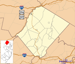
Location map of Sussex County, New Jersey.svg
Red pog.svg
USA New Jersey location map.svg
Red pog.svg
Usa edcp location map.svg
Red pog.svg
LocationSouthwest of Wallpack Center, New Jersey
Coordinates 41°08′53″N74°54′14″W / 41.14806°N 74.90389°W / 41.14806; -74.90389 (Richard Layton House)
Area5.4 acres (2.2 ha)
NRHP reference No. 79000237 [1]
NJRHP No.2641 [2]
Significant dates
Added to NRHPJuly 23, 1979
Designated NJRHPMarch 29, 1979

The Richard Layton House is a historic farmhouse located in the valley of the Delaware River southwest of the Wallpack Center section of Walpack Township in Sussex County, New Jersey, United States. It was added to the National Register of Historic Places on July 23, 1979, for its significance in architecture. The house is now part of the Delaware Water Gap National Recreation Area. [3]
Contents

History and description

The house is a two and one-half story stone building constructed in the early 19th century with traditional country style. It has a one and one-half story wing, which may be the original part. Richard Layton is likely part of the family descending from Thomas Layton, who settled in Sandyston Township in 1790. [3]

See also

Related Research Articles

<span class="mw-page-title-main">Sandyston Township, New Jersey</span> Township in Sussex County, New Jersey, United States

Sandyston Township is a small rural township in Sussex County, in the U.S. state of New Jersey. It is located in the northwestern part of the state near the Pennsylvania border. The township is surrounded by and part of many national and state parks. As of the 2020 United States census, the township's population was 1,977, a decrease of 21 (−1.1%) from the 2010 census count of 1,998, which in turn reflected an increase of 173 (+9.5%) from the 1,825 counted in the 2000 census. Sandyston's growth in recent years has been attributed to the influx of people from more urban parts of the state and even New York City, located less than 75 miles (121 km) away.

<span class="mw-page-title-main">Washington Crossing State Park</span> United States historic place

Washington Crossing State Park is a 3,575-acre (14 km2) New Jersey state park that is part of Washington's Crossing, a U.S. National Historic Landmark area. It is located in the Washington Crossing and Titusville sections of Hopewell Township in Mercer County, north of Trenton along the Delaware River. The park is operated and maintained by the New Jersey Division of Parks and Forestry. It is supported by the Washington Crossing Park Association, a friends group that works to preserve, enhance, and advocate for the park.

<span class="mw-page-title-main">Delaware, Warren County, New Jersey</span> Census-designated place in Middlesex County, New Jersey, US

Delaware is an unincorporated community and census-designated place (CDP) located along the Delaware River within Knowlton Township in Warren County, New Jersey. It was created as part of the 2010 United States Census. As of the 2010 Census, the CDP's population was 150. The area is served as United States Postal Service ZIP Code 07833.

<span class="mw-page-title-main">Crosswicks, New Jersey</span> Populated place in Burlington County, New Jersey, US

Crosswicks is an unincorporated community and census-designated place (CDP) located along the Crosswicks Creek in the northern part of Chesterfield Township in Burlington County in the U.S. state of New Jersey. The area is served as United States Postal Service ZIP Code 08515.

<span class="mw-page-title-main">Abbott Farm Historic District</span> Historic district in New Jersey, United States

The Abbott Farm Historic District is a National Historic Landmark archaeological site in New Jersey. It is the largest known Middle Woodland village of its type on the East Coast of the United States. Significant evidence suggests that the Delaware River floodplain was occupied by Paleoindian people for a long period. It was inhabited between 500 BC and 500 AD. It has been a source of controversy and debate around early development.

<span class="mw-page-title-main">Minisink Archaeological Site</span> United States historic place

Minisink Archeological Site, also known as Minisink Historic District, is an archeological site of 1320 acres located in both Sussex County, New Jersey and Pike County, Pennsylvania. It was part of a region occupied by Munsee-speaking Lenape that extended from southern New York across northern New Jersey to northeastern Pennsylvania. The Munsee were speakers of one of the three major language dialects of the Lenape Native American tribe. This interstate territory became the most important Munsee community for the majority of the 17th and 18th centuries.

<span class="mw-page-title-main">Isaac Watson House</span> Historic house in New Jersey, United States

The Isaac Watson House is the headquarters of the New Jersey State Society of the National Society of the Daughters of the American Revolution (DAR). It is located just outside the state capital of Trenton in Hamilton Township, Mercer County, New Jersey. It is situated on a bluff overlooking Watson's Creek and the Abbott Farm National Historic Landmark in John A. Roebling Park, a 257-acre nature preserve.

<span class="mw-page-title-main">Andrew Snable House</span> Historic house in New Jersey, United States

The Andrew Snable House is a historic house located on Sandyston-Haney's Mill Road near Wallpack Center in Walpack Township of Sussex County, New Jersey. It was added to the National Register of Historic Places on July 23, 1979, for its significance in architecture and exploration/settlement.

<span class="mw-page-title-main">Van Campen's Inn</span> United States historic place

Van Campen's Inn or Isaac Van Campen Inn is a fieldstone residence that was used as a yaugh house during the American colonial era. Located in Walpack Township, Sussex County, New Jersey along the Delaware River, it is a historic site located along the Old Mine Road in the Delaware Water Gap National Recreation Area. It is operated under a memorandum of understanding between the National Park Service and the Walpack Historical Society, a local non-profit corporation.

<span class="mw-page-title-main">Wallpack Center, New Jersey</span> Populated place in Sussex County, New Jersey, US

Wallpack Center is an unincorporated community located within Walpack Township, Sussex County, in the U.S. state of New Jersey. Wallpack Center is located in the Flat Brook Valley 6.7 miles (10.8 km) west of Branchville. Wallpack Center has a post office with ZIP Code 07881. It is now part of the Delaware Water Gap National Recreation Area.

<span class="mw-page-title-main">Flatbrookville, New Jersey</span> Populated place in Sussex County, New Jersey, US

Flatbrookville is an unincorporated community located along Old Mine Road within Walpack Township, in Sussex County, in the U.S. state of New Jersey. It is named after the Flat Brook, a tributary of the Delaware River, which flows through the community. The area is now part of the Delaware Water Gap National Recreation Area.

<span class="mw-page-title-main">Walnford, New Jersey</span> Populated place in Monmouth County, New Jersey, US

Walnford is an unincorporated community located along Crosswicks Creek within Upper Freehold Township in Monmouth County, in the U.S. state of New Jersey. Walnford was named for Richard Waln, the original owner of the town site.

<span class="mw-page-title-main">Millbrook, New Jersey</span> Populated place in Warren County, New Jersey, US

Millbrook, also known as Millbrook Village, is an unincorporated community located along Old Mine Road within Hardwick Township, formerly Pahaquarry Township, in Warren County, in the U.S. state of New Jersey. It is named after the Mill Brook, now known as Van Campens Mill Brook, a tributary of the Delaware River. The area is now part of the Delaware Water Gap National Recreation Area.

<span class="mw-page-title-main">Old Mine Road Historic District</span> Historic district in New Jersey, United States

The Old Mine Road Historic District is a 687-acre (278 ha) historic district located along Old Mine Road in Sussex County and Warren County, New Jersey. It is part of the Delaware Water Gap National Recreation Area. The district was added to the National Register of Historic Places on December 3, 1980, for its significance in agriculture, archaeology, architecture, commerce, exploration/settlement, and transportation. It includes 24 contributing buildings and five contributing sites.

<span class="mw-page-title-main">Pursley's Ferry Historic District</span> Historic district in New Jersey, United States

Pursley's Ferry Historic District is a 61-acre (25 ha) historic district located along Old River Road near Church Road by the Delaware River in Holland Township, Hunterdon County, New Jersey. It was added to the National Register of Historic Places on October 8, 1980 for its significance in architecture, commerce, and transportation. The district includes 4 contributing buildings.

<span class="mw-page-title-main">Bevans, New Jersey</span> Unincorporated community in New Jersey, United States

Bevans, also known as Peters Valley, is an unincorporated community located at the intersection of Bevans Road, Walpack Road, and Kuhn Road in Sandyston Township of Sussex County, New Jersey. The village is now part of the Delaware Water Gap National Recreation Area. Both the Delaware River and the Old Mine Road are nearby.

<span class="mw-page-title-main">Foster–Armstrong House</span> Historic house in New Jersey, United States

The Foster–Armstrong House is a historic house museum located at 320 River Road in Montague Township of Sussex County, New Jersey. It was documented by the Historic American Buildings Survey in 1970. It was added to the National Register of Historic Places on July 23, 1979, for its significance in agriculture, architecture, commerce, and exploration/settlement. The house is now part of the Delaware Water Gap National Recreation Area. The museum is managed by the Montague Association for the Restoration of Community History.

<span class="mw-page-title-main">Millville, Sussex County, New Jersey</span> Unincorporated community in New Jersey, United States

Millville is an unincorporated community located along River Road and Shimers Brook in Montague Township of Sussex County, New Jersey. The Montague Grange and other parts of the community are in the Delaware Water Gap National Recreation Area.

<span class="mw-page-title-main">Rutan Farm</span> United States historic place

The Rutan Farm is a historic 99-acre (40 ha) farm located on Mattison Avenue north of Branchville in Frankford Township of Sussex County, New Jersey. Listed as the Log Cabin and Farm, it was added to the National Register of Historic Places on August 24, 1977, for its significance in architecture. It includes two contributing buildings, the Rutan Log Cabin and a barn.

<span class="mw-page-title-main">Cornelius Gunn House</span> United States historic place

The Cornelius Gunn House is a historic farmhouse located on Ridge Road southwest of the Wallpack Center section of Walpack Township in Sussex County, New Jersey, United States. It was added to the National Register of Historic Places on July 23, 1979, for its significance in architecture. The house is now part of the Delaware Water Gap National Recreation Area.

References

  1. "National Register Information System  (#79000237)". National Register of Historic Places . National Park Service. November 2, 2013.
  2. "New Jersey and National Registers of Historic Places – Sussex County" (PDF). New Jersey Department of Environmental Protection - Historic Preservation Office. June 22, 2023. p. 8.
  3. 1 2 Bodle, Wayne K. (April 1977). "National Register of Historic Places Inventory/Nomination: Richard Layton House". National Park Service. With accompanying photo