Angoumian

Last updated

The Angoumian is a geological group restricted to the northern Aquitaine Basin in France. The group consists of two fossiliferous limestone formations deposited during the Turonian.

Contents

Etymology

The name Angoumian, in French Angoumien, is derived from the Angoumois region around the town of Angoulême in the Charente.

Occurrence

The formation crops out in the surroundings of Angoulême, but also reaches farther south into the Dordogne (Périgord, i.e. Périgord Vert & Périgord Blanc).

Stratigraphy

Simplified stratigraphy of the Angoumian AngoumianStrat.jpg
Simplified stratigraphy of the Angoumian

The Angoumian is usually divided into two formations, a lower Angoumien inférieur and an upper Angoumien supérieur. Some authors even attribute the Ligerian (in French Ligérien) to the Angoumian and then call it basal Angoumian. The Angoumian sensu stricto conformably overlies the Ligerian and closes with a hardground towards the overlying Coniacian.

Lower Angoumian

(Represented on French geological maps as unit c3b)

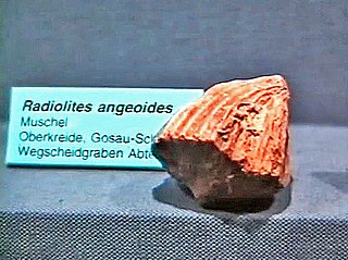
The 15–20 m thick lower Angoumian, also called Angoulême Formation, starts with a 5–6 m thick, thinly bedded, microcrystalline limestone of white to creamy colour. This limestone is characterised by the incorporation of fine debris and by a benthic microfauna consisting of foraminifera such as miliolida and textulariida. The first rudists ( Sphaerulites patera and Biradiolites lumbricalis ) start to appear in this level. Some rare cephalopods have also been found (such as Romaniceras deverianum or Lecointriceras fleuriausianum for instance).

A rudist biostrome in the Angouleme Formation; Aucors quarry near Beaussac, Dordogne AngoumianRudistreef.jpg
A rudist biostrome in the Angoulême Formation; Aucors quarry near Beaussac, Dordogne

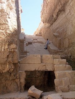
These fairly thin beds then give way to a massive, homogeneous, normally 8–10 m thick, chalky, rudist-bearing limestone of pure white colour. The massive bed stands out geomorphologically, sometimes forming small cliffs in the countryside. Generally this rock is quite soft (it can be cut with a handsaw), it was therefore quarried extensively for building stone with hundreds of small quarries in operation; most of them have closed down by now. The massive member is affected by important thickness variations (its total thickness normally can vary from 5–12 m, sometimes even reaching 15 m), caused either by tectonic disturbances or by post-depositional erosion (for instance, in the Mareuil Anticline, the upper Angoumian discordantly overlies the lower Angoumian, occasionally even cutting down into it). The chalky limestones are mainly composed of rudist debris with comparatively little cement. The rudist debris consists almost exclusively of the species Biradiolites lumbricalis accompanied by minor Durania cornupastoris , Praeradiolites peroni , Radiolites peroni , Radiolites ponsi , Radiolites beaumonti , Radiolites socialis , and Hippurites requieni . In some places, undamaged rudists (mainly the small-sized Biradiolites) can be encountered in numerous biostromes. Towards the top, the massive bed changes its character and thinner beds of a very hard limestone or of an ocre calcarenite appear. This horizon is the upper limit of the quarrying activity and was called chaudron (kettle) by the miners. In addition to the usual fauna, it also comprises small biostromes of Biradiolites angulosus .

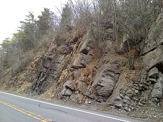
The common facies can change quite suddenly (within less than 500 m) into a coarse, weakly cemented, bioclastic facies (Pierre de Cheyroux) consisting of white to yellowish calcarenites — a beachrock facies, indicating a littoral position of the deposits. The bioclasts are very rounded and are composed of the debris of echinoderms, rudists, single corals (polyps), and milioles. These rather massive calcarenites can reach a thickness of 12–15 m in places and sometimes are affected by cross-bedding. They occur somewhat southeast of the La Tour Blanche anticline and the Périgueux anticline, proving that these major structures were already beginning to rise during the Turonian.

The lower formation finishes with a few metres of thinly bedded, yellowish, microcrystalline limestone rich in bioclasts (lamellibranchs and echinoderms). This member shows cross-bedding and is affected by hiati as observed in Brantôme.

The common rudist-bearing reefal facies can completely change in the western depositional area, taking on a very hard, finely recrystallised aspect without any fossil debris. This facies change is probably due to faulting.

Upper Angoumian

(represented as unit c3c)

The upper Angoumian, also called Bourg-des-Maisons Formation, can be fairly easily recognised in the countryside by its rather arid aspect with a typical flora of junipers and dwarf bushes growing on it. The total thickness of the upper Angoumian varies from 20 to 40 m. The type locality is at Bourg-des-Maisons.

Its lowermost member of up to 20 m thickness is composed of grey to cream-coloured, rudist bearing, cryptocrystalline limestones. Texturally they are wackestones grading into mudstones. They weather in a nodular and prismatic fashion and are interlayered with microcrystalline limestones rich in fine debris and bioclasts.

The fossil content is dominated by rudist biostromes. The rudists are represented by Durania cornupastoris, Praeradiolites ponsi , Radiolites praesauvagesi , Radiolites radiosus , Radiolites trigeri , Biradiolites quadratus , Biradiolites angulosus , Vaccinites praepetrocoriensis , Vaccinites petrocoriensis , and Hippurites requieni var. subpolygonia. The benthic fossils present indicate a calm and not very deep depositional environment; they comprise lamellibranchs, acteonellidae, nerineoidea, chaetetids, miliolids, and others. In some places, the top part undergoes a facies change to more agitated conditions, especially towards the West and near Périgueux (deposition of cream-coloured, coarse, bioclastic limestones, which are much less recrystallised; their grain size is over 2 mm and they can show large cross-beds).

The second member demonstrates pronounced thickness variations (from 8 to 12 m). In contrast to the first member it is composed either of micrites that are slightly debris-bearing, or of microcrystalline limestones rich in debris. Both rock types enclose the same fauna as the first member. The second member likewise can change its facies to calcarenites of the beachrock type. (These calcarenites persisted near Paussac and near Toulon (Périgueux) right from the lower Angoumian onwards).

The upper Angoumian closes with about 5 m (to as much as 15 m in places) of grey to yellow, platy, marly limestones interlayered with yellow marls. Enclosed fossils are again rudists (Praeradiolites praesinuatus, Praeradiolites praecoquandi , Vaccinites petrocoriensis, and Hippurites requieni), and chaetetids (sponges). The benthic microfauna is quite prominent and contains the foramnifera groups rotaliida, discorbidae, and textulariida with the species Valvulammina picardi or Arenobulimina sp. as well as the ostracode species Bairdia , Cythereis , and Pterygocythereis .

Depositional environment

After the generally transgressive Ligerian (in comparison with its underlying Cenomanian) dominated by open marine deposits, the Angoumian clearly shows a regressive trend. This fact combined with the generally warm climate during the Turonian allowed the temperature of the sea-water to reach unprecedented values on the inner shelf of the northern Aquitaine Basin (peaking at roughly 10 °C above today's ocean temperatures during the lower Angoumian) [1] – together with the reigning calm conditions an ideal environment for the widespread expansion of rudist reefs.

During the lower Angoumian (Angoulême Formation), a muddy, calcareous lagoon had established itself on the inner shelf with a low to moderate energy level. The lagoon was fringed or interspersed with extensive rudist reefs shedding their debris mainly towards the open sea. A major reef extended from Périgueux northwestwards thus isolating an inner platform northeast and east of Périgueux from an outer shelf towards the centre of the Aquitaine Basin. On the high(er) energy side of the individual reefs, the more clastic dominated members formed, whereas in the calm inner lagoon, the cryptocrystalline and micritic members were deposited.

By the end of the upper Angoumian (Bourg-des-Maisons Formation), the regression became noticeable as the northern part of the Aquitaine shelf started to fall dry due to uplift in the Massif central. This is recorded in the sediments, which at first took on a clastic character and later underwent profound alterations, breccifications and hardground formation.

The total thickness of the Angoumian varies between 35 and 60 m with a higher accumulation rate occurring on the southwestern side of the depositional area (towards the centre of the Aquitaine Basin).

Structural observations

The Angoumian forms part of two very open synclines striking NW-SE (the Combiers-Saint-Crépin-de-Richemont syncline in the NE) and WNW-ESE (the Gout-Rossignol-Léguillac synline in the SW) respectively. The group is therefore mainly flat-lying, yet in some places (like near Champeaux it dips 5° to the SW. Only near Beaussac a greater dip (of about 30°) can be found caused by local faulting. Nearby in the Aucors quarry, a slump overlies the rudist reef, followed by a grain flow. These synsedimentary structures point to a tectonically disturbed setting possibly related to the rising Mareuil Anticline. Small strike-slip faults can be observed near Brantôme which mostly show a horizontal movement direction pointing to the SSE, rarely to the SE. There is also a fairly common occurrence of slickolites (a special kind of stylolite), which indicate the direction of pressure solution in the rock. This direction is mostly vertical, i.e. merely representing the overburden of the overlying strata. Yet significant aberrations from this direction can be observed as well, proving that the group was also under the influence of directional stresses.

Age

The lower Angoumian is coeval with the upper two-thirds of the middle Turonian, the upper Angoumian is equivalent to the upper Turonian. The Angoumian therefore represents approximately the time interval 91 to 89 million years BP.

Related Research Articles

Permian Basin (North America) Sedimentary basin in the United States with large mineral and fossil fuel deposits

The Permian Basin is a large sedimentary basin in the southwestern part of the United States. The basin contains the Mid-Continent Oil Field province. This sedimentary basin is located in western Texas and southeastern New Mexico. It reaches from just south of Lubbock, past Midland and Odessa, south nearly to the Rio Grande River in southern West Central Texas, and extending westward into the southeastern part of New Mexico. It is so named because it has one of the world's thickest deposits of rocks from the Permian geologic period. The greater Permian Basin comprises several component basins; of these, the Midland Basin is the largest, Delaware Basin is the second largest, and Marfa Basin is the smallest. The Permian Basin covers more than 86,000 square miles (220,000 km2), and extends across an area approximately 250 miles (400 km) wide and 300 miles (480 km) long.

Chalk Group

The Chalk Group is the lithostratigraphic unit which contains the Late Cretaceous limestone succession in southern and eastern England. The same or similar rock sequences occur across the wider northwest European chalk 'province'. It is characterised by thick deposits of chalk, a soft porous white limestone, deposited in a marine environment.

Abu Rawash Village in Giza Governorate, Egypt

Abu Rawash, 8 kilometres (5.0 mi) north of Giza, is the site of Egypt's most northerly pyramid, also known as the lost pyramid – the mostly ruined Pyramid of Djedefre, the son and successor of Khufu. Originally, it was thought that this pyramid had never been completed, but the current archaeological consensus is that not only was it completed, but that it was built about the same size as the Pyramid of Menkaure – the third largest of the Giza pyramids. One notable fact about the pyramid at Abu Rawash is that the upper most part of the pyramid has seemingly disappeared, revealing the internal passage that runs down into the bedrock. Explanations to why this pyramid is missing its top vary. The second point of interest that this pyramid provides is that it is built on top of a hillock. The builders faced the colossal task of not only hauling megalith stones up a pyramid but also up a hillock.

Bioclast

Bioclasts are skeletal fossil fragments of once living marine or land organisms that are found in sedimentary rocks laid down in a marine environment—especially limestone varieties around the globe. some of which take on distinct textures and coloration from their predominate bioclasts—that geologists, archaeologists and paleontologists use to date a rock strata to a particular geological era.

Aquitaine Basin Mesozoic and Cenozoic sedimentary basin in France

The Aquitaine Basin is the second largest Mesozoic and Cenozoic sedimentary basin in France after the Paris Basin, occupying a large part of the country's southwestern quadrant. Its surface area covers 66,000 km2 onshore. It formed on Variscan basement which was peneplained during the Permian and then started subsiding in the early Triassic. The basement is covered in the Parentis Basin and in the Subpyrenean Basin—both sub-basins of the main Aquitaine Basin—by 11,000 m of sediment.

The Muskeg Formation is a geologic formation of Middle Devonian (Givetian) age in the Western Canada Sedimentary Basin. It extends from the plains of northwestern Alberta to northeastern British Columbia, and includes important petroleum and natural gas reservoirs in the Zama lake and Rainbow Lake areas of northwestern Alberta.

The Tropic Shale is a Mesozoic geologic formation. Dinosaur remains are among the fossils that have been recovered from the formation, including Nothronychus graffami. The Tropic Shale is a stratigraphic unit of the Kaiparowits Plateau of south central Utah. The Tropic Shale was first named in 1931 after the town of Tropic where the Type section is located. The Tropic Shale outcrops in Kane and Garfield counties, with large sections of exposure found in the Grand Staircase-Escalante National Monument.

Geology of the Pyrenees

The Pyrenees are a 430-kilometre-long, roughly east–west striking, intracontinental mountain chain that divide France, Spain, and Andorra. The belt has an extended, polycyclic geological evolution dating back to the Precambrian. The chain's present configuration is due to the collision between the microcontinent Iberia and the southwestern promontory of the European Plate. The two continents were approaching each other since the onset of the Upper Cretaceous (Albian/Cenomanian) about 100 million years ago and were consequently colliding during the Paleogene (Eocene/Oligocene) 55 to 25 million years ago. After its uplift, the chain experienced intense erosion and isostatic readjustments. A cross-section through the chain shows an asymmetric flower-like structure with steeper dips on the French side. The Pyrenees are not solely the result of compressional forces, but also show an important sinistral shearing.

Keyser Formation

The Late Silurian to Early Devonian Keyser Formation is a mapped limestone bedrock unit in Pennsylvania, Maryland, Virginia, and West Virginia.

Raymonden Cave and archaeological site in France

Raymonden is a prehistoric cave near Chancelade in the French département Dordogne. The cave was inhabited during the Upper Paleolithic and contained, besides many artefacts, a human skeleton.

Geology of East Sussex

The geology of East Sussex is defined by the Weald–Artois anticline, a 60 kilometres (37 mi) wide and 100 kilometres (62 mi) long fold within which caused the arching up of the chalk into a broad dome within the middle Miocene, which has subsequently been eroded to reveal a lower Cretaceous to Upper Jurassic stratigraphy. East Sussex is best known geologically for the identification of the first dinosaur by Gideon Mantell, near Cuckfield, to the famous hoax of the Piltdown man near Uckfield.

The Mareuil Anticline, also called Mareuil-Meyssac Anticline, is a structural high within the sedimentary sequence of the northeastern Aquitaine Basin. The northwest-southeast trending anticline was caused by tectonic movements probably starting in the Upper Cretaceous.

The La Tour-Blanche Anticline, also called Chapdeuil Anticline or Chapdeuil-La Tour-Blanche Anticline, is a tectonically caused, dome-like upwarp in the sedimentary succession of the northeastern Aquitaine Basin in France. The structure is oriented west-northwest-east-southeast.

Fossiliferous limestone Wikipedia disambiguation page

Fossiliferous limestone is any type of limestone, made mostly of calcium carbonate (CaCO3) in the form of the minerals calcite or aragonite, that contains an abundance of fossils or fossil traces. The fossils in these rocks may be of macroscopic or microscopic size. The sort of macroscopic fossils often include crinoid stems, brachiopods, gastropods, and other hard shelled mollusk remains.

The Ligérian is a regional geological substage of the Turonian. It designates sediments of the Lower Turonian in western France.

San Cassiano Formation formation

San Cassiano Formation (Anisian-Carnian) is a geologic formation located on the Southern Alps in the Dolomites. These Triassic dolomites are considered to be a classic example of ancient carbonate platforms. As the allochthonous elements in the Shale strata show a good preservation, fossils and microbialites contained in these elements are useful in detailed geochemical analyses.

The Lexington Limestone is a prominent geologic formation that constitutes a large part of the late Ordovician bedrock of the inner Bluegrass region in Kentucky. Named after the city of Lexington, the geologic formation has heavily influenced both the surface topography and economy of the region.

Eagle Ford Group

The Eagle Ford Group is a sedimentary rock formation deposited during the Cenomanian and Turonian ages of the Late Cretaceous over much of the modern-day state of Texas. The Eagle Ford is predominantly composed of organic matter-rich fossiliferous marine shales and marls with interbedded thin limestones. It derives its name from outcrops on the banks of the West Fork of the Trinity River near the old community of Eagle Ford, which is now a neighborhood within the city of Dallas. The Eagle Ford outcrop belt trends from the Oklahoma/Texas border southward to San Antonio, westward to the Rio Grande, Big Bend National Park, and the Quitman Mountains of West Texas. It also occurs in the subsurface of East Texas and South Texas, where it is the source rock for oil found in the Woodbine, Austin Chalk, and the Buda Limestone, and is produced unconventionally in South Texas and the "Eaglebine" play of East Texas. The Eagle Ford was one of the most actively drilled targets for unconventional oil and gas in the United States in 2010, but its output had dropped sharply by 2015. By the summer of 2016, Eagle Ford spending had dropped by two-thirds from $30 billion in 2014 to $10 billion, according to an analysis from the research firm Wood Mackenzie. This strike has been the hardest hit of any oil fields in the world. The spending was, however, expected to increase to $11.6 billion in 2017. A full recovery is not expected any time soon.

Sierra Madre Formation

The Sierra Madre Formation is a geologic formation in Chiapas state, southern Mexico. It consists of marine dolomites and limestones. The formation dates to the Middle Cretaceous, spanning from the Aptian of the Early to the Cenomanian of the Late Cretaceous.

<i>Radiolitidae</i> family of molluscs (fossil)

Radiolitidae is a family of rudists in the order Hippuritida.

References

  1. Clarke LJ & Jenkins HC. (1999). New oxygen evidence for long-term Cretaceous climatic change in the Southern Hemisphere. Geology, 27:699–702.