Avon River (Nova Scotia)

Last updated
Avon River
Land of Evangeline, Dominion Atlantic Railway (1897) (14586291188).jpg
19th-century photograph of the Dominion Atlantic Railway bridge at Windsor
Location
Country Canada
Province Nova Scotia
Physical characteristics
Mouth  
  location
Minas Basin
  elevation
sea level
Length64 km (40 mi)
Basin size1,306 km2 (504 sq mi)

The Avon River is a small river in central Nova Scotia, Canada.

Contents

A northerly flowing river, the Avon River's flow rises at an elevation of 145 metres (475 ft.) at Card and Bag Lakes on the South Mountain, a distance of approximately 29 kilometres (18 miles) southwest of the town of Windsor. Its meander length is 64 km (40 mi). [1] At Windsor Forks, the West Branch Avon River (the main tributary) and the Southwest Branch Avon add their flow to the Avon. The West Branch Avon River rises at an elevation of 175 metres (574 ft.) at Black River Lake. Both the flows of the Avon and the West Branch have been impeded by hydropower developments in the early twentieth century. Near the rural community of Martock, the river enters a broad glacial river valley forming a ria [2] where it becomes tidal, creating an estuary for its remaining route to the Minas Basin at Kempt Shore, [3] [ circular reference ] several kilometres downriver from the town of Hantsport. Another tributary, the St. Croix River joins just below Windsor creating a total watershed of 1,306 square kilometres. [4]

Rivers flowing into the Avon include the Halfway, Herbert, Cogmagun, Kennetcook and St. Croix.

The Avon River is evident on many very early maps of the region and by 1686 is shown, along with its drainage basin, on Jean-Baptiste-Louis Franquelin's map in great detail.

Causeway and controversy

In 1970 the Avon River was completely obstructed by a rock and earth fill causeway immediately downstream from Windsor at its junction with the St. Croix River as part of the development of a controlled access expressway called Highway 101.

The Avon River Causeway replaced an existing road bridge upriver from town and also resulted in the rerouting of the Dominion Atlantic Railway's Halifax-Yarmouth main line which used to run through Windsor's downtown, crossing the river on a bridge parallel to the road bridge immediately upriver from the town.

The causeway controls the Avon River's discharge and the incoming tidal waters of the Minas Basin through a series of flood control gates which are intended to regulate the river's flowage to prevent flooding of agricultural lands upriver near Martock. The section of the Avon River upriver of the causeway along the Windsor waterfront is now a 'man-made' freshwater, Lake Pesaquid.

The construction of the causeway has dramatically affected the Avon River downstream from Windsor, with large parts of the once-navigable river now being obstructed by large mud flats and vegetation, owing to the lack of tidal exchange and freshwater discharge. The nature writer Harry Thurston has noted, "Almost before the last stone was put in place, sediment began to accumulate to an alarming rate - 5 to 14 centimetres per month. Within seven years, a four metre high island of silt formed on the seaward side of the causeway; and the effects were felt 20 kilometres downstream, where two metres of mud impaired navigation at Hantsport." [5] :p43

Dr. Michael Risk of the University of Guelph, researching the build-up of a new mud flat on the seaward side of the causeway, "estimated that the bottom-dwelling creatures at Windsor were experiencing a two-thirds mortality rate", which led him to state the new formation was a "biological desert". The onset of the mud flat formation left the sediments in an initial state which were too soft to support organisms. The need to monitor and assess the impacts of such changes gave impetus to a greater interest in Bay of Fundy ecosystem and the ultimate establishment of the Acadia Centre for Estuarine Research (ACER) in Wolfville. Contrasting the initial decline of bottom-dwelling creatures, Dr. Graham Daborn of ACER found that zoo-plankton "are more abundant than previously thought. They appear to be able to thrive on non-living organic matter..." and that this "abundance of creatures at the lower end of the food chain suggests a considerable nursery role for the inner Bay." This notion is supported by research work completed by Dr. Sherman Bleakney of Acadia University. [5] :p43-44

Recently announced plans for the expansion of Highway 101 between the Halifax Regional Municipality and the eastern end of the Annapolis Valley have raised concerns about maintaining the Avon River causeway. An environmental lobby group, Friends of the Avon River (FAR), has called upon the Federal Fisheries Ministers to instigate a Comprehensive Environmental Impact Assessment Study (CEIA) of the complete Avon River Watershed in order to protect the Endangered Atlantic Salmon, the COSWIC listed American Eel and their 'critical habitats'. The Avon River Causeway has 'zero' fish passageway. Thus, impeding all fish species needing to migrate to their freshwater habitats, in order to complete their lifecycles. FAR reviewed and supported a report to have a more indepth study regarding the protection of fish species before the expansion of gypsum quarries within the river's watershed because of threats to river life, citing the use de-watering runoff from the quarries. [6]

A decision in August 2007 by the New Brunswick government to remove a similar causeway (constructed in 1968) blocking the Petitcodiac River, another tributary of the Bay of Fundy, to avoid facing charges under the federal Fisheries Act, is expected to have ramifications for the Avon River causeway.

See also

Related Research Articles

<span class="mw-page-title-main">Annapolis Valley</span> Economic region in Nova Scotia, Canada

The Annapolis Valley is a valley and region in the province of Nova Scotia, Canada. It is located in the western part of the Nova Scotia peninsula, formed by a trough between two parallel mountain ranges along the shore of the Bay of Fundy. Statistics Canada defines the Annapolis Valley as an economic region, composed of Annapolis County, Kings County, and Hants County.

<span class="mw-page-title-main">Wolfville</span> Town in Nova Scotia, Canada

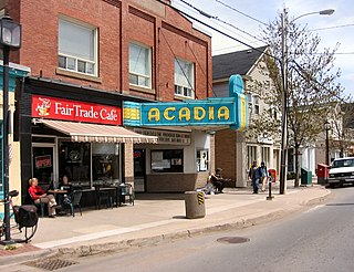
Wolfville is a Canadian town in the Annapolis Valley, Kings County, Nova Scotia, located about 100 kilometres (62 mi) northwest of the provincial capital, Halifax. The town is home to Acadia University and Landmark East School.

<span class="mw-page-title-main">Bay of Fundy</span> Bay on the east coast of North America

The Bay of Fundy is a bay between the Canadian provinces of New Brunswick and Nova Scotia, with a small portion touching the U.S. state of Maine. It is an arm of the Gulf of Maine. Its tidal range is the highest in the world. The name is probably a corruption of the French word fendu, meaning 'split'.

<span class="mw-page-title-main">Hants County, Nova Scotia</span> County in Nova Scotia, Canada

Hants County is a historical county and census division of Nova Scotia, Canada. Local government is provided by the West Hants Regional Municipality, and the Municipality of the District of East Hants.

Windsor is a community located in Hants County, Nova Scotia, Canada. It is a service centre for the western part of the county and is situated on Highway 101.

<span class="mw-page-title-main">Petitcodiac River</span> River in south-eastern New Brunswick, Canada

The Petitcodiac River is a river located in south-eastern New Brunswick, Canada. Local tourist businesses often refer to it as the "chocolate river" due to its distinctive brown mud floor and brown waters. Stretching across a meander length of 79 kilometres, the river traverses Westmorland, Albert, and Kings counties, draining a watershed area of about 2,071 square kilometres (800 sq mi). The watershed features valleys, ridges, and rolling hills, and is home to a diverse population of terrestrial and aquatic species. Ten named tributaries join the river in its course toward its mouth in Shepody Bay. Prior to the construction of a causeway in 1968, the Petitcodiac River had one of the world's largest tidal bores, which ranged from 1 to 2 metres (3.3–6.6 ft) in height and moved at speeds of 5 to 13 kilometres per hour (3.1–8.1 mph). With the opening of the causeway gates in April 2010, the river is flushing itself of ocean silts, and the bore is returning to its former size.

<span class="mw-page-title-main">Minas Basin</span>

The Minas Basin is an inlet of the Bay of Fundy and a sub-basin of the Fundy Basin located in Nova Scotia, Canada. It is known for its extremely high tides.

The Isthmus of Chignecto is an isthmus bordering the Maritime provinces of New Brunswick and Nova Scotia that connects the Nova Scotia peninsula with North America.

<span class="mw-page-title-main">Windsor and Hantsport Railway</span>

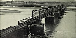
The Windsor and Hantsport Railway was a 56-mile (90.1 km) railway line in Nova Scotia between Windsor Junction and New Minas with a spur at Windsor which runs several miles east, serving two gypsum quarries located at Wentworth Creek and Mantua. It suspended operations in 2011.

Hantsport is an unincorporated area in the West Hants Regional Municipality, Nova Scotia, Canada. It is at the western boundary between West Hants Regional Municipality and Kings County, along the west bank of the Avon River's tidal estuary. The community is best known for its former industries, including shipbuilding, a pulp mill, as well a marine terminal that once loaded gypsum, mined near Windsor. The community is the resting place of Victoria Cross recipient William Hall.

<span class="mw-page-title-main">Nova Scotia Highway 101</span> Highway in Nova Scotia

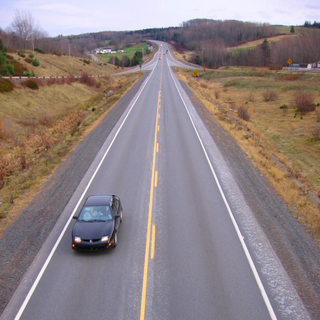
Highway 101 is an east-west highway in Nova Scotia that runs from Bedford to Yarmouth.

<span class="mw-page-title-main">Annapolis River</span> River in Nova Scotia, Canada

The Annapolis River is a Canadian river located in Nova Scotia's Annapolis Valley.

<span class="mw-page-title-main">Nova Scotia Trunk 1</span> Highway in Nova Scotia

Trunk 1 is part of the Canadian province of Nova Scotia's system of Trunk Highways.

The Fundy Shore Ecotour is a former scenic drive and network of tourist destinations in the Canadian province of Nova Scotia and encircles several sub-basins of the Bay of Fundy, which contains the highest tidal range on the planet.

<span class="mw-page-title-main">Nova Scotia Route 215</span>

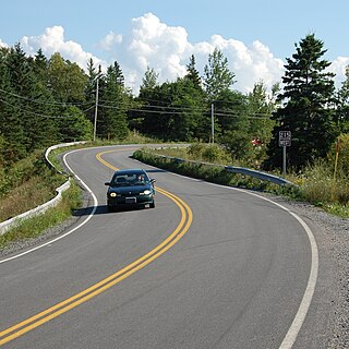
Route 215 is collector road in the Canadian province of Nova Scotia.

<span class="mw-page-title-main">Annapolis Royal Generating Station</span> Canadian tidal power generating station

The Annapolis Royal Generating Station was a tidal power generating station in the Bay of Fundy in Nova Scotia, Canada. When operational, it was the only tidal generating station in North America and was one of the few in the world. Located upstream of Annapolis Royal, Nova Scotia, it generated about 30 million kilowatt hours per year, enough for 4500 houses. Peak output was 20 megawatts.

<span class="mw-page-title-main">Geography of New Brunswick</span>

New Brunswick is one of Canada's three Maritime provinces. While New Brunswick is one of Canada's Maritime Provinces, it differs from its neighbours both ethnoculturally and physiographically. Both Nova Scotia and Prince Edward Island are either wholly or nearly surrounded by water and the ocean, therefore, tends to define their climate, economy and culture. New Brunswick, on the other hand, although having a significant seacoast, is sheltered from the Atlantic Ocean proper and has a large interior that is removed from oceanic effects. New Brunswick, therefore, tends to be defined by its rivers rather than its seacoast.

<span class="mw-page-title-main">Kennetcook River</span> River in Nova Scotia, Canada

The Kennetcook River is a river that flows through Hants County, Nova Scotia. From headwaters near the mouth of the Shubenacadie River, the Kennetcook traverses about 45 kilometres of mostly rural terrain, discharging into the Avon River at Windsor. The Kennetcook cuts through fossiliferous limestone rocks for part of its length. A tidal river near its mouth, the Kennetcook experiences a tidal bore which may be seen at Scotch Village. It is a known salmon river popular with anglers.

Mount Denson is a small community in the Canadian province of Nova Scotia, located in The Municipality of the District of West Hants in Hants County. The community is named after Mount Denson; the mid-eighteenth-century estate of Henry Denny Denson.

The Halfway River is a tributary of the Avon River in Nova Scotia, Canada.

References

  1. North American Gazetteer Archived January 6, 2006, at the Wayback Machine
  2. Schematic drawing and description Archived September 27, 2006, at the Wayback Machine
  3. "Kempt Shore, Nova Scotia".
  4. Natural History of Nova Scotia, Volume 1, Chapter T8 "Freshwater Hydrology", Nova Scotia Museum (1996) p.152
  5. 1 2 Harry Thurston, Tidal Life: A Natural History of the Bay of Fundy. Camden House Publishing, 1990
  6. FAR Press Release [ permanent dead link ]

Further reading

44°59′21.35″N64°9′7.29″W / 44.9892639°N 64.1520250°W / 44.9892639; -64.1520250