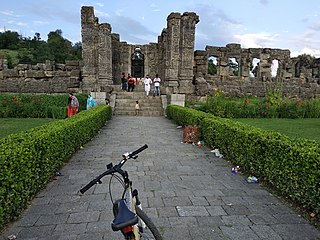
Sisai is one of the biggest villages in Bihar. It comes under Siwan District, India, located about 42 km by road and 52 km by train route north of the Chhapra. It is a typical village of Bihar. From September to April, a blanket is necessary during nights. It is the biggest village in Siwan. It has 51 tola. It comes under Goriyakothi Police Station and Sisai Panchayat. There is a famous middle school which built in 1916. It is bounded by Chhitaouli from north, Bishunpur from South, Angya from East and Pahlegpur from West.

Gopalganj is a town, municipality and headquarters of Gopalganj district in the Indian state of Bihar.
Barahiya is a town and nagar parishad in Lakhisarai district in the Indian state of Bihar. It has a total population of 43,032. It lies on the southern bank of the river Ganges, about 116.8 km east of Patna
Chhabra is a city and a municipality in Baran district in the state of Rajasthan, India, near to the border with Madhya Pradesh. Chhabra is a historic walled city with a fort. Its name comes from the six gates in the walls.
Dhampur is a city and a municipal board in Bijnor district in the state of Uttar Pradesh, India. It is located at 29.51°N 78.50°E, and lies in Northern India.
Lalganj is an important town and Nearest City, (60 kilometres Morden Old City Mehsi), and river port situated in Vaishali district, Bihar.

Mattan is a town, tehsil and a notified area committee, near Anantnag city in the Anantnag district of the Indian union territory of Jammu and Kashmir.
Mhowgaon is a Nagar Panchayat under Sub Division Dr. Ambedkar Nagar (Mhow) in Indore district in the Indian state of Madhya Pradesh. The total geographical area of Mhowgaon nagar panchayat is 13.5 km2 and it is the smallest city by area in the sub district. The population density of the city is 2309 persons per km2. Mhowgaon is divided into 15 wards for which elections are held every 5 years. Among them, Mhowgaon Ward No. 2 is the most populous ward with a population of 3440 and Mhowgaon Ward No. 15 is the least populous ward with a population of 957. Mhowgaon Nagar Panchayat has total administration over 6,373 houses to which it supplies basic amenities like water and sewerage. It is also authorized to build roads within Nagar Panchayat limits and impose taxes on properties coming under its jurisdiction.
Mokama is a town and a municipal council in barh of Patna district in the Indian state of Bihar. It is located 90 km (56 mi) east of Patna on the southern banks of the river Ganges. Mokama is the connecting town of north and south Bihar and has 2nd highest amount of lentil production in India. It emerged as an industrial area in State of Bihar after independence.
Nallur (Nalloor) is a panchayat town in Kanniyakumari district in the Indian state of Tamil Nadu.
Salumbar is a District in the Indian state of Rajasthan.
Thakurganj is a town and a notified area, divided into 12 wards, in Kishanganj district in the Indian state of Bihar.
Islampur is a city and Notified area in Nalanda district in the Indian state of Bihar. it is a city council and no of ward is 26 here.
Kerur is a town in Bagalkot district in Karnataka, which located on NH 218. It has an average elevation of 617 meters (2024 feet). It's the birthplace of Jagadish Shettar, a former Chief Minister of Karnataka. Kerur is a Town Panchayat city in the district of Bagalkot, Karnataka. The Kerur city is divided into 16 wards for which elections are held every five years. The Kerur Town Panchayat has a population of 19,731 of which 9,929 are males while 9,802 are females as per report released by Census India 2011.

Bramhapuri is a town and municipal council in Chandrapur district in the state of Maharashtra, India.
Pakri Barawan is a town in the Nawada District of the Indian state of Bihar.
Harpur Kalan is a small village of 1269 families located in Majorganj, Sitamarhi, Bihar, India. The Harpur Kalan village has a population of 5510 of which 2990 are males while 2520 are females as per Population Census 2011. In Harpur Kalan village the population of children between the ages of 0-6 is 1027, which makes up 18.64% of the total population. The average sex ratio of Harpur Kalan village is 843, lower than the Bihar state average of 918. The child sex ratio for Harpur Kalan as per census is 824, lower than the Bihar average of 935.
Rajepur Nawada is a village in the East Champaran District of Bihar.
Akauna is a village located in Masaurhi block, Patna district, Bihar, India.
Akauna is a large village located in Sirdala block, Nawada district, Bihar, India.


