Garhwa is a town and a municipality in, and headquarters of, Garhwa district in the state of Jharkhand, India. Uttar Pradesh, Chhattisgarh and Bihar are nearby states. Garhwa Road (Rehla) is a major Railway Junction where thousands of passengers find this station most convenient to catch their train for Delhi and Kolkata. Bus services are available for Ranchi, Ambikapur, Gaya, etc.
Araria is a city and a municipality that is the headquarters of Araria district in the Indian state of Bihar. Araria is situated in the northern part of Bihar.
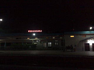
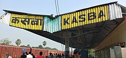
Kishanganj is a city and district headquarters of Kishanganj district in Purnia division of Bihar state in India.

Katihar is a city situated in the eastern part of the state of Bihar in India. It is the regional headquarters of Katihar district. It is one of the important cities of Bihar. It is also a main stop on the Barauni–Guwahati line.
Madhepura is a municipality in Madhepura district in the Indian state of Bihar. It stands at the centre of Kosi ravine, It was called Madhyapura- a place centrally situated which was subsequently transformed as Madhipura into present Madhepura. It is surrounded by Araria and Supaul districts in the north, Khagaria and Bhagalpur districts in the south, Purnia district in the east and Saharsa district in the West.

Muzaffarpur is a city located in Muzaffarpur district in the Tirhut region of the Indian state of Bihar. It serves as the headquarters of the Tirhut division, the Muzaffarpur district and the Muzaffarpur Railway District. It is the fourth most populous city in Bihar.

Purnia is the fourth largest city of Bihar and is emerging as the largest economic hub in North Bihar. It serves as the administrative headquarters of both Purnia district and Purnia division in the Indian state of Bihar. It is well known for its favourable climate like Darjeeling and has an abundance of resources for human settlements and economic activities.

Saharsa is a city and municipal corporation in the Saharsa District in the eastern part of the state of Bihar, India. It is situated near the eastern banks of the Kosi River. It serves as the administrative headquarters for the Saharsa District and is also the Divisional headquarters of the Kosi Division.
Supaul is a town and a municipality that is headquarters of Supaul district in the Indian state of Bihar. Supaul is the administrative headquarters of this district. There Are 11 block under the Supaul district Supaul, Kishanpur, Saraigarh-Bhaptiyahi, Pipra, Triveniganj, Raghopur, chhatapur, Nirmali, Marauna, Basantpur and pratapganj.
Banmankhi Bazar is a town and a notified area in Purnia district in the state of Bihar, India.
Forbesganj is a city with municipality in the Araria District in the state of Bihar, India, situated at the border of Nepal.

Jogbani is a municipal council area, in Araria District of Bihar state, India. It lies on the Indo-Nepal border with Morang District, Koshi Zone and is a gateway to Biratnagar city. There is a customs checkpoint for goods at the border. Indian and Nepalese nationals cross without restrictions.
Kamalganj is a town and a nagar panchayat in Farrukhabad district in the Indian state of Uttar Pradesh. The town is one of the key contributors to Potato production in the district. Kamalganj was named after Muslim religion promoter and social worker 'Kamal Baba'.
Kandra is a census town in the Adityapur CD block in the Seraikela Sadar subdivision of the Saraikela Kharsawan district in the Indian state of Jharkhand.
Khadda is a town, a nagar panchayat and a tehsil in Kushinagar district in the Indian state of Uttar Pradesh. It is situated approximately 8 kilometres (5.0 mi) from the border with Bihar and 18 kilometres (11 mi) from the India-Nepal border.

Manihari is a town and a notified area in Katihar district in the Indian state of Bihar. Pincode of Manihari is 854113.
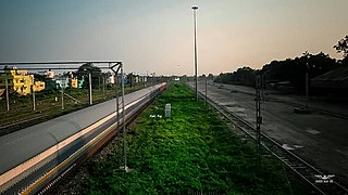
The Barauni–Katihar, Saharsa and Purnia sections of the Barauni–Guwahati line connects Barauni, Saharsa, Purnia and Katihar in the Indian state of Bihar.
Bhagwanpur is a town in the Bhagwanpur block of Vaishali district in Bihar, India.
Dagarua (Dagarwa) is a town and a notified area in Purnia district (Purnea) in the Indian state of Bihar. It is a block and village panchayat located near NH 31 in Purnia. It is situated 15 km East of Purnia City. It comes under seemanchal region. It consists of one police station. It has a total population of 2,21,229 in which male are 1,14,933 and female population of 1,06,296 and children is 45,940. It has a literacy rate of 37.39%. It has sex-ratio of 48 out of 52 males.
Lasanpur is a large village located in Dagarua of Purnia district, Bihar with total 437 families residing. It has population of 2126 of which 1115 are males while 1011 are females as per Population Census 2011.