Bankati, Paschim Bardhaman

Last updated

Bankati
Village
West Bengal location map.svg
Red pog.svg
Bankati
Location in West Bengal, India
India location map.svg
Red pog.svg
Bankati
Bankati (India)
Coordinates: 23°36′00″N87°29′19″E / 23.6001°N 87.4886°E / 23.6001; 87.4886 Coordinates: 23°36′00″N87°29′19″E / 23.6001°N 87.4886°E / 23.6001; 87.4886
CountryFlag of India.svg  India
State West Bengal
District Paschim Bardhaman
Population
 (2011)
  Total1,255
Languages*
  Official Bengali, English
Time zone UTC+5:30 (IST)
PIN
713212
Telephone code91 341
Lok Sabha constituency Bardhaman-Durgapur
Vidhan Sabha constituency Durgapur Purba
Website pascimbardhaman.co.in

Bankati is a village in Kanksa CD block in the Durgapur subdivision of the Paschim Bardhaman district in the Indian state of West Bengal.

Contents

Geography

Cities and towns in the southern and eastern portions of Durgapur subdivision in Paschim Bardhaman district
MC: Municipal Corporation, CT: census town, R: rural centre, A: airport, B: barrage, H: historical site
Owing to space constraints in the small map, the actual locations in a larger map may vary slightly

Urbanisation

According to the 2011 census, 79.22% of the population of the Durgapur subdivision was urban and 20.78% was rural. The Durgapur subdivision has 1 municipal corporation at Durgapur and 38 (+1 partly) census towns (partly presented in the map alongside; all places marked on the map are linked in the full-screen map). [1]

Location

Bankati is located at 23°36′00″N87°29′19″E / 23.6001°N 87.4886°E / 23.6001; 87.4886 .

Demographics

According to the 2011 Census of India, Bankati had a toal population of 1,255 of which 650 (52%) were males and 605 (48%) were females. Population in the age range 0–6 years was 125. The total number of literate persons in Bankati was 880 (71.50% of the population over 6 years). [2]

*For language details see Kanksa (community development block)#Language and religion

Education

Eklabya Model School (residential) is a Hindi-medium coeducational institution established in 2002. It has facilities forteaching from class VI to class XII. The school has a library with 81 books and a playground. [3]

Ajodhya High School is a Bengali-medium coeducational school established in 1957. It has facilities for teaching from class V to class XII. [4]

Culture

There is a 15 feet high bell metal (pital) chariot at Bankati, built in the 19th century. Designed in the style of a pancharatna temple it has carvings on its body. Bankati has two Shiva temples - Gopeswar Shiva Temple built in 1155 and Pancha Ratna Shiva temple built in 1782. [5]

David J. McCutchion mentions a Shiva Temple at Bankati built in 1832. It is described as a standard type pancharatna temple with bridged rekha turrets and single entrance and terracotta decoration. [6]

Related Research Articles

Kanksa is a census town and a gram panchayat in the Kanksa CD block in the Durgapur subdivision of the Paschim Bardhaman district in the Indian state of West Bengal.

Debipur is a census town in the Kanksa CD block of the Durgapur subdivision in the Paschim Bardhaman district in the state of West Bengal, India.

<span class="mw-page-title-main">Khirpai</span> City in West Bengal, India

Khirpai, also known as Kshirpai, is a city and a municipality in the Ghatal subdivision of the Paschim Medinipur district in the state of West Bengal, India. The city is situated between Ghatal and Chandrakona, near the banks of the rivers Shilabati and Kethai, and is one of the oldest municipalities in India. Khirpai is also famous for its ‘Babarsha’, a special type of sweetmeat, which is not available elsewhere.

<span class="mw-page-title-main">Ukhra</span> Census Town in West Bengal, India

Ukhra is a census town in the Andal CD block in the Durgapur subdivision of the Paschim Bardhaman district in the Indian state of West Bengal.

<span class="mw-page-title-main">Durgapur subdivision</span> Subdivision in West Bengal, India

Durgapur subdivision is an administrative subdivision of the Paschim Bardhaman district in the state of West Bengal, India.

Masagram is a village in Ajhapur gram panchayat of Jamalpur CD block in Bardhaman Sadar South subdivision of Purba Bardhaman district in the Indian state of West Bengal.

<span class="mw-page-title-main">Andal, Paschim Bardhaman</span> Census Town in West Bengal, India

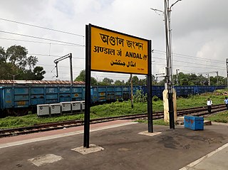
Andal is a census town in the Andal CD block in the Durgapur subdivision of the Paschim Bardhaman district in the Indian state of West Bengal.

<span class="mw-page-title-main">Baidyapur</span> Village in West Bengal, India

Baidyapur is a village in Kalna II CD block in Kalna subdivision of Purba Bardhaman district, West Bengal, India.

Patrasayer is a village in the Patrasayer CD block in the Bishnupur subdivision of the Bankura district in the state of West Bengal, India.

Laudoha is a village in the Faridpur Durgapur CD block in the Durgapur subdivision of the Paschim Bardhaman district in the state of the West Bengal, India.

Mankar is a village in Galsi I CD Block in Bardhaman Sadar North subdivision of Purba Bardhaman district in the state of West Bengal, India.

Hatgobindapur is a village in Burdwan II CD block in Bardhaman Sadar North subdivision of Purba Bardhaman district in the state of West Bengal, India.

Arra is a census town in the Kanksa CD block in the Durgapur subdivision of the Paschim Bardhaman district in the Indian state of West Bengal.

Gopalpur is a census town in the Kanksa CD block in the Durgapur subdivision of the Paschim Bardhaman district in the Indian state of West Bengal.

<span class="mw-page-title-main">Gourangapur</span> Village in West Bengal, India

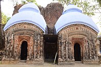
Gourangapur is a village in Kanksa CD block in Durgapur subdivision of Paschim Bardhaman district in the Indian state of West Bengal. The place has links with Ichhai Ghosh, king of Gopbhum, and it is believed that his capital, Dhekur, was located nearby. The area was earlier a part of Senpahari pargana.

Ajodhya is a village in the Bishnupur CD block in the Bishnupur subdivision of the Bankura district in the state of West Bengal, India.

Balsi Purbapara is a village in the Patrasayer CD block in the Bishnupur subdivision of the Bankura district in the state of West Bengal, India.

Sibpur is a village in Kanksa CD block in the Durgapur subdivision of the Paschim Bardhaman district in the Indian state of West Bengal.

Malandighi is a village and a gram panchayat in Kanksa CD block in the Durgapur subdivision of the Paschim Bardhaman district in the Indian state of West Bengal.

Loyada is a village in the Debra CD block in the Kharagpur subdivision of the Paschim Medinipur district in the state of West Bengal, India.

References

  1. "District Statistical Handbook 2014 Burdwan". Table 2.2, 2.4(a). Department of Statistics and Programme Implementation, Government of West Bengal. Archived from the original on 21 January 2019. Retrieved 15 September 2018.
  2. "2011 Census – Primary Census Abstract Data Tables". West Bengal – District-wise. Registrar General and Census Commissioner, India. Retrieved 15 June 2020.
  3. "Eklabya Model School (Residential)". Schools.org. Retrieved 14 June 2020.
  4. "Ajodhya High School". Schools.org.in. Retrieved 14 June 2020.
  5. Chattopadhyay, Akkori, Bardhaman Jelar Itihas O Lok Sanskriti (History and Folk lore of Bardhaman District.), (in Bengali), Vol II, pages 539-540, Radical Impression. ISBN   81-85459-36-3
  6. McCutchion, David J., Late Mediaeval Temples of Bengal, first published 1972, reprinted 2017, page 48, The Asiatic Society, Kolkata, ISBN   978-93-81574-65-2