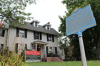
Claymont is a census-designated place (CDP) in New Castle County, Delaware, United States. The estimated 2017 population of the 19703 ZIP code, which Claymont encompasses, was 15,292.

Ellendale is a town in Sussex County, Delaware, United States. The population was 381 at the 2010 census, an increase of 16.5% since 2000. It is part of the Salisbury, Maryland-Delaware Metropolitan Statistical Area. Ellendale is the "Gateway to Delaware's Resort Beaches" because it is the town located on U.S. Highway 113, the resort area's westernmost border, and Delaware Route 16, the resort area's northernmost border with the eastern border being the Delaware Bay and Atlantic Ocean and the southern border being the state line with Maryland.
Newtown Township is a township in Delaware County, Pennsylvania, United States. Prior to 1789 it was part of Chester County. The population was 12,216 as of the 2010 census, and was 19,705 as of 2017.
Brandywine Hundred is an unincorporated subdivision of New Castle County, Delaware, United States. It is located to the north and northeast of the city of Wilmington. Hundreds were once used as a basis for representation in the Delaware General Assembly. Brandywine Hundred and North Wilmington are commonly used colloquial names for this area. However, while their names still appear on all real estate transactions, all other hundreds in Delaware presently have no meaningful use or purpose except as a geographical point of reference. In the 2010 census, Brandywine had 77,182 people.
Christiana Hundred is an unincorporated subdivision of New Castle County, Delaware. Hundreds were once used as a basis for representation in the Delaware General Assembly, and while their names still appear on all real estate transactions, they presently have no meaningful use or purpose except as a geographical point of reference.
Mill Creek Hundred is an unincorporated subdivision of New Castle County, Delaware. Hundreds were once used as a basis for representation in the Delaware General Assembly, and while their names still appear on all real estate transactions, they presently have no meaningful use or purpose except as a geographical point of reference.

David Hazzard was an American merchant and politician from Milton, in Sussex County, Delaware. He was a member of the Democratic-Republican Party, then the National Republican Party, and finally the Whig Party. He served in the Delaware General Assembly, as Governor of Delaware, and as an Associate Justice of the Delaware Superior Court.
Blackbird Hundred is an unincorporated subdivision of New Castle County, Delaware. Hundreds were once used as a basis for representation in the Delaware General Assembly, and while their names still appear on all real estate transactions, they now have no purpose except as a geographical point of reference.
Appoquinimink Hundred is an unincorporated subdivision of New Castle County, Delaware. Hundreds were once used as a basis for representation in the Delaware General Assembly, and while their names still appear on all real estate transactions, they presently have no meaningful use or purpose except as a geographical point of reference.
St. Georges Hundred is an unincorporated subdivision of New Castle County, Delaware. Hundreds were once used as a basis for representation in the Delaware General Assembly, and while their names still appear on all real estate transactions, they presently have no meaningful use or purpose except as a geographical point of reference.
Red Lion Hundred is an unincorporated subdivision of New Castle County, Delaware. Hundreds were once used as a basis for representation in the Delaware General Assembly, and while their names still appear on all real estate transactions, they presently have no meaningful use or purpose except as a geographical point of reference.
White Clay Creek Hundred is an unincorporated subdivision of New Castle County, Delaware. Hundreds were once used as a basis for representation in the Delaware General Assembly, and while their names still appear on all real estate transactions, they presently have no meaningful use or purpose except as a geographical point of reference.
Joseph Haslet was an American planter and politician from Cedar Creek Village in Cedar Creek Hundred, Sussex County, Delaware. He was a member of the Democratic-Republican Party, who served twice as Governor of Delaware.

John Clark was an American farmer and politician from Blackbird Hundred in New Castle County, Delaware, near Smyrna. He was a member of the Federalist Party, who served in the Delaware General Assembly and as Governor of Delaware.

Marshallton is an unincorporated community in Mill Creek Hundred, New Castle County, Delaware, United States. The community was founded in 1836 and is named for John Marshall, mill owner.

Cheyney is an unincorporated community that sits astride Chester and Delaware counties in the U.S. state of Pennsylvania. It corresponds to the census-designated place known as Cheyney University, which had a population of 988 at the 2010 census. It is the home of Cheyney University of Pennsylvania. The university derive their name from George Cheyney's Farm, which became the current campus of Cheyney University in 1902. George Cheyney's Farm and the surrounding area was part of the original land grant given to William Penn in 1681.

Cheyney station is a train station in Thornbury Township, Delaware County, Pennsylvania. It currently serves as a stop on the West Chester Railroad tourist railroad line, and previously served as a station for the Pennsylvania Railroad and SEPTA.

The Sourlands is a region in the US state of New Jersey that includes portions of Hunterdon County, Mercer County and Somerset County. It is centered on Sourland Mountain and comprises parts of Lambertville, East Amwell, West Amwell, Hillsborough, Hopewell Boro, Hopewell Township, and Montgomery. The region is flanked by the Hopewell Fault to the south and Amwell Valley to the north that runs from Mount Airy to an area just west of Flagtown and a diabase formation running from Lambertville to Mount Airy. The Sourland also include a hilly area towards the southwest called Pleasant Valley, with a number of farms. Although much of the Sourlands is not conducive to farming, Pleasant Valley and the slopes on the surrounding ridges have a number of farms. The slopes of the ridge to the north are also home to Unionville Vineyard.

Pearsons Corner is an unincorporated community in Kent County, Delaware, United States. Pearsons Corner is located at the intersection of Delaware Route 8 and Delaware Route 44 west of Dover.

St. James, an unincorporated community in Cedar County, Nebraska, United States, was first settled in 1856 and served as the first county seat of Cedar County. St. James, however, claims two former locations. The first was at the confluence of Bow Creek and the Missouri River. The second covered ~67 acres 1.5 miles south of its original location and 0.6 miles northwest of today's location. Today’s St. James includes the St. James Marketplace, the Catholic cemetery, a bar/restaurant, and several homes.


