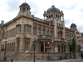
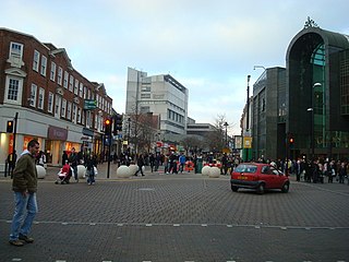
Ilford is a large town in East London, England in the London Borough of Redbridge. Identified as a metropolitan centre in the London Plan, Ilford is classed as a significant commercial and retail centre for the wider south east of England. It had a population of 168,168 in 2011, compared to 303,858 for the entire borough.

Coulsdon is a town in south London, England, within the London Borough of Croydon and the historic county of Surrey.

Edgware is a suburban town in northern Greater London, mostly in the London Borough of Barnet but with a small part falling in the London Borough of Harrow. Edgware is centred 9.5 miles (15.3 km) north-northwest of Charing Cross and has its own commercial centre. Edgware has a generally suburban character, typical of the rural-urban fringe. It was an ancient parish in the county of Middlesex directly east of the ancient Watling Street, and gives its name to the present day Edgware Road that runs from central London towards the town. The community benefits from some elevated woodland on a high ridge marking the Hertfordshire border of gravel and sand. It includes the areas of Burnt Oak, The Hale, Edgwarebury, Canons Park, and parts of Queensbury.

The London Borough of Barnet is a suburban London borough in North London. The borough was formed in 1965 from parts of the ceremonial counties of Middlesex and Hertfordshire. It forms part of Outer London and is the largest London borough by population with 384,774 inhabitants, also making it the 13th largest district in England. The borough covers an area of 86.74 square kilometres (33 sq mi), the fourth highest of the 32 London boroughs, and has a population density of 45.8 people per hectare, which ranks it 25th.

Witham is a town in the county of Essex in the East of England, with a population of 25,353. It is part of the District of Braintree and is twinned with the town of Waldbröl, Germany. Witham stands between the city of Chelmsford and the town of Colchester, on the Roman road between the two. The River Brain runs through the town and joins the River Blackwater just outside.

Harpenden is a town and civil parish in the City and District of St Albans in the county of Hertfordshire, England. The population of the built-up area was 30,240 in the 2011 census, whilst the population of the civil parish was 29,448. Harpenden is a commuter town, with a direct rail connection through Central London and property prices well over triple the national average.

Barking is a town and area in East London, England, within the London Borough of Barking and Dagenham. It is 9.3 miles (15 km) east of Charing Cross. The total population of Barking was 59,068 at the 2011 census. In addition to an extensive and fairly low-density residential area, the town centre forms a large retail and commercial district, currently a focus for regeneration. The former industrial lands to the south are being redeveloped as Barking Riverside.
Bromley is a large town in south east London, England, within the London Borough of Bromley. It is 9.3 miles (15.0 km) south-east of Charing Cross, and had a population of 87,889 as of 2011.
Chipping Barnet or High Barnet is a suburban market town in north London, forming part of the London Borough of Barnet, England. It is a suburban development built around a 12th-century settlement, and is located 10+1⁄2 miles (17 km) north-northwest of Charing Cross, 3 miles (4.8 km) east from Borehamwood, 5.2 miles (8.4 km) west from Enfield and 3.2 miles (5.1 km) south from Potters Bar. Its population, including its localities East Barnet, New Barnet, Hadley Wood, Monken Hadley, Cockfosters and Arkley, was 47,359 as of 2011.

New Barnet is a neighbourhood on the north east side of the London Borough of Barnet. It is a largely residential North London suburb located east of Chipping Barnet, west of Cockfosters, south of the village of Monken Hadley and north of Oakleigh Park.

Chipping Ongar is a market town and former civil parish, now in the parish of Ongar, in the Epping Forest District of the county of Essex, England. It is located 6 miles (10 km) east of Epping, 7 miles (11 km) southeast of Harlow and 7 miles (11 km) northwest of Brentwood. In 2020 the built-up area had an estimated population of 6420. In 1961 the parish had a population of 1673.

The River Brent is a river in west and northwest London, England, and a tributary of the River Thames. 17.9 miles (28.8 km) in length, it rises in the Borough of Barnet and flows in a generally south-west direction before joining the Tideway stretch of the Thames at Brentford.

St Albans is a constituency represented in the House of Commons of the UK Parliament since 2019 by Daisy Cooper, a Liberal Democrat.

Osidge is a district in the London Borough of Barnet, between Brunswick Park and Southgate, just west of the border with the London Borough of Enfield. It may be loosely defined as the part of postal district N14 that is in Barnet. Osidge has no formal border and is entirely enclosed within the electoral ward of Brunswick Park, East Barnet; however Oak Hill Park forms a natural boundary to the North and Pymmes Brook to the West, with the A111 to the East and the Piccadilly line to the South/East.

Barnet Gate is a hamlet on the northern edge of the London Borough of Barnet to the west of Arkley, in England. There was a settlement there during the Roman occupation of Britain and in the Anglo-Saxon period it was known as Grendeles Gatan after Grendel, the monster in the epic poem Beowulf. Manor courts were held there and brickmaking was an important local industry. It was on the edge of Southaw wood which was cleared when nearby Chipping Barnet was developed after which it was known as Barnet Gate. The Gate referred to no longer exists but was either a gate used to prevent cattle straying onto Barnet Common or a gate that marked the boundary between Hertfordshire and Middlesex.
Christ Church Barnet, is a Church of England church in St Albans Road, Chipping Barnet.

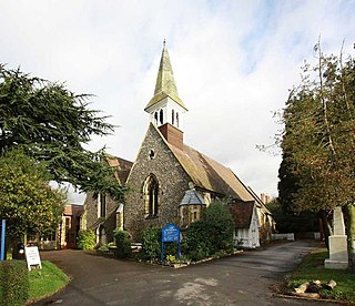
St John the Baptist Church is the Church of England parish church of Chipping Barnet. It forms part of the Chipping Barnet Team Ministry, comprising St Mark's, Barnet Vale, St Peter's, Arkley and St Stephen's, Bell's Hill. It crowns the ascent up Barnet Hill, and stands at the junction of Wood Street and High Street. It is one of the few Anglican churches in Greater London to belong to the Diocese of St Albans.

The Mitre Inn is a public house at 58 High Street, Chipping Barnet, London. It was established by 1633 and is probably the oldest remaining of the town's once numerous coaching inns. It is a grade II listed building with Historic England and is currently styled "Ye Olde Mitre Inne".

The Chipping Barnet War Memorial is located immediately west of St John the Baptist Church in Wood Street, Chipping Barnet, Greater London. It commemorates the men of the district who died in the first and second World Wars and is in the form of an octagonal base below a pedestal surmounted by a tapering column with a Celtic cross head. The cross is intersected by a corona in a flattened octagonal section. It was unveiled by Lord Byng of Vimy in April 1921. Byng was born at nearby Wrotham Park in Hertfordshire.
