Becontree or is an area of approximately 4 square miles (10 km2) in the London Borough of Barking and Dagenham. It is located 11 miles (17.7 km) east-northeast of Charing Cross and was constructed in the interwar period as the largest public housing estate in the world. The Housing Act 1919 permitted the London County Council to build housing outside the County of London and Becontree was constructed between 1921 and 1935 to cottage estate principles in the parishes of Barking, Dagenham and Ilford, then in the administrative and ceremonial county of Essex. The official completion of the estate was celebrated in 1935, by which time the estate had a population of around 100,000 people in 26,000 homes.

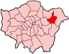
The London Borough of Barking and Dagenham is a London borough in East London. It lies around 9 miles (14.4 km) east of Central London. The borough was created in 1965 as the London Borough of Barking; the name was changed in 1980. It is an Outer London borough and the south is within the London Riverside section of the Thames Gateway; an area designated as a national priority for urban regeneration. At the 2011 census it had a population of 187,000. The borough's three main towns are Barking, Chadwell Heath and Dagenham. The local authority is the Barking and Dagenham London Borough Council. Barking and Dagenham was one of six London boroughs to host the 2012 Summer Olympics.
Dagenham is a town in East London, England, within the London Borough of Barking and Dagenham. Dagenham is centred 11+1⁄2 miles east of Charing Cross.

Barking is a riverside town in East London, England, within the London Borough of Barking and Dagenham. It is 9.3 miles (15 km) east of Charing Cross. The total population of Barking was 59,068 at the 2011 census. In addition to an extensive and fairly low-density residential area, the town centre forms a large retail and commercial district, currently a focus for regeneration. The former industrial lands to the south are being redeveloped as Barking Riverside.
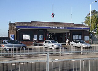
Dagenham East is a London Underground station located on the eastern side of the town of Dagenham in the London Borough of Barking and Dagenham, east London. It is on the District line between Dagenham Heathway to the west and Elm Park to the east. It is 6.4 kilometres (4.0 mi) along the line from the eastern terminus at Upminster and 27.8 kilometres (17.3 mi) to Earl's Court in central London where the line divides into numerous branches. The station has moderate usage for a suburban station, with approximately 3 million exits/entrances per year.

Elm Park is a London Underground station serving Elm Park in the London Borough of Havering, east London. It is on the District line between Dagenham East and Hornchurch. It is 4 kilometres (2.5 mi) along the line from the eastern terminus at Upminster and 30 kilometres (19 mi) to Earl's Court in central London where the line divides into numerous branches.

Hornchurch is a London Underground station serving the town of Hornchurch in the London Borough of Havering, east London. It is on the District line between Elm Park to the west and Upminster Bridge to the east. It is 2.5 kilometres (1.6 mi) along the line from the eastern terminus at Upminster and 31.7 kilometres (19.7 mi) to Earl's Court in central London where the line divides into numerous branches.
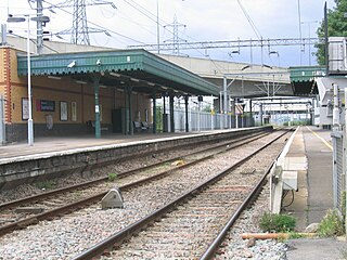
Dagenham Dock is a National Rail station in the Dagenham Dock neighbourhood of Dagenham in the London Borough of Barking and Dagenham, east London. The station is on the Tilbury loop of the London, Tilbury and Southend line, located 10 miles 45 chains (17.0 km) down the line from London Fenchurch Street between Barking to the west and Rainham to the east. The station was opened in 1908 by the London, Tilbury and Southend Railway. The station serves a primarily industrial area adjacent to the River Thames, including the Ford Dagenham site, that is now going through redevelopment as a commercial and residential district. Its three-letter station code is DDK and it is in London fare zone 5. The station and all trains serving it are currently operated by c2c. It is an interchange with the East London Transit bus service.

Becontree is a London Underground station located to the south of Becontree in the London Borough of Barking and Dagenham, east London. It is on the District line between Upney to the west and Dagenham Heathway to the east. It is 9.1 kilometres (5.7 mi) along the line from the eastern terminus at Upminster and 25.1 kilometres (15.6 mi) to Earl's Court in central London where the line divides into numerous branches. It is in London fare zone 5.

East London is the northeastern part of Greater London, England, east of the ancient City of London and north of the River Thames as it begins to widen. Containing areas in the historic counties of Middlesex and Essex, East London developed as London's docklands and the primary industrial centre. The expansion of railways in the 19th century encouraged the eastward expansion of the East End of London and a proliferation of new suburbs. The industrial lands of East London are today an area of regeneration, which are well advanced in places such as Canary Wharf and ongoing elsewhere.

East London Transit (ELT) is a part-segregated bus rapid transit, operated as part of the London Buses network. The East London Transit opened in phases between 2010 and 2013. The scheme for this system was developed by Transport for London to meet the existing and anticipated demand for public transport in East London caused by the Thames Gateway redevelopment, and has been planned to allow for a possible future upgrade to tram operation.
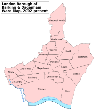
Barking and Dagenham London Borough Council in London, England is elected every four years. Since the last boundary changes in 2022 the council has comprised 51 councillors representing 19 wards, with each ward electing two or three councillors. Elections are held every four years.
Becontree Heath is an open space in the London Borough of Barking and Dagenham. The name has also been applied to the local area, in particular to the RM8 postal district.

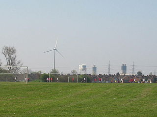
Dagenham Dock is an industrial district in the London Borough of Barking and Dagenham in London, England. It is located to the south of Dagenham and is on the River Thames. It was once the site of a large coaling port and continues to be the location of a small terminal licensed to handle coal off-loading. Today the site is used for a number of river-related operations including a 25-acre (100,000 m2) TDG depot with around 200 tanks for the storage of petrol, distillates, aviation fuel, biofuels, tallow, ethanol, fertilisers, and urea.
Barking Abbey is a former royal monastery located in Barking, in the London Borough of Barking and Dagenham. It has been described as having been "one of the most important nunneries in the country".

Barking and Dagenham London Borough Council, also known as Barking and Dagenham Council, is the local authority for the London Borough of Barking and Dagenham in Greater London, England. It is a London borough council, one of 32 in the United Kingdom capital of London. It provides a broad range of local government services including Council Tax billing, libraries, social services, processing planning applications, waste collection and disposal, and it is a local education authority. The council has been under Labour majority control since its creation in 1965. The council was created by the London Government Act 1963 as the Barking London Borough Council and replaced two local authorities: Barking Borough Council and Dagenham Borough Council. The council was renamed on 1 January 1980. It is based at Barking Town Hall in the centre of Barking.

Barking Power Station refers to a series of power stations at various sites within the London Borough of Barking and Dagenham in east London. The original power station site, of the coal-fired A, B and C stations, was at River Road, Creekmouth, on the north bank of the River Thames. These stations were decommissioned by 1981 and were subsequently demolished. The later gas-fired power station was built further down the Thames near Dagenham Dock in the early 1990s. The site of the former power stations is being redeveloped as Barking Riverside.

Thames View Estate is a large housing estate in Barking and Dagenham in East London, England.

Mayesbrook Park is a 43 hectare public park in the London Borough of Barking and Dagenham and in the post town of Dagenham and the pre-1965 borough of Barking. It is owned and managed by the borough council. The southern end, which is mainly a large lake, is a Local Nature Reserve.[broken link] The area covered by the park was once part of the historic Manor of Jenkins, seat of the Fanshawe family. For reasons which remain obscure, the park is nicknamed "Matchstick Island".

Barking Riverside is a railway station in the London Borough of Barking and Dagenham, East London. The station serves the Barking Riverside regeneration area, and was built as part of a £327m extension of the Gospel Oak to Barking line to the area. It opened on 18 July 2022. It is served by London Overground, and provides interchange with the Uber Boat by Thames Clippers boat service from Barking Riverside Pier.