Rush Green, London

Last updated

Rush Green
Rush green london.jpg
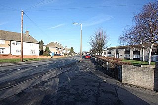
Corner of Rush Green Road and Dagenham Road
Greater London UK location map 2.svg
Red pog.svg
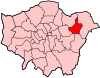
Rush Green
Location within Greater London
OS grid reference TQ505875
  Charing Cross 13.5 mi (21.7 km)  WSW
London borough
Ceremonial county Greater London
Region
Country England
Sovereign state United Kingdom
Post town ROMFORD
Postcode district RM7
Dialling code 020
01708
Police Metropolitan
Fire London
Ambulance London
EU Parliament London
UK Parliament
London Assembly
List of places
UK
England
London
51°33′56″N0°10′34″E / 51.5655°N 0.176°E / 51.5655; 0.176 Coordinates: 51°33′56″N0°10′34″E / 51.5655°N 0.176°E / 51.5655; 0.176

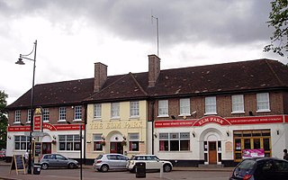
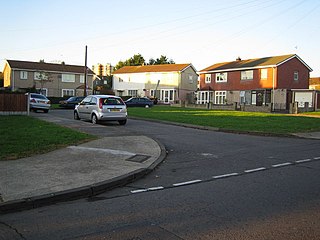
Rush Green is a suburban area in Romford in East London, England. It straddles the boundary of the London Borough of Barking and Dagenham and the London Borough of Havering, and is located 13.5 miles (22 km) east-northeast of Charing Cross.

Romford town in northeast London, United Kingdom

Romford is a large town in east London and the administrative centre of the London Borough of Havering. It is located 14.1 miles (22.7 km) northeast of Charing Cross and is one of the major metropolitan centres identified in the London Plan. Historically Romford was a market town in the county of Essex and formed the administrative centre of the liberty of Havering, until it was dissolved in 1892. Good road links to London and the opening of the railway station in 1839 were key to the development of the town and the economic history of Romford is underpinned by a shift from agriculture to light industry and then to retail and commerce. As part of the suburban growth of London in the 20th century, Romford significantly expanded and increased in population, becoming a municipal borough in 1937 and has formed part of Greater London since 1965 when the area was transferred from Essex. It now forms one of the largest commercial, retail, entertainment and leisure districts in London and has a developed night-time economy.

East London Northeastern part of London, United Kingdom

East London is a popularly and informally defined part of London, capital of the United Kingdom. By most definitions it is east of the ancient City of London and north of the River Thames. It broadly comprises the London boroughs of Barking and Dagenham, Hackney, Havering, Newham, Redbridge, Tower Hamlets and Waltham Forest. The East End of London is a subset of East London, consisting of areas close to the ancient City of London. The Eastern (E) Postal District is a different subset of East London; and there is also an "East" sub-region used in the London Plan for planning policy reporting purposes. The most recent (2011) iteration includes seven boroughs north of the Thames, with the addition of three boroughs south of the river.

London Capital of the United Kingdom

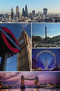
London is the capital and largest city of England and the United Kingdom, with the largest municipal population in the European Union. Standing on the River Thames in the south-east of England, at the head of its 50-mile (80 km) estuary leading to the North Sea, London has been a major settlement for two millennia. Londinium was founded by the Romans. The City of London, London's ancient core − an area of just 1.12 square miles (2.9 km2) and colloquially known as the Square Mile − retains boundaries that follow closely its medieval limits. The City of Westminster is also an Inner London borough holding city status. Greater London is governed by the Mayor of London and the London Assembly.

Contents

Government

Rush Green is divided between the Eastbrook Ward in the London Borough of Barking and Dagenham and the Brooklands Ward in the London Borough of Havering, electing three councillors to Barking and Dagenham London Borough Council and three councillors to Havering London Borough Council. It is also divided between the Dagenham and Rainham and Romford parliamentary constituencies, each electing a member of parliament.

Barking and Dagenham London Borough Council local authority for the London Borough of Barking and Dagenham in Greater London, England

Barking and Dagenham London Borough Council is the local authority for the London Borough of Barking and Dagenham in Greater London, England. It is a London borough council, one of 32 in the United Kingdom capital of London. It provides a broad range of local government services including Council Tax billing, libraries, social services, processing planning applications, waste collection and disposal, and it is a local education authority. Barking and Dagenham is divided into 17 wards, each electing three councillors. At the May 2014 election, the Labour Party won all 51 seats. The council was created by the London Government Act 1963 as the Barking London Borough Council and replaced two local authorities: Barking Borough Council and Dagenham Borough Council. The council was renamed on 1 January 1980. The next election to the authority will be in May 2022.

Havering London Borough Council

Havering London Borough Council is the local authority for the London Borough of Havering in Greater London, England. It is a London borough council, one of 32 in the United Kingdom capital of London. Havering is divided into 18 wards, each electing three councillors. Since May 2018, Havering London Borough Council has been in no overall control. It comprises 25 Conservative Party members, 23 Havering Residents Association members, 5 Labour Party members and 1 Independent member. The council was created by the London Government Act 1963 and replaced two local authorities: Hornchurch Urban District Council and Romford Borough Council.

Dagenham and Rainham (UK Parliament constituency) Parliamentary constituency in the United Kingdom, 2010 onwards

Dagenham and Rainham is a constituency represented in the House of Commons of the UK Parliament since its 2010 creation by Jon Cruddas of the Labour Party.

Geography

The central part of the district is at the crossroads of Rush Green Road and Dagenham Road (in Havering), approximately half a mile south of Romford town centre. Several shops and businesses are located around this junction. Other parts extend further south along Dagenham Road into Barking and Dagenham; this neighbourhood is the location of Barking and Dagenham College and Rush Green Library, and was the site of Rush Green Hospital (once the main maternity unit for this part of London), now replaced by a housing estate.

London Borough of Havering London borough in United Kingdom

The London Borough of Havering in East London, England, forms part of Outer London. The principal town is Romford. Other communities are Hornchurch, Upminster and Rainham. The borough is mainly suburban, with large areas of protected open space. Romford is a major retail and night time entertainment centre, and to the south the borough extends into the London Riverside redevelopment area of the Thames Gateway. The name Havering is a reference to the Royal Liberty of Havering which occupied the area for several centuries. The local authority is Havering London Borough Council.

London Borough of Barking and Dagenham Borough in United Kingdom

Barking and Dagenham is a London borough in East London, England. It lies around 9 miles (14.4 km) east of Central London. It is an Outer London borough and the south is within the London Riverside section of the Thames Gateway; an area designated as a national priority for urban regeneration. At the 2011 census it had a population of 187,000, the majority of which are within the Becontree estate. The local authority is Barking and Dagenham London Borough Council. Barking and Dagenham was one of six London boroughs to host the 2012 Summer Olympics.

Barking and Dagenham College college in Barking and Dagenham, UK

Barking & Dagenham College is a mixed further education college in Rush Green, Romford, Essex, England.

Nearest places are Romford, Dagenham, Elm Park and Becontree Heath. Rush Green is roughly 70% White British, 10% Asian and 10% Black (2011).

Elm Park human settlement in United Kingdom

Elm Park is a suburban planned community in East London within the London Borough of Havering. Located 14.3 miles (23.0 km) east-northeast of Charing Cross, it is identified as a district centre in the London Plan with several streets of shops and a priority for regeneration. Prior to the construction of the extensive Elm Park Garden City development in the 1930s it was a scattered settlement of farms in the south of the parish of Hornchurch. Elm Park has been connected to central London by the electrified District line service since 1935 and the planned development of the area formed part of the interwar private housing boom that was interrupted by World War II. After the war Elm Park expanded with social housing and it has formed part of Greater London since 1965.

Becontree Heath open space in the London Borough of Barking and Dagenham

Becontree Heath is an open space in the London Borough of Barking and Dagenham. The name has also been applied to the local area, in particular to the RM8 postal district.

Transport

The nearest tube station is Dagenham East tube station and the nearest railway station is Romford railway station.

Dagenham East tube station London Underground station

Dagenham East is a London Underground station on the District line, located in the suburb of Dagenham, in the London Borough of Barking and Dagenham. The station is in Zone 5 and is located between Dagenham Heathway to the west and Elm Park to the east. The station has moderate usage for a suburban station, with approximately 2 million exits or entrances a year. The station was opened as a main line station in 1885 and was called Dagenham. The current station buildings date from the introduction of electric services in 1932 and of typical railway architectural style for the period, with little trace remaining of the station's Victorian origins. In 2006 the station was extensively refurbished by Metronet.

Romford railway station East London, United Kingdom

Romford railway station is an interchange station on the Great Eastern Main Line, serving Romford town centre in the London Borough of Havering, east London. It is 12 miles 30 chains (19.9 km) down the line from London Liverpool Street and is situated between Chadwell Heath and Gidea Park. It is also the northern terminus of a branch line to Upminster operated by London Overground. Its three-letter station code is RMF and it is in Travelcard Zone 6.

Education

Sport

Since December 2015, Rush Green has been the site of the training ground for West Ham United F.C. after the club decided to move from their previous facility at Chadwell Heath. The women's team use Rush Green for home matches.

West Ham United F.C. Association football club

West Ham United Football Club is an English professional football club based in Stratford, East London. They compete in the Premier League, the top tier of English football. The club play at the London Stadium, having moved from their former home the Boleyn Ground in 2016.

Chadwell Heath suburban area of East London, England

Chadwell Heath is a suburban area in north Dagenham and east Ilford in East London, England. It is situated on the boundary of the London Borough of Barking and Dagenham and the London Borough of Redbridge, around 2 miles (3.2 km) west of Romford and 4 miles (6.4 km) east of Ilford town centres, and 12 miles (19 km) north-east of Charing Cross.

West Ham United F.C. Women English womens association football team

West Ham United Women Football Club is an English women's football club affiliated with West Ham United. They were formed in 1991 and play home games at Rush Green Stadium, at the West Ham United Training Ground in Romford.

Related Research Articles

Harold Wood Suburban neighbourhood in Havering, east London

Harold Wood is a suburban neighbourhood in the London Borough of Havering, east London. It is situated 16.5 miles (26.6 km) east-northeast of Charing Cross and near to the Greater London boundary.

Hornchurch suburban town in the London Borough of Havering, East London, England

Hornchurch is a suburban town in East London, England, and is part of the London Borough of Havering. It is 15.2 miles (24.5 km) east-northeast of Charing Cross. It comprises a number of shopping streets and a large residential area. It historically formed a large ancient parish in the county of Essex that became the manor and liberty of Havering. The economic history of Hornchurch is underpinned by a shift away from agriculture to other industries with the growing significance of nearby Romford as a market town and centre of administration. As part of the suburban growth of London in the 20th century, Hornchurch significantly expanded and increased in population, becoming an urban district in 1926 and has formed part of Greater London since 1965. It includes two large housing estates, Elm Park and Harold Wood. It is the location of Queen's Theatre, Havering Sixth Form College and Havering College of Further and Higher Education.

Upminster suburban town in east London, England

Upminster is a suburban town in Greater London, England, and part of the London Borough of Havering. Located 16.5 miles (26.6 km) east-northeast of Charing Cross, it is one of the locally important district centres identified in the London Plan, and comprises a number of shopping streets and a large residential area. Historically a rural village, it formed an ancient parish in the county of Essex. Although peripheral to London, the town has good transport links; it was first connected to central London by rail in 1885 and has a terminal station on the London Underground network. The economic history of Upminster is characterised by a shift from farming to garden suburb. As part of the suburban growth of London in the 20th century, Upminster significantly expanded and increased in population, becoming part of Hornchurch Urban District in 1934, and has formed part of Greater London since 1965.

Harold Hill district in northeast London

Harold Hill is a suburban area in East London, England, 16.6 miles (26.7 km) northeast of Charing Cross, which is identified as a district centre in the London Plan. The name refers to Harold Godwinson who held the manor of Havering-atte-Bower. It is peripheral to London, forming an eastern edge of the urban sprawl.

Hainault, London suburb of east London, England

Hainault is a large suburban housing estate in northeast London in the London Borough of Redbridge. It is located 12.5 miles (20.1 km) northeast of Charing Cross. Most of the housing in Hainault was built by the London County Council between 1947 and 1953. Originally spanning the parishes of Chigwell, Dagenham and Ilford, in 1965 the area was combined in a single London borough and became part of Greater London. It is adjacent to the Metropolitan Green Belt, bordered on the east by Hainault Forest Country Park and to the north by open land and the boundary with the Epping Forest District of Essex. For postal addresses, it is split between the Chigwell and Ilford post towns and it is within the London 020 telephone area code. The area is served by London Underground's Central Line.

Hornchurch Urban District

Hornchurch was a local government district in southwest Essex from 1926 to 1965, formed as an urban district for the civil parish of Hornchurch. It was greatly expanded in 1934 with the addition of Cranham, Great Warley, Rainham, Upminster and Wennington; and in 1935 by gaining North Ockendon. Hornchurch Urban District Council was based at Langtons House in Hornchurch from 1929. The district formed a suburb of London and with a population peaking at 131,014 in 1961, it was one of the largest districts of its type in England. It now forms the greater part of the London Borough of Havering in Greater London.

South Hornchurch human settlement in United Kingdom

South Hornchurch is a locality to the south of Hornchurch in London Borough of Havering, east London. It is a suburban development situated 13.6 miles (21.8 km) east of Charing Cross. The area is a relatively recent addition, compared with the more mature suburbs in Havering. It was built on open farmland and the former site of RAF Hornchurch.

River Rom river in the United Kingdom

The River Rom, also known as the River Beam below its confluence with the Ravensbourne, is a tributary of the River Thames in England that flows through east London suburbs surrounding the metropolitan centre of Romford, forming the boundary between the London boroughs of Barking and Dagenham and Havering. The Rom is culverted for a brief midsection as it passes through the centre of Romford.

Creekmouth area in east London, England

Creekmouth is an area in east London, England. It is best known for its large industrial estate. The industrial area around River Road and Thames Road is one of the London Borough of Barking and Dagenham's largest employment areas. Creekmouth has a wide range of businesses from small local manufacturers to major multi-national companies.

Rainham, London Suburban town on the outskirts of east London, England

Rainham is a suburban town in East London, England, in the London Borough of Havering. Historically an ancient parish in the county of Essex, Rainham is 13.6 miles (21.9 km) east of Charing Cross and is surrounded by a residential area, which has grown from the historic village, to the north and a commercial area, fronting the River Thames, to the south. As part of the suburban growth of London in the 20th century, Rainham significantly expanded and increased in population, becoming part of Hornchurch Urban District in 1934, and has formed part of Greater London since 1965. The economic history of Rainham is underpinned by a shift from agriculture to industry and manufacture and is now in a period of regeneration, coming within the London Riverside section of the Thames Gateway redevelopment area.

Public transport in the London Borough of Havering, in east London, England, is a mix of National Rail, London Underground, London Overground and Crossrail and London Buses services. Rail services are primarily radial to central London with bus services providing most of the orbital connections. The public transport authority is Transport for London and the local authority is Havering London Borough Council.

References