
Quezon City, also known as the City of Quezon and Q.C., is the most populous city in the Philippines. According to the 2020 census, it has a population of 2,960,048 people. It was founded on October 12, 1939, and was named after Manuel L. Quezon, the second president of the Philippines.

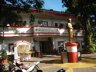
Rodriguez, officially the Municipality of Rodriguez and commonly known by its former name Montalban, is a 1st class urban municipality in the province of Rizal, Philippines. According to the 2020 census, it has a population of 443,954 people making it the most populous municipality in the country. Pending an affirmation through plebiscite, Republic Act No. 11812 repealed Batas Pambansa Blg. 275 and intend to formally revert to its original municipal name Montalban.

The State of the Nation Address is an annual address by the president of the Philippines to a joint session of the Congress of the Philippines. Mandated by the 1987 Constitution, the speech is delivered on the fourth Monday of July at the Plenary Session Hall of the Batasang Pambansa Complex in Batasan Hills, Quezon City.

GMA–Kamuning station, also known as Kamuning station, is an elevated Metro Rail Transit (MRT) station located on the MRT Line 3 (MRT-3) system at the boundary of barangays South Triangle and Pinyahan in the Scout Area of Diliman, Quezon City. The station derives its name from the nearby barangay of Kamuning and the road sharing the same name, as well as, apparently, the adjacent GMA Network Center, which serves as the headquarters of GMA Network Inc.
Bagong Silangan is a barangay located in the 2nd district of Quezon City, Philippines. Nearby barangays are Commonwealth, Batasan Hills and Payatas. Separated by a river in the east, the barangay leads to the Municipality of San Mateo in the province of Rizal.

Commonwealth Avenue, formerly known as Don Mariano Marcos Avenue, is a 12.4-kilometer (7.7 mi) highway located in Quezon City, Philippines. It spans six to eighteen lanes, making it the widest road in the country. The avenue is one of the major roads in Metro Manila and is designated as part of Radial Road 7 (R-7) of the older Manila arterial road system and National Route 170 (N170) of the Philippine highway network.

Batasan Hills is a barangay of Quezon City, Philippines. The barangay was originally planned as the National Government Center of the Philippines. The Batasang Pambansa Complex, which sits atop the Constitution Hill, is the legislative session hall of the House of Representatives of the Philippines. The Sandiganbayan, a special appellate court, is also located here.
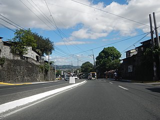
The Batasan–San Mateo Road is a four-lane east–west highway connecting Quezon City and San Mateo, Rizal in the Philippines.

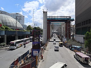
Batasan station is an under-construction Metro Rail Transit (MRT) station located on the MRT Line 7 (MRT-7) system in Batasan Hills, Quezon City, Philippines. It is near the Sandiganbayan Centennial Building, Public Attorneys Office Building, Batasan TODA Terminal, the Commission on Audit Complex and the Batasan Pambansa Complex. It is the ninth station for trains headed towards the North Triangle Common Station and the sixth station for trains headed to San Jose del Monte.
Payatas is an administrative division in eastern Metro Manila, the Philippines. It is an urban barangay located in the 2nd district of Quezon City adjacent to the barangays of Commonwealth, Batasan Hills and Bagong Silangan.

The Batasang Pambansa Complex, or simply the Batasan, is the seat of the House of Representatives of the Philippines. It is located along the Batasan Road in Batasan Hills, Quezon City.

Manuel L. Quezon Avenue, more often called Quezon Avenue or simply Quezon Ave, is a 6.1-kilometer (3.8 mi) major thoroughfare in Metro Manila named after President Manuel Luis Quezon, the second president of the Philippines. The avenue starts at the Quezon Memorial Circle and runs through to the Welcome Rotonda near the boundary of Quezon City and Manila.

Aurora Boulevard is a four-to-ten-lane major thoroughfare in Quezon City and San Juan in Metro Manila, Philippines. It is named after Doña Aurora Quezon, the consort of Commonwealth President Manuel Luis Quezon. It is one of the major roads in the commercial district of Araneta City in Cubao. LRT Line 2 follows the alignment of the boulevard.

SM City San Mateo is a shopping mall owned by the largest mall developer in the Philippines, SM Prime Holdings. It is located along Gen. Luna Avenue, Brgy. Ampid 1, San Mateo, Rizal. This first major mall of San Mateo opens on May 15, 2015, being the fourth SM Supermall in Rizal Province after SM City Taytay, SM City Masinag and SM Center Angono, and the 52nd SM Supermall in the country. The mall is designed by JRP Design Inc., a local architectural design firm in Ayala Alabang, Muntinlupa and DSGN associates, a firm based in Dallas, Texas, United States, which also designed SM City Marikina.
North Avenue is a major road located in Quezon City within the Diliman area of northeastern Metro Manila, Philippines. It runs east–west through barangays Bagong Pag-asa, Project 6, and Vasra, forming the northern part of the North Triangle area. The street is located in Quezon City's mixed-use and government area, known for its malls, condominiums, hotels, and the upcoming QC CBD. It is also home to SM North EDSA, Trinoma, and Ayala Malls Vertis North, located on the avenue's junction with Epifanio de los Santos Avenue (EDSA). The entire avenue is designated National Route 173 (N173) of the Philippine highway network.

Timog Avenue is a major road located in Quezon City within the Diliman area of northeastern Metro Manila, Philippines. It runs east–west through the southern edge of the barangay of South Triangle. The street is within Quezon City's entertainment area, known for its trendy restaurants, bars, and karaoke and comedy clubs. It is also home to the GMA Network Center studios on the avenue's junction with Epifanio de los Santos Avenue (EDSA). The entire avenue is designated National Route 172 (N172) of the Philippine highway network.

The following is an alphabetical list of articles related to the Philippine capital region of Metro Manila.

Congressional Avenue is a 6-kilometer (3.7 mi) six-lane highway in Quezon City, Philippines. It is one of the secondary roads in Metro Manila. Part of it is designated as part of Circumferential Road 5 (C-5) of the Manila arterial road system and National Route 129 (N129) of the Philippine highway system.

East Avenue is a major street in the Diliman area of Quezon City, Philippines. It runs north–south through the eastern edge of Triangle Park. The street is within Quezon City's government area, known for national and local government institutions, offices, and hospitals. It is also home to the Quezon City Hall Complex on the avenue's junction with Elliptical Road. The entire avenue is designated National Route 174 (N174) of the Philippine highway network.
National Route 170 (N170) is a national secondary road of the Philippine highway network. It passes through the northern part of Metro Manila, traversing through the cities of Quezon City, Manila, and Pasay.


