Boone County Airport is a public airport in Boone County, Arkansas. Also known as Boone County Regional Airport, it is four miles northwest of Harrison, Arkansas and serves the surrounding areas including Branson, Missouri. It is used for general aviation and sees one airline, a service subsidized by the federal government's Essential Air Service program at a cost of $2,251,207 per year.

South Arkansas Regional Airport at Goodwin Field is nine miles west of El Dorado, in Union County, Arkansas, United States. It was served by SeaPort Airlines, a service subsidized by the federal government's Essential Air Service program at a cost of $1,977,153. SeaPort Airlines ceased operations on September 20, 2016.
Springdale Municipal Airport is a public use airport in Washington County, Arkansas, United States. It is owned by the City of Springdale and located one nautical mile (2 km) southeast of its central business district. This airport is included in the National Plan of Integrated Airport Systems for 2011–2015, which categorized it as a general aviation facility.
Monticello Municipal Airport, also known as Ellis Field, is a public-use airport located two nautical miles east of the central business district of Monticello, in Drew County, Arkansas, United States. It is owned by the City of Monticello.

Marion County Regional Airport is a county-owned public-use airport in Marion County, Arkansas, United States. It is located one nautical mile north of the central business district of Flippin, Arkansas.

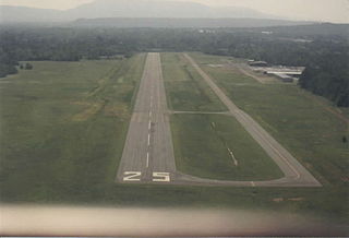
Hartselle–Morgan County Regional Airport is a public-use airport located two nautical miles south of the central business district of Hartselle, a city in Morgan County, Alabama, United States. The airport was formerly known as Rountree Field, named in the 1960s for Asa Rountree Sr., a former head of the Alabama Department of Aeronautics.

Stuttgart Municipal Airport is in Prairie County, Arkansas. It is eight miles north of Stuttgart, which owns the airport and is the county seat of Arkansas County's northern district. The FAA's National Plan of Integrated Airport Systems for 2009–2013 categorized it as a general aviation facility.

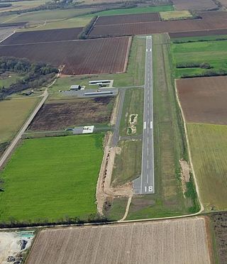
Clarksville Municipal Airport is a public-use airport located three nautical miles east of the central business district of Clarksville, in Johnson County, Arkansas, United States. It is owned by the City of Clarksville.

Bentonville Municipal Airport is a city-owned, public-use airport located two nautical miles (3.7 km) south of the central business district of Bentonville, a city in Benton County, Arkansas, United States. It is also known as Louise M. Thaden Field or Louise Thaden Field, a name it was given in 1951 to honor Louise McPhetridge Thaden (1905–1979), an aviation pioneer from Bentonville.
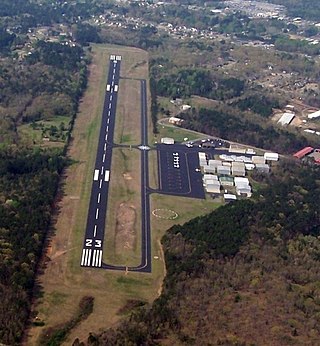
Russellville Regional Airport is a city-owned public-use airport located two nautical miles (3.7 km) southeast of the central business district of Russellville, a city in Pope County, Arkansas, United States. According to the FAA's National Plan of Integrated Airport Systems for 2009–2013, it is categorized as a general aviation facility. It was formerly known as Russellville Municipal Airport.

Carroll County Airport is a county-owned, public-use airport in Carroll County, Arkansas, United States. It is located three nautical miles (6 km) west of the central business district of Berryville, Arkansas. This airport is included in the National Plan of Integrated Airport Systems for 2011–2015, which categorized it as a general aviation facility.

Dexter B. Florence Memorial Field is a city-owned public-use airport located one nautical mile south of the central business district of Arkadelphia, a city in Clark County, Arkansas, United States.

Blytheville Municipal Airport is a public use airport located three nautical miles east of the central business district of Blytheville, in Mississippi County, Arkansas, United States. It is owned by the City of Blytheville.
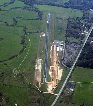
J. Lynn Helms Sevier County Airport is a county-owned public-use airport in Sevier County, Arkansas, United States. It is located three nautical miles west of the central business district of De Queen, Arkansas. The airport is named for J. Lynn Helms, who was Administrator of the Federal Aviation Administration under U.S. President Ronald Reagan. Helms was born in De Queen.
Heber Springs Municipal Airport is a public-use airport located 2 nautical miles (3.7 km) northeast of the central business district of Heber Springs, in Cleburne County, Arkansas, United States. It is owned by the City of Heber Springs.
Warren Municipal Airport is a city-owned, public-use airport located three nautical miles (6 km) south of the central business district of Warren, a city in Bradley County, Arkansas, United States. It is included in the National Plan of Integrated Airport Systems for 2011–2015, which categorized it as a general aviation facility.
Osceola Municipal Airport is a city-owned, public-use airport located two nautical miles (4 km) southwest of the central business district of Osceola, a city in Mississippi County, Arkansas, United States. It is included in the National Plan of Integrated Airport Systems for 2011–2015, which categorized it as a general aviation facility.
Billy Free Municipal Airport is a public use airport in Desha County, Arkansas, United States. The airport is owned by the City of Dumas and located two nautical miles (4 km) west of its central business district. It is included in the National Plan of Integrated Airport Systems for 2011–2015, which categorized it as a general aviation facility.

Carlisle Municipal Airport is a city-owned, public-use airport located two nautical miles (4 km) northeast of the central business district of Carlisle, a city in Lonoke County, Arkansas, United States. It is included in the National Plan of Integrated Airport Systems for 2011–2015, which categorized it as a general aviation facility.

Corning Municipal Airport is a city-owned, public-use airport located three nautical miles (6 km) west of the central business district of Corning, a city in Clay County, Arkansas, United States. It is included in the National Plan of Integrated Airport Systems for 2011–2015, which categorized it as a general aviation facility.