
Texarkana Regional Airport, also known as Webb Field, is a public use airport located three nautical miles (6 km) northeast of the central business district of Texarkana, a city in Miller County, Arkansas, United States. It is owned by the Texarkana Airport Authority. The airport is located within the city limits of Texarkana, roughly 3 miles east of State Line Avenue. The front gate opens to the northwest, at the intersection of Arkansas Boulevard and U.S. Route 67. A Union Pacific Railroad line runs parallel to US 67 on the side of the highway facing the airport. It is mostly used for general aviation, but is also served by American Eagle with nonstop regional jet service to the American Airlines hub located at the Dallas/Fort Worth International Airport (DFW).
Springdale Municipal Airport is a public use airport in Washington County, Arkansas, United States. It is owned by the City of Springdale and located one nautical mile (2 km) southeast of its central business district. This airport is included in the National Plan of Integrated Airport Systems for 2011–2015, which categorized it as a general aviation facility.

Baxter County Airport, is a county-owned public-use airport located four nautical miles northwest of the central business district of Mountain Home, a city in Baxter County, Arkansas, United States. It was known as Baxter County Airport until 2005. It changed its name back to Baxter County Airport due to confusion with the close proximity of Ozark, Arkansas and Ozark, Missouri, both of which have airports. The airport used to be served by Lone Star Airlines, which operated services to Dallas-Fort Worth International in the mid-1990s.
North Little Rock Municipal Airport is a public use airport in Pulaski County, Arkansas, United States. It is owned by the City of North Little Rock and located four nautical miles north of its central business district.
Monticello Municipal Airport, also known as Ellis Field, is a public-use airport located two nautical miles east of the central business district of Monticello, in Drew County, Arkansas, United States. It is owned by the City of Monticello.

Marion County Regional Airport is a county-owned public-use airport in Marion County, Arkansas, United States. It is located one nautical mile north of the central business district of Flippin, Arkansas.

Saline County Regional Airport is a county-owned, public-use airport located five nautical miles east of the central business district of Benton, a city in Saline County, Arkansas, United States. The airport's address is 1100 Hill Farm Road in Bryant, Arkansas. It is included in the FAA's National Plan of Integrated Airport Systems for 2011–2015, which categorized it as a general aviation facility.

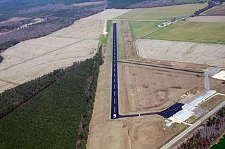
Clinton Municipal Airport is a city-owned public-use airport located one nautical mile (2 km) northeast of the central business district of Clinton, a city in Van Buren County, Arkansas, United States.

Sylacauga Municipal Airport, also known as Merkel Field, is a city-owned public-use airport located three nautical miles west of the central business district of Sylacauga, a city in Talladega County, Alabama, United States. It is included in the FAA's National Plan of Integrated Airport Systems for 2011–2015, which categorized it as a general aviation facility.

Walnut Ridge Regional Airport is a city-owned public-use airport located four nautical miles (7 km) northeast of the central business district of Walnut Ridge, a city in Lawrence County, Arkansas, United States. According to the FAA's National Plan of Integrated Airport Systems for 2009–2013, its FAA airport category is general aviation.

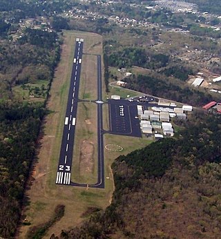
Bentonville Municipal Airport is a city-owned, public-use airport located two nautical miles (3.7 km) south of the central business district of Bentonville, a city in Benton County, Arkansas, United States. It is also known as Louise M. Thaden Field or Louise Thaden Field, a name it was given in 1951 to honor Louise McPhetridge Thaden (1905–1979), an aviation pioneer from Bentonville.
Searcy Municipal Airport is a city-owned public-use airport located three nautical miles south of the central business district of Searcy, in White County, Arkansas, United States.
Z. M. Jack Stell Field is a city-owned public-use airport located five nautical miles northeast of the central business district of Crossett, in Ashley County, Arkansas, United States.

Manila Municipal Airport is a public-use airport located two nautical miles northeast of the central business district of Manila, in Mississippi County, Arkansas, United States. It is owned by the City of Manila.

Blytheville Municipal Airport is a public use airport located three nautical miles east of the central business district of Blytheville, in Mississippi County, Arkansas, United States. It is owned by the City of Blytheville.
J. Lynn Helms Sevier County Airport is a county-owned public-use airport in Sevier County, Arkansas, United States. It is located three nautical miles west of the central business district of De Queen, Arkansas. The airport is named for J. Lynn Helms, who was Administrator of the Federal Aviation Administration under U.S. President Ronald Reagan. Helms was born in De Queen.

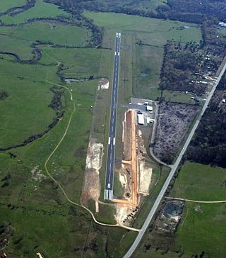
Batesville Regional Airport is a public-use airport located three nautical miles south of the central business district of Batesville, in Independence County, Arkansas, United States. It is owned by the City of Batesville.
Heber Springs Municipal Airport is a public-use airport located 2 nautical miles (3.7 km) northeast of the central business district of Heber Springs, in Cleburne County, Arkansas, United States. It is owned by the City of Heber Springs.
Morrilton Municipal Airport is a public use airport located two nautical miles southeast of the central business district of Morrilton, in Conway County, Arkansas, United States. It is owned by the City of Morrilton.
Mission Field is a public use airport located five nautical miles east of the central business district of Livingston, a city in Park County, Montana, United States. It is owned by the city and county. This airport is included in the National Plan of Integrated Airport Systems for 2011–2015, which categorized it as a general aviation facility.

