Leesburg is a town in and the county seat of Loudoun County, Virginia, United States. It is part of both the Northern Virginia region of the state and the Washington metropolitan area, including Washington, D.C., the nation's capital.

An IATA airport code, also known as an IATA location identifier, IATA station code, or simply a location identifier, is a three-letter geocode designating many airports and metropolitan areas around the world, defined by the International Air Transport Association (IATA). The characters prominently displayed on baggage tags attached at airport check-in desks are an example of a way these codes are used.

Ronald Reagan Washington National Airport is a public airport in Crystal City, Virginia, United States, five miles from Washington, D.C. It is the closest airport to Washington, D.C., the nation's capital, the 24th-busiest airport in the nation, the busiest airport in the Washington metropolitan area, and the second busiest in the Washington–Baltimore combined statistical area.

Hampton Roads is a body of water in the United States that serves as a wide channel for the James, Nansemond, and Elizabeth rivers between Old Point Comfort and Sewell's Point near where the Chesapeake Bay flows into the Atlantic Ocean. It also gave its name to the surrounding metropolitan region located in the southeastern Virginia and northeastern North Carolina portions of the Tidewater Region.

In aviation, the instrument landing system (ILS) is a precision radio navigation system that provides short-range guidance to aircraft to allow them to approach a runway at night or in bad weather. In its original form, it allows an aircraft to approach until it is 200 feet (61 m) over the ground, within a 1⁄2 mile (800 m) of the runway. At that point the runway should be visible to the pilot; if it is not, they perform a missed approach. Bringing the aircraft this close to the runway dramatically increases the range of weather conditions in which a safe landing can be made. Other versions of the system, or "categories", have further reduced the minimum altitudes, runway visual ranges (RVRs), and transmitter and monitoring configurations designed depending on the normal expected weather patterns and airport safety requirements.
Colgan Air was a regional airline in the United States that operated from 1965 until 2012. It became a subsidiary of Pinnacle Airlines Corp. in 2012. The initial headquarters of Colgan Air was located in Manassas, Virginia until 2010, and then Memphis, Tennessee until closure in 2012.
Newport News-Williamsburg Airport is in Newport News, Virginia, United States, and serves the Hampton Roads area along with Norfolk International Airport in Norfolk. The airport is owned and operated by the Peninsula Airport Commission, a political subdivision of the Commonwealth of Virginia. PHF covers 1,800 acres.

Ashburn is a rapidly growing census-designated place (CDP) in Loudoun County, Virginia, United States. At the 2010 United States census, its population was 43,511, up from 3,393 in 1990. It is 30 miles (48 km) northwest of Washington, D.C., and part of the Washington metropolitan area.

Stafford Regional Airport is a public airport located three miles (5 km) southwest of the central business district of Stafford, the county seat of Stafford County, Virginia, United States. The airport is southwest of the intersection of Route 630 and U.S. Route 1 near Interstate 95, approximately 40 miles (64 km) south of Washington, D.C., and 60 miles (97 km) north of Richmond. It is owned and operated by the Stafford Regional Airport Authority, an independent body of representatives from Stafford and Prince William Counties and the City of Fredericksburg.

Hoover Field was an early airport serving the city of Washington, D.C. It was constructed as a private airfield in 1925, but opened to public commercial use on July 16, 1926. It was located in Arlington, Virginia, near the intersection of the Highway Bridge and the Mount Vernon Memorial Parkway, where The Pentagon and its northern parking lots now stand.

Washington-Virginia Airport was an airport that was located in Fairfax County, Virginia from 1947 to 1970. The airport was mainly used for general aviation purposes until encroaching residential and commercial activities forced its closure.
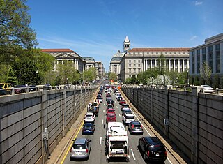
Washington, D.C. has a number of different modes of transportation available for use. Commuters have a major influence on travel patterns, with only 28% of people employed in Washington, D.C. commuting from within the city, whereas 33.5% commute from the nearby Maryland suburbs, 22.7% from Northern Virginia, and the rest from Washington, D.C.'s outlying suburbs.
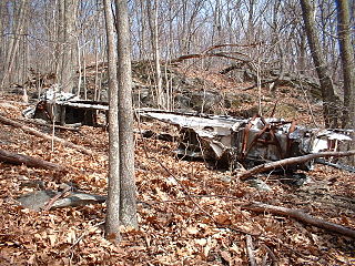
On October 30, 1959, Piedmont Airlines Flight 349, a Douglas DC-3, crashed on Bucks Elbow Mountain near Crozet, Virginia, killing the crew of three and all but one of its twenty-four passengers. The sole survivor was seriously injured and lay on the ground near the wreckage, still strapped in his seat.

Marine Corps Air Facility Quantico is a United States Marine Corps airfield located within Marine Corps Base Quantico, Virginia. It was commissioned in 1919 and is currently home to HMX-1, the squadron that flies the President of the United States. The airfield is also known as Turner Field, after Colonel Thomas C. Turner, a veteran Marine aviator and the second director of Marine Corps Aviation, who lost his life in Haiti in 1931.

Washington-Hoover Airport was an airport serving the city of Washington, D.C., in the United States from 1933 to 1941. It was created by the merger of Hoover Field and Washington Airport on August 2, 1933. It was in Arlington, Virginia, near the intersection of the Highway Bridge and the Mount Vernon Memorial Highway. Washington-Hoover Airport, like its predecessors, suffered from safety problems, short runways, and little room to grow. It closed for public use in June 1941, and the United States Department of War purchased the site in September, closing it for good. Washington National Airport, which opened in June 1941, was built as its replacement. The Pentagon now occupies the site.

The United States capital, Washington, D.C., has been the site of several events in the nation's history of aviation, beginning from the time of the American Civil War, often for the purpose of promoting the adoption of new aeronautical technologies by the government. It has also been home to several governmental and civilian aircraft manufacturers and aviation organizations, and several aerospace contractors.

Congressional Airport was a 40-acre (16 ha) airfield, located in what is now Rockville, Maryland, just outside Washington, D.C., used for the Civilian Pilot Training Program.

Falls Church Airpark was an airport located in the Falls Church area of Fairfax County, Virginia from 1945 to 1961. The facility was located on a parcel of land owned by Eakin Properties, a Virginia real estate development firm. The airport was primarily used for general aviation and civil defense purposes until encroaching residential development forced its closure. The area formerly occupied by the airport is now mainly used as a shopping center with the western end of the complex occupied by the Thomas Jefferson branch of the Fairfax County Public Library system. Parts of several apartment complexes are also located on some of the airport's former grounds.

Aero Flight 217 was a domestic passenger flight from Helsinki, Finland, to Mariehamn in the autonomous territory of Åland, operated by the Finnish flag carrier Aero O/Y. On 8 November 1963, the aircraft serving the flight crashed in poor visibility while attempting to land on a non-precision approach at Mariehamn Airport in the municipality of Jomala, resulting in the deaths of 22 people out of 25 on board. The crash remains the second deadliest aviation accident in Finland, the first being Aero Flight 311 almost two years earlier.
