Benson, North Carolina

Last updated

Benson, North Carolina
Main Street in Benson.JPG
Downtown Benson
Motto: 
"The Center of Attention"
NCMap-doton-Benson.PNG
Location of Benson, North Carolina
Coordinates: 35°23′10″N78°32′37″W / 35.38611°N 78.54361°W / 35.38611; -78.54361
Country United States
State North Carolina
County Johnston
Government
  MayorJerry M. Medlin
  Town ManagerKimberly Pickett
Area
[1]
  Total2.81 sq mi (7.28 km2)
  Land2.81 sq mi (7.26 km2)
  Water0.01 sq mi (0.01 km2)
Elevation
[2]
236 ft (72 m)
Population
 (2020)
  Total3,967
  Density1,414.26/sq mi (546.07/km2)
Time zone UTC-5 (Eastern (EST))
  Summer (DST) UTC-4 (EDT)
ZIP code
27504
Area code(s) 919 and 984
FIPS code 37-05040 [3]
GNIS feature ID2405242 [2]
Website www.townofbenson.com

Benson is a town in Johnston County, North Carolina, United States, near the intersection of Interstates 95 and 40. Benson celebrates Mule Days on the fourth Saturday of September, a festival that attracts over 60,000 people each year. [4] In 2010, the population was 3,311, [5] up from 2,923 in 2000.

Contents

History

Main Street, 1925 Benson, North Carolina (1925).jpg
Main Street, 1925

The town of Benson, which derives its name from early settler Alfred Monroe ("Mim") Benson, owes much of its historical development to the railroad line which passed through the present location in town in 1886 on its route between Fayetteville and Contentnea. More information on the history of Benson and the surrounding communities may be found at the new Benson Museum of Local History located at 102 W. Main Street, next to the Mary Duncan Library.

Mr. Benson's purchase of a 402-acre (1.63 km2) tract along the Smithfield-Fayetteville Road in 1874 initiated the settlement of the area now known as Benson. During the 1880s Benson sold portions of his original tract to incoming settlers, many of whom were farmers. Benson was incorporated in 1887 and soon attracted a number of entrepreneurs wishing to take advantage of this new town along an important transportation route. [6]

A prominent early resident of the Benson area was John William Wood Sr. (December 28, 1855 - October 31, 1928) who rode to Benson each morning on a mule and wagon from his home at Peacocks Crossroads near Meadow. After having served on the Board of Education and as a county commissioner, where he was known to be a watchdog of the treasury, he was elected to a term in the State House of Representatives in 1927. Meadow School was built on land donated by him.

The Benson Historic District and Hannah's Creek Primitive Baptist Church are listed on the National Register of Historic Places. [7]

Benson is home to Alpha Company 230th BSB, who were deployed in 2009 in support of Operation Iraqi Freedom.

Geography

Benson is in southwestern Johnston County, less than 1 mile (1.6 km) from the Harnett County line. U.S. Route 301 (Wall Street) passes through the center of the town, leading northeast 15 miles (24 km) to Smithfield, the Johnston county seat, and southwest 6 miles (10 km) to Dunn. North Carolina Highway 50 is Benson's Main Street, crossing US 301 in the center of town and leading north 24 miles (39 km) to Garner and southeast 15 miles (24 km) to Newton Grove. Interstate 95 passes through the southeastern side of Benson and runs parallel to US 301, connecting Fayetteville and Rocky Mount, while Interstate 40 passes northeast of the town and runs parallel to NC 50, leading to Raleigh and Wilmington.

According to the United States Census Bureau, Benson has a total area of 2.8 square miles (7.2 km2), of which 0.004 square miles (0.01 km2), or 0.16%, is water. [5]

Demographics

Historical population
CensusPop.Note
1890 191
1900 384101.0%
1910 800108.3%
1920 1,12340.4%
1930 1,52235.5%
1940 1,83720.7%
1950 2,10214.4%
1960 2,35512.0%
1970 2,267−3.7%
1980 2,79223.2%
1990 2,8100.6%
2000 2,9234.0%
2010 3,31113.3%
2020 3,96719.8%
U.S. Decennial Census [8]

2020 census

Benson racial composition [9]
RaceNumberPercentage
White (non-Hispanic)2,14354.02%
Black or African American (non-Hispanic)98824.91%
Native American 260.66%
Asian 200.5%
Pacific Islander 10.03%
Other/Mixed 1694.26%
Hispanic or Latino 62015.63%

As of the 2020 United States census, there were 3,967 people, 1,309 households, and 943 families residing in the town.

2010 census

As of the census [3] of 2010, there were 3,311 people, 1,301 households, and 787 families residing in the town. The population density was 1,402 inhabitants per square mile (541/km2). There were 1,554 housing units at an average density of 650 per square mile (250/km2). The racial makeup of the town was 57.61% White, 34.04% African American, 0.48% Native American, 0.44% Asian, 0.07% Pacific Islander, 5.78% from other races, and 1.57% from two or more races. 7.29% of the population were Hispanic or Latino of any race.

There were 1,230 households, out of which 29.7% had children under the age of 18 living with them, 37.0% were married couples living together, 20.6% had a female householder with no husband present, and 38.4% were non-families. 34.2% of all households were made up of individuals, and 17.1% had someone living alone who was 65 years of age or older. The average household size was 2.38 and the average family size was 3.05.

In the town, the population was spread out, with 27.5% under the age of 18, 9.5% from 18 to 24, 27.6% from 25 to 44, 20.1% from 45 to 64, and 15.2% who were 65 years of age or older. The median age was 34 years. For every 100 females, there were 83.0 males. For every 100 females age 18 and over, there were 74.0 males.

The median income for a household in the town was $26,582, and the median income for a family was $32,277. Males had a median income of $29,375 versus $20,045 for females. The per capita income for the town was $14,350. 25.0% of the population and 20.2% of families were below the poverty line. 39.7% of those under the age of 18 and 23.2% of those 65 and older were living below the poverty line.

Education

Schools located in Benson include Benson Elementary School, Meadow Elementary School, Benson Middle School, and South Johnston High School.

Notable people

Related Research Articles

<span class="mw-page-title-main">Johnston County, North Carolina</span> County in North Carolina, United States

Johnston County is a county located in the U.S. state of North Carolina. As of the 2020 census, the population was 215,999. Its county seat is Smithfield.

<span class="mw-page-title-main">Eastover, North Carolina</span> Town in North Carolina, United States

Eastover is a town in Cumberland County, North Carolina, United States. The population was 3,656 at the 2020 census. It was incorporated on July 25, 2007.

<span class="mw-page-title-main">Godwin, North Carolina</span> Town in North Carolina, United States

Godwin is a town in Cumberland County, North Carolina, United States. The population was 139 at the 2010 census.

<span class="mw-page-title-main">Hope Mills, North Carolina</span> Town in North Carolina, United States

Hope Mills is a town in Cumberland County, North Carolina, United States. Its population was 15,176 at the 2010 census.

<span class="mw-page-title-main">Linden, North Carolina</span> Town in North Carolina, United States

Linden is a town in Cumberland County, North Carolina, United States. The population was 130 at the 2010 census, the mayor is Frances Collier.

<span class="mw-page-title-main">Spring Lake, North Carolina</span> Town in North Carolina, United States

Spring Lake is a town in Cumberland County, North Carolina, United States. The 2010 census recorded the population at 11,964 people, with an estimated population in 2019 of 12,005.

<span class="mw-page-title-main">Stedman, North Carolina</span> Town in North Carolina, United States

Stedman is a town in Cumberland County, North Carolina, United States. The population was 1,028 at the 2010 census. It is named for Civil War Major Charles Manly Stedman.

<span class="mw-page-title-main">Wade, North Carolina</span> Town in North Carolina, United States

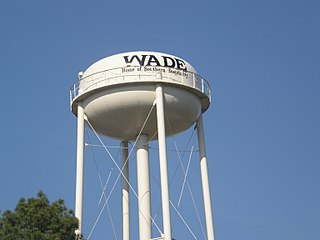
Wade is a town in Cumberland County, North Carolina, United States. The population was 556 at the 2010 census.

<span class="mw-page-title-main">Creedmoor, North Carolina</span> City in North Carolina, United States

Creedmoor is a city in Granville County, North Carolina, United States. The population was 4,124 at the 2010 census.

<span class="mw-page-title-main">Coats, North Carolina</span> Town in North Carolina, United States

Coats is a town in Harnett County, North Carolina, United States. The population was 2,112 at the 2010 census, and in 2018 the estimated population was 2,464. Coats is a part of the Dunn Micropolitan Area, which is a part of the greater Raleigh–Durham–Cary Combined Statistical Area (CSA) as defined by the United States Census Bureau.

<span class="mw-page-title-main">Dunn, North Carolina</span> City in North Carolina, United States

Dunn is the most populous city of Harnett County, North Carolina, United States. The population was 9,263 at the 2010 census. It is, along with Harnett County, part of the Anderson Creek, NC Micropolitan Statistical Area, which is also included in the Raleigh-Durham-Cary, NC Combined Statistical Area.

<span class="mw-page-title-main">Four Oaks, North Carolina</span> Town in North Carolina, United States

Four Oaks is a town in Johnston County, North Carolina, United States. As of the 2010 census it had a population of 1,921, up from 1,424 in 2000.

<span class="mw-page-title-main">Selma, North Carolina</span> Town in North Carolina, United States

Selma is a town in Johnston County, North Carolina, United States. In 2010, the population was 6,073, and as of 2018 the estimated population was 6,913. Selma is part of the Raleigh-Durham-Cary Combined Statistical Area. The area has a population over 1.7 million residents, though the town of Selma is able to maintain its rural character. The Everitt P. Stevens House, located in Selma, was the site of the last Grand Review of the Confederate Army held on April 6, 1865, after its defeat at the Battle of Bentonville.

<span class="mw-page-title-main">Smithfield, North Carolina</span> Town in North Carolina, United States

Smithfield is a town in and the county seat of Johnston County, North Carolina, United States. As of the 2010 census, its population was 10,966, and in 2019 the estimated population was 12,985. Smithfield is home to the Ava Gardner Museum and is situated along the Neuse River, where visitors enjoy the annual Smithfield Ham and Yam Festival, walks along the Buffalo Creek Greenway, and the historic downtown district. The town is located near North Carolina's Research Triangle and is about 30 miles (48 km) southeast of downtown Raleigh. The Raleigh-Durham-Cary combined statistical area has a population over 2 million residents.

<span class="mw-page-title-main">Wilson's Mills, North Carolina</span> Town in North Carolina, United States

Wilson's Mills is a town in Johnston County, North Carolina, United States. In 2010, the population was 2,277, up from 1,291 in 2000. As of 2018, the estimated population was 2,689.

<span class="mw-page-title-main">Johnston, South Carolina</span> Town in South Carolina, United States

Johnston is a town in Edgefield County, South Carolina, United States. The population was 2,362 at the 2010 census. It is part of the Augusta, Georgia, metropolitan area. The town's official welcome sign states that it is "Peach Capital of the World".

<span class="mw-page-title-main">Fayetteville, Texas</span> City in Texas, United States

Fayetteville is a city in Fayette County, Texas, United States. The population was 246 at the 2020 census.

<span class="mw-page-title-main">Falcon, North Carolina</span> Town in North Carolina, United States

Falcon is a town in Cumberland and Sampson counties in the U.S. state of North Carolina. The population was 258 at the 2010 census.

<span class="mw-page-title-main">Sharpsburg, North Carolina</span> Town in North Carolina, United States

Sharpsburg is a town in Edgecombe, Nash, and Wilson counties, North Carolina, United States. It is part of the Rocky Mount, North Carolina Metropolitan Statistical Area. The population was 2,024 at the 2010 Census.

<span class="mw-page-title-main">Kenly, North Carolina</span> Town in North Carolina, United States

Kenly is a town in Johnston and Wilson counties in the U.S. state of North Carolina. It was named for John R. Kenly, Northern Division Superintendent of the Atlantic Coast Line Railroad, who later became president of the railroad in 1913. The population was 1,339 at the 2010 census, down from 1,569 in 2000.

References

  1. "ArcGIS REST Services Directory". United States Census Bureau. Retrieved September 20, 2022.
  2. 1 2 U.S. Geological Survey Geographic Names Information System: Benson, North Carolina
  3. 1 2 "U.S. Census website". United States Census Bureau . Retrieved January 31, 2008.
  4. "Benson Mule Days" . Retrieved April 18, 2013.
  5. 1 2 "Geographic Identifiers: 2010 Census Summary File 1 (G001): Benson town, North Carolina". American Factfinder. U.S. Census Bureau. Archived from the original on February 13, 2020. Retrieved October 11, 2018.
  6. Town of Benson. "About Benson, Benson NC". Archived from the original on January 13, 2009. Retrieved April 18, 2013.
  7. "National Register Information System". National Register of Historic Places . National Park Service. July 9, 2010.
  8. "Census of Population and Housing". Census.gov. Retrieved June 4, 2015.
  9. "Explore Census Data". data.census.gov. Retrieved December 23, 2021.
  10. "Controversy over, NC poet laureate Shelby Stephenson installed | News and Observer News and Observer". Archived from the original on April 5, 2015.
  11. Town of Benson - Johnston County. Retrieved December 18, 2020.