Smithfield, North Carolina

Last updated

Smithfield, North Carolina
Smithfield NC 3rd x Market SW corner 1.JPG
Smithfield, NC Town Seal.jpg
NCMap-doton-Smithfield.PNG
Location in Johnston County and the state of North Carolina
USA North Carolina relief location map.jpg
Red pog.svg
Smithfield
Location of Smithfield in the US
Usa edcp relief location map.png
Red pog.svg
Smithfield
Smithfield (the United States)
North America laea relief location map with borders.jpg
Red pog.svg
Smithfield
Smithfield (North America)
Coordinates: 35°30′50″N78°21′00″W / 35.51389°N 78.35000°W / 35.51389; -78.35000
CountryFlag of the United States (23px).png  United States
State Flag of North Carolina.svg  North Carolina
County Johnston
Townships Selma, Smithfield, Wilson Mills
Chartered May 9, 1777 (1777-05-09Tmdy)
Named for John Smith
Government
[1]
  Type Council–Manager
   Council Smithfield Town Council
   Manager Michael Scott
Area
[2]
  Total12.39 sq mi (32.08 km2)
  Land12.37 sq mi (32.05 km2)
  Water0.01 sq mi (0.04 km2)
Elevation
[3]
125 ft (38 m)
Population
 (2020)
  Total11,292
  Density912.56/sq mi (352.34/km2)
Time zone UTC−5 (Eastern (EST))
  Summer (DST) UTC−4 (EDT)
ZIP code
27577
Area code 919
FIPS code 37-62520 [4]
GNIS feature ID2407352 [3]
Major airport RDU
Website smithfield-nc.com

Smithfield is a town in and the county seat of Johnston County, North Carolina, [5] United States. As of the 2010 census, its population was 10,966, [6] and in 2019 the estimated population was 12,985. [7] Smithfield is home to the Ava Gardner Museum and is situated along the Neuse River, where visitors enjoy the annual Smithfield Ham and Yam Festival, walks along the Buffalo Creek Greenway, and the historic downtown district. The town is located near North Carolina's Research Triangle and is about 30 miles (48 km) southeast of downtown Raleigh. The Raleigh-Durham-Cary combined statistical area has a population over 2 million residents.

Contents

History

Smithfield, founded near Smith's ferry on the Neuse River, was Johnston County's first town and second county seat. The county courthouse was moved from Hinton's Quarter to Smithfield in 1771. The settlement was first known as Johnston County Court House and was incorporated as Smithfield in 1777. [8] [9] The third North Carolina state legislature met in Smithfield in 1779 and 1780. [10] [11]

Geography

Smithfield is in central Johnston County and is bordered to the northeast by Selma. Interstate 95 runs along the southeastern edge of the town, with access from Exits 93, 95, and 97. I-95 leads northeast 46 miles (74 km) to Rocky Mount and southwest the same distance to Fayetteville. U.S. Route 301 passes through Selma on Brightleaf Boulevard, leading northeast 4 miles (6 km) to the center of Selma and southwest 15 miles (24 km) to Benson. U.S. Route 70 passes just northeast of Smithfield, leading northwest 30 miles (48 km) to Raleigh, and southeast 22 miles (35 km) to Goldsboro. U.S. Route 70 Business passes through the center of Smithfield as Market Street.

According to the U.S. Census Bureau, the town has a total area of 12.1 square miles (31.4 km2), of which 0.02 sq mi (0.04 km2), or 0.11%, is covered by water. [6] The Neuse River runs through the town west of the downtown area, separating it from the neighborhood of West Smithfield.

Climate

Smithfield has a humid subtropical climate(Cfa), with cool winters and hot summers. Its climate is famous for the growth of pine forests with laurel understory as well as live oaks.

Climate data for Smithfield, North Carolina(1991-2020 normals)
MonthJanFebMarAprMayJunJulAugSepOctNovDecYear
Mean daily maximum °F (°C)53.6
(12.0)
57.0
(13.9)
64.5
(18.1)
74.1
(23.4)
81.0
(27.2)
88.9
(31.6)
91.7
(33.2)
89.3
(31.8)
83.6
(28.7)
74.3
(23.5)
64.4
(18.0)
56.7
(13.7)
73.3
(22.9)
Daily mean °F (°C)42.5
(5.8)
45.2
(7.3)
51.9
(11.1)
60.8
(16.0)
69.2
(20.7)
77.1
(25.1)
81.2
(27.3)
78.9
(26.1)
73.3
(22.9)
62.2
(16.8)
51.7
(10.9)
45.2
(7.3)
61.6
(16.4)
Mean daily minimum °F (°C)31.4
(−0.3)
33.3
(0.7)
39.3
(4.1)
47.5
(8.6)
57.4
(14.1)
65.9
(18.8)
70.8
(21.6)
68.6
(20.3)
62.9
(17.2)
50.1
(10.1)
39.0
(3.9)
33.8
(1.0)
50.0
(10.0)
Average precipitation inches (mm)3.45
(88)
3.31
(84)
4.01
(102)
3.69
(94)
4.20
(107)
4.67
(119)
5.54
(141)
5.28
(134)
5.51
(140)
3.21
(82)
3.25
(83)
3.25
(83)
49.37
(1,257)
Source: https://w2.weather.gov/climate/

Demographics

Historical population
CensusPop.Note
1850 329
1870 415
1880 48516.9%
1890 55013.4%
1900 76438.9%
1910 1,34776.3%
1920 1,89540.7%
1930 2,54334.2%
1940 3,67844.6%
1950 5,57451.5%
1960 6,1179.7%
1970 6,6779.2%
1980 7,2889.2%
1990 7,5403.5%
2000 11,51052.7%
2010 10,966−4.7%
2020 11,2923.0%
U.S. Decennial Census [12]

2020 census

Smithfield racial composition [13]
RaceNumberPercentage
White (non-Hispanic)5,01144.38%
Black or African American (non-Hispanic)3,10127.46%
Native American 400.35%
Asian 1050.93%
Pacific Islander 60.05%
Other/mixed 3633.21%
Hispanic or Latino 2,66623.61%

As of the 2020 United States census, 11,292 people, 4,951 households, and 2,919 families resided in the town.

2000 census

As of the census [4] of 2000, 11,510 people, 4,417 households, and 2,676 families resided in the town. The population density was 1,007.6 inhabitants per square mile (389.0/km2). The 4,674 housing units had an average density of 409.2 per square mile (158.0/km2). The racial makeup of the town was 62.66% White, 30.99% African American, 0.43% Native American, 0.63% Asian, 4.16% from other races, and 1.13% from two or more races. Hispanics or Latinos of any race were 9.9% of the population.

Of the 4,417 households, 26.6% had children under 18 living with them, 42.1% were married couples living together, 14.9% had a female householder with no husband present, and 39.4% were not families. About 35.7% of all households were made up of individuals, and 16.3% had someone living alone who was 65 or older. The average household size was 2.30, and the average family size was 2.97.

In the town, the age distribution was 21.3% under the age of 18, 8.3% from 18 to 24, 29.2% from 25 to 44, 22.9% from 45 to 64, and 18.2% who were 65 or older. The median age was 39 years. For every 100 females, there were 99.4 males. For every 100 females 18 and over, there were 97.6 males. The median income for a household in the town was $27,813, and for a family was $37,929. Males had a median income of $29,567 versus $24,440 for females. The per capita income for the town was $18,012. About 14.5% of families and 20.6% of the population were below the poverty line, including 27.1% of those under 18 and 19.2% of those 65 or over.

Government

Smithfield has a council–manager form of government. The council, the town's legislative body, consists of seven members and a mayor. The council sets policy, and the manager oversees day-to-day operations.

Education

Healthcare

Notable people

See also

Related Research Articles

<span class="mw-page-title-main">Wilson County, North Carolina</span> County in North Carolina, United States

Wilson County is a county located in the U.S. state of North Carolina. As of the 2020 census, the population was 78,784. The county seat is Wilson. The county comprises the Wilson, NC Micropolitan Statistical Area, which is also included within the Rocky Mount-Wilson-Roanoke Rapids, NC Combined Statistical Area.

<span class="mw-page-title-main">Wayne County, North Carolina</span> County in North Carolina, United States

Wayne County is a county located in the U.S. state of North Carolina. As of the 2020 census, the population was 117,333. Its county seat is Goldsboro, and it is home to Seymour Johnson Air Force Base.

<span class="mw-page-title-main">Wake County, North Carolina</span> County in North Carolina, United States

Wake County is located in the U.S. state of North Carolina. As of the 2020 census, its population was 1,129,410, making it North Carolina's most populous county. From July 2005 to July 2006, Wake County was the 9th-fastest growing county in the United States, with Cary and Raleigh being the 8th- and 15th-fastest growing communities, respectively.

<span class="mw-page-title-main">Johnston County, North Carolina</span> County in North Carolina, United States

Johnston County is a county located in the U.S. state of North Carolina. As of the 2020 census, the population was 215,999. Its county seat is Smithfield.

<span class="mw-page-title-main">Angier, North Carolina</span> Town in North Carolina, United States

Angier is a town in the Black River Township of Harnett County, North Carolina, United States. The population was 4,350 at the 2010 census and estimated as of 2018 to be 5,253. Angier is a part of the greater Raleigh–Durham–Cary Combined Statistical Area (CSA) as defined by the United States Census Bureau.

<span class="mw-page-title-main">Benson, North Carolina</span> Town in North Carolina, United States

Benson is a town in Johnston County, North Carolina, United States, near the intersection of Interstates 95 and 40. Benson celebrates Mule Days on the fourth Saturday of September, a festival that attracts over 60,000 people each year. In 2010, the population was 3,311, up from 2,923 in 2000.

<span class="mw-page-title-main">Clayton, North Carolina</span> Town in North Carolina, United States

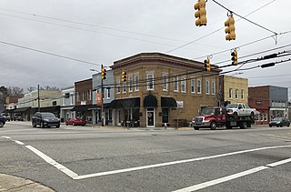
Clayton is a town in Johnston County, North Carolina, United States, and is considered a satellite town of Raleigh. As of 2010, Clayton's population was 16,116, up from 6,973 at the 2000 census. By 2019 the town's estimated population was 24,887. Much of that growth can be attributed to the town's proximity to the Research Triangle area and access to major highways such as I-40 and US 70.

<span class="mw-page-title-main">Four Oaks, North Carolina</span> Town in North Carolina, United States

Four Oaks is a town in Johnston County, North Carolina, United States. As of the 2010 census it had a population of 1,921, up from 1,424 in 2000.

<span class="mw-page-title-main">Pine Level, Johnston County, North Carolina</span> Town in North Carolina, United States

Pine Level, chartered 1872, is a town in Johnston County, North Carolina, United States. The population was 1,700 at the 2010 census, up from 1,313 in 2000. Pine Level is located 35 miles (56 km) southeast of Raleigh, the state capital.

<span class="mw-page-title-main">Selma, North Carolina</span> Town in North Carolina, United States

Selma is a town in Johnston County, North Carolina, United States. In 2010, the population was 6,073, and as of 2018 the estimated population was 6,913. Selma is part of the Raleigh-Durham-Cary Combined Statistical Area. The area has a population over 1.7 million residents, though the town of Selma is able to maintain its rural character. The Everitt P. Stevens House, located in Selma, was the site of the last Grand Review of the Confederate Army held on April 6, 1865, after its defeat at the Battle of Bentonville.

<span class="mw-page-title-main">West Smithfield, North Carolina</span> Former census-designated place in North Carolina, United States

West Smithfield was an unincorporated community and census-designated place and is now a district of Smithfield, North Carolina in Johnston County, North Carolina, United States. The population was last recorded separately from Smithfield in 2000, when 59 people resided in the CDP.

<span class="mw-page-title-main">Wilson's Mills, North Carolina</span> Town in North Carolina, United States

Wilson's Mills is a town in Johnston County, North Carolina, United States. In 2010, the population was 2,277, up from 1,291 in 2000. As of 2018, the estimated population was 2,689.

<span class="mw-page-title-main">Kinston, North Carolina</span> City in North Carolina, United States

Kinston is a city in Lenoir County, North Carolina, United States, with a population of 19,900 as of the 2020 census. It has been the county seat of Lenoir County since its formation in 1791. Kinston is located in the coastal plains region of eastern North Carolina.

<span class="mw-page-title-main">La Grange, North Carolina</span> Town in North Carolina, United States

La Grange is a town in Lenoir County, North Carolina, United States. The population was 2,873 based on the 2010 census. La Grange is located in North Carolina's Inner Banks region.

<span class="mw-page-title-main">Apex, North Carolina</span> Town in North Carolina, United States

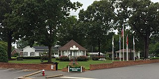
Apex is a town in Wake County, North Carolina, United States. At its southern border, Apex encompasses the community of Friendship. In 1994, the downtown area was designated a historic district, and the Apex train depot, built in 1867, is designated a Wake County landmark. The depot location marks the highest point on the old Chatham Railroad, hence the town's name. The town motto is "The Peak of Good Living".

<span class="mw-page-title-main">Garner, North Carolina</span> Town in North Carolina, United States

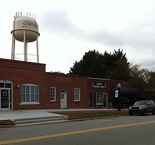
Garner is a town in Wake County, North Carolina, United States and a suburb of Raleigh. The population is 31,159 as of the 2020 census. The city limits are entirely within Wake County, though portions of unincorporated Wake County, as well as the Cleveland community in northern Johnston County, have Garner mailing addresses. It is part of the Research Triangle region of North Carolina and serves as a bedroom community for the region.

<span class="mw-page-title-main">Knightdale, North Carolina</span> Town in North Carolina, United States

Knightdale is a town in Wake County, North Carolina, United States. As of the 2020 census, Knightdale has a population of 19,435, up from 11,401 in 2010. The U.S. Census Bureau estimates the town's population to be 17,843, as of July 1, 2019. Knightdale's population grew 10.4% from 2010 to 2013, making it the second fastest-growing community in the Research Triangle region for that time period.

Brogden is a census-designated place (CDP) in Wayne County, North Carolina, United States. The population was 2,510 in 2020. It is included in the Goldsboro, North Carolina Metropolitan Statistical Area.

<span class="mw-page-title-main">Goldsboro, North Carolina</span> City in North Carolina, United States

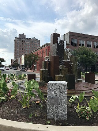
Goldsboro, originally Goldsborough, is a city in and the county seat of Wayne County, North Carolina, United States. The population was 33,657 at the 2020 census. It is the principal city of and is included in the Goldsboro, North Carolina Metropolitan Statistical Area. The nearby town of Waynesboro was founded in 1787, and Goldsboro was incorporated in 1847. It is the county seat of Wayne County.

<span class="mw-page-title-main">Archer Lodge, North Carolina</span> Town in North Carolina, United States

Archer Lodge is a town in Johnston County, North Carolina, United States. Its population was 4,292 as of the 2010 census, and as of 2018 the estimated population was 5,014.

References

  1. "Johnston County's Elected Officials". Johnston County Board of Elections. Retrieved June 23, 2017.
  2. "ArcGIS REST Services Directory". United States Census Bureau. Retrieved September 20, 2022.
  3. 1 2 U.S. Geological Survey Geographic Names Information System: Smithfield, North Carolina
  4. 1 2 "U.S. Census website". United States Census Bureau . Retrieved January 31, 2008.
  5. "Find a County". National Association of Counties. Retrieved June 7, 2011.
  6. 1 2 "Geographic Identifiers: 2010 Census Summary File 1 (G001): Smithfield town, North Carolina". American Factfinder. U.S. Census Bureau. Archived from the original on February 13, 2020. Retrieved October 15, 2018.
  7. "Population and Housing Unit Estimates" . Retrieved May 21, 2020.
  8. Lewis, J.D. "A History of Smithfield, North Carolina". The American Revolution in North Carolina. Retrieved August 15, 2019.
  9. Thomas J Lassiter; Wingate Lassiter (1996). Johnston County, 1746-1996 : the 250-year journey of an early American community. Smithfield, N.C.: T.J. & W. Lassiter. ASIN   B00237UX14.{{cite book}}: CS1 maint: multiple names: authors list (link)
  10. Connor, R.D.D. (1913). A Manual of North Carolina (PDF). Raleigh: North Carolina Historical Commission. Retrieved April 27, 2019.
  11. Wheeler, John H. (1874). "The Legislative Manual and Political Register of the State of North Carolina" . Retrieved April 9, 2019.
  12. "Census of Population and Housing". Census.gov. Retrieved June 4, 2015.
  13. "Explore Census Data". data.census.gov. Retrieved December 23, 2021.
  14. Gary Clark Stats. Basketball-Reference. Retrieved December 18, 2020.
  15. Anderson, Bruce. (May-June, 2013). The Outsider | Dartmouth Alumni Magazine. Retrieved December 18, 2020.
  16. Cannon, Doris Rollins (2012). "Ava Gardner". NCpedia. State Library of North Carolina . Retrieved July 15, 2017.

Further reading

Government
General information