Bayboro, North Carolina

Last updated

Bayboro, North Carolina
Pamlico County North Carolina Courthouse.jpg
Pamlico County Courthouse
Bayboro, NC Town Seal.jpg
Motto: 
"A Southern Hospitality Village"
NCMap-doton-Bayboro.PNG
Location of Bayboro, North Carolina
Coordinates: 35°08′51″N76°46′09″W / 35.14750°N 76.76917°W / 35.14750; -76.76917
Country United States
State North Carolina
County Pamlico
Area
[1]
  Total1.86 sq mi (4.83 km2)
  Land1.86 sq mi (4.81 km2)
  Water0.01 sq mi (0.01 km2)
Elevation
[2]
7 ft (2 m)
Population
 (2020)
  Total1,161
  Density624.87/sq mi (241.22/km2)
Time zone UTC-5 (Eastern (EST))
  Summer (DST) UTC-4 (EDT)
ZIP code
28515
Area code 252
FIPS code 37-03960 [3]
GNIS feature ID2405218 [2]
Website www.townofbayboro.net

Bayboro is a town in Pamlico County, North Carolina, United States. The population was 1,161 at the 2020 U.S. census. It is the county seat of Pamlico County. [4]

Contents

Bayboro is part of the New Bern, North Carolina Metropolitan Statistical Area.

Bayboro received the most rain of any American town during Hurricane Irene in 2011, at 15.74 inches.

Geography

According to the United States Census Bureau, the town has a total area of 1.5 square miles (3.9 km2), of which 1.5 square miles (3.9 km2) is land and 0.04 square miles (0.10 km2) (1.34%) is water.

Demographics

Historical population
CensusPop.Note
1890 252
1900 29215.9%
1910 37026.7%
1920 349−5.7%
1930 46834.1%
1940 428−8.5%
1950 4535.8%
1960 54520.3%
1970 66522.0%
1980 75914.1%
1990 733−3.4%
2000 7411.1%
2010 1,26370.4%
2020 1,161−8.1%
2023 (est.)1,026 [5] −11.6%
U.S. Decennial Census [6]
Commercial fishing boats on the Bay River Commercial fishing boats on the Bay River, Bayboro, North Carolina.jpg
Commercial fishing boats on the Bay River

2020 census

Bayboro racial composition [7]
RaceNumberPercentage
White (non-Hispanic)53345.91%
Black or African American (non-Hispanic)52645.31%
Native American 40.34%
Asian 10.09%
Pacific Islander 20.17%
Other/Mixed 363.1%
Hispanic or Latino 595.08%

As of the 2020 United States census, there were 1,161 people, 272 households, and 162 families residing in the town.

2000 census

As of the census [3] of 2000, there were 741 people, 301 households, and 198 families residing in the town. The population density was 502.6 inhabitants per square mile (194.1/km2). There were 340 housing units at an average density of 230.6 per square mile (89.0/km2). The racial makeup of the town was 46.69% White, 51.15% African American, 0.40% Native American, 0.40% Asian, 0.94% from other races, and 0.40% from two or more races. Hispanic or Latino of any race were 1.48% of the population.

There were 301 households, out of which 24.3% had children under the age of 18 living with them, 38.5% were married couples living together, 24.3% had a female householder with no husband present, and 33.9% were non-families. 31.6% of all households were made up of individuals, and 14.3% had someone living alone who was 65 years of age or older. The average household size was 2.36 and the average family size was 2.97.

In the town, the population was spread out, with 25.0% under the age of 18, 6.9% from 18 to 24, 25.9% from 25 to 44, 23.2% from 45 to 64, and 19.0% who were 65 years of age or older. The median age was 41 years. For every 100 females, there were 95.0 males. For every 100 females age 18 and over, there were 87.8 males.

The median income for a household in the town was $26,563, and the median income for a family was $35,769. Males had a median income of $23,750 versus $19,196 for females. The per capita income for the town was $13,709. About 22.3% of families and 28.5% of the population were below the poverty line, including 48.3% of those under age 18 and 17.9% of those age 65 or over.

Notable residents

Related Research Articles

<span class="mw-page-title-main">Pamlico County, North Carolina</span> County in North Carolina, United States

PamlicoCounty is a county located in the U.S. state of North Carolina. As of the 2020 census, the population was 12,276. Its county seat is Bayboro.

<span class="mw-page-title-main">Beaufort County, North Carolina</span> County in North Carolina, United States

Beaufort County is a county located in the U.S. state of North Carolina. As of the 2020 census, the population was 44,652. Its county seat is Washington. The county was founded in 1705 as Pamptecough Precinct. Originally included in Bath County, it was renamed Beaufort Precinct in 1712 and became Beaufort County in 1739.

Bellevue Township is a civil township of Eaton County in the U.S. state of Michigan. As of the 2020 census, the township population was 3,200.

<span class="mw-page-title-main">Portland, New York</span> Town in New York, United States

Portland is a town in Chautauqua County, New York, United States. The population was 4,366 according to the 2020 census. The town is on the shore of Lake Erie southwest of Dunkirk.

<span class="mw-page-title-main">Aurora, North Carolina</span> Town in North Carolina, United States

Aurora is a town in Beaufort County, North Carolina, United States. The population was 520 at the 2010 Census.

<span class="mw-page-title-main">Trenton, North Carolina</span> Town in North Carolina, United States

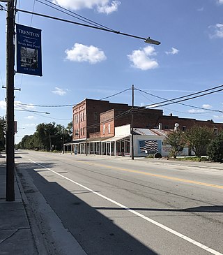
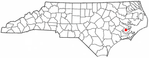
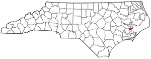
Trenton is a town in Jones County, North Carolina, United States. The population was 238 in 2020 census. It is the county seat of Jones County.

<span class="mw-page-title-main">Alliance, North Carolina</span> Town in North Carolina, United States

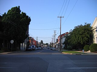
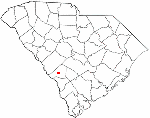
Alliance is a town in Pamlico County, North Carolina, United States. Its name is derived from the Farmers Alliance Movement from around 1874, two years after Pamlico was founded. Alliance was incorporated in 1965. The majority of land in Alliance is farmland. The population was 776 at the 2010 census. It is part of the New Bern, North Carolina Micropolitan Statistical Area.

<span class="mw-page-title-main">Mesic, North Carolina</span> Town in North Carolina, United States

Mesic is a town in Pamlico County, North Carolina, United States. The population was 220 at the 2010 census. It is part of the New Bern, North Carolina Micropolitan Statistical Area.

<span class="mw-page-title-main">Minnesott Beach, North Carolina</span> Town in North Carolina, United States

Minnesott Beach is a town in Pamlico County, North Carolina, United States. The population was 440 at the 2010 census. It is part of the New Bern, North Carolina Metropolitan Statistical Area.

<span class="mw-page-title-main">Stonewall, North Carolina</span> Town in North Carolina, United States

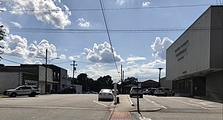
Stonewall is a town in Pamlico County, North Carolina, United States. The population was 281 at the 2010 census. It is part of the New Bern, North Carolina Micropolitan Statistical Area.

Vandemere is a town in Pamlico County, North Carolina, United States. As of the 2010 census, the town population was 254. It is part of the New Bern, North Carolina Micropolitan Statistical Area.

<span class="mw-page-title-main">Columbia, North Carolina</span> Town in North Carolina, United States

Columbia is a town in Tyrrell County, North Carolina, United States. The population was 610 at the 2020 census. It is the county seat of Tyrrell County.

<span class="mw-page-title-main">Yadkinville, North Carolina</span> Town in North Carolina, United States

Yadkinville is a town in Yadkin County, North Carolina, United States. The population was 2,995 at the 2020 census. Located in the Piedmont Triad, it is the county seat and most populous city of Yadkin County.

<span class="mw-page-title-main">Reamstown, Pennsylvania</span> Census-designated place in Pennsylvania, United States

Reamstown is an unincorporated community and census-designated place (CDP) in Lancaster County, Pennsylvania, United States. The population was 3,361 at the 2010 census.

<span class="mw-page-title-main">Hilda, South Carolina</span> Town in South Carolina, United States

Hilda is a town in Barnwell County, South Carolina, United States. The population was 447 at the 2010 census..

<span class="mw-page-title-main">Snelling, South Carolina</span> Town in South Carolina, United States

Snelling is a town in Barnwell County, South Carolina, United States. The population was 274 at the 2010 census.

<span class="mw-page-title-main">Olanta, South Carolina</span> Town in South Carolina, United States

Olanta is a town in Florence County, South Carolina, United States. The population was 563 at the 2010 census, down from 613 in 2000. It is part of the Florence Metropolitan Statistical Area.

<span class="mw-page-title-main">North Hills, West Virginia</span> Town in West Virginia, United States

North Hills is a town in Wood County, West Virginia, United States. It is a suburb of Parkersburg. The population was 837 at the 2020 census. North Hills was incorporated on February 15, 1979.

<span class="mw-page-title-main">Douglas, Wisconsin</span> Town in Wisconsin, United States

Douglas is a town in Marquette County, Wisconsin, United States. The population was 768 at the 2000 census. The unincorporated communities of Briggsville and Douglas Center are located within the town.

<span class="mw-page-title-main">Mills, Wyoming</span> Town in Wyoming, United States

Mills is a town in Natrona County, Wyoming, United States. It is part of the Casper, Wyoming Metropolitan Statistical Area. The population was 3,461 at the 2010 census.

References

  1. "ArcGIS REST Services Directory". United States Census Bureau. Retrieved September 20, 2022.
  2. 1 2 U.S. Geological Survey Geographic Names Information System: Bayboro, North Carolina
  3. 1 2 "U.S. Census website". United States Census Bureau . Retrieved January 31, 2008.
  4. "Find a County". National Association of Counties. Archived from the original on July 12, 2012. Retrieved June 7, 2011.
  5. "City and Town Population Totals: 2020-2023". United States Census Bureau. May 16, 2024. Retrieved May 16, 2024.
  6. "Census of Population and Housing". Census.gov. Retrieved June 4, 2015.
  7. "Explore Census Data". data.census.gov. Retrieved December 23, 2021.