Wadesboro, North Carolina

Last updated

Wadesboro, North Carolina
Wadesboro, North Carolina 03.jpg
Wadesboro, NC Town Flag.gif
Wadesboro, NC Town Seal.jpg
Nickname: 
"The Heart of the Carolinas"
NCMap-doton-Wadesboro.PNG
Location within the state of North Carolina
Usa edcp location map.svg
Red pog.svg
Wadesboro
Coordinates: 34°57′53″N80°04′29″W / 34.96472°N 80.07472°W / 34.96472; -80.07472
Country Flag of the United States.svg  United States
State Flag of North Carolina.svg  North Carolina
County Anson
Township Wadesboro
Founded1783
Founded by Patrick Boggan
Named for Thomas Wade
Government
  Type Council–Manager
   Mayor John I. Ballard (I)
Area
[1]
  Total6.61 sq mi (17.12 km2)
  Land6.60 sq mi (17.08 km2)
  Water0.01 sq mi (0.03 km2)
Elevation
[2]
525 ft (160 m)
Population
 (2020)
  Total5,008
  Density759.25/sq mi (293.16/km2)
Time zone UTC-5 (Eastern (EST))
  Summer (DST) UTC-4 (EDT)
ZIP code(s)
28135, 28170
Area code 704
FIPS code 37-70380 [3]
GNIS feature ID2406812 [2]
Website townofwadesboro.org

Wadesboro is a town and the county seat of Anson County, North Carolina, United States. The population was 5,008 at the 2020 census. [4] The town was originally found in 1783 as New Town but changed by the North Carolina General Assembly to Wadesboro in 1787 to honor Colonel Thomas Wade, [5] [6] a native son, state legislator, and Revolutionary War commander of the Anson County Regiment. [7] [8] [9] [10]

Contents

History

Children in Wadesboro, 1938. Photo by Marion Post Wolcott. Children in Wadesboro.jpg
Children in Wadesboro, 1938. Photo by Marion Post Wolcott.

Originally named Newtown, the town was renamed by the North Carolina General Assembly in 1787 to honor of Colonel Thomas Wade after his service with the Anson County Regiment of militia in the American Revolutionary War.

In 1900, astronomers determined that Wadesboro would be the best location in North America for viewing a total solar eclipse. The Smithsonian Astrophysical Observatory, then based in Washington, D.C., loaded several railroad cars with scientific equipment and headed to the town.

The Boggan-Hammond House and Alexander Little Wing, United States Post Office, and Wadesboro Downtown Historic District are listed on the National Register of Historic Places. [11]

Geography

According to the U.S. Census Bureau, the town has a total area of 6.3 square miles (16.4 km2), of which 0.012 square miles (0.03 km2), or 0.20%, is water. [7]

Wadesboro is situated 19 miles (31 km) west of Rockingham, 23 miles (37 km) north of Cheraw, 28 miles (45 km) east of Monroe, and 30 miles (48 km) south of Albemarle.

Demographics

Historical population
CensusPop.Note
1850 460
1870 480
1880 80066.7%
1890 1,19849.8%
1900 1,54629.0%
1910 2,37653.7%
1920 2,64811.4%
1930 3,12418.0%
1940 3,58714.8%
1950 3,408−5.0%
1960 3,7449.9%
1970 3,9776.2%
1980 4,2065.8%
1990 3,645−13.3%
2000 3,552−2.6%
2010 5,81363.7%
2020 5,008−13.8%
2021 (est.)5,038 [4] 0.6%
U.S. Decennial Census [12]

2020 census

Wadesboro racial composition [13]
RaceNumberPercentage
White (non-Hispanic)1,61032.15%
Black or African American (non-Hispanic)3,06661.88%
Native American 180.36%
Asian 661.32%
Other/Mixed 1262.52%
Hispanic or Latino 891.78%

As of the 2020 United States census, there were 5,008 people, 2,022 households, and 1,164 families residing in the town.

2010 census

As of the census [3] of 2010, there were 5,813 people, 2,303 households, and 1,428 families residing in the town. The population density was 921.2 inhabitants per square mile (355.7/km2). There were 2,692 housing units at an average density of 426.6 per square mile (164.7/km2). The racial makeup of the town was 35.6% White, 60.7% African American, 0.2% Native American, 1.4% Asian, 0.9% some other race, and 1.3% from two or more races. Hispanic or Latino of any race were 1.8% of the population. [14]

There were 2,303 households, out of which 32.0% had children under the age of 18 living with them, 31.1% were headed by married couples living together, 25.7% had a female householder with no husband present, and 38.0% were non-families. 34.5% of all households were made up of individuals, and 16.3% were someone living alone who was 65 years of age or older. The average household size was 2.40, and the average family size was 3.09. [14]

In the town, the population was spread out, with 24.6% under the age of 18, 8.6% from 18 to 24, 23.1% from 25 to 44, 24.8% from 45 to 64, and 19.0% who were 65 years of age or older. The median age was 39.8 years. For every 100 females there were 81.9 males. For every 100 females age 18 and over, there were 76.5 males. [14]

For the period 200711, the estimated median annual income for a household in the town was $32,550, and the median income for a family was $34,522. Male full-time workers had a median income of $38,385 versus $29,297 for females. The per capita income for the town was $17,055. About 19.0% of families and 22.8% of the population were below the poverty line, including 39.1% of those under age 18 and 11.1% of those age 65 or over. [15]

Education

Wadesboro is served by the Anson County School District.

Media

Television stations available are from the Charlotte Designated Market Area, which Anson County and Wadesboro are a part of. Additionally, the local cable provider carries one station from Columbia, South Carolina, WIS-TV.

Notable people

Horror film Evil Dead II was filmed in Wadesboro, and the Huntley House became the production office for the film. Most of Evil Dead II was filmed in the woods near that farmhouse, or J.R. Faison Junior High School, which is where the interior cabin set was located.[ citation needed ]

See also

Related Research Articles

<span class="mw-page-title-main">Warren County, North Carolina</span> County in North Carolina, United States

Warren County is a county located in the northeastern Piedmont region of the U.S. state of North Carolina, on the northern border with Virginia, made famous for a landfill and birthplace of the environmental justice movement. As of the 2020 census, its population was 18,642. Its county seat is Warrenton. It was a center of tobacco and cotton plantations, education, and later textile mills.

<span class="mw-page-title-main">Duplin County, North Carolina</span> County in North Carolina, United States

Duplin County is a county located in the U.S. state of North Carolina. As of the 2020 census, the population was 48,715. Its county seat is Kenansville.

<span class="mw-page-title-main">Anson County, North Carolina</span> County in North Carolina, United States

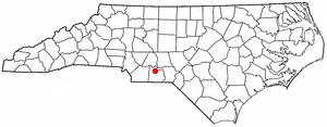
Anson County is a county located in the U.S. state of North Carolina. As of the 2020 census, the population was 22,055. Its county seat is Wadesboro.

<span class="mw-page-title-main">Conklin, New York</span> Town in New York, United States

Conklin is a town in Broome County, New York, United States. Per the 2020 census, the population was 5,008.

<span class="mw-page-title-main">Ansonville, North Carolina</span> Town in North Carolina, United States

Ansonville is a town in Anson County, North Carolina, United States. The population was 440 at the 2020 census. The town has a total area of 1.5 square miles (3.8 km2), all land. It is located on the northern edge of Anson County, about a mile west of the Pee Dee River.

<span class="mw-page-title-main">Lilesville, North Carolina</span> Town in North Carolina, United States

Lilesville is a town in Anson County, North Carolina, United States. The population was 395 at the 2020 census.

<span class="mw-page-title-main">Morven, North Carolina</span> Town in North Carolina, United States

Morven is a town in Anson County, North Carolina, United States. The population was 329 at the 2020 census. The town was named after a town in Argyllshire, Scotland.

<span class="mw-page-title-main">Polkton, North Carolina</span> Town in North Carolina, United States

Polkton is a town in Anson County, North Carolina, United States. As of the 2020 census, the town population was 2,250, down from 3,375 in 2010.

<span class="mw-page-title-main">Clarkton, North Carolina</span> Town in North Carolina, United States

Clarkton is a town in Bladen County, North Carolina, United States. The population was 837 at the 2010 census.

<span class="mw-page-title-main">Salem, North Carolina</span> Census-designated place in North Carolina, United States

Salem is a census-designated place (CDP) in Burke County, North Carolina, United States. The population was 2,218 at the 2010 census. It is part of the Hickory–Lenoir–Morganton Metropolitan Statistical Area.

<span class="mw-page-title-main">Claremont, North Carolina</span> City in North Carolina, United States

Claremont is a city in Catawba County, North Carolina, United States. The population was 1,352 at the 2010 census. It is part of the Hickory–Lenoir–Morganton Metropolitan Statistical Area.

<span class="mw-page-title-main">Godwin, North Carolina</span> Town in North Carolina, United States

Godwin is a town in Cumberland County, North Carolina, United States. The population was 139 at the 2010 census.

<span class="mw-page-title-main">Wade, North Carolina</span> Town in North Carolina, United States

Wade is a town in Cumberland County, North Carolina, United States. The population was 556 at the 2010 census.

<span class="mw-page-title-main">Oxford, North Carolina</span> Town in North Carolina, United States

Oxford is a town in Granville County, North Carolina, United States, with a population of 8,628 as of the 2020 census. It is the county seat of Granville County.

<span class="mw-page-title-main">Smithfield, North Carolina</span> Town in North Carolina, United States

Smithfield is a town in and the county seat of Johnston County, North Carolina, United States. As of the 2010 census, its population was 10,966, and in 2019 the estimated population was 12,985. Smithfield is home to the Ava Gardner Museum and is situated along the Neuse River, where visitors enjoy the annual Smithfield Ham and Yam Festival, walks along the Buffalo Creek Greenway, and the historic downtown district. The town is located near North Carolina's Research Triangle and is about 30 miles (48 km) southeast of downtown Raleigh. The Raleigh-Durham-Cary combined statistical area has a population over 2 million residents.

<span class="mw-page-title-main">Calhoun Falls, South Carolina</span> Town in South Carolina, United States

Calhoun Falls is a town in Abbeville County, South Carolina, United States. The population was 1,724 at the 2020 census, down from 2,004 at the 2010 census.

<span class="mw-page-title-main">Mount Croghan, South Carolina</span> Town in South Carolina, United States

Mount Croghan is a town in Chesterfield County, South Carolina, United States. The population was 195 at the 2010 census, up from 155 in 2000. It houses a Flea market

Varnville is a town in Hampton County, South Carolina, United States. The population was 2,162 as of the 2010 census. Varnville forms a twin town with Hampton, the county seat; the two towns often share civic and cultural events.

<span class="mw-page-title-main">Fletcher, Vermont</span> Town in Vermont, United States

Fletcher is a town in Franklin County, Vermont, United States. The population was 1,346 at the 2020 census.

<span class="mw-page-title-main">Long View, North Carolina</span> Town in North Carolina, United States

Long View is a town in Burke and Catawba counties in the U.S. state of North Carolina. The population was 4,871 at the 2010 census. It is part of the Hickory–Lenoir–Morganton Metropolitan Statistical Area.

References

  1. "ArcGIS REST Services Directory". United States Census Bureau. Retrieved September 20, 2022.
  2. 1 2 U.S. Geological Survey Geographic Names Information System: Wadesboro, North Carolina
  3. 1 2 "U.S. Census website". United States Census Bureau . Retrieved January 31, 2008.
  4. 1 2 "City and Town Population Totals: 2020-2021". Census.gov. US Census Bureau. Retrieved July 10, 2022.
  5. "The Patriot Leaders in North Carolina - Thomas Wade". www.carolana.com. Retrieved October 29, 2022.
  6. "Boggan, Patrick | NCpedia". ncpedia.org. Retrieved October 29, 2022.
  7. 1 2 "Geographic Identifiers: 2010 Demographic Profile Data (G001): Wadesboro town, North Carolina". U.S. Census Bureau, American Factfinder. Archived from the original on February 12, 2020. Retrieved July 3, 2013.
  8. "Find a County". National Association of Counties. Retrieved June 7, 2011.
  9. "Thomas Wade". NCPedia. Retrieved April 22, 2019.
  10. "Anson County | NCpedia". www.ncpedia.org. Retrieved October 29, 2022.
  11. "National Register Information System". National Register of Historic Places . National Park Service. July 9, 2010.
  12. "Census of Population and Housing". Census.gov. Retrieved June 4, 2016.
  13. "Explore Census Data". data.census.gov. Retrieved December 22, 2021.
  14. 1 2 3 "Profile of General Population and Housing Characteristics: 2010 Demographic Profile Data (DP-1): Wadesboro town, North Carolina". U.S. Census Bureau, American Factfinder. Archived from the original on February 12, 2020. Retrieved July 3, 2013.
  15. "Selected Economic Characteristics: 2007-2011 American Community Survey 5-Year Estimates (DP03): Wadesboro town, North Carolina". U.S. Census Bureau, American Factfinder. Archived from the original on February 12, 2020. Retrieved July 3, 2013.

Further reading