Lilesville, North Carolina

Last updated

Lilesville, North Carolina
Lilesville, North Carolina.jpg
West Wall Street
USA North Carolina location map.svg
Red pog.svg
Lilesville
Location within the state of North Carolina
Coordinates: 34°58′03″N79°59′04″W / 34.96750°N 79.98444°W / 34.96750; -79.98444
Country United States
State North Carolina
County Anson
Founded1827 [1]
Incorporated1874 [1]
Named for Nelson P. Liles [1]
Area
[2]
  Total0.99 sq mi (2.57 km2)
  Land0.99 sq mi (2.57 km2)
  Water0.00 sq mi (0.00 km2)
Elevation
[3]
502 ft (153 m)
Population
 (2020)
  Total395
  Density397.78/sq mi (153.56/km2)
Time zone UTC-5 (Eastern (EST))
  Summer (DST) UTC-4 (EDT)
ZIP code
28091
Area code 704
FIPS code 37-38200 [4]
GNIS feature ID2406019 [3]
Website www.lilesvilletown.com

Lilesville is a town in Anson County, North Carolina, United States. The population was 395 at the 2020 census.

Contents

History

A post office called Lilesville has been in operation since 1827. [5] The town was named for an early merchant. [6]

Geography

According to the United States Census Bureau, the town has a total area of 1.0 square mile (2.6 km2), all land. [7]

Geology

Lilesville is home to the Lilesville Granite, a porphyritic igneous rock named for the town. [8]

Demographics

Historical population
CensusPop.Note
1880 192
1890 22215.6%
1900 213−4.1%
1910 38681.2%
1920 44014.0%
1930 49612.7%
1940 55612.1%
1950 6058.8%
1960 6355.0%
1970 6410.9%
1980 588−8.3%
1990 468−20.4%
2000 459−1.9%
2010 53616.8%
2020 395−26.3%
2021 (est.)404 [9] 2.3%
U.S. Decennial Census [10]

As of the census [4] of 2000, there were 459 people, 186 households, and 129 families residing in the town. The population density was 460.1 inhabitants per square mile (177.6/km2). There were 202 housing units at an average density of 202.5 per square mile (78.2/km2). The racial makeup of the town was 52.07% White, 47.49% African American, 0.22% Native American, and 0.22% from two or more races. Hispanic or Latino of any race were 0.22% of the population.

There were 186 households, out of which 28.0% had children under the age of 18 living with them, 50.0% were married couples living together, 15.6% had a female householder with no husband present, and 30.6% were non-families. 29.0% of all households were made up of individuals, and 12.4% had someone living alone who was 65 years of age or older. The average household size was 2.47 and the average family size was 3.04.

In the town, the population was spread out, with 24.4% under the age of 18, 8.3% from 18 to 24, 25.1% from 25 to 44, 24.0% from 45 to 64, and 18.3% who were 65 years of age or older. The median age was 40 years. For every 100 females, there were 82.9 males. For every 100 females age 18 and over, there were 86.6 males.

The median income for a household in the town was $29,167, and the median income for a family was $40,000. Males had a median income of $30,179 versus $21,250 for females. The per capita income for the town was $14,099. About 11.9% of families and 13.0% of the population were below the poverty line, including 12.8% of those under age 18 and 30.4% of those age 65 or over.

Related Research Articles

<span class="mw-page-title-main">Anson County, North Carolina</span> County in North Carolina, United States

Anson County is a county located in the U.S. state of North Carolina. As of the 2020 census, the population was 22,055. Its county seat is Wadesboro.

<span class="mw-page-title-main">Emerson, Iowa</span> City in Iowa, United States

Emerson is a city in Mills County, Iowa, United States. The population was 403 at the time of the 2020 census.

<span class="mw-page-title-main">Ansonville, North Carolina</span> Town in North Carolina, United States

Ansonville is a town in Anson County, North Carolina, United States. The population was 440 at the 2020 census. The town has a total area of 1.5 square miles (3.8 km2), all land. It is located on the northern edge of Anson County, about a mile west of the Pee Dee River.

<span class="mw-page-title-main">McFarlan, North Carolina</span> Town in North Carolina, United States

McFarlan is a town in Anson County, North Carolina, United States. The population was 94 at the 2020 census. The town was named after Alan McFarland, a railroad official.

<span class="mw-page-title-main">Morven, North Carolina</span> Town in North Carolina, United States

Morven is a town in Anson County, North Carolina, United States. The population was 329 at the 2020 census. The town was named after a town in Argyllshire, Scotland.

<span class="mw-page-title-main">Peachland, North Carolina</span> Town in North Carolina, United States

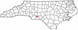
Peachland is a town in Anson County, North Carolina, United States. The population was 390 at the 2020 census.

<span class="mw-page-title-main">Polkton, North Carolina</span> Town in North Carolina, United States

Polkton is a town in Anson County, North Carolina, United States. As of the 2020 census, the town population was 2,250, down from 3,375 in 2010.

<span class="mw-page-title-main">Wadesboro, North Carolina</span> Town in North Carolina, United States

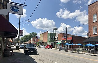
Wadesboro is a town and the county seat of Anson County, North Carolina, United States. The population was 5,008 at the 2020 census. The town was originally found in 1783 as New Town but changed by the North Carolina General Assembly to Wadesboro in 1787 to honor Colonel Thomas Wade, a native son, state legislator, and Revolutionary War commander of the Anson County Regiment.

<span class="mw-page-title-main">Lewiston Woodville, North Carolina</span> Town in North Carolina, United States

Lewiston Woodville is a town in Bertie County, North Carolina, United States. The population was 549 at the 2010 census. It is the location of Perdue Farms, one of the largest chicken-producing companies in North Carolina.

<span class="mw-page-title-main">Lawndale, North Carolina</span> Town in North Carolina, United States

Lawndale is a town in Cleveland County, North Carolina, United States, situated along the First Broad River. The population was 606 at the 2010 census.

Brunswick is a town in Columbus County, North Carolina, United States. The population was 1,119 at the 2010 census.

<span class="mw-page-title-main">Pleasant Garden, North Carolina</span> Town in North Carolina, United States

Pleasant Garden is a town in Guilford County, North Carolina, United States.

<span class="mw-page-title-main">Pilot Mountain, North Carolina</span> Town in North Carolina, United States

Pilot Mountain is a town in Surry County, North Carolina, United States. The population was 1,443 at the 2020 census. It is named for the nearby landmark of Pilot Mountain, a distinctive geological formation.

<span class="mw-page-title-main">Ronda, North Carolina</span> Town in North Carolina, United States

Ronda is a town in Wilkes County, North Carolina, United States. The population was 417 at the 2010 census, and 413 at the 2020 census. Ronda was named after a nearby estate called "Roundabout", which was the residence of Benjamin Cleveland, a locally prominent planter and a colonel in the North Carolina militia during the Revolutionary War. The town is home to East Wilkes High School, one of Wilkes County's five public high schools.

Ulmer is a town in Allendale County, South Carolina, United States. The population was 65 at the 2020 census.

<span class="mw-page-title-main">North, South Carolina</span> Town in South Carolina, United States

North is a town in Orangeburg County, South Carolina, United States. The population was 696 at the 2020 census.

<span class="mw-page-title-main">Anawalt, West Virginia</span> Town in West Virginia, United States

Anawalt is a town in McDowell County, West Virginia, United States. At one time it was known as Jeanette. It is named in honor of James White Anawalt, who was then manager of Union Supply Company, a subsidiary of the United States Steel Company. The population was 186 at the 2020 census. Coal mining was the town's chief industry.

<span class="mw-page-title-main">Weddington, North Carolina</span> Town in North Carolina, United States

Weddington is a suburban town in Union County, North Carolina, United States. The population was 9,459 at the 2010 census. It is a suburb in the Charlotte metropolitan area. The current mayor of Weddington is Jim Bell.

Anson is a census-designated place (CDP) in the town of Anson in Somerset County, Maine, United States. The population was 818 at the 2000 census.

<span class="mw-page-title-main">Anson, Maine</span> Town in the state of Maine, United States

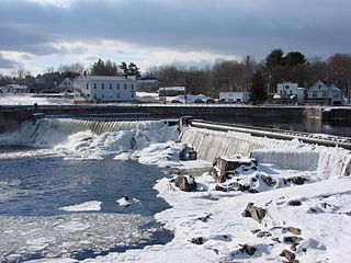
Anson is a town in Somerset County, Maine, United States. The population was 2,291 at the time of the 2020 census. It includes the villages of Anson and North Anson.

References

  1. 1 2 3 "North Carolina Gazetteer" . Retrieved December 19, 2022.
  2. "ArcGIS REST Services Directory". United States Census Bureau. Retrieved September 20, 2022.
  3. 1 2 U.S. Geological Survey Geographic Names Information System: Lilesville, North Carolina
  4. 1 2 "U.S. Census website". United States Census Bureau . Retrieved January 31, 2008.
  5. "Anson County". Jim Forte Postal History. Retrieved June 16, 2015.
  6. Gannett, Henry (1905). The Origin of Certain Place Names in the United States. U.S. Government Printing Office. p.  186.
  7. "Geographic Identifiers: 2010 Demographic Profile Data (G001): Lilesville town, North Carolina". U.S. Census Bureau, American Factfinder. Archived from the original on February 12, 2020. Retrieved July 2, 2013.
  8. "Geolex — Lilesville publications". ngmdb.usgs.gov. Retrieved April 19, 2021.
  9. Bureau, US Census. "City and Town Population Totals: 2020-2021". Census.gov. US Census Bureau. Retrieved July 10, 2022.
  10. "Census of Population and Housing". Census.gov. Retrieved June 4, 2016.