
Yancey County is a county located in the U.S. state of North Carolina. As of the 2020 census, the population was 18,470. Its county seat is Burnsville.

Anson County is a county located in the U.S. state of North Carolina. As of the 2020 census, the population was 22,055. Its county seat is Wadesboro.

Burnsville is a town in Tishomingo County in northeastern Mississippi, United States. The population was 936 at the 2010 census.

Burnsville is a town that serves as the county seat of Yancey County, North Carolina, United States. The population was 1,612 at the 2020 census.
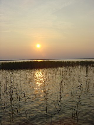
Lake Waccamaw State Park is a North Carolina state park in Columbus County, North Carolina, in the United States. Located near the town of Lake Waccamaw, North Carolina, it covers 2,398-acre (9.70 km2), along the shores of Lake Waccamaw, a Carolina bay. Recent work by the U.S. Geological Survey has interpreted the Carolina Bays as relict thermokarst lakes that formed several thousands of years ago when the climate was colder, drier, and windier. Thermokarst lakes develop by thawing of frozen ground (permafrost) and by subsequent modification by wind and water. Thus, this interpretation suggests that permafrost once extended as far south as the Carolina Bays during the last ice age and (or) previous ice ages.
Copen is an unincorporated community in Braxton County, central West Virginia, United States. The community is located at the confluence of Copen and Bull Fork Creeks. Its most famous resident was Melvin Wine (1909–2003), an acclaimed old-time fiddler.
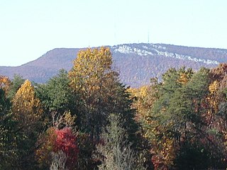
The Sauratown Mountains, which are sometimes called "the mountains away from the mountains", are an isolated mountain range located within Stokes and Surry counties in the U.S. state of North Carolina. The vast majority of the range is located in Stokes County. Although the range occupies only 5% of Stokes County's area, it dominates the county's scenery from almost every direction. The Sauras rise sharply 800 to 1,700 feet above the surrounding terrain.

Woody's Knob, at an elevation of 4,170 feet, is a summit or "knob" in the Blue Ridge Mountains and one of the highest points in the unincorporated village of Little Switzerland and in Mitchell County, North Carolina.
Green Mountain is an unincorporated community and township in Yancey County, North Carolina, United States. Green Mountain sits along the Toe River, approximately seven miles north of Burnsville, the county seat. It shares a name with the ridgeline north of Burnsville that includes Phillips Knob and Rocky Knob. Its elevation is 2,159 feet (658 m). It has a post office with the ZIP code 28740, which is one of only two ZIP codes used for street addresses in the county.

Burnsville is an unincorporated community in Rock Creek Township, Bartholomew County, in the U.S. state of Indiana.
Micaville is an unincorporated community in Yancey County, North Carolina, United States. The name comes from a mineral mined there called mica. It was the central mining location in the county.
Doskie is an unincorporated community located on Mississippi Highway 365 in Tishomingo County, Mississippi, United States. Doskie is just north of the Tennessee–Tombigbee Waterway, approximately 6 miles (9.7 km) north of Burnsville and approximately 13 miles (21 km) northwest of Iuka.
Cane River is an unincorporated community in Yancey County, North Carolina, United States. It is located west of Burnsville, at the intersection of U.S. Routes 19, 19E and 19W, along the Cane River.

Snake Mountain is a mountain located along the border of North Carolina and Tennessee, east of the community of Zionville, in the southeastern United States. It is part of the Blue Ridge Mountains, and includes parts of Watauga County, North Carolina, and Johnson County, Tennessee. It has two peaks, the higher of which reaches an elevation of 5,564 feet (1,696 m). The lower peak, at 5,518 feet (1,682 m), is Johnson County's high point.

Buck Creek Gap is a mountain pass along the Blue Ridge Mountains. NC 80 connects with the Blue Ridge Parkway at the gap, where it travelers can go either towards Burnsville, Marion, Mount Mitchell or Little Switzerland. A scenic overlook is located at the gap, along NC 80; which is sometimes also used as a staging area for motorcycle enthusiasts. The gap is also along the Eastern Continental Divide and the McDowell–Yancey county line.
The Cane River is a 38.3-mile (61.6 km) river in Yancey County, North Carolina. It originates from the confluence of Beech Nursery Creek, off the western slope of Mount Mitchell, and Blue Sea Creek, off the northeastern slope of Blackstock Knob, in the Black Mountains. A tributary in the French Broad River basin, it flows northward to join the North Toe River, forming the Nolichucky River.
Burnsville, also known as Byrnville, is an unincorporated community in Dallas County, Alabama.
Cribs Creek is a 4.72 mi (7.60 km) long 2nd order tributary to the Rocky River in Anson County, North Carolina. This is the only stream of this name in the United States.
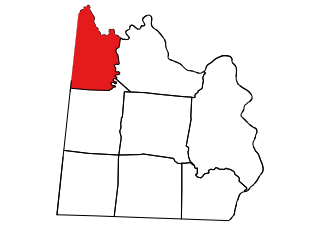
Burnsville Township, population 1,942, is one of eight townships in Anson County, North Carolina. Burnsville Township is 48.93 square miles (126.7 km2) in size and is located in northwestern Anson County. This township does not have any cities or towns within it.

Kona is an unincorporated community in Mitchell County, North Carolina, United States. The community is located along North Carolina Highway 80 (NC 80), near the confluence of the North and South Toe Rivers and at the western slope of Ellis Mountain.

