Archaeological excavations performed by Dr. David Moore during the early 1980s, revealed artifacts and other evidence that the earliest inhabitants of McDowell County lived there from the Woodland period and Mississippian culture era, from 250 to 1500 AD. Dr. Moore discovered this material in an area close to the Catawba River, in and around an unusual topographical site known as Round Hill.[4] Both the historic Cherokee and Catawba Indians were Native American peoples known to live in what is now McDowell County, and they had been there long before any Europeans. These Native Americans were living in this section for centuries before the Spanish Juan Pardo's 1566 expedition to the interior region from the Atlantic coast.[5]
In the next two years, Pardo traveled from the Spanish colony on an island, through what are now South Carolina and Western North Carolina and into southeastern Tennessee. His expedition traveled through the area that is now McDowell County. His purpose was to acquire territory for Spain and establish forts for an alternative interior route to central Mexico. The Spanish mistakenly believed that the Appalachians connected to a range there, where they had established silver mines.[6][7]
Pardo also hoped to find precious metals during his expedition, in which he stopped at several Native American villages. Pardo and his men built a log blockhouse, Fort San Juan, at a Mississippian chiefdom known as Joara at the headwaters of the Catawba River, a site north of present-day Morganton, North Carolina. They wintered over at Joara.[8] Pardo directed his forces to establish five more forts in the interior, including one at Chiaha, in present-day southeastern Tennessee. The Native Americans raided the Spanish newcomers and killed all but one of the soldiers in the garrisons, burning all six forts in 1568. Pardo had already left for Spain by then. The Spanish gave up their efforts to settle the interior.[9][10]
In 1748, "Hunting" John McDowell received a land grant from the colony of North Carolina for property known today as Pleasant Gardens, including acreage that originally extended from Swan's Pond (Catawba County) up the Catawba River west to present-day Marion and into the region known as Buck Creek. McDowell went hunting with his friend Henry Weidner, and the two came upon a lush green valley with thousands of acres of what they thought was virgin forest. They were both interested in the land, and McDowell won a wrestling match to decide who should apply for it.[11]
McDowell settled here with his family, and received two more land grants. established residence here family, and subsequently received two land grants. He is noted in Max Dixon's book, The Wataugans, as being instrumental in Jacob Brown's purchase of one of the last remaining pieces of acreage along the Nolichucky River in eastern Tennessee. McDowell hosted negotiations with the Cherokee from that area on his farm in North Carolina.
His son, Joseph McDowell, fought in the Battle of Kings Mountain. McDowell County is named in his honor. Today, McDowell's home survives, one of the few remaining that was built by its namesake.[12]
The settlement of what was known as Old Fort took place nearby; this became for a time the westernmost outpost of colonial society. These early pioneers established a community protected by a series of forts that were used into the early 19th century.
In 1793, Colonel John Carson built a plantation house near Buck Creek in the Pleasant Gardens community. It is known as the historic Carson House. He also operated gold mines in the southern part of the county. Colonel Carson had contributed to the Patriot cause in the American Revolutionary War.[13]
Marion, the county seat of McDowell County, was planned and built on land selected by the first McDowell County Commissioners when they met on March 14, 1844, at the Carson House. It was not until 1845, however, that Marion was designated as the county seat by the state legislature. The settlement was named after Francis Marion, the American Revolutionary War hero known as the "Swamp Fox."[14]
During the Carolina Gold Rush period of the early 19th century, the south county area was known for its gold production. The banks of the Muddy Creek and mines at Vein Mountain were productive areas. Many mines and thriving gold rush towns such as Brackettown no longer exist; scattered ruins and abandoned cemeteries mark once-active sites of the gold rush period. An old mine in Woodlawn is from this period.[16]
According to the U.S. Census Bureau, the county has a total area of 445.35 square miles (1,153.5km2), of which 439.95 square miles (1,139.5km2) is land and 5.40 square miles (14.0km2) (1.21%) is water.[19]
Numerous small creeks and streams flow through the county. The Catawba River originates in and crosses the county and empties into Lake James. It flows over Catawba Falls on its way, which is accessible to the public. Other waterfalls can be found in the county, such as Toms Creek Falls. Almost half of the county, including the two aforementioned waterfalls, is located inside the Pisgah National Forest. Linville Caverns, North Carolina's only limestone cavern system open to the public, is located in the far northern part of the county.
Geologically, McDowell County is located within the southern Appalachian Mountains region. The Blue Ridge Parkway closely follows the northwestern boundary of the county. McDowell County rises rapidly from the Piedmont (United States) in its extreme eastern border where elevations average about 1200 feet above sea level, to the Blue Ridge Mountains in the north and west. Its lowest point is 969 feet above sea level along Cane Creek in the county's southeastern corner. Its highest point is Pinnacle—at 5,665 feet above sea level the second-highest mountain (after Grandfather Mountain) in the Blue Ridge, and also considered the southernmost tip of the Black Mountains, the highest ridge in eastern America. Much of the county lies in the Foothills (North Carolina) region of Western North Carolina.
As of the 2020 census, there were 44,578 people, 18,173 households, and 13,065 families residing in the county.
2000 census
At the 2000 census,[27] there were 42,151 people, 16,604 households, and 11,954 families residing in the county. The population density was 95 peopleper square mile (37 people/km2). There were 18,377 housing units at an average density of 42 unitsper square mile (16 units/km2). The racial makeup of the county was 92.18% White, 4.16% Black or African American, 0.29% Native American, 0.92% Asian, 0.01% Pacific Islander, 1.61% from other races, and 0.84% from two or more races. 2.88% of the population were Hispanic or Latino of any race.
There were 16,604 households, out of which 30.30% had children under the age of 18 living with them, 57.50% were married couples living together, 10.20% had a female householder with no husband present, and 28.00% were non-families. 24.30% of all households were made up of individuals, and 10.30% had someone living alone who was 65 years of age or older. The average household size was 2.45 and the average family size was 2.90.
In the county, the population was spread out, with 22.80% under the age of 18, 8.20% from 18 to 24, 29.90% from 25 to 44, 24.90% from 45 to 64, and 14.30% who were 65 years of age or older. The median age was 38 years. For every 100 females there were 99.30 males. For every 100 females age 18 and over, there were 97.70 males.
The median income for a household in the county was $32,396, and the median income for a family was $37,789. Males had a median income of $26,609 versus $21,640 for females. The per capita income for the county was $16,109. About 9.00% of families and 11.60% of the population were below the poverty line, including 15.10% of those under age 18 and 15.70% of those age 65 or over.
McDowell County voted Republican in the three elections from 1900 to 1908, but otherwise was solidly Democratic until 1956, when Dwight D. Eisenhower carried the county. Since then, like other areas of the North Carolina Foothills, it has become predominantly Republican. Since 1956, only two Democratic candidates have won the county's vote in presidential elections: Lyndon Johnson in 1964 and Jimmy Carter in 1976, both hailing from the southern region of the nation.
United States presidential election results for McDowell County, North Carolina[28]
Yancey County is a county located in the U.S. state of North Carolina. As of the 2020 census, the population was 18,470. Its county seat is Burnsville.
Watauga County is a county located in the U.S. state of North Carolina. As of the 2020 census, the population was 54,086. Its county seat and largest community is Boone. The county is in an exceptionally mountainous region, known as the High Country. It is the home of Appalachian State University, which has approximately 20,023 students as of August 2020. Watauga County comprises the Boone, NC Micropolitan Statistical Area.
Transylvania County is a county in the U.S. state of North Carolina. As of the 2020 census the population is 32,986. Its county seat is Brevard.
Mitchell County is a county located in the U.S. state of North Carolina. As of the 2020 census, the population was 14,903. Its county seat is Bakersville.
Lincoln County is a county located in the U.S. state of North Carolina. As of the 2020 census, the population was 86,810, making it the most populous "Lincoln County" in the United States. Its county seat is Lincolnton.
Jackson County is a county located in the western part of the U.S. state of North Carolina. As of the 2020 census, the population was 43,109. Since 1913, its county seat has been Sylva, which replaced Webster.
Iredell County is a county located in the U.S. state of North Carolina. As of the 2020 census, the population was 186,693. Its county seat is Statesville, and its largest community is Mooresville. The county was formed in 1788, subtracted from Rowan County. It is named for James Iredell, one of the first justices of the Supreme Court. Iredell County is included in the Charlotte-Concord-Gastonia, NC-SC Metropolitan Statistical Area, as defined by the Office of Management and Budget, with data from the U.S. Census Bureau.
Haywood County is a county located in the U.S. state of North Carolina. As of the 2020 census, the population was 62,089. The county seat and its largest community is Waynesville.
Harnett County is a county located in the U.S. state of North Carolina. As of the 2020 census, the population was 133,568. Its county seat is Lillington; its largest community is Anderson Creek. Harnett County is part of the Anderson Creek, NC Micropolitan Statistical Area.
Gaston County is a county in the U.S. state of North Carolina. As of the 2020 census, the population was 227,943. The county seat is Gastonia. Dallas served as the original county seat from 1846 until 1911.
Caldwell County is a county in the U.S. state of North Carolina. It is located in the foothills of the Blue Ridge Mountains. As of the 2020 census, the population was 80,652. Its county seat is Lenoir. Caldwell County is part of the Hickory-Lenoir-Morganton, NC Metropolitan Statistical Area.
Burke County is a county located in the U.S. state of North Carolina. As of the 2020 census, its population was 87,570. Its county seat is Morganton.
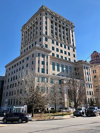
Buncombe County is a county located in the U.S. state of North Carolina. It is classified within Western North Carolina. The 2020 census reported the population was 269,452, making it the 7th-most populous county in North Carolina. Its county seat is Asheville. Buncombe County is part of the Asheville, NC Metropolitan Statistical Area.
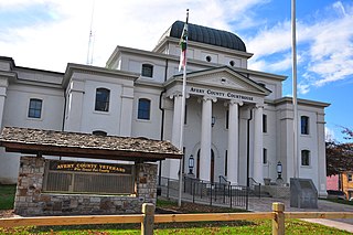
Avery County is a county located in the U.S. state of North Carolina. As of the 2020 census, the population was 17,806. The county seat is Newland. The county seat was initially established in Elk Park when the county was first formed, but was moved to Newland upon completion of the courthouse in 1912. Founded in 1911, it is the youngest of North Carolina's 100 counties.
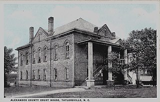
Alexander County is a county established in the U.S. state of North Carolina in 1847. As of the 2020 census, the population was 36,444. Its county seat is Taylorsville. Alexander County is part of the Hickory-Lenoir-Morganton, NC Metropolitan Statistical Area.
Lenoir is a city in and the county seat of Caldwell County, North Carolina, United States. The population was 18,263 at the 2020 census. Lenoir is located in the foothills of the Blue Ridge Mountains. To the northeast are the Brushy Mountains, a spur of the Blue Ridge Mountains. Hibriten Mountain, located just east of the city limits, marks the western end of the Brushy Mountains range.
Marion is a city in and the county seat of McDowell County, North Carolina, United States. Founded in 1844, the city was named in honor of Brigadier General Francis Marion, the American Revolutionary War Hero whose talent in guerrilla warfare earned him the name "Swamp Fox". Marion's Main Street Historic District is listed on the National Register of Historic Places. The population was 7,717 at the 2020 Census.
Old Fort is a town in McDowell County, North Carolina, United States. The population was 811 people in the 2020 U.S. census.
Pisgah National Forest is a National Forest in the Appalachian Mountains of western North Carolina. It is administered by the United States Forest Service, part of the United States Department of Agriculture. The Pisgah National Forest is completely contained within the state of North Carolina. The forest is managed together with the other three North Carolina National Forests from common headquarters in Asheville, North Carolina. There are local ranger district offices located in Pisgah Forest, Mars Hill, and Nebo.
Western North Carolina is the region of North Carolina which includes the Appalachian Mountains; it is often known geographically as the state's Mountain Region. It contains the highest mountains in the Eastern United States, with 125 peaks rising to over 5,000 feet in elevation. Mount Mitchell at 6,684 feet, is the highest peak of the Appalachian Mountains and mainland eastern North America. The population of the 23 most commonly associated counties for the region, as measured by the 2020 U.S. Census, is 1,149,405. The region accounts for approximately 11% of North Carolina's total population.
↑ "Marker: N–47 – FORT SAN JUAN". North Carolina Highway Historical Marker Program. North Carolina Department of Cultural Resources. Retrieved August 17, 2013.
This page is based on this Wikipedia article Text is available under the CC BY-SA 4.0 license; additional terms may apply. Images, videos and audio are available under their respective licenses.